M2.8 earthquake 2 km WSW of Gabbs, Nevada
A magnitude 2.8 earthquake struck 2 km WSW of Gabbs, Nevada on Wed, May 19, 2021, 4:56 PM PDT (23:56 UTC), 11 km (7 mi) below the surface.
A larger quake followed: M4.0 33 km SE of Mina, Nevada. This one was a foreshock.
Map
Where this earthquake was located, with the others nearby. Select one for its page.
The earthquake
- Magnitude
- 2.8 (ML, local (Richter)), micro
- Magnitude from
- Nevada Seismological Laboratory
- Local time
- UTC
- 2021-05-19 23:56:13 UTC
- Depth
- 11.1 km (6.9 mi), shallow
- Epicenter
- 38.858° N, 117.952° W
- Region
- Nevada
- Felt reports
- 1
- Tsunami flag
- No
- Status
- Reviewed by a seismologist
Magnitude estimates
Different scales measure different things and differ by a few tenths. The USGS marks one as preferred, and it is the one this page uses.
| Mag. | Scale | Computed by | Notes |
|---|---|---|---|
| 2.8 | ML, local (Richter) | Nevada Seismological Laboratory | Preferred · Reviewed · ±0.49 · 10 stations |
| 2.5 | ML, local (Richter) | USGS National Earthquake Information Center | Reviewed · ±0.048 · 56 stations |
Did you feel it?
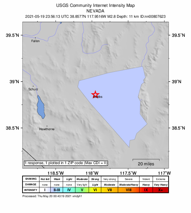
1 person reported to the USGS what they felt; the strongest reported shaking was II, weak shaking.
How well it is located
Reviewed by a seismologist.
- Magnitude uncertainty
- ±0.49
- Station coverage gap
- 46°
- Stations used
- 22
Nearest places
Distance and direction from each place to the epicenter, with its forecast.
Nearby
Within 100 km, magnitude 1.5 and up: 178 in the 60 days after this one and 152 in the 30 days before it.
After
- 4.033 km SE of Mina, Nevada · 1962 days ago · 9 km deep · 78 km away · felt by 4
- 1.533 km SE of Mina, Nevada · 1962 days ago · 9 km deep · 78 km away
- 1.726 km SSW of Mina, Nevada · 1962 days ago · 7 km deep · 80 km away
- 1.833 km SE of Mina, Nevada · 1962 days ago · 10 km deep · 80 km away
- 1.831 km NE of Benton, California · 1960 days ago · 2 km deep · 100 km away
- 1.939 km NNW of Gabbs, Nevada · 1960 days ago · 14 km deep · 40 km away
- 1.838 km ESE of Mina, Nevada · 1959 days ago · 2 km deep · 75 km away
- 2.225 km S of Mina, Nevada · 1959 days ago · 3 km deep · 78 km away
- 1.930 km SE of Mina, Nevada · 1959 days ago · 7 km deep · 75 km away
- 1.733 km SE of Mina, Nevada · 1958 days ago · 6 km deep · 78 km away
- 1.632 km SE of Mina, Nevada · 1958 days ago · 0 km deep · 71 km away
- 1.532 km SE of Mina, Nevada · 1958 days ago · 4 km deep · 72 km away
- 1.833 km SE of Mina, Nevada · 1958 days ago · 9 km deep · 78 km away
- 1.528 km SSE of Mina, Nevada · 1958 days ago · 3 km deep · 78 km away
- 1.529 km SSE of Mina, Nevada · 1958 days ago · 3 km deep · 80 km away
- 1.733 km SE of Mina, Nevada · 1958 days ago · 2 km deep · 74 km away
- 1.832 km SSE of Mina, Nevada · 1958 days ago · 8 km deep · 80 km away
- 2.936 km SE of Mina, Nevada · 1958 days ago · 11 km deep · 77 km away
- 1.726 km SSW of Mina, Nevada · 1956 days ago · 4 km deep · 81 km away
- 2.724 km S of Mina, Nevada · 1956 days ago · 7 km deep · 77 km away
- 1.736 km SE of Mina, Nevada · 1955 days ago · 6 km deep · 78 km away
- 1.631 km SE of Mina, Nevada · 1955 days ago · 12 km deep · 76 km away
- 2.229 km SSE of Mina, Nevada · 1955 days ago · 4 km deep · 80 km away
- 1.929 km SSE of Mina, Nevada · 1955 days ago · 3 km deep · 80 km away
- 1.827 km SSW of Mina, Nevada · 1955 days ago · 3 km deep · 82 km away
- 1.533 km SE of Mina, Nevada · 1955 days ago · 8 km deep · 80 km away
- 2.329 km SSE of Mina, Nevada · 1955 days ago · 2 km deep · 79 km away
- 1.830 km SSE of Mina, Nevada · 1954 days ago · 10 km deep · 79 km away
- 1.733 km SE of Mina, Nevada · 1953 days ago · 12 km deep · 78 km away
- 1.732 km SSW of Mina, Nevada · 1952 days ago · 3 km deep · 85 km away
- 2.136 km SE of Mina, Nevada · 1952 days ago · 4 km deep · 78 km away
- 1.833 km SSW of Mina, Nevada · 1951 days ago · 5 km deep · 87 km away
- 2.135 km SE of Mina, Nevada · 1951 days ago · 6 km deep · 78 km away
- 1.629 km SSW of Mina, Nevada · 1951 days ago · 1 km deep · 83 km away
- 2.037 km SE of Mina, Nevada · 1951 days ago · 3 km deep · 80 km away
- 2.334 km SE of Mina, Nevada · 1951 days ago · 8 km deep · 78 km away
- 2.334 km SE of Mina, Nevada · 1950 days ago · 9 km deep · 77 km away
- 2.032 km SSW of Mina, Nevada · 1950 days ago · 4 km deep · 86 km away
- 1.835 km SE of Mina, Nevada · 1949 days ago · 9 km deep · 78 km away
- 2.034 km SE of Mina, Nevada · 1949 days ago · 8 km deep · 77 km away
- 1.930 km SE of Mina, Nevada · 1949 days ago · 5 km deep · 76 km away
- 1.832 km SE of Mina, Nevada · 1949 days ago · 9 km deep · 79 km away
- 1.829 km SSE of Mina, Nevada · 1949 days ago · 9 km deep · 80 km away
- 1.936 km SE of Mina, Nevada · 1948 days ago · 2 km deep · 76 km away
- 1.529 km SSE of Mina, Nevada · 1948 days ago · 4 km deep · 80 km away
- 2.731 km SE of Mina, Nevada · 1948 days ago · 10 km deep · 78 km away
- 1.631 km SE of Mina, Nevada · 1948 days ago · 9 km deep · 77 km away
- 2.1Nevada · 1948 days ago · 10 km deep · 78 km away
- 1.730 km SE of Mina, Nevada · 1948 days ago · 10 km deep · 77 km away
- 1.936 km SE of Mina, Nevada · 1947 days ago · 8 km deep · 78 km away
- 2.029 km SSE of Mina, Nevada · 1947 days ago · 8 km deep · 79 km away
- 2.040 km SE of Mina, Nevada · 1947 days ago · 11 km deep · 78 km away
- 1.930 km S of Mina, Nevada · 1947 days ago · 2 km deep · 84 km away
- 1.927 km SSE of Mina, Nevada · 1947 days ago · 4 km deep · 79 km away
- 1.625 km SSW of Mina, Nevada · 1946 days ago · 2 km deep · 79 km away
- 1.835 km SE of Mina, Nevada · 1945 days ago · 2 km deep · 79 km away
- 1.926 km SSW of Mina, Nevada · 1944 days ago · 3 km deep · 79 km away
- 1.835 km SE of Mina, Nevada · 1944 days ago · 11 km deep · 79 km away
- 1.933 km SE of Mina, Nevada · 1944 days ago · 11 km deep · 73 km away
- 1.837 km SE of Mina, Nevada · 1943 days ago · 3 km deep · 77 km away
The first 60 of 178.
Before
- 1.536 km SE of Mina, Nevada · 1963 days ago · 10 km deep · 77 km away
- 2.233 km SE of Mina, Nevada · 1964 days ago · 8 km deep · 79 km away
- 2.532 km SE of Mina, Nevada · 1964 days ago · 8 km deep · 78 km away
- 1.829 km SSE of Mina, Nevada · 1964 days ago · 6 km deep · 81 km away
- 2.131 km SE of Mina, Nevada · 1964 days ago · 9 km deep · 77 km away
- 1.736 km SE of Mina, Nevada · 1964 days ago · 6 km deep · 77 km away
- 1.528 km SSE of Mina, Nevada · 1964 days ago · 8 km deep · 79 km away
- 1.933 km SE of Mina, Nevada · 1964 days ago · 3 km deep · 73 km away
- 1.828 km SSE of Mina, Nevada · 1965 days ago · 3 km deep · 81 km away
- 2.027 km SSE of Mina, Nevada · 1965 days ago · 2 km deep · 79 km away
- 1.538 km SE of Mina, Nevada · 1965 days ago · 12 km deep · 76 km away
- 2.236 km SE of Mina, Nevada · 1966 days ago · 13 km deep · 77 km away
- 1.629 km SE of Mina, Nevada · 1966 days ago · 9 km deep · 76 km away
- 3.630 km SE of Mina, Nevada · 1966 days ago · 5 km deep · 75 km away · felt by 2
- 2.132 km SE of Mina, Nevada · 1966 days ago · 12 km deep · 77 km away
- 1.833 km SSW of Mina, Nevada · 1968 days ago · 2 km deep · 87 km away
- 1.530 km SE of Mina, Nevada · 1968 days ago · 6 km deep · 74 km away
- 1.529 km SSE of Mina, Nevada · 1969 days ago · 9 km deep · 80 km away
- 1.527 km SSE of Mina, Nevada · 1970 days ago · 3 km deep · 76 km away
- 1.627 km SSE of Mina, Nevada · 1970 days ago · 0 km deep · 78 km away
Earthquakes todayNevada earthquakesLive radar here
Sources
From the USGS Earthquake Hazards Program and its partner networks, event nn00807623 (also filed as us7000e4lh). Read Sat, Oct 3, 2026, 2:01 PM UTC.