M3.2 earthquake 25 km WSW of Coyanosa, Texas
A magnitude 3.2 earthquake struck 25 km WSW of Coyanosa, Texas on Sun, Nov 28, 2021, 5:03 PM CST (23:03 UTC), 3 km (2 mi) below the surface.
A larger quake followed: M4.4 35 km NW of Toyah, Texas. This one was a foreshock.
Map
Where this earthquake was located, with the others nearby. Select one for its page.
The earthquake
- Magnitude
- 3.2 (ml), minor
- Local time
- UTC
- 2021-11-28 23:03:03 UTC
- Depth
- 2.9 km (1.8 mi), shallow
- Epicenter
- 31.180° N, 103.317° W
- Region
- Texas
- Felt reports
- 1
- Strongest shaking
- IV, light shaking
- Tsunami flag
- No
- Status
- Reviewed by a seismologist
Shaking
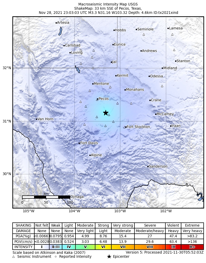
The USGS ShakeMap: shaking estimated from seismic stations and the quake’s size, on the Modified Mercalli intensity scale.
- Strongest estimated
- IV, light shaking
- Peak ground acceleration
- 1.0% of gravity
- Peak ground velocity
- 0.2 cm/s
- Map
- Automatic
Did you feel it?
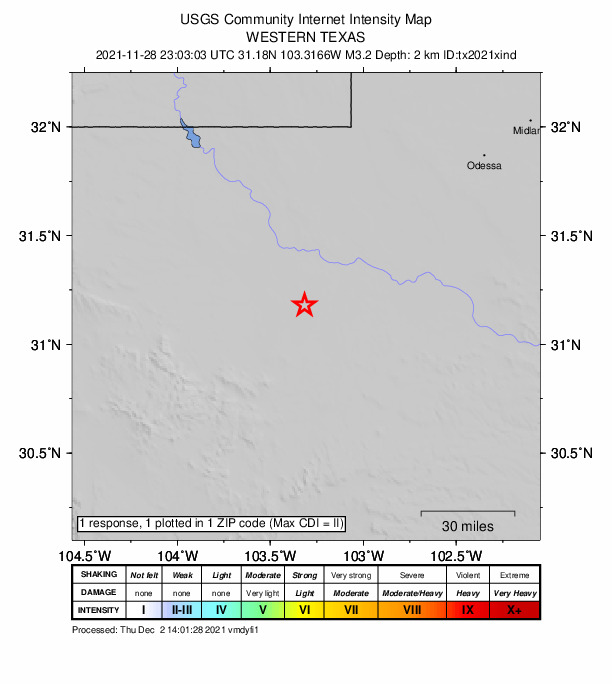
1 person reported to the USGS what they felt; the strongest reported shaking was II, weak shaking.
Fault motion and ground failure
How the rock slipped, from the moment tensor, and the USGS estimate of landslides and liquefaction.
- Faulting
- Normal
- Moment magnitude
- 3.3 Mwr
- Nodal plane 1
- Strike 135°, dip 55°, rake -90°
- Nodal plane 2
- Strike 315°, dip 35°, rake -90°
How well it is located
Reviewed by a seismologist.
- Location uncertainty
- About 0.9 km horizontally, 1.3 km in depth
- Magnitude uncertainty
- ±0.20
- Station coverage gap
- 55°
- Stations used
- 25
Nearest places
Distance and direction from each place to the epicenter, with its forecast.
Nearby
Within 100 km, magnitude 1.5 and up: 69 in the 60 days after this one and 53 in the 30 days before it.
After
- 2.017 km ESE of Lindsay, Texas · 1761 days ago · 5 km deep · 14 km away
- 3.1western Texas · 1759 days ago · 7 km deep · 98 km away
- 2.546 km W of Mentone, Texas · 1759 days ago · 7 km deep · 96 km away
- 1.636 km NNW of Toyah, Texas · 1758 days ago · 9 km deep · 79 km away
- 2.154 km NW of Toyah, Texas · 1757 days ago · 6 km deep · 100 km away
- 2.3western Texas · 1757 days ago · 7 km deep · 100 km away
- 2.354 km NW of Toyah, Texas · 1756 days ago · 7 km deep · 100 km away
- 3.031 km SW of Coyanosa, Texas · 1755 days ago · 5 km deep · 14 km away
- 2.631 km SW of Coyanosa, Texas · 1755 days ago · 6 km deep · 14 km away
- 2.132 km SW of Coyanosa, Texas · 1755 days ago · 6 km deep · 14 km away
- 2.136 km NNW of Toyah, Texas · 1755 days ago · 9 km deep · 79 km away
- 2.236 km NNW of Toyah, Texas · 1755 days ago · 8 km deep · 79 km away
- 2.217 km S of Lindsay, Texas · 1755 days ago · 4 km deep · 21 km away
- 2.251 km NW of Toyah, Texas · 1754 days ago · 7 km deep · 97 km away
- 2.254 km NW of Toyah, Texas · 1753 days ago · 7 km deep · 100 km away
- 2.454 km NW of Toyah, Texas · 1751 days ago · 8 km deep · 100 km away
- 2.026 km WSW of Coyanosa, Texas · 1751 days ago · 5 km deep · 2 km away
- 2.444 km NW of Toyah, Texas · 1751 days ago · 7 km deep · 89 km away
- 2.625 km WSW of Coyanosa, Texas · 1750 days ago · 5 km deep · 2 km away
- 2.054 km NW of Toyah, Texas · 1750 days ago · 6 km deep · 100 km away
- 4.435 km NW of Toyah, Texas · 1747 days ago · 9 km deep · 80 km away · felt by 12
- 2.235 km NW of Toyah, Texas · 1747 days ago · 8 km deep · 80 km away
- 2.217 km ESE of Balmorhea, Texas · 1747 days ago · 7 km deep · 40 km away
- 2.444 km NW of Toyah, Texas · 1745 days ago · 7 km deep · 89 km away
- 2.244 km NW of Toyah, Texas · 1745 days ago · 8 km deep · 89 km away
- 1.944 km NW of Toyah, Texas · 1745 days ago · 7 km deep · 89 km away
- 2.324 km WSW of Coyanosa, Texas · 1744 days ago · 5 km deep · 2 km away
- 2.524 km W of Coyanosa, Texas · 1743 days ago · 6 km deep · 3 km away
- 2.337 km NW of Toyah, Texas · 1741 days ago · 9 km deep · 80 km away
- 1.825 km W of Coyanosa, Texas · 1738 days ago · 5 km deep · 4 km away
- 2.748 km W of Mentone, Texas · 1736 days ago · 7 km deep · 97 km away
- 2.648 km W of Mentone, Texas · 1734 days ago · 7 km deep · 97 km away
- 2.725 km WSW of Coyanosa, Texas · 1734 days ago · 4 km deep · 1 km away
- 2.647 km W of Mentone, Texas · 1734 days ago · 7 km deep · 97 km away
- 2.624 km W of Coyanosa, Texas · 1732 days ago · 5 km deep · 4 km away
- 2.739 km NNW of Toyah, Texas · 1730 days ago · 7 km deep · 82 km away
- 1.838 km NNW of Toyah, Texas · 1730 days ago · 8 km deep · 82 km away
- 2.640 km NNW of Toyah, Texas · 1729 days ago · 7 km deep · 83 km away · felt by 1
- 3.239 km NNW of Toyah, Texas · 1729 days ago · 7 km deep · 82 km away
- 2.353 km NW of Toyah, Texas · 1728 days ago · 6 km deep · 99 km away
- 2.031 km NNW of Toyah, Texas · 1728 days ago · 6 km deep · 73 km away
- 2.431 km NNW of Toyah, Texas · 1728 days ago · 7 km deep · 73 km away
- 1.917 km NW of Coyanosa, Texas · 1727 days ago · 6 km deep · 22 km away
- 2.136 km NNW of Toyah, Texas · 1727 days ago · 8 km deep · 80 km away
- 2.442 km NW of Toyah, Texas · 1724 days ago · 7 km deep · 89 km away
- 2.226 km WSW of Coyanosa, Texas · 1723 days ago · 5 km deep · 2 km away
- 2.245 km NW of Toyah, Texas · 1722 days ago · 7 km deep · 91 km away
- 2.027 km SE of Lindsay, Texas · 1721 days ago · 3 km deep · 3 km away
- 1.530 km ENE of Balmorhea, Texas · 1719 days ago · 5 km deep · 17 km away
- 2.435 km NW of Toyah, Texas · 1718 days ago · 8 km deep · 80 km away
- 1.628 km SE of Lindsay, Texas · 1718 days ago · 5 km deep · 4 km away
- 2.244 km NW of Toyah, Texas · 1717 days ago · 6 km deep · 89 km away
- 2.244 km NW of Toyah, Texas · 1717 days ago · 7 km deep · 89 km away
- 2.017 km WSW of Coyanosa, Texas · 1716 days ago · 3 km deep · 10 km away
- 2.345 km NW of Toyah, Texas · 1716 days ago · 7 km deep · 90 km away
- 2.153 km NW of Toyah, Texas · 1716 days ago · 7 km deep · 99 km away
- 1.825 km WSW of Coyanosa, Texas · 1715 days ago · 6 km deep · 2 km away
- 1.727 km WSW of Coyanosa, Texas · 1715 days ago · 6 km deep · 2 km away
- 1.936 km NNW of Toyah, Texas · 1715 days ago · 8 km deep · 79 km away
- 2.226 km WSW of Coyanosa, Texas · 1715 days ago · 5 km deep · 2 km away
The first 60 of 69.
Before
- 2.036 km NNW of Toyah, Texas · 1765 days ago · 8 km deep · 80 km away
- 2.336 km NNW of Toyah, Texas · 1765 days ago · 8 km deep · 80 km away
- 2.353 km NW of Toyah, Texas · 1766 days ago · 7 km deep · 100 km away
- 2.025 km WSW of Coyanosa, Texas · 1766 days ago · 3 km deep · 1 km away
- 2.327 km NW of Toyah, Texas · 1767 days ago · 5 km deep · 73 km away
- 1.936 km NNW of Toyah, Texas · 1768 days ago · 8 km deep · 79 km away
- 2.640 km W of Mentone, Texas · 1768 days ago · 8 km deep · 84 km away
- 2.221 km SSE of Lindsay, Texas · 1768 days ago · 2 km deep · 17 km away
- 2.121 km SSE of Lindsay, Texas · 1768 days ago · 3 km deep · 15 km away
- 2.245 km NW of Toyah, Texas · 1768 days ago · 8 km deep · 90 km away
- 2.351 km NW of Toyah, Texas · 1770 days ago · 7 km deep · 97 km away
- 2.237 km NNW of Toyah, Texas · 1770 days ago · 8 km deep · 80 km away
- 2.254 km NW of Toyah, Texas · 1771 days ago · 6 km deep · 100 km away
- 2.320 km WSW of Coyanosa, Texas · 1771 days ago · 4 km deep · 6 km away
- 2.437 km NNW of Toyah, Texas · 1772 days ago · 8 km deep · 79 km away
- 2.044 km NW of Toyah, Texas · 1772 days ago · 7 km deep · 89 km away
- 2.032 km NNW of Toyah, Texas · 1773 days ago · 8 km deep · 73 km away
- 2.937 km NNW of Toyah, Texas · 1773 days ago · 8 km deep · 80 km away · felt by 1
- 2.1western Texas · 1774 days ago · 7 km deep · 89 km away
- 2.244 km NW of Toyah, Texas · 1774 days ago · 7 km deep · 88 km away
Earthquakes todayTexas earthquakesLive radar here
Sources
From the USGS Earthquake Hazards Program and its partner networks, event tx2021xind (also filed as us7000fxu5). Read Mon, Sep 28, 2026, 12:23 PM UTC.