M2.3 earthquake 22km SW of Big Pine, CA
A magnitude 2.3 earthquake struck 22km SW of Big Pine, CA on Wed, Mar 31, 2021, 3:34 PM PDT (22:34 UTC), 7 km (4 mi) below the surface.
A larger quake followed: M3.1 9km WSW of Toms Place, CA. This one was a foreshock.
Map
Where this earthquake was located, with the others nearby. Select one for its page.
The earthquake
- Magnitude
- 2.3 (Md, duration), micro
- Magnitude from
- Northern California Seismic System
- Local time
- UTC
- 2021-03-31 22:34:13 UTC
- Depth
- 7.1 km (4.4 mi), shallow
- Epicenter
- 37.005° N, 118.445° W
- Region
- California
- Felt reports
- 1
- Tsunami flag
- No
- Status
- Reviewed by a seismologist
Did you feel it?
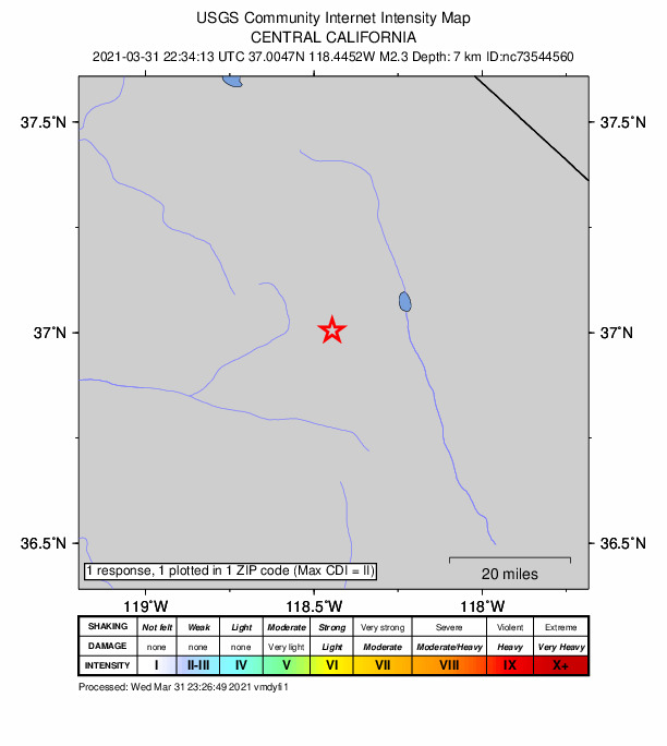
1 person reported to the USGS what they felt; the strongest reported shaking was II, weak shaking.
How well it is located
Reviewed by a seismologist.
- Location uncertainty
- About 0.3 km horizontally, 1.3 km in depth
- Magnitude uncertainty
- ±0.22
- Depth from
- From location
- Station coverage gap
- 58°
- Stations used
- 37
Nearest places
Distance and direction from each place to the epicenter, with its forecast.
Nearby
Within 100 km, magnitude 1.5 and up: 106 in the 60 days after this one and 57 in the 30 days before it.
After
- 2.118km SSE of Lone Pine, CA · 2011 days ago · 8 km deep · 75 km away
- 1.914km SSW of Olancha, CA · 2009 days ago · 2 km deep · 100 km away
- 1.614km SSW of Olancha, CA · 2007 days ago · 1 km deep · 99 km away
- 1.638km NNE of Toms Place, CA · 2007 days ago · 6 km deep · 99 km away
- 1.67km E of North Fork, CA · 2006 days ago · 25 km deep · 92 km away
- 2.633km NW of Stovepipe Wells, CA · 2004 days ago · 1 km deep · 93 km away
- 1.918km SW of Toms Place, CA · 2003 days ago · 4 km deep · 62 km away
- 2.011km SE of Mammoth Lakes, CA · 2002 days ago · 5 km deep · 73 km away
- 1.813km SE of Mammoth Lakes, CA · 2001 days ago · 6 km deep · 73 km away
- 1.613km SE of Mammoth Lakes, CA · 2001 days ago · 6 km deep · 73 km away
- 2.26km ENE of Deep Springs, CA · 2000 days ago · 10 km deep · 63 km away
- 2.214km SE of Lone Pine, CA · 2000 days ago · 10 km deep · 72 km away
- 2.52km S of Round Valley, CA · 1999 days ago · 13 km deep · 46 km away
- 1.82km NNE of Wilkerson, CA · 1999 days ago · 12 km deep · 33 km away
- 2.813km W of Toms Place, CA · 1999 days ago · 4 km deep · 71 km away · felt by 1
- 1.539km NNE of Toms Place, CA · 1995 days ago · 5 km deep · 99 km away
- 1.520km NNW of Toms Place, CA · 1995 days ago · 7 km deep · 86 km away
- 2.99km W of Toms Place, CA · 1992 days ago · 8 km deep · 67 km away · felt by 5
- 1.716km SE of Lone Pine, CA · 1992 days ago · 8 km deep · 73 km away
- 3.19km WSW of Toms Place, CA · 1990 days ago · 8 km deep · 67 km away · felt by 9
- 1.561 km NNE of Keeler, California · 1989 days ago · 0 km deep · 83 km away
- 1.88km WNW of Round Valley, CA · 1989 days ago · 13 km deep · 53 km away
- 2.113km W of Toms Place, CA · 1989 days ago · 4 km deep · 71 km away
- 2.03km NNE of Wilkerson, CA · 1989 days ago · 7 km deep · 33 km away
- 1.94km ENE of Round Valley, CA · 1988 days ago · 18 km deep · 48 km away
- 1.62km E of Round Valley, CA · 1988 days ago · -1 km deep · 47 km away
- 2.46km ENE of Deep Springs, CA · 1988 days ago · 11 km deep · 63 km away
- 2.151 km ENE of Independence, California · 1987 days ago · 14 km deep · 68 km away
- 1.98km E of Sanger, CA · 1987 days ago · 33 km deep · 97 km away · felt by 1
- 1.510 km NW of Benton, California · 1986 days ago · 1 km deep · 98 km away
- 2.46km ESE of Lone Pine, CA · 1986 days ago · 6 km deep · 63 km away
- 1.938km NNE of Toms Place, CA · 1986 days ago · 6 km deep · 98 km away
- 1.538km NNE of Toms Place, CA · 1986 days ago · 1 km deep · 99 km away
- 2.119km SE of Lone Pine, CA · 1985 days ago · 8 km deep · 76 km away
- 1.76km ENE of Big Pine, CA · 1984 days ago · 8 km deep · 28 km away
- 1.65km NNE of Wilkerson, CA · 1983 days ago · 9 km deep · 35 km away
- 2.616km WSW of Toms Place, CA · 1983 days ago · 2 km deep · 67 km away
- 1.910km WSW of Toms Place, CA · 1980 days ago · 6 km deep · 64 km away
- 1.530km NE of Oakhurst, CA · 1980 days ago · 17 km deep · 98 km away
- 1.630km NE of Oakhurst, CA · 1980 days ago · 15 km deep · 98 km away
- 1.630km NE of Oakhurst, CA · 1980 days ago · 14 km deep · 98 km away
- 1.728km NNW of Deep Springs, CA · 1979 days ago · 6 km deep · 71 km away
- 1.830km NE of Oakhurst, CA · 1979 days ago · 11 km deep · 99 km away
- 1.630km NE of Oakhurst, CA · 1979 days ago · 16 km deep · 98 km away
- 1.730km NE of Oakhurst, CA · 1979 days ago · 18 km deep · 97 km away
- 1.630km NE of Oakhurst, CA · 1979 days ago · 16 km deep · 98 km away
- 1.629km ENE of Oakhurst, CA · 1979 days ago · 17 km deep · 97 km away
- 2.630km NE of Oakhurst, CA · 1979 days ago · 11 km deep · 99 km away · felt by 5
- 1.917km SE of Lone Pine, CA · 1979 days ago · 9 km deep · 74 km away
- 1.930km NE of Oakhurst, CA · 1978 days ago · 15 km deep · 97 km away
- 1.730km NE of Oakhurst, CA · 1978 days ago · 12 km deep · 98 km away
- 1.921km SW of Olancha, CA · 1977 days ago · 4 km deep · 97 km away
- 1.613km W of Toms Place, CA · 1977 days ago · 4 km deep · 69 km away
- 1.816km SW of Toms Place, CA · 1977 days ago · 8 km deep · 62 km away
- 2.87km ESE of Lone Pine, CA · 1977 days ago · 7 km deep · 64 km away · felt by 8
- 2.17km ESE of Lone Pine, CA · 1977 days ago · 7 km deep · 63 km away
- 1.67km ESE of Lone Pine, CA · 1977 days ago · 9 km deep · 63 km away
- 2.47km ESE of Lone Pine, CA · 1977 days ago · 7 km deep · 63 km away · felt by 1
- 2.313km W of Toms Place, CA · 1977 days ago · 4 km deep · 69 km away
- 1.729km NE of Oakhurst, CA · 1977 days ago · 16 km deep · 97 km away
The first 60 of 106.
Before
- 1.512km SW of Olancha, CA · 2012 days ago · 3 km deep · 96 km away
- 1.638km NNE of Toms Place, CA · 2016 days ago · 5 km deep · 99 km away
- 1.639km NNE of Toms Place, CA · 2016 days ago · 3 km deep · 100 km away
- 2.129km W of Olancha, CA · 2017 days ago · 5 km deep · 80 km away
- 1.817km SSE of Mammoth Lakes, CA · 2017 days ago · 9 km deep · 68 km away
- 1.97km ESE of Lone Pine, CA · 2017 days ago · 8 km deep · 63 km away
- 1.739km NNE of Toms Place, CA · 2017 days ago · 7 km deep · 100 km away
- 1.814km SSW of Olancha, CA · 2018 days ago · 3 km deep · 100 km away
- 1.96km ESE of Lone Pine, CA · 2018 days ago · 8 km deep · 63 km away
- 2.839km NNE of Toms Place, CA · 2019 days ago · 6 km deep · 99 km away · felt by 1
- 1.89km W of Toms Place, CA · 2021 days ago · 8 km deep · 67 km away
- 2.27km ESE of Lone Pine, CA · 2021 days ago · 8 km deep · 63 km away
- 1.89km WSW of Toms Place, CA · 2021 days ago · 8 km deep · 67 km away
- 3.139km NNE of Toms Place, CA · 2022 days ago · 6 km deep · 100 km away · felt by 4
- 1.643 km ESE of Big Pine, California · 2022 days ago · 3 km deep · 57 km away
- 1.67km ESE of Lone Pine, CA · 2023 days ago · 8 km deep · 63 km away
- 2.819km SW of Toms Place, CA · 2023 days ago · 11 km deep · 62 km away · felt by 2
- 2.219km SW of Toms Place, CA · 2023 days ago · 10 km deep · 62 km away
- 2.47km ESE of Lone Pine, CA · 2023 days ago · 7 km deep · 63 km away
- 2.57km ESE of Lone Pine, CA · 2024 days ago · 8 km deep · 63 km away
Earthquakes todayCalifornia earthquakesLive radar here
Sources
From the USGS Earthquake Hazards Program and its partner networks, event nc73544560. Read Sat, Oct 3, 2026, 10:20 AM UTC.