M3.3 earthquake 42 km WNW of Ninilchik, Alaska
A magnitude 3.3 earthquake struck 42 km WNW of Ninilchik, Alaska on Mon, Sep 28, 2020, 1:28 AM AKDT (09:28 UTC), 91 km (57 mi) below the surface.
Map
Where this earthquake was located, with the others nearby. Select one for its page.
The earthquake
- Magnitude
- 3.3 (ML, local (Richter)), minor
- Magnitude from
- Alaska Earthquake Center
- Local time
- UTC
- 2020-09-28 09:28:01 UTC
- Depth
- 91.3 km (56.7 mi), intermediate-depth
- Epicenter
- 60.164° N, 152.401° W
- Region
- Alaska
- Felt reports
- 2
- Tsunami flag
- No
- Status
- Reviewed by a seismologist
Magnitude estimates
Different scales measure different things and differ by a few tenths. The USGS marks one as preferred, and it is the one this page uses.
| Mag. | Scale | Computed by | Notes |
|---|---|---|---|
| 3.3 | ML, local (Richter) | Alaska Earthquake Center | Preferred · Preliminary |
| 3.5 | ML, local (Richter) | USGS National Earthquake Information Center | Reviewed · ±0.029 · 156 stations |
Did you feel it?
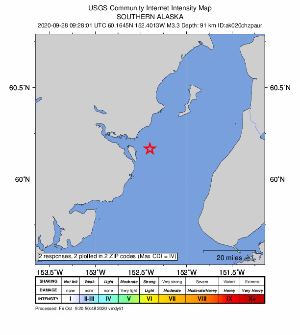
2 people reported to the USGS what they felt; the strongest reported shaking was IV, light shaking.
How well it is located
Reviewed by a seismologist.
- Stations used
- 185
Nearest places
Distance and direction from each place to the epicenter, with its forecast.
Nearby
Within 100 km, magnitude 1.5 and up: at least 199 in the 60 days after this one and 166 in the 30 days before it.
After
- 2.064 km ESE of Pedro Bay, Alaska · 2197 days ago · 107 km deep · 69 km away
- 1.96 km ESE of Ninilchik, Alaska · 2197 days ago · 70 km deep · 49 km away
- 1.663 km WNW of Anchor Point, Alaska · 2197 days ago · 110 km deep · 32 km away
- 1.737 km E of Pedro Bay, Alaska · 2197 days ago · 130 km deep · 71 km away
- 1.742 km E of Pedro Bay, Alaska · 2197 days ago · 136 km deep · 64 km away
- 1.662 km WNW of Happy Valley, Alaska · 2197 days ago · 103 km deep · 22 km away
- 1.953 km E of Pedro Bay, Alaska · 2197 days ago · 105 km deep · 64 km away
- 1.659 km WNW of Ninilchik, Alaska · 2197 days ago · 100 km deep · 17 km away
- 1.747 km WNW of Happy Valley, Alaska · 2197 days ago · 81 km deep · 12 km away
- 1.636 km WNW of Nanwalek, Alaska · 2196 days ago · 66 km deep · 70 km away
- 2.260 km ESE of Pedro Bay, Alaska · 2196 days ago · 106 km deep · 81 km away
- 1.627 km NW of Nikiski, Alaska · 2196 days ago · 78 km deep · 85 km away
- 2.124 km WNW of Cohoe, Alaska · 2196 days ago · 71 km deep · 47 km away
- 1.554 km WNW of Happy Valley, Alaska · 2196 days ago · 91 km deep · 14 km away
- 2.163 km ESE of Pedro Bay, Alaska · 2195 days ago · 112 km deep · 76 km away
- 1.9Southern Alaska · 2195 days ago · 68 km deep · 41 km away
- 2.07 km SSE of Clam Gulch, Alaska · 2195 days ago · 44 km deep · 59 km away
- 2.038 km WNW of Nanwalek, Alaska · 2195 days ago · 82 km deep · 70 km away
- 2.135 km W of Nanwalek, Alaska · 2194 days ago · 64 km deep · 93 km away
- 3.339 km E of Pedro Bay, Alaska · 2194 days ago · 129 km deep · 67 km away
- 1.841 km WNW of Ninilchik, Alaska · 2194 days ago · 81 km deep · 4 km away
- 2.937 km WNW of Nanwalek, Alaska · 2193 days ago · 78 km deep · 82 km away
- 2.024 km W of Anchor Point, Alaska · 2193 days ago · 70 km deep · 44 km away
- 2.261 km E of Pedro Bay, Alaska · 2193 days ago · 105 km deep · 56 km away
- 1.838 km WNW of Nanwalek, Alaska · 2192 days ago · 77 km deep · 71 km away
- 2.120 km WNW of Cohoe, Alaska · 2192 days ago · 66 km deep · 49 km away
- 2.143 km NE of Pedro Bay, Alaska · 2192 days ago · 167 km deep · 65 km away
- 1.724 km WNW of Nikiski, Alaska · 2192 days ago · 74 km deep · 82 km away
- 1.565 km ENE of Pedro Bay, Alaska · 2191 days ago · 120 km deep · 39 km away
- 2.030 km WSW of Tyonek, Alaska · 2191 days ago · 69 km deep · 95 km away
- 1.638 km W of Nanwalek, Alaska · 2191 days ago · 73 km deep · 95 km away
- 2.343 km E of Pedro Bay, Alaska · 2191 days ago · 117 km deep · 66 km away
- 2.058 km W of Anchor Point, Alaska · 2191 days ago · 83 km deep · 48 km away
- 2.051 km ENE of Pedro Bay, Alaska · 2191 days ago · 110 km deep · 55 km away
- 1.546 km WNW of Ninilchik, Alaska · 2191 days ago · 83 km deep · 4 km away
- 1.726 km WNW of Nikiski, Alaska · 2190 days ago · 79 km deep · 83 km away
- 1.645 km WNW of Nanwalek, Alaska · 2190 days ago · 85 km deep · 77 km away
- 1.842 km W of Nanwalek, Alaska · 2190 days ago · 75 km deep · 85 km away
- 1.657 km WNW of Anchor Point, Alaska · 2190 days ago · 94 km deep · 37 km away
- 1.949 km NW of Ninilchik, Alaska · 2190 days ago · 92 km deep · 16 km away
- 1.634 km W of Salamatof, Alaska · 2190 days ago · 83 km deep · 57 km away
- 2.831 km WSW of Anchor Point, Alaska · 2190 days ago · 66 km deep · 51 km away
- 1.743 km SE of Pedro Bay, Alaska · 2189 days ago · 125 km deep · 95 km away
- 1.619 km NW of Ninilchik, Alaska · 2189 days ago · 84 km deep · 25 km away
- 1.77 km W of Homer, Alaska · 2189 days ago · 45 km deep · 71 km away · felt by 1
- 1.640 km E of Pedro Bay, Alaska · 2189 days ago · 137 km deep · 67 km away
- 1.741 km WSW of Salamatof, Alaska · 2189 days ago · 78 km deep · 42 km away
- 1.856 km E of Port Alsworth, Alaska · 2189 days ago · 156 km deep · 50 km away
- 1.952 km WNW of Ninilchik, Alaska · 2188 days ago · 96 km deep · 11 km away
- 2.960 km WNW of Anchor Point, Alaska · 2188 days ago · 91 km deep · 33 km away
- 2.066 km E of Port Alsworth, Alaska · 2188 days ago · 131 km deep · 39 km away
- 2.250 km WNW of Nanwalek, Alaska · 2188 days ago · 84 km deep · 65 km away
- 2.440 km ESE of Port Alsworth, Alaska · 2188 days ago · 160 km deep · 68 km away
- 1.831 km ESE of Pedro Bay, Alaska · 2187 days ago · 129 km deep · 83 km away
- 1.852 km WNW of Ninilchik, Alaska · 2187 days ago · 86 km deep · 10 km away
- 1.518 km SW of Anchor Point, Alaska · 2187 days ago · 54 km deep · 59 km away
- 1.518 km W of Clam Gulch, Alaska · 2187 days ago · 72 km deep · 38 km away
- 1.757 km WSW of Anchor Point, Alaska · 2187 days ago · 87 km deep · 61 km away
- 2.669 km WNW of Happy Valley, Alaska · 2187 days ago · 115 km deep · 31 km away
- 1.733 km WNW of Nikiski, Alaska · 2187 days ago · 81 km deep · 82 km away
The first 60 of at least 199.
Before
- 1.56 km SSE of Clam Gulch, Alaska · 2198 days ago · 52 km deep · 58 km away
- 1.547 km ESE of Pedro Bay, Alaska · 2198 days ago · 108 km deep · 74 km away
- 2.046 km WNW of Nanwalek, Alaska · 2198 days ago · 73 km deep · 69 km away
- 1.864 km WNW of Anchor Point, Alaska · 2198 days ago · 114 km deep · 39 km away
- 2.3Southern Alaska · 2198 days ago · 85 km deep · 65 km away
- 1.914 km SSW of Halibut Cove, Alaska · 2198 days ago · 47 km deep · 99 km away
- 1.769 km NW of Ninilchik, Alaska · 2199 days ago · 102 km deep · 34 km away
- 1.540 km W of Anchor Point, Alaska · 2199 days ago · 87 km deep · 48 km away
- 1.860 km W of Anchor Point, Alaska · 2199 days ago · 99 km deep · 45 km away
- 1.960 km ESE of Pedro Bay, Alaska · 2199 days ago · 112 km deep · 66 km away
- 2.2Southern Alaska · 2199 days ago · 115 km deep · 48 km away
- 1.555 km W of Anchor Point, Alaska · 2200 days ago · 94 km deep · 43 km away
- 1.744 km E of Pedro Bay, Alaska · 2200 days ago · 117 km deep · 65 km away
- 1.559 km WSW of Anchor Point, Alaska · 2200 days ago · 89 km deep · 63 km away
- 2.311 km N of Ridgeway, Alaska · 2200 days ago · 58 km deep · 94 km away
- 1.842 km WNW of Nanwalek, Alaska · 2200 days ago · 66 km deep · 67 km away
- 1.713 km E of Happy Valley, Alaska · 2201 days ago · 45 km deep · 56 km away
- 1.843 km E of Port Alsworth, Alaska · 2201 days ago · 162 km deep · 63 km away
- 1.815 km E of Ninilchik, Alaska · 2201 days ago · 61 km deep · 57 km away
- 1.568 km W of Tyonek, Alaska · 2201 days ago · 114 km deep · 99 km away
Earthquakes todayAlaska earthquakesLive radar here
Sources
From the USGS Earthquake Hazards Program and its partner networks, event ak020chzpaur (also filed as us6000c241). Read Sun, Oct 4, 2026, 5:48 PM UTC.