M3.5 earthquake 29 km WSW of Nanwalek, Alaska
A magnitude 3.5 earthquake struck 29 km WSW of Nanwalek, Alaska on Sun, Jan 26, 2020, 1:18 PM AKST (22:18 UTC), 62 km (39 mi) below the surface.
A larger quake followed: M3.8 62 km WNW of Anchor Point, Alaska. This one was a foreshock.
Map
Where this earthquake was located, with the others nearby. Select one for its page.
The earthquake
- Magnitude
- 3.5 (ML, local (Richter)), minor
- Magnitude from
- Alaska Earthquake Center
- Local time
- UTC
- 2020-01-26 22:18:10 UTC
- Depth
- 62.1 km (38.6 mi), shallow
- Epicenter
- 59.288° N, 152.429° W
- Region
- Alaska
- Felt reports
- 1
- Tsunami flag
- No
- Status
- Reviewed by a seismologist
Magnitude estimates
Different scales measure different things and differ by a few tenths. The USGS marks one as preferred, and it is the one this page uses.
| Mag. | Scale | Computed by | Notes |
|---|---|---|---|
| 3.5 | ML, local (Richter) | Alaska Earthquake Center | Preferred · Preliminary |
| 4.3 | mb, body-wave | USGS National Earthquake Information Center | Reviewed · ±0.153 · 12 stations |
Did you feel it?
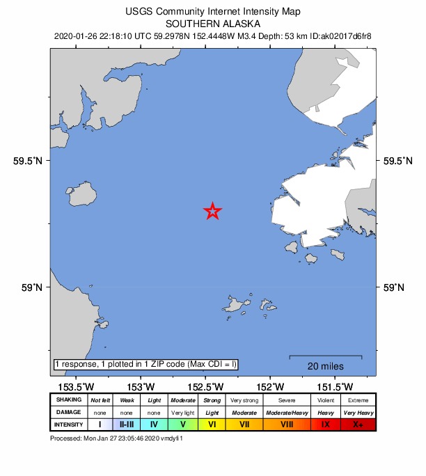
1 person reported to the USGS what they felt; the strongest reported shaking was I, not felt shaking.
How well it is located
Reviewed by a seismologist.
- Stations used
- 222
Nearest places
Distance and direction from each place to the epicenter, with its forecast.
Nearby
Within 100 km, magnitude 1.5 and up: at least 202 in the 60 days after this one and 182 in the 30 days before it.
After
- 1.844 km W of Anchor Point, Alaska · 2441 days ago · 77 km deep · 48 km away
- 1.78 km SE of Happy Valley, Alaska · 2440 days ago · 50 km deep · 82 km away
- 3.063 km W of Anchor Point, Alaska · 2440 days ago · 104 km deep · 64 km away
- 1.860 km SE of Kokhanok, Alaska · 2440 days ago · 105 km deep · 97 km away
- 1.950 km E of Pedro Bay, Alaska · 2439 days ago · 105 km deep · 68 km away
- 1.5Southern Alaska · 2439 days ago · 71 km deep · 38 km away
- 1.955 km W of Anchor Point, Alaska · 2439 days ago · 94 km deep · 66 km away
- 1.850 km W of Nanwalek, Alaska · 2439 days ago · 75 km deep · 22 km away
- 2.3Southern Alaska · 2439 days ago · 65 km deep · 31 km away
- 1.747 km WNW of Happy Valley, Alaska · 2439 days ago · 94 km deep · 88 km away
- 2.293 km SE of Kokhanok, Alaska · 2438 days ago · 9 km deep · 87 km away
- 1.966 km W of Nanwalek, Alaska · 2438 days ago · 80 km deep · 39 km away
- 2.548 km WNW of Anchor Point, Alaska · 2438 days ago · 85 km deep · 71 km away
- 1.661 km W of Happy Valley, Alaska · 2438 days ago · 103 km deep · 85 km away
- 1.655 km WNW of Anchor Point, Alaska · 2438 days ago · 96 km deep · 73 km away
- 1.992 km SE of Kokhanok, Alaska · 2437 days ago · 9 km deep · 87 km away
- 1.691 km SE of Kokhanok, Alaska · 2437 days ago · 5 km deep · 85 km away
- 2.145 km W of Nanwalek, Alaska · 2437 days ago · 71 km deep · 17 km away
- 1.691 km SE of Kokhanok, Alaska · 2437 days ago · 3 km deep · 86 km away
- 1.790 km SE of Kokhanok, Alaska · 2437 days ago · 5 km deep · 88 km away
- 3.183 km SE of Kokhanok, Alaska · 2437 days ago · 0 km deep · 91 km away
- 1.691 km SE of Kokhanok, Alaska · 2437 days ago · 8 km deep · 86 km away
- 2.094 km NNW of Aleneva, Alaska · 2437 days ago · 10 km deep · 85 km away
- 1.594 km SE of Kokhanok, Alaska · 2437 days ago · 7 km deep · 84 km away
- 2.293 km SE of Kokhanok, Alaska · 2437 days ago · 6 km deep · 84 km away
- 2.394 km NNW of Aleneva, Alaska · 2437 days ago · 7 km deep · 84 km away
- 1.694 km NNW of Aleneva, Alaska · 2437 days ago · 8 km deep · 85 km away
- 1.649 km WNW of Nanwalek, Alaska · 2437 days ago · 72 km deep · 34 km away
- 1.833 km W of Nanwalek, Alaska · 2437 days ago · 64 km deep · 5 km away
- 1.794 km NNW of Aleneva, Alaska · 2437 days ago · 10 km deep · 85 km away
- 2.294 km NNW of Aleneva, Alaska · 2437 days ago · 7 km deep · 84 km away
- 1.594 km NNW of Aleneva, Alaska · 2437 days ago · 6 km deep · 84 km away
- 1.693 km NNW of Aleneva, Alaska · 2437 days ago · 4 km deep · 85 km away
- 2.093 km NNW of Aleneva, Alaska · 2437 days ago · 9 km deep · 84 km away
- 1.636 km W of Happy Valley, Alaska · 2437 days ago · 90 km deep · 77 km away
- 1.594 km SE of Kokhanok, Alaska · 2437 days ago · 7 km deep · 85 km away
- 1.792 km NNW of Aleneva, Alaska · 2437 days ago · 5 km deep · 84 km away
- 3.495 km SE of Kokhanok, Alaska · 2437 days ago · 8 km deep · 85 km away
- 1.693 km SE of Kokhanok, Alaska · 2437 days ago · 11 km deep · 87 km away
- 1.592 km SE of Kokhanok, Alaska · 2437 days ago · 8 km deep · 86 km away
- 1.694 km NNW of Aleneva, Alaska · 2437 days ago · 10 km deep · 86 km away
- 1.795 km SE of Kokhanok, Alaska · 2437 days ago · 6 km deep · 84 km away
- 1.590 km SE of Kokhanok, Alaska · 2437 days ago · 3 km deep · 86 km away
- 1.794 km NNW of Aleneva, Alaska · 2437 days ago · 5 km deep · 84 km away
- 1.587 km SSE of Pope-Vannoy Landing, Alaska · 2437 days ago · 5 km deep · 83 km away
- 2.140 km ENE of Pedro Bay, Alaska · 2437 days ago · 135 km deep · 96 km away
- 3.494 km NNW of Aleneva, Alaska · 2437 days ago · 7 km deep · 84 km away
- 2.163 km W of Anchor Point, Alaska · 2437 days ago · 103 km deep · 65 km away
- 3.484 km SE of Kokhanok, Alaska · 2437 days ago · 0 km deep · 93 km away
- 1.693 km SE of Kokhanok, Alaska · 2437 days ago · 7 km deep · 85 km away
- 1.692 km SE of Kokhanok, Alaska · 2437 days ago · 9 km deep · 86 km away
- 1.692 km SE of Kokhanok, Alaska · 2437 days ago · 7 km deep · 85 km away
- 1.591 km SE of Kokhanok, Alaska · 2437 days ago · 3 km deep · 86 km away
- 1.694 km NNW of Aleneva, Alaska · 2437 days ago · 5 km deep · 85 km away
- 1.694 km SE of Kokhanok, Alaska · 2437 days ago · 8 km deep · 85 km away
- 1.792 km SE of Kokhanok, Alaska · 2437 days ago · 8 km deep · 86 km away
- 1.695 km NNW of Aleneva, Alaska · 2437 days ago · 4 km deep · 84 km away
- 1.859 km ESE of Pedro Bay, Alaska · 2437 days ago · 100 km deep · 56 km away
- 1.993 km NNW of Aleneva, Alaska · 2437 days ago · 3 km deep · 84 km away
- 1.792 km SE of Kokhanok, Alaska · 2437 days ago · 8 km deep · 86 km away
The first 60 of at least 202.
Before
- 1.663 km ESE of Pedro Bay, Alaska · 2441 days ago · 102 km deep · 48 km away
- 1.849 km E of Pedro Bay, Alaska · 2442 days ago · 133 km deep · 79 km away
- 1.649 km WNW of Happy Valley, Alaska · 2442 days ago · 92 km deep · 87 km away
- 1.771 km SE of Kokhanok, Alaska · 2442 days ago · 10 km deep · 92 km away
- 2.077 km SE of Kokhanok, Alaska · 2442 days ago · 10 km deep · 89 km away
- 1.870 km SE of Kokhanok, Alaska · 2442 days ago · 7 km deep · 94 km away
- 3.5Southern Alaska · 2442 days ago · 112 km deep · 76 km away
- 2.162 km W of Ninilchik, Alaska · 2443 days ago · 109 km deep · 99 km away
- 1.840 km W of Anchor Point, Alaska · 2443 days ago · 86 km deep · 63 km away
- 2.056 km SE of Kokhanok, Alaska · 2443 days ago · 110 km deep · 96 km away
- 1.64 km SSE of Ninilchik, Alaska · 2443 days ago · 52 km deep · 92 km away
- 1.557 km E of Pedro Bay, Alaska · 2443 days ago · 101 km deep · 67 km away
- 2.034 km S of Port Graham, Alaska · 2443 days ago · 75 km deep · 39 km away
- 2.036 km E of Pedro Bay, Alaska · 2443 days ago · 124 km deep · 82 km away
- 2.369 km SE of Pedro Bay, Alaska · 2443 days ago · 88 km deep · 47 km away
- 1.659 km W of Happy Valley, Alaska · 2443 days ago · 97 km deep · 84 km away
- 1.761 km SW of Nanwalek, Alaska · 2443 days ago · 67 km deep · 38 km away
- 1.859 km W of Anchor Point, Alaska · 2443 days ago · 83 km deep · 56 km away
- 1.964 km ENE of Pedro Bay, Alaska · 2443 days ago · 120 km deep · 85 km away
- 2.147 km E of Pedro Bay, Alaska · 2444 days ago · 108 km deep · 67 km away
Earthquakes todayAlaska earthquakesLive radar here
Sources
From the USGS Earthquake Hazards Program and its partner networks, event ak02017d6fr8 (also filed as us60007gqw). Read Sat, Oct 3, 2026, 5:34 AM UTC.