M3.0 earthquake 12 km N of Meadow Lakes, Alaska
A magnitude 3.0 earthquake struck 12 km N of Meadow Lakes, Alaska on Sun, Sep 27, 2020, 12:29 PM AKDT (20:29 UTC), 40 km (25 mi) below the surface.
A larger quake followed: M5.1 2 km E of Big Lake, Alaska. This one was a foreshock.
Map
Where this earthquake was located, with the others nearby. Select one for its page.
The earthquake
- Magnitude
- 3.0 (ML, local (Richter)), minor
- Magnitude from
- Alaska Earthquake Center
- Local time
- UTC
- 2020-09-27 20:29:54 UTC
- Depth
- 40.0 km (24.9 mi), shallow
- Epicenter
- 61.732° N, 149.642° W
- Region
- Alaska
- Felt reports
- 2
- Strongest shaking
- II, weak shaking
- Tsunami flag
- No
- Status
- Reviewed by a seismologist
Magnitude estimates
Different scales measure different things and differ by a few tenths. The USGS marks one as preferred, and it is the one this page uses.
| Mag. | Scale | Computed by | Notes |
|---|---|---|---|
| 3.0 | ML, local (Richter) | Alaska Earthquake Center | Preferred · Preliminary |
| 3.1 | ML, local (Richter) | USGS National Earthquake Information Center | Reviewed · ±0.03 · 144 stations |
What happened
The USGS’s account of the effects of this earthquake.
Also felt at Chugiak and Eagle River.
From the USGS event page for ak020cgiq1t3. U.S. Geological Survey text and figures are in the public domain.
Shaking
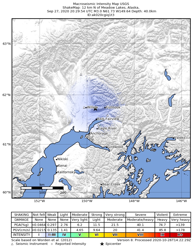
The USGS ShakeMap: shaking estimated from seismic stations and the quake’s size, on the Modified Mercalli intensity scale.
- Strongest estimated
- II, weak shaking
- Peak ground acceleration
- 0.1% of gravity
- Peak ground velocity
- -3.3 cm/s
- Map
- Automatic
Did you feel it?
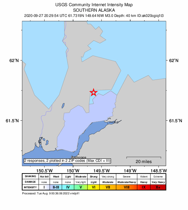
2 people reported to the USGS what they felt; the strongest reported shaking was III, weak shaking.
How well it is located
Reviewed by a seismologist.
- Stations used
- 129
Nearest places
Distance and direction from each place to the epicenter, with its forecast.
Nearby
Within 100 km, magnitude 1.5 and up: 190 in the 60 days after this one and 119 in the 30 days before it.
After
- 2.68 km NW of Glacier View, Alaska · 2197 days ago · 38 km deep · 99 km away
- 3.014 km W of Trapper Creek, Alaska · 2197 days ago · 62 km deep · 80 km away · felt by 2
- 1.815 km WSW of Anchorage, Alaska · 2197 days ago · 39 km deep · 67 km away
- 2.427 km SW of Susitna North, Alaska · 2197 days ago · 44 km deep · 46 km away · felt by 2
- 1.531 km NNW of Susitna, Alaska · 2197 days ago · 66 km deep · 53 km away
- 1.52 km NW of Point MacKenzie, Alaska · 2197 days ago · 35 km deep · 44 km away
- 2.2Central Alaska · 2197 days ago · 34 km deep · 37 km away
- 1.624 km NNE of Willow, Alaska · 2196 days ago · 37 km deep · 24 km away
- 1.532 km NW of Susitna, Alaska · 2196 days ago · 76 km deep · 71 km away
- 1.522 km ESE of Susitna North, Alaska · 2196 days ago · 39 km deep · 37 km away
- 1.85 km E of Big Lake, Alaska · 2196 days ago · 39 km deep · 26 km away
- 1.932 km N of Sutton-Alpine, Alaska · 2195 days ago · 43 km deep · 59 km away
- 1.513 km ENE of Point Possession, Alaska · 2195 days ago · 46 km deep · 94 km away
- 1.625 km ENE of Skwentna, Alaska · 2195 days ago · 72 km deep · 75 km away
- 1.815 km ESE of Chickaloon, Alaska · 2195 days ago · 26 km deep · 77 km away
- 2.82 km SSW of Big Lake, Alaska · 2194 days ago · 39 km deep · 31 km away
- 2.04 km SE of Big Lake, Alaska · 2194 days ago · 39 km deep · 29 km away
- 1.58 km SSW of Big Lake, Alaska · 2193 days ago · 43 km deep · 37 km away
- 1.65 km NNE of Point MacKenzie, Alaska · 2193 days ago · 38 km deep · 39 km away
- 1.950 km NNE of Chickaloon, Alaska · 2193 days ago · 8 km deep · 95 km away
- 2.046 km NNE of Chickaloon, Alaska · 2193 days ago · 10 km deep · 92 km away · felt by 1
- 1.838 km E of Chase, Alaska · 2193 days ago · 58 km deep · 87 km away
- 1.610 km W of Houston, Alaska · 2193 days ago · 46 km deep · 23 km away
- 1.910 km W of Big Lake, Alaska · 2192 days ago · 47 km deep · 35 km away
- 1.617 km W of Willow, Alaska · 2192 days ago · 52 km deep · 38 km away
- 1.622 km SSW of Anchorage, Alaska · 2192 days ago · 38 km deep · 81 km away
- 1.716 km WSW of Trapper Creek, Alaska · 2192 days ago · 15 km deep · 73 km away
- 1.95 km SSW of Houston, Alaska · 2192 days ago · 39 km deep · 20 km away
- 1.527 km SW of Petersville, Alaska · 2191 days ago · 72 km deep · 100 km away
- 2.23 km SSW of Big Lake, Alaska · 2191 days ago · 40 km deep · 32 km away
- 1.620 km WSW of Susitna North, Alaska · 2190 days ago · 12 km deep · 50 km away
- 1.636 km E of Susitna North, Alaska · 2190 days ago · 42 km deep · 50 km away
- 1.521 km ESE of Skwentna, Alaska · 2190 days ago · 81 km deep · 75 km away
- 2.15 km WNW of Houston, Alaska · 2190 days ago · 41 km deep · 18 km away
- 1.56 km N of Meadow Lakes, Alaska · 2189 days ago · 34 km deep · 6 km away
- 1.64 km SSW of Big Lake, Alaska · 2189 days ago · 38 km deep · 33 km away
- 2.18 km WSW of Point MacKenzie, Alaska · 2189 days ago · 37 km deep · 52 km away
- 3.07 km NNE of Point MacKenzie, Alaska · 2189 days ago · 39 km deep · 38 km away · felt by 6
- 2.222 km WSW of Anchorage, Alaska · 2189 days ago · 50 km deep · 75 km away
- 4.131 km WNW of Susitna, Alaska · 2188 days ago · 69 km deep · 76 km away · felt by 316 · tsunami flag
- 1.69 km SW of Point MacKenzie, Alaska · 2187 days ago · 45 km deep · 54 km away
- 1.7Southern Alaska · 2187 days ago · 37 km deep · 41 km away
- 1.633 km ESE of Susitna North, Alaska · 2187 days ago · 40 km deep · 43 km away
- 2.212 km NNE of Susitna North, Alaska · 2187 days ago · 15 km deep · 60 km away · felt by 3
- 2.35 km SE of Willow, Alaska · 2187 days ago · 11 km deep · 18 km away · felt by 1
- 1.79 km ESE of Elmendorf Air Force Base, Alaska · 2185 days ago · 27 km deep · 56 km away
- 3.334 km SSW of Trapper Creek, Alaska · 2185 days ago · 51 km deep · 57 km away · felt by 1
- 1.835 km SSW of Trapper Creek, Alaska · 2185 days ago · 50 km deep · 56 km away
- 1.918 km ENE of Skwentna, Alaska · 2185 days ago · 69 km deep · 85 km away
- 2.023 km SW of Petersville, Alaska · 2185 days ago · 80 km deep · 99 km away
- 1.526 km SW of Susitna, Alaska · 2184 days ago · 64 km deep · 77 km away
- 2.66 km S of Houston, Alaska · 2184 days ago · 44 km deep · 20 km away · felt by 12
- 1.745 km E of Chase, Alaska · 2184 days ago · 3 km deep · 86 km away
- 1.611 km SW of Trapper Creek, Alaska · 2184 days ago · 19 km deep · 68 km away
- 2.35 km NW of Point MacKenzie, Alaska · 2184 days ago · 44 km deep · 44 km away
- 1.514 km SW of Anchorage, Alaska · 2183 days ago · 38 km deep · 72 km away
- 3.816 km N of Susitna, Alaska · 2183 days ago · 59 km deep · 47 km away · felt by 70
- 1.836 km SW of Trapper Creek, Alaska · 2183 days ago · 12 km deep · 65 km away
- 1.546 km NNW of Glacier View, Alaska · 2182 days ago · 36 km deep · 99 km away
- 1.934 km E of Skwentna, Alaska · 2182 days ago · 68 km deep · 63 km away
The first 60 of 190.
Before
- 2.335 km N of Sutton-Alpine, Alaska · 2198 days ago · 32 km deep · 58 km away · felt by 1
- 2.44 km SSE of Big Lake, Alaska · 2198 days ago · 38 km deep · 31 km away
- 2.38 km N of Point MacKenzie, Alaska · 2198 days ago · 42 km deep · 38 km away
- 1.5Southern Alaska · 2199 days ago · 37 km deep · 67 km away
- 1.96 km W of Fishhook, Alaska · 2200 days ago · 28 km deep · 15 km away
- 1.512 km SW of Hope, Alaska · 2200 days ago · 35 km deep · 98 km away
- 2.434 km SW of Trapper Creek, Alaska · 2201 days ago · 0 km deep · 66 km away
- 2.869 km N of Chickaloon, Alaska · 2202 days ago · 37 km deep · 96 km away
- 1.541 km S of Skwentna, Alaska · 2202 days ago · 76 km deep · 92 km away
- 1.611 km NNE of Fishhook, Alaska · 2202 days ago · 27 km deep · 28 km away
- 1.78 km S of Big Lake, Alaska · 2202 days ago · 17 km deep · 36 km away
- 2.016 km N of Fishhook, Alaska · 2202 days ago · 2 km deep · 26 km away
- 1.73 km SE of Big Lake, Alaska · 2202 days ago · 42 km deep · 29 km away
- 1.516 km W of Hope, Alaska · 2203 days ago · 36 km deep · 94 km away
- 1.925 km WSW of Susitna North, Alaska · 2203 days ago · 54 km deep · 48 km away
- 1.633 km NNW of Susitna, Alaska · 2203 days ago · 66 km deep · 62 km away
- 1.732 km NW of Willow, Alaska · 2203 days ago · 54 km deep · 50 km away
- 2.022 km NW of Glacier View, Alaska · 2204 days ago · 36 km deep · 89 km away
- 1.59 km NW of Big Lake, Alaska · 2204 days ago · 39 km deep · 28 km away
- 1.834 km SW of Trapper Creek, Alaska · 2204 days ago · 64 km deep · 71 km away
Earthquakes todayAlaska earthquakesLive radar here
Sources
From the USGS Earthquake Hazards Program and its partner networks, event ak020cgiq1t3 (also filed as us6000c1zh). Read Sun, Oct 4, 2026, 7:54 AM UTC.