M3.4 earthquake 84 km ESE of King Cove, Alaska
A magnitude 3.4 earthquake struck 84 km ESE of King Cove, Alaska on Sat, Aug 8, 2020, 10:39 PM AKDT (06:39 UTC), 35 km (22 mi) below the surface.
A larger quake followed: M5.9 68 km SE of Sand Point, Alaska. This one was a foreshock.
Map
Where this earthquake was located, with the others nearby. Select one for its page.
The earthquake
- Magnitude
- 3.4 (mb), minor
- Local time
- UTC
- 2020-08-09 06:39:50 UTC
- Depth
- 35.0 km (21.7 mi), shallow
- Epicenter
- 54.671° N, 161.190° W
- Region
- Alaska
- Felt reports
- 1
- Tsunami flag
- No
- Status
- Reviewed by a seismologist
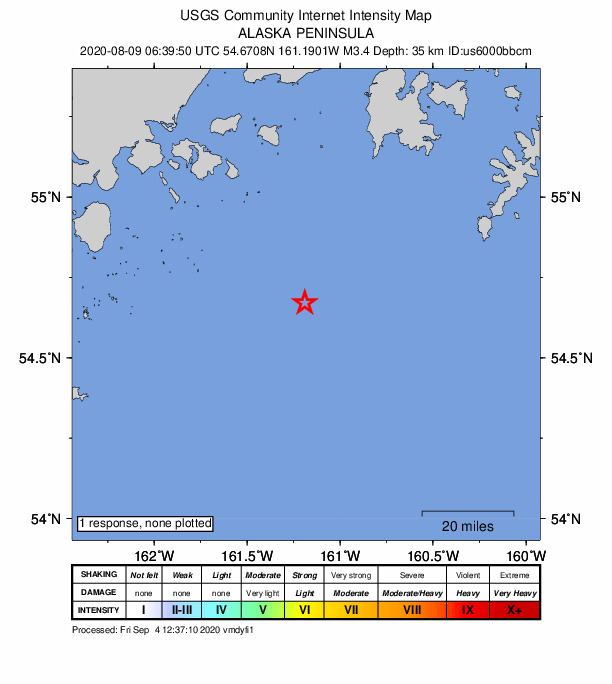
Did you feel it?
1 person reported to the USGS what they felt.
How well it is located
Reviewed by a seismologist.
- Location uncertainty
- About 4.0 km horizontally, 2.0 km in depth
- Magnitude uncertainty
- ±0.17
- Depth from
- Operator assigned
- Station coverage gap
- 178°
- Stations used
- 102
Nearest places
Distance and direction from each place to the epicenter, with its forecast.
Nearby
Within 100 km, magnitude 1.5 and up: at least 200 in the 60 days after this one and at least 200 in the 30 days before it.
After
- 1.982 km SSW of Sand Point, Alaska · 2240 days ago · 26 km deep · 4 km away
- 2.094 km SE of King Cove, Alaska · 2240 days ago · 13 km deep · 12 km away
- 2.165 km SE of Sand Point, Alaska · 2240 days ago · 24 km deep · 93 km away
- 1.981 km ESE of King Cove, Alaska · 2240 days ago · 26 km deep · 5 km away
- 1.654 km SSE of Sand Point, Alaska · 2240 days ago · 23 km deep · 60 km away
- 1.579 km SSW of Sand Point, Alaska · 2240 days ago · 19 km deep · 20 km away
- 2.386 km SSW of Sand Point, Alaska · 2240 days ago · 13 km deep · 5 km away
- 2.377 km SSE of Sand Point, Alaska · 2240 days ago · 10 km deep · 81 km away
- 1.782 km ESE of King Cove, Alaska · 2240 days ago · 23 km deep · 4 km away
- 2.063 km S of Sand Point, Alaska · 2240 days ago · 27 km deep · 37 km away
- 2.295 km SE of King Cove, Alaska · 2240 days ago · 13 km deep · 17 km away
- 1.982 km SSW of Sand Point, Alaska · 2240 days ago · 25 km deep · 4 km away
- 3.781 km SSW of Sand Point, Alaska · 2240 days ago · 21 km deep · 5 km away · felt by 1
- 2.456 km SSE of Sand Point, Alaska · 2240 days ago · 26 km deep · 60 km away
- 1.858 km SE of Sand Point, Alaska · 2240 days ago · 14 km deep · 90 km away
- 3.055 km S of Sand Point, Alaska · 2240 days ago · 26 km deep · 58 km away
- 1.554 km S of Sand Point, Alaska · 2240 days ago · 22 km deep · 57 km away
- 4.253 km SSE of Sand Point, Alaska · 2239 days ago · 40 km deep · 62 km away · felt by 1
- 1.866 km S of Sand Point, Alaska · 2239 days ago · 13 km deep · 33 km away
- 1.671 km ESE of King Cove, Alaska · 2239 days ago · 55 km deep · 16 km away
- 1.986 km ESE of King Cove, Alaska · 2239 days ago · 26 km deep · 3 km away
- 3.757 km SSE of Sand Point, Alaska · 2239 days ago · 30 km deep · 62 km away
- 1.577 km ESE of King Cove, Alaska · 2239 days ago · 13 km deep · 9 km away
- 2.083 km ESE of King Cove, Alaska · 2239 days ago · 13 km deep · 1 km away
- 1.882 km ESE of King Cove, Alaska · 2239 days ago · 26 km deep · 3 km away
- 1.554 km ENE of King Cove, Alaska · 2239 days ago · 83 km deep · 66 km away
- 2.451 km SSE of Sand Point, Alaska · 2239 days ago · 23 km deep · 61 km away
- 1.681 km ESE of King Cove, Alaska · 2239 days ago · 17 km deep · 4 km away
- 3.581 km SSW of Sand Point, Alaska · 2239 days ago · 10 km deep · 18 km away
- 3.284 km SSW of Sand Point, Alaska · 2239 days ago · 21 km deep · 2 km away
- 3.088 km SSW of Sand Point, Alaska · 2239 days ago · 27 km deep · 17 km away
- 1.559 km SSW of Sand Point, Alaska · 2239 days ago · 25 km deep · 34 km away
- 2.0124 km S of Sand Point, Alaska · 2239 days ago · 26 km deep · 66 km away
- 2.981 km S of Sand Point, Alaska · 2239 days ago · 35 km deep · 30 km away
- 1.582 km ESE of King Cove, Alaska · 2239 days ago · 26 km deep · 4 km away
- 3.357 km S of Sand Point, Alaska · 2238 days ago · 27 km deep · 57 km away
- 1.695 km SSW of Sand Point, Alaska · 2238 days ago · 19 km deep · 17 km away
- 1.877 km SSE of Sand Point, Alaska · 2238 days ago · 20 km deep · 68 km away
- 1.8106 km SE of King Cove, Alaska · 2238 days ago · 50 km deep · 35 km away
- 3.174 km ESE of King Cove, Alaska · 2238 days ago · 33 km deep · 11 km away
- 1.561 km SSW of Sand Point, Alaska · 2238 days ago · 13 km deep · 33 km away
- 1.783 km ESE of King Cove, Alaska · 2238 days ago · 21 km deep · 2 km away
- 1.557 km S of Sand Point, Alaska · 2238 days ago · 20 km deep · 57 km away
- 1.558 km S of Sand Point, Alaska · 2238 days ago · 20 km deep · 57 km away
- 1.980 km SSW of Sand Point, Alaska · 2238 days ago · 21 km deep · 8 km away
- 3.887 km SSW of Sand Point, Alaska · 2238 days ago · 41 km deep · 19 km away
- 1.687 km SSW of Sand Point, Alaska · 2238 days ago · 25 km deep · 8 km away
- 1.780 km ESE of King Cove, Alaska · 2237 days ago · 26 km deep · 4 km away
- 2.7102 km SE of King Cove, Alaska · 2237 days ago · 10 km deep · 25 km away
- 2.260 km SSW of Sand Point, Alaska · 2237 days ago · 27 km deep · 35 km away
- 1.710 km WNW of Sand Point, Alaska · 2237 days ago · 72 km deep · 83 km away
- 2.255 km SSE of Sand Point, Alaska · 2237 days ago · 25 km deep · 61 km away
- 1.7101 km SE of King Cove, Alaska · 2237 days ago · 26 km deep · 25 km away
- 1.797 km SE of King Cove, Alaska · 2237 days ago · 22 km deep · 27 km away
- 1.762 km S of Sand Point, Alaska · 2237 days ago · 23 km deep · 50 km away
- 1.659 km SSE of Sand Point, Alaska · 2237 days ago · 19 km deep · 77 km away
- 2.772 km S of Sand Point, Alaska · 2237 days ago · 22 km deep · 34 km away
- 1.867 km S of Sand Point, Alaska · 2237 days ago · 26 km deep · 45 km away
- 1.897 km SE of King Cove, Alaska · 2237 days ago · 9 km deep · 17 km away
- 1.764 km SE of Sand Point, Alaska · 2237 days ago · 21 km deep · 89 km away
The first 60 of at least 200.
Before
- 2.283 km SSW of Sand Point, Alaska · 2241 days ago · 28 km deep · 3 km away
- 1.580 km ESE of King Cove, Alaska · 2241 days ago · 13 km deep · 5 km away
- 2.958 km S of Sand Point, Alaska · 2241 days ago · 22 km deep · 55 km away
- 1.5100 km SE of King Cove, Alaska · 2241 days ago · 23 km deep · 31 km away
- 3.981 km SSW of Sand Point, Alaska · 2241 days ago · 45 km deep · 5 km away
- 1.684 km SSE of Sand Point, Alaska · 2241 days ago · 25 km deep · 67 km away
- 2.8107 km SE of King Cove, Alaska · 2241 days ago · 10 km deep · 30 km away
- 1.752 km S of Sand Point, Alaska · 2241 days ago · 22 km deep · 59 km away
- 4.280 km SSW of Sand Point, Alaska · 2241 days ago · 44 km deep · 6 km away
- 1.658 km S of Sand Point, Alaska · 2241 days ago · 19 km deep · 56 km away
- 1.552 km S of Sand Point, Alaska · 2241 days ago · 27 km deep · 59 km away
- 1.698 km SSW of Sand Point, Alaska · 2241 days ago · 16 km deep · 29 km away
- 2.281 km SSW of Sand Point, Alaska · 2241 days ago · 26 km deep · 6 km away
- 3.975 km SSW of Sand Point, Alaska · 2241 days ago · 46 km deep · 12 km away
- 3.175 km SSW of Sand Point, Alaska · 2241 days ago · 23 km deep · 11 km away
- 3.579 km ESE of King Cove, Alaska · 2241 days ago · 28 km deep · 8 km away
- 1.786 km SSW of Sand Point, Alaska · 2241 days ago · 14 km deep · 4 km away
- 5.579 km SSW of Sand Point, Alaska · 2241 days ago · 39 km deep · 7 km away · felt by 7
- 1.582 km ESE of King Cove, Alaska · 2241 days ago · 22 km deep · 2 km away
- 1.655 km S of Sand Point, Alaska · 2241 days ago · 19 km deep · 57 km away
Earthquakes todayAlaska earthquakesLive radar here
Sources
From the USGS Earthquake Hazards Program and its partner networks, event us6000bbcm (also filed as ak020a794430). Read Sun, Sep 27, 2026, 5:36 PM UTC.