M3.7 earthquake 63 km N of Chase, Alaska
A magnitude 3.7 earthquake struck 63 km N of Chase, Alaska on Sun, Sep 27, 2020, 7:41 PM AKDT (03:41 UTC), 102 km (64 mi) below the surface.
Map
Where this earthquake was located, with the others nearby. Select one for its page.
The earthquake
- Magnitude
- 3.7 (ML, local (Richter)), minor
- Magnitude from
- Alaska Earthquake Center
- Local time
- UTC
- 2020-09-28 03:41:31 UTC
- Depth
- 102.3 km (63.6 mi), intermediate-depth
- Epicenter
- 63.015° N, 150.160° W
- Region
- Alaska
- Felt reports
- 3
- Tsunami flag
- No
- Status
- Reviewed by a seismologist
Magnitude estimates
Different scales measure different things and differ by a few tenths. The USGS marks one as preferred, and it is the one this page uses.
| Mag. | Scale | Computed by | Notes |
|---|---|---|---|
| 3.7 | ML, local (Richter) | Alaska Earthquake Center | Preferred · Preliminary |
| 4.1 | mb, body-wave | USGS National Earthquake Information Center | Reviewed · ±0.234 · 5 stations |
What happened
The USGS’s account of the effects of this earthquake.
Also felt at Cantwell.
From the USGS event page for ak020chw7jvg. U.S. Geological Survey text and figures are in the public domain.
Did you feel it?
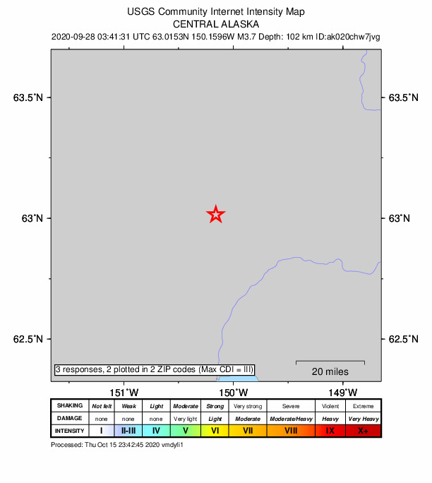
3 people reported to the USGS what they felt; the strongest reported shaking was III, weak shaking.
How well it is located
Reviewed by a seismologist.
- Stations used
- 275
Nearest places
Distance and direction from each place to the epicenter, with its forecast.
Nearby
Within 100 km, magnitude 1.5 and up: 198 in the 60 days after this one and 130 in the 30 days before it.
After
- 1.936 km WSW of Petersville, Alaska · 2196 days ago · 86 km deep · 95 km away
- 2.327 km S of Denali National Park, Alaska · 2196 days ago · 11 km deep · 87 km away
- 3.561 km S of Denali National Park, Alaska · 2195 days ago · 4 km deep · 70 km away
- 2.338 km WSW of McKinley Park, Alaska · 2195 days ago · 118 km deep · 75 km away
- 2.048 km WSW of McKinley Park, Alaska · 2194 days ago · 128 km deep · 72 km away
- 1.918 km ESE of Denali National Park, Alaska · 2194 days ago · 10 km deep · 79 km away
- 1.812 km SSW of Cantwell, Alaska · 2194 days ago · 1 km deep · 64 km away
- 1.820 km SE of Denali National Park, Alaska · 2193 days ago · 1 km deep · 77 km away
- 1.653 km NNW of Petersville, Alaska · 2193 days ago · 105 km deep · 57 km away
- 1.856 km S of Denali National Park, Alaska · 2192 days ago · 1 km deep · 70 km away
- 2.270 km ESE of Denali National Park, Alaska · 2192 days ago · 116 km deep · 32 km away
- 2.859 km W of Cantwell, Alaska · 2191 days ago · 9 km deep · 38 km away
- 1.838 km E of Chase, Alaska · 2191 days ago · 58 km deep · 70 km away
- 1.536 km SE of Denali National Park, Alaska · 2191 days ago · 6 km deep · 62 km away
- 1.951 km SSE of Denali National Park, Alaska · 2191 days ago · 5 km deep · 68 km away
- 1.765 km N of Petersville, Alaska · 2191 days ago · 117 km deep · 29 km away
- 2.425 km W of Petersville, Alaska · 2191 days ago · 88 km deep · 82 km away
- 1.627 km SSW of Denali National Park, Alaska · 2191 days ago · 9 km deep · 95 km away
- 1.662 km NNW of Petersville, Alaska · 2190 days ago · 118 km deep · 43 km away
- 1.760 km S of Denali National Park, Alaska · 2190 days ago · 4 km deep · 75 km away
- 1.673 km ESE of Denali National Park, Alaska · 2190 days ago · 118 km deep · 26 km away
- 1.716 km WSW of Trapper Creek, Alaska · 2190 days ago · 15 km deep · 88 km away
- 1.857 km N of Petersville, Alaska · 2190 days ago · 115 km deep · 39 km away
- 1.831 km W of Cantwell, Alaska · 2190 days ago · 104 km deep · 49 km away
- 1.755 km SSE of Denali National Park, Alaska · 2190 days ago · 8 km deep · 66 km away
- 1.645 km NNW of Petersville, Alaska · 2190 days ago · 104 km deep · 47 km away
- 1.527 km SW of Petersville, Alaska · 2190 days ago · 72 km deep · 93 km away
- 1.859 km S of Denali National Park, Alaska · 2190 days ago · 3 km deep · 71 km away
- 2.851 km S of Denali National Park, Alaska · 2190 days ago · 11 km deep · 71 km away
- 1.856 km NNW of Petersville, Alaska · 2189 days ago · 107 km deep · 58 km away
- 2.110 km NNE of Cantwell, Alaska · 2189 days ago · 8 km deep · 84 km away
- 1.546 km WSW of Cantwell, Alaska · 2189 days ago · 98 km deep · 30 km away
- 2.246 km SW of Cantwell, Alaska · 2189 days ago · 84 km deep · 28 km away
- 1.928 km NW of Petersville, Alaska · 2189 days ago · 88 km deep · 67 km away
- 2.054 km SSW of Cantwell, Alaska · 2188 days ago · 83 km deep · 37 km away
- 1.753 km W of Cantwell, Alaska · 2188 days ago · 3 km deep · 37 km away
- 1.749 km S of Denali National Park, Alaska · 2188 days ago · 12 km deep · 72 km away
- 1.755 km N of Petersville, Alaska · 2188 days ago · 107 km deep · 27 km away
- 1.962 km SE of Denali National Park, Alaska · 2188 days ago · 129 km deep · 37 km away
- 1.518 km ESE of Denali National Park, Alaska · 2188 days ago · 5 km deep · 81 km away
- 1.851 km SW of Cantwell, Alaska · 2188 days ago · 84 km deep · 26 km away
- 1.636 km NE of Chase, Alaska · 2188 days ago · 68 km deep · 50 km away
- 1.564 km SE of Denali National Park, Alaska · 2187 days ago · 121 km deep · 41 km away
- 1.969 km S of Cantwell, Alaska · 2187 days ago · 15 km deep · 74 km away
- 1.722 km S of Denali National Park, Alaska · 2187 days ago · 4 km deep · 90 km away
- 2.212 km NNE of Susitna North, Alaska · 2185 days ago · 15 km deep · 86 km away · felt by 3
- 1.673 km NNE of Petersville, Alaska · 2185 days ago · 104 km deep · 17 km away
- 1.564 km ENE of Denali National Park, Alaska · 2185 days ago · 7 km deep · 81 km away
- 1.928 km SW of Petersville, Alaska · 2185 days ago · 79 km deep · 92 km away
- 1.947 km SW of Cantwell, Alaska · 2185 days ago · 86 km deep · 27 km away
- 2.959 km S of Denali National Park, Alaska · 2184 days ago · 5 km deep · 67 km away
- 1.725 km NNE of Petersville, Alaska · 2184 days ago · 81 km deep · 40 km away
- 1.658 km S of Denali National Park, Alaska · 2184 days ago · 2 km deep · 69 km away
- 2.733 km NNE of Petersville, Alaska · 2184 days ago · 83 km deep · 33 km away
- 1.657 km S of Denali National Park, Alaska · 2184 days ago · 3 km deep · 68 km away
- 1.857 km S of Denali National Park, Alaska · 2184 days ago · 1 km deep · 68 km away
- 2.158 km SSE of Denali National Park, Alaska · 2184 days ago · 11 km deep · 67 km away
- 1.654 km E of Denali National Park, Alaska · 2184 days ago · 10 km deep · 72 km away
- 2.260 km N of Petersville, Alaska · 2183 days ago · 121 km deep · 37 km away
- 2.023 km SW of Petersville, Alaska · 2183 days ago · 80 km deep · 89 km away
The first 60 of 198.
Before
- 3.014 km W of Trapper Creek, Alaska · 2196 days ago · 62 km deep · 79 km away · felt by 2
- 1.552 km WNW of Petersville, Alaska · 2196 days ago · 94 km deep · 92 km away
- 1.940 km NNW of Petersville, Alaska · 2196 days ago · 100 km deep · 46 km away
- 3.16 km SW of McKinley Park, Alaska · 2196 days ago · 4 km deep · 95 km away · felt by 9
- 1.760 km SE of Denali National Park, Alaska · 2197 days ago · 128 km deep · 39 km away
- 2.048 km E of Denali National Park, Alaska · 2197 days ago · 9 km deep · 69 km away
- 2.438 km SSW of Cantwell, Alaska · 2197 days ago · 73 km deep · 52 km away
- 2.120 km ESE of Denali National Park, Alaska · 2198 days ago · 12 km deep · 77 km away
- 1.972 km S of Cantwell, Alaska · 2198 days ago · 59 km deep · 75 km away
- 2.810 km NNE of Cantwell, Alaska · 2198 days ago · 4 km deep · 82 km away · felt by 3
- 1.69 km NE of Cantwell, Alaska · 2199 days ago · 9 km deep · 82 km away
- 1.89 km NNE of Cantwell, Alaska · 2199 days ago · 11 km deep · 82 km away
- 4.011 km NNE of Cantwell, Alaska · 2199 days ago · 9 km deep · 83 km away · felt by 20
- 1.868 km SE of Denali National Park, Alaska · 2199 days ago · 118 km deep · 30 km away
- 2.123 km SE of Denali National Park, Alaska · 2199 days ago · 8 km deep · 74 km away
- 1.569 km ESE of Denali National Park, Alaska · 2199 days ago · 119 km deep · 31 km away
- 2.537 km NNE of Chase, Alaska · 2199 days ago · 69 km deep · 29 km away
- 1.659 km ENE of Chase, Alaska · 2200 days ago · 66 km deep · 68 km away
- 2.546 km SSE of Cantwell, Alaska · 2200 days ago · 68 km deep · 74 km away
- 1.568 km SE of Denali National Park, Alaska · 2201 days ago · 123 km deep · 29 km away
Earthquakes todayAlaska earthquakesLive radar here
Sources
From the USGS Earthquake Hazards Program and its partner networks, event ak020chw7jvg (also filed as us6000c215). Read Fri, Oct 2, 2026, 5:04 PM UTC.