M3.0 earthquake 52 km N of Chase, Alaska
A magnitude 3.0 earthquake struck 52 km N of Chase, Alaska on Thu, Apr 23, 2020, 12:13 AM AKDT (08:13 UTC), 82 km (51 mi) below the surface.
A larger quake followed: M3.4 57 km N of Petersville, Alaska. This one was a foreshock.
Map
Where this earthquake was located, with the others nearby. Select one for its page.
The earthquake
- Magnitude
- 3.0 (ML, local (Richter)), minor
- Magnitude from
- Alaska Earthquake Center
- Local time
- UTC
- 2020-04-23 08:13:18 UTC
- Depth
- 81.7 km (50.8 mi), intermediate-depth
- Epicenter
- 62.918° N, 150.085° W
- Region
- Alaska
- Felt reports
- 2
- Tsunami flag
- No
- Status
- Reviewed by a seismologist
Magnitude estimates
Different scales measure different things and differ by a few tenths. The USGS marks one as preferred, and it is the one this page uses.
| Mag. | Scale | Computed by | Notes |
|---|---|---|---|
| 3.0 | ML, local (Richter) | Alaska Earthquake Center | Preferred · Preliminary |
| 3.5 | mb, body-wave | USGS National Earthquake Information Center | Reviewed · ±0.174 · 8 stations |
Did you feel it?
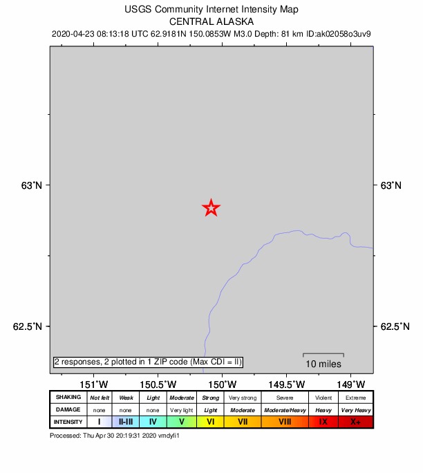
2 people reported to the USGS what they felt; the strongest reported shaking was II, weak shaking.
How well it is located
Reviewed by a seismologist.
- Stations used
- 267
Nearest places
Distance and direction from each place to the epicenter, with its forecast.
Nearby
Within 100 km, magnitude 1.5 and up: at least 199 in the 60 days after this one and 130 in the 30 days before it.
After
- 1.534 km E of Chase, Alaska · 2353 days ago · 59 km deep · 57 km away
- 2.858 km W of Cantwell, Alaska · 2353 days ago · 105 km deep · 42 km away
- 1.75 km S of Trapper Creek, Alaska · 2353 days ago · 50 km deep · 72 km away
- 1.760 km S of Cantwell, Alaska · 2352 days ago · 60 km deep · 54 km away
- 2.163 km SW of Cantwell, Alaska · 2352 days ago · 92 km deep · 14 km away
- 1.543 km NNE of Chase, Alaska · 2351 days ago · 69 km deep · 26 km away
- 1.718 km NNE of Cantwell, Alaska · 2351 days ago · 3 km deep · 95 km away
- 1.522 km ESE of Denali National Park, Alaska · 2351 days ago · 6 km deep · 86 km away
- 1.667 km N of Petersville, Alaska · 2351 days ago · 118 km deep · 37 km away
- 2.064 km SE of Denali National Park, Alaska · 2350 days ago · 130 km deep · 46 km away
- 1.538 km WSW of Cantwell, Alaska · 2350 days ago · 98 km deep · 45 km away
- 1.936 km SE of Denali National Park, Alaska · 2350 days ago · 8 km deep · 72 km away
- 1.546 km NW of Petersville, Alaska · 2349 days ago · 115 km deep · 61 km away
- 1.86 km E of Talkeetna, Alaska · 2349 days ago · 52 km deep · 68 km away
- 2.4Central Alaska · 2349 days ago · 15 km deep · 89 km away · felt by 1
- 2.044 km WSW of McKinley Park, Alaska · 2349 days ago · 124 km deep · 81 km away
- 1.624 km WSW of Trapper Creek, Alaska · 2348 days ago · 60 km deep · 84 km away
- 1.737 km SE of Cantwell, Alaska · 2348 days ago · 69 km deep · 91 km away
- 1.664 km N of Petersville, Alaska · 2347 days ago · 106 km deep · 33 km away
- 1.657 km NNW of Petersville, Alaska · 2346 days ago · 110 km deep · 65 km away
- 1.555 km NE of Chase, Alaska · 2346 days ago · 65 km deep · 46 km away
- 1.578 km SSE of Cantwell, Alaska · 2346 days ago · 49 km deep · 91 km away
- 2.235 km E of Denali National Park, Alaska · 2346 days ago · 7 km deep · 83 km away
- 2.160 km N of Petersville, Alaska · 2346 days ago · 108 km deep · 27 km away
- 1.513 km NE of Susitna North, Alaska · 2345 days ago · 54 km deep · 79 km away
- 1.853 km NNW of Petersville, Alaska · 2345 days ago · 110 km deep · 59 km away
- 1.963 km SW of Cantwell, Alaska · 2345 days ago · 85 km deep · 15 km away
- 2.056 km NNE of Petersville, Alaska · 2345 days ago · 13 km deep · 11 km away
- 1.558 km N of Petersville, Alaska · 2345 days ago · 111 km deep · 29 km away
- 1.651 km NNW of Petersville, Alaska · 2345 days ago · 111 km deep · 59 km away
- 1.959 km SSW of Cantwell, Alaska · 2344 days ago · 77 km deep · 26 km away
- 1.867 km WSW of Cantwell, Alaska · 2344 days ago · 89 km deep · 21 km away
- 1.720 km SW of Trapper Creek, Alaska · 2344 days ago · 9 km deep · 83 km away
- 2.146 km N of Petersville, Alaska · 2344 days ago · 91 km deep · 29 km away
- 1.636 km ESE of Cantwell, Alaska · 2344 days ago · 73 km deep · 95 km away
- 2.228 km SSW of Denali National Park, Alaska · 2343 days ago · 5 km deep · 98 km away
- 1.963 km SW of Cantwell, Alaska · 2343 days ago · 84 km deep · 16 km away
- 2.161 km SE of Denali National Park, Alaska · 2343 days ago · 130 km deep · 46 km away
- 3.066 km NNE of Petersville, Alaska · 2342 days ago · 104 km deep · 27 km away
- 2.042 km NNE of Petersville, Alaska · 2342 days ago · 87 km deep · 21 km away
- 2.350 km SSE of Cantwell, Alaska · 2341 days ago · 80 km deep · 82 km away
- 1.635 km SE of Denali National Park, Alaska · 2341 days ago · 1 km deep · 73 km away
- 2.461 km SE of Denali National Park, Alaska · 2340 days ago · 125 km deep · 48 km away
- 2.566 km ESE of Denali National Park, Alaska · 2340 days ago · 127 km deep · 43 km away
- 1.916 km SSE of Cantwell, Alaska · 2340 days ago · 80 km deep · 74 km away
- 1.661 km S of Denali National Park, Alaska · 2339 days ago · 2 km deep · 74 km away
- 1.569 km SE of Denali National Park, Alaska · 2339 days ago · 113 km deep · 39 km away
- 1.751 km WSW of Cantwell, Alaska · 2339 days ago · 85 km deep · 31 km away
- 1.760 km N of Petersville, Alaska · 2339 days ago · 113 km deep · 43 km away
- 1.555 km N of Chase, Alaska · 2339 days ago · 83 km deep · 3 km away
- 2.165 km ESE of Denali National Park, Alaska · 2338 days ago · 132 km deep · 47 km away
- 2.045 km WSW of McKinley Park, Alaska · 2338 days ago · 123 km deep · 78 km away
- 1.654 km E of Denali National Park, Alaska · 2337 days ago · 5 km deep · 81 km away
- 2.263 km SE of Denali National Park, Alaska · 2337 days ago · 122 km deep · 46 km away
- 1.612 km WNW of Susitna North, Alaska · 2337 days ago · 10 km deep · 79 km away
- 1.656 km N of Petersville, Alaska · 2336 days ago · 109 km deep · 31 km away
- 1.537 km SE of Cantwell, Alaska · 2335 days ago · 70 km deep · 93 km away
- 1.872 km W of Cantwell, Alaska · 2335 days ago · 118 km deep · 44 km away
- 1.852 km NNW of Petersville, Alaska · 2335 days ago · 113 km deep · 48 km away
- 2.145 km NE of Chase, Alaska · 2334 days ago · 75 km deep · 38 km away
The first 60 of at least 199.
Before
- 1.766 km NNE of Petersville, Alaska · 2355 days ago · 94 km deep · 25 km away
- 1.849 km N of Petersville, Alaska · 2355 days ago · 105 km deep · 43 km away
- 1.871 km W of Cantwell, Alaska · 2355 days ago · 109 km deep · 43 km away
- 2.128 km E of Susitna North, Alaska · 2356 days ago · 60 km deep · 93 km away
- 2.164 km SSE of Cantwell, Alaska · 2356 days ago · 71 km deep · 90 km away
- 2.064 km NNE of Petersville, Alaska · 2356 days ago · 94 km deep · 26 km away
- 2.155 km NNE of Petersville, Alaska · 2357 days ago · 89 km deep · 21 km away
- 2.037 km NNE of Petersville, Alaska · 2357 days ago · 80 km deep · 26 km away
- 1.541 km NE of Chase, Alaska · 2357 days ago · 67 km deep · 34 km away
- 1.728 km SW of Petersville, Alaska · 2357 days ago · 82 km deep · 86 km away
- 1.7Central Alaska · 2358 days ago · 34 km deep · 90 km away
- 1.538 km ENE of Susitna North, Alaska · 2358 days ago · 22 km deep · 90 km away
- 1.747 km W of McKinley Park, Alaska · 2358 days ago · 138 km deep · 83 km away
- 3.671 km NNE of Petersville, Alaska · 2358 days ago · 96 km deep · 23 km away · felt by 1
- 2.239 km WSW of McKinley Park, Alaska · 2358 days ago · 115 km deep · 83 km away
- 1.663 km N of Petersville, Alaska · 2358 days ago · 121 km deep · 41 km away
- 1.537 km E of Denali National Park, Alaska · 2359 days ago · 9 km deep · 82 km away
- 2.167 km NNE of Petersville, Alaska · 2359 days ago · 109 km deep · 27 km away
- 2.242 km W of Cantwell, Alaska · 2359 days ago · 103 km deep · 48 km away
- 1.653 km SSE of Denali National Park, Alaska · 2359 days ago · 129 km deep · 63 km away
Earthquakes todayAlaska earthquakesLive radar here
Sources
From the USGS Earthquake Hazards Program and its partner networks, event ak02058o3uv9 (also filed as us60009aft). Read Sat, Oct 3, 2026, 6:18 AM UTC.