M6.0 earthquake 75 km NNE of Calama, Chile
A magnitude 6.0 earthquake struck 75 km NNE of Calama, Chile on Mon, Dec 14, 2020, 12:20 PM GMT-3 (15:20 UTC), 114 km (71 mi) below the surface.
Map
Where this earthquake was located, with the others nearby. Select one for its page.
The earthquake
- Magnitude
- 6.0 (Mww, W-phase moment), strong
- Magnitude from
- USGS National Earthquake Information Center
- Local time
- UTC
- 2020-12-14 15:20:49 UTC
- Depth
- 114.0 km (70.8 mi), intermediate-depth
- Epicenter
- 21.806° S, 68.708° W
- Region
- Chile
- Felt reports
- 38
- Strongest shaking
- IV, light shaking
- PAGER alert
- Green
- Tsunami flag
- No
- Status
- Reviewed by a seismologist
Magnitude estimates
Different scales measure different things and differ by a few tenths. The USGS marks one as preferred, and it is the one this page uses.
| Mag. | Scale | Computed by | Notes |
|---|---|---|---|
| 6.0 | Mww, W-phase moment | USGS National Earthquake Information Center | Preferred · Reviewed · ±0.045 · 47 stations |
| 6.05 | Mw, moment | ISC-GEM global catalog | Final · ±0.1 |
| 5.8 | Mi | NOAA Pacific Tsunami Warning Center | First automatic solution · Reviewed · 7 stations |
| 6.0 | Mwb, body-wave moment | USGS National Earthquake Information Center | Moment tensor · Reviewed |
| 6.1 | Mww, W-phase moment | USGS, automatic first solution | First automatic solution · Confirmed |
Shaking
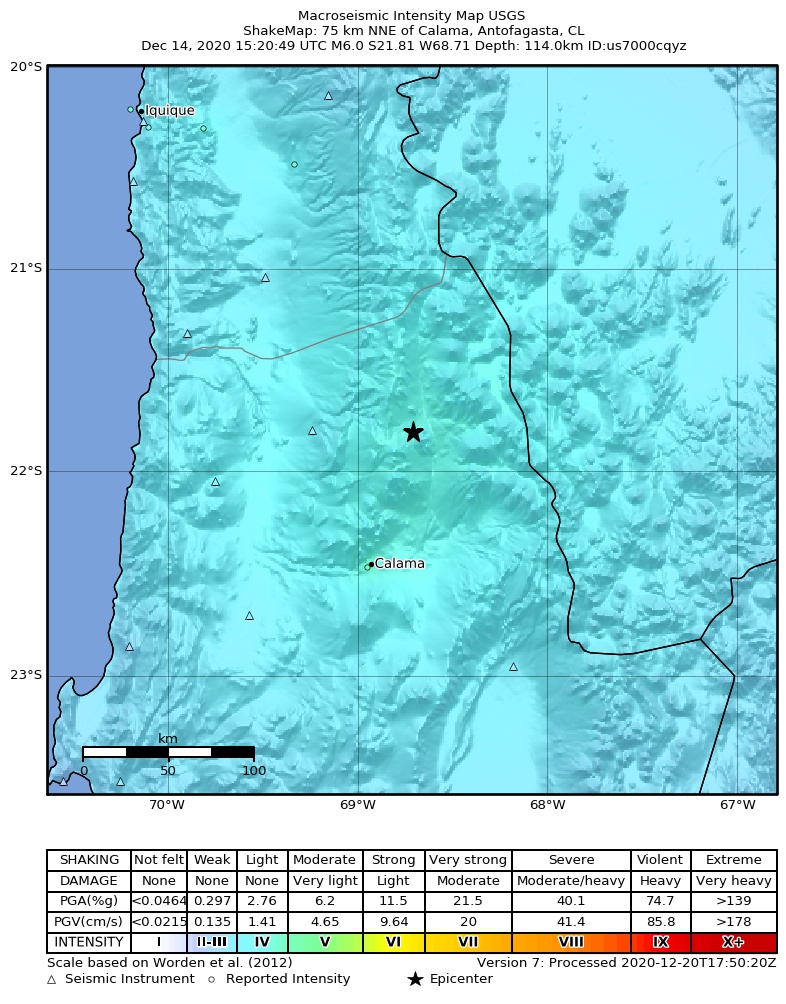
The USGS ShakeMap: shaking estimated from seismic stations and the quake’s size, on the Modified Mercalli intensity scale.
- Strongest estimated
- IV, light shaking
- Peak ground acceleration
- 2.9% of gravity
- Peak ground velocity
- 0.4 cm/s
- Map
- Automatic
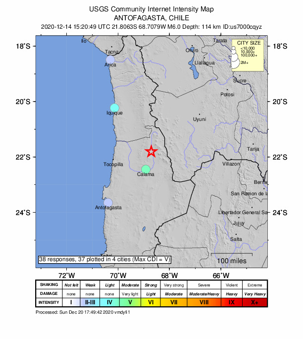
Did you feel it?
38 people reported to the USGS what they felt; the strongest reported shaking was V, moderate shaking.
Estimated impact
The USGS PAGER system estimates deaths and economic losses from the shaking and the population and buildings exposed to it.
- Alert level
- Green: little or no damage or loss of life expected
| Range | Chance |
|---|---|
| Under 1 | 65% |
| 1 to 10 | 30% |
| 10 to 100 | 4% |
| 100 to 1,000 | Under 1% |
| 1,000 to 10,000 | Under 1% |
| 10,000 to 100,000 | Under 1% |
| 100,000 to 10,000,000 | Under 1% |
| Range, million USD | Chance |
|---|---|
| Under 1 | 65% |
| 1 to 10 | 30% |
| 10 to 100 | 4% |
| 100 to 1,000 | Under 1% |
| 1,000 to 10,000 | Under 1% |
| 10,000 to 100,000 | Under 1% |
| 100,000 to 10,000,000 | Under 1% |
Fault motion and ground failure
How the rock slipped, from the moment tensor, and the USGS estimate of landslides and liquefaction.
- Faulting
- Strike-slip
- Moment magnitude
- 6.0 Mww
- Nodal plane 1
- Strike 257°, dip 37°, rake -27°
- Nodal plane 2
- Strike 9°, dip 74°, rake -124°
- Landslide alert
- Green
- Liquefaction alert
- Green
How well it is located
Reviewed by a seismologist.
- Location uncertainty
- About 5.6 km horizontally, 1.8 km in depth
- Magnitude uncertainty
- ±0.04
- Depth from
- From modeling of broad-band P waveforms
- Station coverage gap
- 34°
- Stations used
- 88
Nearest places
Distance and direction from each place to the epicenter, with its forecast.
Nearby
Within 100 km, magnitude 3.0 and up: 10 in the 60 days after this one and 12 in the 30 days before it.
After
- 4.055 km NNE of Calama, Chile · 2113 days ago · 121 km deep · 22 km away
- 4.249 km NNE of Calama, Chile · 2112 days ago · 118 km deep · 26 km away
- 4.229 km E of Calama, Chile · 2108 days ago · 111 km deep · 70 km away
- 4.2134 km NNE of Calama, Chile · 2107 days ago · 135 km deep · 60 km away · felt by 2
- 4.0134 km N of Calama, Chile · 2104 days ago · 132 km deep · 63 km away
- 4.845 km E of Calama, Chile · 2092 days ago · 105 km deep · 79 km away
- 4.1156 km ESE of Iquique, Chile · 2090 days ago · 106 km deep · 99 km away
- 4.982 km NNE of Calama, Chile · 2090 days ago · 117 km deep · 8 km away · felt by 1
- 4.1149 km N of Calama, Chile · 2071 days ago · 127 km deep · 76 km away
- 4.2136 km SE of Iquique, Chile · 2064 days ago · 108 km deep · 99 km away · felt by 2
Before
- 4.6145 km N of Calama, Chile · 2124 days ago · 119 km deep · 77 km away · felt by 1
- 4.2115 km N of Calama, Chile · 2128 days ago · 118 km deep · 44 km away
- 4.6132 km N of Calama, Chile · 2131 days ago · 116 km deep · 64 km away
- 4.2107 km NNE of Calama, Chile · 2132 days ago · 115 km deep · 33 km away
- 4.2104 km NNE of Calama, Chile · 2133 days ago · 138 km deep · 30 km away
- 4.165 km NE of Calama, Chile · 2135 days ago · 138 km deep · 29 km away
- 4.3156 km N of Calama, Chile · 2138 days ago · 151 km deep · 82 km away
- 4.224 km E of Calama, Chile · 2140 days ago · 114 km deep · 73 km away
- 4.4135 km N of Calama, Chile · 2143 days ago · 125 km deep · 65 km away
- 4.172 km NE of Calama, Chile · 2144 days ago · 126 km deep · 25 km away
- 4.283 km NNE of Calama, Chile · 2144 days ago · 108 km deep · 14 km away
- 4.3134 km N of Calama, Chile · 2148 days ago · 128 km deep · 69 km away
Earthquakes todayChile earthquakesLive radar here
Sources
From the USGS Earthquake Hazards Program and its partner networks, event us7000cqyz (also filed as usauto7000cqyz, pt20349000, iscgem619610208). Read Sat, Oct 3, 2026, 5:03 PM UTC.