M1.7 earthquake 49 km WSW of Alamo, Nevada
A magnitude 1.7 earthquake struck 49 km WSW of Alamo, Nevada on Fri, Jan 24, 2020, 7:33 PM PST (03:33 UTC), 0 km (0 mi) below the surface.
A larger quake followed: M2.8 31 km SW of Hiko, Nevada. This one was a foreshock.
Map
Where this earthquake was located, with the others nearby. Select one for its page.
The earthquake
- Magnitude
- 1.7 (ML, local (Richter)), micro
- Magnitude from
- Nevada Seismological Laboratory
- Local time
- UTC
- 2020-01-25 03:33:09 UTC
- Depth
- 0.0 km (0.0 mi), shallow
- Epicenter
- 37.146° N, 115.644° W
- Region
- Nevada
- Tsunami flag
- No
- Status
- Reviewed by a seismologist
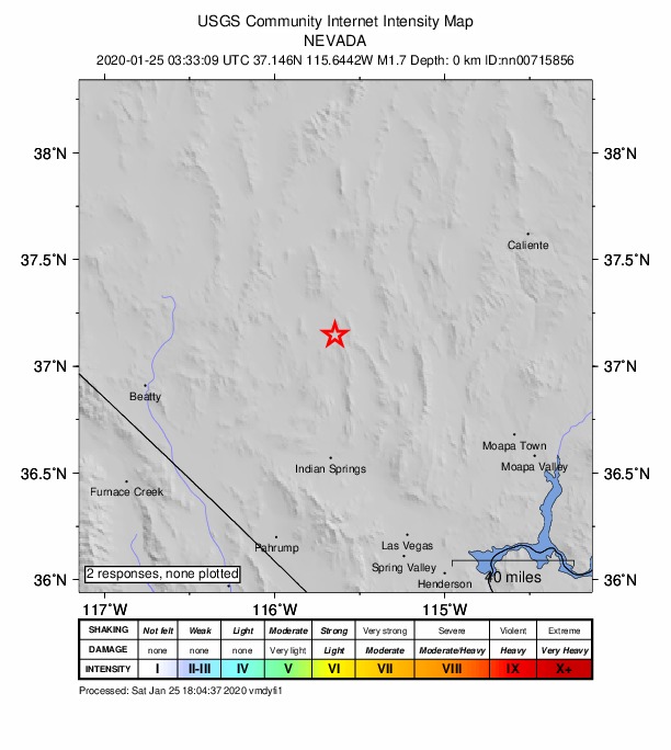
Did you feel it?
No one has reported feeling this quake to the USGS.
How well it is located
Reviewed by a seismologist.
- Magnitude uncertainty
- ±0.51
- Station coverage gap
- 68°
- Stations used
- 14
Nearest places
Distance and direction from each place to the epicenter, with its forecast.
Nearby
Within 100 km, magnitude 1.5 and up: 27 in the 60 days after this one and 5 in the 30 days before it.
After
- 2.831 km SW of Hiko, Nevada · 2445 days ago · 3 km deep · 34 km away
- 1.530 km SE of Rachel, Nevada · 2444 days ago · 12 km deep · 34 km away
- 2.730 km SE of Rachel, Nevada · 2443 days ago · 14 km deep · 35 km away · felt by 1
- 1.624 km NNE of Hiko, Nevada · 2443 days ago · 8 km deep · 87 km away
- 2.128 km SE of Rachel, Nevada · 2443 days ago · 17 km deep · 37 km away
- 1.825 km SSW of Caliente, Nevada · 2443 days ago · 3 km deep · 91 km away
- 2.328 km WNW of Alamo, Nevada · 2442 days ago · 0 km deep · 34 km away
- 2.131 km SE of Rachel, Nevada · 2442 days ago · 3 km deep · 34 km away
- 2.030 km SE of Rachel, Nevada · 2442 days ago · 11 km deep · 34 km away
- 1.827 km NNE of Hiko, Nevada · 2440 days ago · 0 km deep · 88 km away
- 1.729 km SE of Rachel, Nevada · 2440 days ago · 0 km deep · 37 km away
- 2.325 km NNE of Hiko, Nevada · 2436 days ago · 0 km deep · 87 km away
- 1.544 km SE of Alamo, Nevada · 2434 days ago · 0 km deep · 73 km away
- 1.728 km SE of Rachel, Nevada · 2434 days ago · 14 km deep · 36 km away
- 2.825 km NNE of Hiko, Nevada · 2433 days ago · 10 km deep · 86 km away
- 1.726 km NNE of Hiko, Nevada · 2430 days ago · 0 km deep · 87 km away
- 2.236 km N of Moapa Town, Nevada · 2428 days ago · 1 km deep · 98 km away
- 1.851 km ESE of Beatty, Nevada · 2422 days ago · 8 km deep · 78 km away
- 1.523 km NW of Indian Springs, Nevada · 2421 days ago · 4 km deep · 47 km away
- 1.829 km SE of Rachel, Nevada · 2418 days ago · 3 km deep · 34 km away
- 1.625 km WSW of Alamo, Nevada · 2415 days ago · 2 km deep · 23 km away
- 1.738 km WNW of Rachel, Nevada · 2414 days ago · 0 km deep · 86 km away
- 2.028 km ENE of Beatty, Nevada · 2409 days ago · 14 km deep · 74 km away
- 1.916 km NW of Indian Springs, Nevada · 2398 days ago · 0 km deep · 52 km away
- 1.929 km SE of Rachel, Nevada · 2398 days ago · 13 km deep · 35 km away
- 1.635 km W of Indian Springs, Nevada · 2393 days ago · 6 km deep · 69 km away
- 1.815 km NE of Hiko, Nevada · 2393 days ago · 6 km deep · 78 km away
Before
- 1.739 km ENE of Beatty, Nevada · 2447 days ago · 9 km deep · 66 km away
- 1.523 km NNE of Hiko, Nevada · 2447 days ago · 0 km deep · 86 km away
- 2.830 km SW of Hiko, Nevada · 2456 days ago · 0 km deep · 34 km away
- 2.230 km SW of Hiko, Nevada · 2461 days ago · 12 km deep · 35 km away
- 1.917 km SE of Alamo, Nevada · 2467 days ago · 2 km deep · 54 km away
Earthquakes todayNevada earthquakesLive radar here
Sources
From the USGS Earthquake Hazards Program and its partner networks, event nn00715856. Read Mon, Oct 5, 2026, 5:31 AM UTC.