M5.0 earthquake 238 km WSW of Adak, Alaska
A magnitude 5.0 earthquake struck 238 km WSW of Adak, Alaska on Mon, Mar 2, 2020, 8:41 PM GMT-12 (08:41 UTC), 10 km (6 mi) below the surface.
Map
Where this earthquake was located, with the others nearby. Select one for its page.
The earthquake
- Magnitude
- 5.0 (mww), moderate
- Local time
- UTC
- 2020-03-03 08:41:58 UTC
- Depth
- 10.0 km (6.2 mi), shallow
- Epicenter
- 51.036° N, 179.795° W
- Region
- Alaska
- Felt reports
- 2
- Tsunami flag
- No
- Status
- Reviewed by a seismologist
Did you feel it?
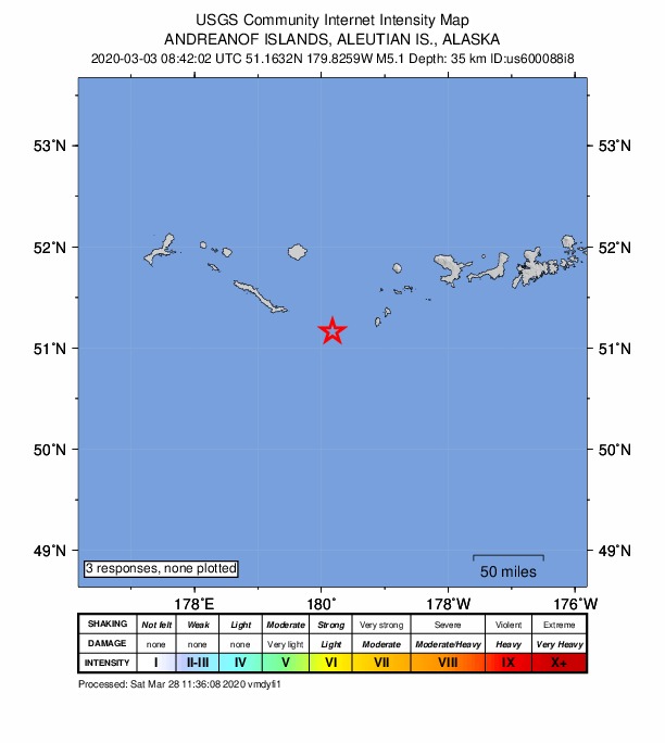
2 people reported to the USGS what they felt; the strongest reported shaking was II, weak shaking.
Fault motion and ground failure
How the rock slipped, from the moment tensor, and the USGS estimate of landslides and liquefaction.
- Faulting
- Reverse (thrust)
- Moment magnitude
- 5.0 Mww
- Nodal plane 1
- Strike 267°, dip 32°, rake 103°
- Nodal plane 2
- Strike 72°, dip 59°, rake 82°
How well it is located
Reviewed by a seismologist.
- Location uncertainty
- About 3.2 km horizontally, 1.8 km in depth
- Magnitude uncertainty
- ±0.05
- Depth from
- Operator assigned
- Station coverage gap
- 114°
- Stations used
- 142
Nearby
Within 100 km, magnitude 2.0 and up: 66 in the 60 days after this one and 45 in the 30 days before it.
After
- 2.0235 km WSW of Adak, Alaska · 2402 days ago · 26 km deep · 3 km away
- 3.0234 km WSW of Adak, Alaska · 2401 days ago · 18 km deep · 5 km away
- 4.1240 km WSW of Adak, Alaska · 2400 days ago · 10 km deep · 8 km away
- 3.5235 km WSW of Adak, Alaska · 2398 days ago · 57 km deep · 38 km away
- 2.8186 km WSW of Adak, Alaska · 2397 days ago · 30 km deep · 55 km away
- 2.0176 km WSW of Adak, Alaska · 2397 days ago · 26 km deep · 62 km away
- 2.9202 km WSW of Adak, Alaska · 2397 days ago · 10 km deep · 58 km away
- 2.7242 km WSW of Adak, Alaska · 2396 days ago · 35 km deep · 24 km away
- 2.2158 km WSW of Adak, Alaska · 2396 days ago · 13 km deep · 80 km away
- 2.0187 km WSW of Adak, Alaska · 2393 days ago · 24 km deep · 52 km away
- 2.1188 km WSW of Adak, Alaska · 2393 days ago · 24 km deep · 52 km away
- 4.3Rat Islands, Aleutian Islands, Alaska · 2393 days ago · 36 km deep · 97 km away
- 2.4235 km WSW of Adak, Alaska · 2392 days ago · 23 km deep · 30 km away
- 2.3255 km W of Adak, Alaska · 2391 days ago · 93 km deep · 83 km away
- 2.9223 km WSW of Adak, Alaska · 2390 days ago · 10 km deep · 17 km away
- 2.0211 km WSW of Adak, Alaska · 2389 days ago · 10 km deep · 33 km away
- 3.7270 km W of Adak, Alaska · 2389 days ago · 70 km deep · 76 km away
- 2.4Rat Islands, Aleutian Islands, Alaska · 2388 days ago · 29 km deep · 93 km away
- 3.3Rat Islands, Aleutian Islands, Alaska · 2387 days ago · 54 km deep · 99 km away
- 2.2250 km WSW of Adak, Alaska · 2386 days ago · 13 km deep · 12 km away
- 2.0144 km WSW of Adak, Alaska · 2385 days ago · 24 km deep · 97 km away
- 2.2292 km W of Adak, Alaska · 2384 days ago · 71 km deep · 94 km away
- 2.0216 km WSW of Adak, Alaska · 2383 days ago · 14 km deep · 23 km away
- 2.9259 km WSW of Adak, Alaska · 2381 days ago · 52 km deep · 53 km away
- 2.5238 km WSW of Adak, Alaska · 2380 days ago · 13 km deep · 4 km away
- 2.9235 km WSW of Adak, Alaska · 2380 days ago · 16 km deep · 4 km away
- 2.6242 km WSW of Adak, Alaska · 2380 days ago · 11 km deep · 7 km away
- 2.0Andreanof Islands, Aleutian Islands, Alaska · 2376 days ago · 14 km deep · 14 km away
- 3.3242 km WSW of Adak, Alaska · 2376 days ago · 13 km deep · 8 km away
- 3.4201 km WSW of Adak, Alaska · 2376 days ago · 26 km deep · 38 km away
- 2.2226 km WSW of Adak, Alaska · 2376 days ago · 13 km deep · 35 km away
- 2.0148 km WSW of Adak, Alaska · 2376 days ago · 13 km deep · 90 km away
- 2.2234 km W of Adak, Alaska · 2375 days ago · 13 km deep · 78 km away
- 2.4235 km WSW of Adak, Alaska · 2375 days ago · 19 km deep · 30 km away
- 2.4253 km W of Adak, Alaska · 2373 days ago · 101 km deep · 90 km away
- 2.0219 km W of Adak, Alaska · 2372 days ago · 98 km deep · 82 km away
- 3.8229 km WSW of Adak, Alaska · 2369 days ago · 14 km deep · 38 km away
- 2.9229 km WSW of Adak, Alaska · 2369 days ago · 22 km deep · 34 km away
- 2.1247 km W of Adak, Alaska · 2368 days ago · 80 km deep · 60 km away
- 4.2243 km WSW of Adak, Alaska · 2368 days ago · 55 km deep · 25 km away
- 2.2253 km WSW of Adak, Alaska · 2367 days ago · 55 km deep · 53 km away
- 2.2222 km W of Adak, Alaska · 2367 days ago · 93 km deep · 80 km away
- 2.1236 km WSW of Adak, Alaska · 2366 days ago · 14 km deep · 4 km away
- 3.0234 km WSW of Adak, Alaska · 2366 days ago · 15 km deep · 5 km away
- 2.2235 km WSW of Adak, Alaska · 2365 days ago · 13 km deep · 3 km away
- 3.9249 km WSW of Adak, Alaska · 2364 days ago · 10 km deep · 12 km away
- 3.9223 km WSW of Adak, Alaska · 2363 days ago · 72 km deep · 50 km away
- 2.3247 km W of Adak, Alaska · 2360 days ago · 66 km deep · 60 km away
- 3.1268 km W of Adak, Alaska · 2358 days ago · 83 km deep · 82 km away
- 3.4252 km WSW of Adak, Alaska · 2357 days ago · 57 km deep · 49 km away
- 2.6220 km WSW of Adak, Alaska · 2356 days ago · 10 km deep · 27 km away
- 3.3242 km WSW of Adak, Alaska · 2355 days ago · 10 km deep · 15 km away
- 2.5211 km WSW of Adak, Alaska · 2354 days ago · 25 km deep · 27 km away
- 2.3245 km WSW of Adak, Alaska · 2353 days ago · 26 km deep · 8 km away
- 3.9261 km WSW of Adak, Alaska · 2353 days ago · 10 km deep · 31 km away
- 2.5158 km WSW of Adak, Alaska · 2352 days ago · 10 km deep · 80 km away
- 3.0239 km WSW of Adak, Alaska · 2352 days ago · 10 km deep · 10 km away
- 3.9270 km W of Adak, Alaska · 2352 days ago · 111 km deep · 78 km away
- 2.8227 km WSW of Adak, Alaska · 2351 days ago · 35 km deep · 19 km away
- 2.2240 km WSW of Adak, Alaska · 2349 days ago · 12 km deep · 11 km away
The first 60 of 66.
Before
- 3.5239 km WSW of Adak, Alaska · 2402 days ago · 10 km deep · 5 km away
- 2.4237 km WSW of Adak, Alaska · 2402 days ago · 16 km deep · 19 km away
- 2.0237 km WSW of Adak, Alaska · 2403 days ago · 14 km deep · 17 km away
- 2.8240 km WSW of Adak, Alaska · 2403 days ago · 10 km deep · 5 km away
- 2.2237 km WSW of Adak, Alaska · 2403 days ago · 13 km deep · 19 km away
- 2.5244 km WSW of Adak, Alaska · 2403 days ago · 10 km deep · 6 km away
- 2.3263 km W of Adak, Alaska · 2403 days ago · 11 km deep · 66 km away
- 2.8244 km WSW of Adak, Alaska · 2403 days ago · 15 km deep · 8 km away
- 2.3239 km WSW of Adak, Alaska · 2403 days ago · 28 km deep · 25 km away
- 3.4242 km WSW of Adak, Alaska · 2403 days ago · 13 km deep · 4 km away
- 5.7239 km WSW of Adak, Alaska · 2403 days ago · 20 km deep · 9 km away · felt by 1 · tsunami flag
- 2.2211 km WSW of Adak, Alaska · 2407 days ago · 74 km deep · 56 km away
- 2.7244 km WSW of Adak, Alaska · 2408 days ago · 16 km deep · 14 km away
- 2.1192 km WSW of Adak, Alaska · 2408 days ago · 26 km deep · 46 km away
- 2.0154 km WSW of Adak, Alaska · 2409 days ago · 25 km deep · 90 km away
- 2.1244 km WSW of Adak, Alaska · 2409 days ago · 14 km deep · 16 km away
- 2.1207 km W of Adak, Alaska · 2412 days ago · 74 km deep · 59 km away
- 2.8216 km WSW of Adak, Alaska · 2413 days ago · 9 km deep · 39 km away
- 2.5215 km WSW of Adak, Alaska · 2413 days ago · 10 km deep · 37 km away
- 3.3219 km WSW of Adak, Alaska · 2413 days ago · 10 km deep · 42 km away
Earthquakes todayAlaska earthquakesLive radar here
Sources
From the USGS Earthquake Hazards Program and its partner networks, event us600088i8 (also filed as ak0202wbvc1u, iscgem617606886). Read Wed, Sep 30, 2026, 5:13 AM UTC.