M1.6 earthquake 15 km NE of Healy, Alaska
A magnitude 1.6 earthquake struck 15 km NE of Healy, Alaska on Fri, Aug 23, 2019, 10:19 PM AKDT (06:19 UTC), 111 km (69 mi) below the surface.
A larger quake followed: M4.1 19 km WSW of Healy, Alaska. This one was a foreshock.
Map
Where this earthquake was located, with the others nearby. Select one for its page.
The earthquake
- Magnitude
- 1.6 (ml), micro
- Local time
- UTC
- 2019-08-24 06:19:58 UTC
- Depth
- 110.8 km (68.8 mi), intermediate-depth
- Epicenter
- 63.953° N, 148.750° W
- Region
- Alaska
- Felt reports
- 1
- Tsunami flag
- No
- Status
- Reviewed by a seismologist
Did you feel it?
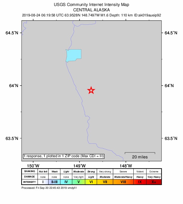
1 person reported to the USGS what they felt; the strongest reported shaking was III, weak shaking.
How well it is located
Reviewed by a seismologist.
- Stations used
- 47
Nearest places
Distance and direction from each place to the epicenter, with its forecast.
Nearby
Within 100 km, magnitude 1.5 and up: 63 in the 60 days after this one and 35 in the 30 days before it.
After
- 2.182 km ESE of McKinley Park, Alaska · 2591 days ago · 2 km deep · 83 km away
- 3.548 km WSW of Cantwell, Alaska · 2590 days ago · 96 km deep · 96 km away
- 1.778 km ESE of McKinley Park, Alaska · 2590 days ago · 2 km deep · 80 km away
- 1.842 km W of Cantwell, Alaska · 2590 days ago · 105 km deep · 84 km away
- 1.535 km WSW of Cantwell, Alaska · 2589 days ago · 3 km deep · 83 km away
- 1.674 km ESE of McKinley Park, Alaska · 2589 days ago · 2 km deep · 78 km away
- 1.681 km ESE of McKinley Park, Alaska · 2588 days ago · 5 km deep · 83 km away
- 1.830 km SW of Salcha, Alaska · 2587 days ago · 1 km deep · 79 km away
- 1.835 km W of Cantwell, Alaska · 2584 days ago · 105 km deep · 77 km away
- 1.885 km E of McKinley Park, Alaska · 2583 days ago · 1 km deep · 85 km away
- 1.685 km E of McKinley Park, Alaska · 2583 days ago · 2 km deep · 85 km away
- 1.715 km S of Cantwell, Alaska · 2583 days ago · 79 km deep · 78 km away
- 2.06 km NNE of Healy, Alaska · 2582 days ago · 2 km deep · 10 km away
- 1.656 km WNW of Cantwell, Alaska · 2582 days ago · 116 km deep · 78 km away
- 1.564 km W of Cantwell, Alaska · 2581 days ago · 118 km deep · 89 km away
- 2.632 km WNW of Cantwell, Alaska · 2581 days ago · 108 km deep · 64 km away
- 1.751 km WSW of Clear, Alaska, Alaska · 2580 days ago · 9 km deep · 73 km away
- 1.789 km ESE of McKinley Park, Alaska · 2580 days ago · 2 km deep · 91 km away
- 1.618 km SSE of McKinley Park, Alaska · 2578 days ago · 5 km deep · 40 km away
- 1.572 km ESE of McKinley Park, Alaska · 2578 days ago · 4 km deep · 76 km away
- 2.045 km WSW of Cantwell, Alaska · 2576 days ago · 97 km deep · 92 km away
- 2.133 km WNW of Cantwell, Alaska · 2576 days ago · 108 km deep · 66 km away
- 2.367 km E of McKinley Park, Alaska · 2574 days ago · 77 km deep · 68 km away
- 1.634 km WSW of Cantwell, Alaska · 2573 days ago · 14 km deep · 87 km away
- 1.754 km W of Ferry, Alaska · 2572 days ago · 8 km deep · 72 km away
- 1.652 km SSW of Harding-Birch Lakes, Alaska · 2571 days ago · 2 km deep · 83 km away
- 3.132 km E of Anderson, Alaska · 2570 days ago · 16 km deep · 41 km away
- 1.738 km WSW of Clear, Alaska, Alaska · 2568 days ago · 17 km deep · 58 km away
- 1.537 km WSW of Clear, Alaska, Alaska · 2568 days ago · 5 km deep · 58 km away
- 1.577 km ESE of McKinley Park, Alaska · 2568 days ago · 3 km deep · 80 km away
- 2.17 km NNE of Healy, Alaska · 2567 days ago · 4 km deep · 9 km away
- 1.521 km W of McKinley Park, Alaska · 2563 days ago · 115 km deep · 37 km away
- 1.539 km W of Four Mile Road, Alaska · 2563 days ago · 9 km deep · 88 km away
- 4.119 km WSW of Healy, Alaska · 2562 days ago · 10 km deep · 34 km away · felt by 67
- 2.718 km W of McKinley Park, Alaska · 2562 days ago · 12 km deep · 35 km away
- 2.816 km W of McKinley Park, Alaska · 2562 days ago · 11 km deep · 34 km away · felt by 1
- 1.619 km W of McKinley Park, Alaska · 2561 days ago · 13 km deep · 38 km away
- 2.015 km NNW of Four Mile Road, Alaska · 2559 days ago · 23 km deep · 90 km away
- 1.686 km ESE of McKinley Park, Alaska · 2559 days ago · 1 km deep · 89 km away
- 2.844 km ENE of Ferry, Alaska · 2558 days ago · 117 km deep · 33 km away
- 1.619 km WSW of McKinley Park, Alaska · 2558 days ago · 109 km deep · 40 km away
- 2.04 km ENE of Cantwell, Alaska · 2558 days ago · 93 km deep · 61 km away
- 2.562 km ESE of McKinley Park, Alaska · 2557 days ago · 7 km deep · 68 km away
- 1.65 km NNW of Four Mile Road, Alaska · 2556 days ago · 14 km deep · 79 km away
- 2.036 km W of Cantwell, Alaska · 2556 days ago · 92 km deep · 83 km away
- 1.526 km W of Cantwell, Alaska · 2554 days ago · 104 km deep · 75 km away
- 1.647 km ESE of McKinley Park, Alaska · 2553 days ago · 12 km deep · 56 km away
- 1.776 km ESE of McKinley Park, Alaska · 2553 days ago · 9 km deep · 79 km away
- 1.718 km WSW of Cantwell, Alaska · 2553 days ago · 82 km deep · 76 km away
- 1.951 km WSW of McKinley Park, Alaska · 2553 days ago · 134 km deep · 69 km away
- 1.830 km ESE of Cantwell, Alaska · 2552 days ago · 81 km deep · 74 km away
- 3.520 km ENE of Cantwell, Alaska · 2551 days ago · 7 km deep · 55 km away · felt by 2
- 1.57 km WNW of Four Mile Road, AK · 2547 days ago · 18 km deep · 80 km away
- 1.917 km W of McKinley Park, Alaska · 2546 days ago · 8 km deep · 35 km away
- 1.814 km WSW of Cantwell, Alaska · 2546 days ago · 18 km deep · 71 km away
- 1.931 km W of Four Mile Road, Alaska · 2545 days ago · 13 km deep · 86 km away
- 1.656 km W of Ferry, Alaska · 2544 days ago · 10 km deep · 75 km away
- 1.827 km SSW of Cantwell, Alaska · 2544 days ago · 76 km deep · 91 km away
- 1.622 km SSE of Cantwell, Alaska · 2543 days ago · 5 km deep · 85 km away
- 2.015 km W of Healy, Alaska · 2542 days ago · 120 km deep · 29 km away
The first 60 of 63.
Before
- 1.967 km WSW of Ferry, Alaska · 2594 days ago · 9 km deep · 83 km away
- 1.515 km NNE of Four Mile Road, Alaska · 2596 days ago · 16 km deep · 89 km away
- 1.882 km E of Cantwell, Alaska · 2596 days ago · 0 km deep · 88 km away
- 2.173 km E of McKinley Park, Alaska · 2597 days ago · 7 km deep · 74 km away
- 1.840 km WSW of Cantwell, Alaska · 2597 days ago · 93 km deep · 89 km away
- 1.765 km SW of Whitestone, Alaska · 2598 days ago · 4 km deep · 91 km away
- 1.760 km W of Cantwell, Alaska · 2598 days ago · 112 km deep · 93 km away
- 1.938 km WSW of McKinley Park, Alaska · 2598 days ago · 120 km deep · 57 km away
- 1.948 km WSW of Ferry, Alaska · 2599 days ago · 2 km deep · 63 km away
- 1.833 km WNW of Four Mile Road, Alaska · 2601 days ago · 19 km deep · 94 km away
- 1.578 km E of Cantwell, Alaska · 2601 days ago · 6 km deep · 88 km away
- 1.966 km E of McKinley Park, Alaska · 2601 days ago · 85 km deep · 67 km away
- 1.748 km WSW of McKinley Park, Alaska · 2601 days ago · 125 km deep · 68 km away
- 1.667 km E of Denali National Park, Alaska · 2601 days ago · 1 km deep · 99 km away
- 2.184 km E of Cantwell, Alaska · 2603 days ago · 71 km deep · 93 km away
- 1.584 km WNW of Paxson, Alaska · 2603 days ago · 1 km deep · 99 km away
- 2.487 km WNW of Paxson, Alaska · 2604 days ago · 2 km deep · 95 km away
- 2.032 km SSW of Cantwell, Alaska · 2605 days ago · 4 km deep · 95 km away
- 1.537 km SW of Cantwell, Alaska · 2606 days ago · 80 km deep · 96 km away
- 1.939 km SSW of South Van Horn, Alaska · 2606 days ago · 13 km deep · 67 km away
Earthquakes todayAlaska earthquakesLive radar here
Sources
From the USGS Earthquake Hazards Program and its partner networks, event ak019aueip92. Read Wed, Sep 30, 2026, 5:19 AM UTC.