M1.7 earthquake 40 km WSW of Clear, Alaska, Alaska
A magnitude 1.7 earthquake struck 40 km WSW of Clear, Alaska, Alaska on Thu, Feb 21, 2019, 11:54 AM AKST (20:54 UTC), 11 km (7 mi) below the surface.
A larger quake followed: M4.5 15 km NNW of Four Mile Road, Alaska. This one was a foreshock.
Map
Where this earthquake was located, with the others nearby. Select one for its page.
The earthquake
- Magnitude
- 1.7 (ML, local (Richter)), micro
- Magnitude from
- Alaska Earthquake Center
- Local time
- UTC
- 2019-02-21 20:54:30 UTC
- Depth
- 10.6 km (6.6 mi), shallow
- Epicenter
- 64.167° N, 149.996° W
- Region
- Alaska
- Felt reports
- 1
- Tsunami flag
- No
- Status
- Reviewed by a seismologist
Did you feel it?
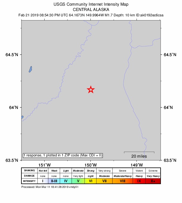
1 person reported to the USGS what they felt; the strongest reported shaking was II, weak shaking.
How well it is located
Reviewed by a seismologist.
- Stations used
- 42
Nearest places
Distance and direction from each place to the epicenter, with its forecast.
Nearby
Within 100 km, magnitude 1.5 and up: 54 in the 60 days after this one and 29 in the 30 days before it.
After
- 1.811 km NNE of Healy, Alaska · 2778 days ago · 111 km deep · 61 km away
- 2.311 km N of Four Mile Road, Alaska · 2777 days ago · 20 km deep · 73 km away
- 1.610 km N of Four Mile Road, Alaska · 2777 days ago · 18 km deep · 73 km away
- 2.346 km E of Anderson, Alaska · 2777 days ago · 20 km deep · 89 km away
- 2.414 km N of Four Mile Road, Alaska · 2777 days ago · 20 km deep · 76 km away
- 1.849 km WSW of Cantwell, Alaska · 2776 days ago · 103 km deep · 96 km away
- 2.312 km N of Four Mile Road, Alaska · 2775 days ago · 21 km deep · 73 km away
- 1.852 km W of Cantwell, Alaska · 2775 days ago · 3 km deep · 90 km away
- 1.539 km SW of Manley Hot Springs, Alaska · 2770 days ago · 16 km deep · 81 km away
- 1.624 km SE of McKinley Park, Alaska · 2769 days ago · 84 km deep · 96 km away
- 1.612 km N of Four Mile Road, Alaska · 2768 days ago · 16 km deep · 74 km away
- 1.647 km WSW of McKinley Park, Alaska · 2767 days ago · 125 km deep · 61 km away
- 1.631 km W of Anderson, Alaska · 2765 days ago · 22 km deep · 24 km away · felt by 1
- 1.547 km E of Clear, Alaska, Alaska · 2764 days ago · 12 km deep · 87 km away
- 1.556 km E of Denali National Park, Alaska · 2762 days ago · 9 km deep · 66 km away
- 1.628 km W of McKinley Park, Alaska · 2760 days ago · 121 km deep · 56 km away
- 3.18 km WSW of Healy, Alaska · 2758 days ago · 119 km deep · 57 km away · felt by 1
- 1.642 km W of Four Mile Road, Alaska · 2757 days ago · 15 km deep · 43 km away
- 1.738 km W of Four Mile Road, Alaska · 2757 days ago · 25 km deep · 46 km away
- 2.011 km ENE of McKinley Park, Alaska · 2756 days ago · 106 km deep · 77 km away
- 2.030 km SSE of Minto, Alaska · 2755 days ago · 25 km deep · 96 km away
- 1.571 km W of Cantwell, Alaska · 2754 days ago · 113 km deep · 99 km away
- 1.867 km W of Cantwell, Alaska · 2754 days ago · 131 km deep · 90 km away
- 2.533 km W of Cantwell, Alaska · 2752 days ago · 100 km deep · 88 km away
- 1.743 km WSW of McKinley Park, Alaska · 2751 days ago · 134 km deep · 61 km away
- 1.721 km NNW of Four Mile Road, Alaska · 2747 days ago · 26 km deep · 78 km away
- 1.520 km N of Four Mile Road, Alaska · 2746 days ago · 20 km deep · 82 km away
- 1.941 km W of Cantwell, Alaska · 2745 days ago · 101 km deep · 92 km away
- 2.645 km W of Cantwell, Alaska · 2745 days ago · 105 km deep · 94 km away
- 2.031 km SE of Minto, Alaska · 2745 days ago · 18 km deep · 98 km away
- 1.559 km SSW of Manley Hot Springs, Alaska · 2743 days ago · 4 km deep · 64 km away
- 2.417 km NE of Healy, Alaska · 2740 days ago · 0 km deep · 69 km away
- 2.9Central Alaska · 2739 days ago · 121 km deep · 77 km away
- 1.855 km WSW of Healy, Alaska · 2738 days ago · 10 km deep · 50 km away
- 1.927 km ESE of Nenana, Alaska · 2737 days ago · 9 km deep · 75 km away
- 1.617 km NW of Anderson, Alaska · 2737 days ago · 14 km deep · 43 km away
- 1.641 km W of Cantwell, Alaska · 2736 days ago · 8 km deep · 83 km away
- 2.017 km E of Ferry, Alaska · 2735 days ago · 5 km deep · 62 km away
- 1.570 km ESE of Denali National Park, Alaska · 2735 days ago · 128 km deep · 100 km away
- 1.621 km W of Four Mile Road, Alaska · 2732 days ago · 22 km deep · 52 km away
- 1.522 km W of Four Mile Road, Alaska · 2732 days ago · 23 km deep · 51 km away
- 1.642 km E of Denali National Park, Alaska · 2732 days ago · 15 km deep · 89 km away
- 1.844 km W of Cantwell, Alaska · 2730 days ago · 102 km deep · 89 km away
- 4.515 km NNW of Four Mile Road, Alaska · 2730 days ago · 20 km deep · 74 km away · felt by 235
- 2.357 km WNW of Cantwell, Alaska · 2729 days ago · 136 km deep · 66 km away
- 1.711 km NW of Cantwell, Alaska · 2728 days ago · 97 km deep · 90 km away
- 1.732 km SSW of Manley Hot Springs, Alaska · 2728 days ago · 17 km deep · 79 km away
- 1.617 km NNW of Four Mile Road, Alaska · 2725 days ago · 22 km deep · 75 km away
- 1.580 km W of Clear, Alaska, Alaska · 2725 days ago · 15 km deep · 43 km away
- 1.618 km NE of Healy, Alaska · 2724 days ago · 0 km deep · 65 km away
- 1.756 km E of Denali National Park, Alaska · 2722 days ago · 5 km deep · 66 km away
- 1.861 km ESE of Denali National Park, Alaska · 2721 days ago · 4 km deep · 93 km away
- 1.541 km E of Denali National Park, Alaska · 2721 days ago · 7 km deep · 84 km away
- 1.669 km SW of Manley Hot Springs, Alaska · 2721 days ago · 21 km deep · 85 km away
Before
- 1.722 km E of Denali National Park, Alaska · 2782 days ago · 10 km deep · 97 km away
- 1.644 km SSW of Manley Hot Springs, Alaska · 2782 days ago · 18 km deep · 67 km away
- 2.541 km WNW of Cantwell, Alaska · 2782 days ago · 10 km deep · 78 km away
- 1.525 km NW of Cantwell, Alaska · 2784 days ago · 100 km deep · 76 km away
- 1.86 km E of Healy, Alaska · 2784 days ago · 113 km deep · 67 km away
- 1.945 km WSW of McKinley Park, Alaska · 2785 days ago · 8 km deep · 58 km away
- 2.527 km SSE of Minto, Alaska · 2788 days ago · 22 km deep · 97 km away
- 2.2Central Alaska · 2789 days ago · 12 km deep · 88 km away
- 1.652 km W of Cantwell, Alaska · 2789 days ago · 112 km deep · 76 km away
- 1.559 km W of Cantwell, Alaska · 2792 days ago · 109 km deep · 84 km away
- 2.134 km W of Cantwell, Alaska · 2792 days ago · 102 km deep · 86 km away
- 1.529 km WSW of McKinley Park, Alaska · 2792 days ago · 114 km deep · 61 km away
- 2.924 km ENE of McKinley Park, Alaska · 2793 days ago · 103 km deep · 87 km away · felt by 1
- 2.650 km E of Denali National Park, Alaska · 2794 days ago · 11 km deep · 74 km away
- 1.653 km W of Cantwell, Alaska · 2799 days ago · 6 km deep · 90 km away
- 1.532 km E of Denali National Park, Alaska · 2800 days ago · 4 km deep · 88 km away
- 1.532 km W of McKinley Park, Alaska · 2800 days ago · 126 km deep · 56 km away
- 2.323 km NNE of Four Mile Road, Alaska · 2800 days ago · 18 km deep · 87 km away
- 2.123 km ESE of Denali National Park, Alaska · 2801 days ago · 11 km deep · 100 km away
- 2.027 km NE of Four Mile Road, Alaska · 2801 days ago · 17 km deep · 92 km away
Earthquakes todayAlaska earthquakesLive radar here
Sources
From the USGS Earthquake Hazards Program and its partner networks, event ak0192ec6csa. Read Thu, Oct 1, 2026, 4:46 AM UTC.