M2.0 earthquake 61 km E of Cantwell, Alaska
A magnitude 2.0 earthquake struck 61 km E of Cantwell, Alaska on Thu, Oct 31, 2019, 10:53 PM AKDT (06:53 UTC), 4 km (3 mi) below the surface.
A larger quake followed: M2.9 61 km ESE of McKinley Park, Alaska. This one was a foreshock.
Map
Where this earthquake was located, with the others nearby. Select one for its page.
The earthquake
- Magnitude
- 2.0 (ML, local (Richter)), micro
- Magnitude from
- Alaska Earthquake Center
- Local time
- UTC
- 2019-11-01 06:53:20 UTC
- Depth
- 4.3 km (2.7 mi), shallow
- Epicenter
- 63.457° N, 147.719° W
- Region
- Alaska
- Felt reports
- 2
- Tsunami flag
- No
- Status
- Reviewed by a seismologist
Did you feel it?
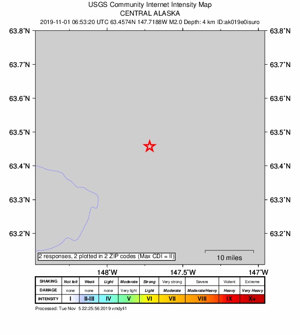
2 people reported to the USGS what they felt; the strongest reported shaking was II, weak shaking.
How well it is located
Reviewed by a seismologist.
- Stations used
- 50
Nearest places
Distance and direction from each place to the epicenter, with its forecast.
Nearby
Within 100 km, magnitude 1.5 and up: 71 in the 60 days after this one and 33 in the 30 days before it.
After
- 1.579 km ESE of McKinley Park, Alaska · 2527 days ago · 0 km deep · 22 km away
- 1.628 km WNW of Cantwell, Alaska · 2527 days ago · 101 km deep · 88 km away
- 2.477 km ESE of McKinley Park, Alaska · 2525 days ago · 3 km deep · 19 km away
- 1.782 km ESE of McKinley Park, Alaska · 2525 days ago · 5 km deep · 21 km away
- 1.878 km ESE of McKinley Park, Alaska · 2525 days ago · 5 km deep · 19 km away
- 1.870 km S of Cantwell, Alaska · 2524 days ago · 6 km deep · 96 km away
- 1.536 km SSW of Cantwell, Alaska · 2524 days ago · 69 km deep · 82 km away
- 1.778 km NW of Lake Louise, Alaska · 2524 days ago · 45 km deep · 86 km away
- 1.968 km ESE of McKinley Park, Alaska · 2523 days ago · 5 km deep · 10 km away
- 1.573 km ESE of McKinley Park, Alaska · 2522 days ago · 6 km deep · 18 km away
- 1.54 km W of Healy, Alaska · 2522 days ago · 107 km deep · 80 km away
- 1.977 km S of Cantwell, Alaska · 2521 days ago · 55 km deep · 97 km away
- 2.354 km SSE of Cantwell, Alaska · 2521 days ago · 65 km deep · 75 km away
- 1.750 km SSW of Cantwell, Alaska · 2519 days ago · 93 km deep · 100 km away
- 1.547 km SSE of Cantwell, Alaska · 2518 days ago · 62 km deep · 72 km away
- 1.677 km SSE of Cantwell, Alaska · 2515 days ago · 60 km deep · 79 km away
- 2.745 km SSW of Cantwell, Alaska · 2511 days ago · 72 km deep · 94 km away
- 1.6Central Alaska · 2509 days ago · 89 km deep · 81 km away
- 1.57 km ENE of McKinley Park, Alaska · 2508 days ago · 111 km deep · 62 km away
- 1.617 km W of McKinley Park, Alaska · 2507 days ago · 110 km deep · 83 km away
- 2.733 km SSE of Cantwell, Alaska · 2504 days ago · 72 km deep · 67 km away
- 1.835 km WSW of Cantwell, Alaska · 2504 days ago · 96 km deep · 97 km away
- 1.648 km ENE of Cantwell, Alaska · 2503 days ago · 1 km deep · 15 km away
- 1.966 km E of McKinley Park, Alaska · 2501 days ago · 80 km deep · 24 km away
- 1.670 km ESE of McKinley Park, Alaska · 2500 days ago · 5 km deep · 12 km away
- 2.729 km SE of Cantwell, Alaska · 2500 days ago · 6 km deep · 50 km away
- 1.931 km SW of Cantwell, AK · 2499 days ago · 3 km deep · 90 km away
- 1.523 km W of McKinley Park, Alaska · 2498 days ago · 117 km deep · 87 km away
- 1.615 km W of Healy, Alaska · 2498 days ago · 116 km deep · 87 km away
- 1.580 km ESE of McKinley Park, Alaska · 2497 days ago · 5 km deep · 21 km away
- 1.781 km E of Cantwell, Alaska · 2495 days ago · 2 km deep · 19 km away
- 1.580 km ESE of McKinley Park, Alaska · 2494 days ago · 3 km deep · 20 km away
- 1.529 km E of Cantwell, Alaska · 2494 days ago · 17 km deep · 32 km away
- 2.138 km WSW of McKinley Park, Alaska · 2494 days ago · 120 km deep · 97 km away
- 1.663 km SSE of Cantwell, Alaska · 2492 days ago · 16 km deep · 83 km away
- 1.765 km S of Cantwell, Alaska · 2491 days ago · 66 km deep · 92 km away
- 2.431 km W of McKinley Park, Alaska · 2490 days ago · 9 km deep · 96 km away
- 2.961 km ESE of McKinley Park, Alaska · 2486 days ago · 3 km deep · 11 km away
- 1.563 km ESE of Cantwell, Alaska · 2485 days ago · 10 km deep · 41 km away
- 1.770 km E of Cantwell, Alaska · 2485 days ago · 8 km deep · 9 km away
- 2.365 km SSE of Cantwell, Alaska · 2485 days ago · 63 km deep · 72 km away
- 1.733 km W of McKinley Park, Alaska · 2483 days ago · 117 km deep · 96 km away
- 2.671 km S of Cantwell, Alaska · 2482 days ago · 56 km deep · 95 km away
- 1.614 km NW of Cantwell, Alaska · 2481 days ago · 94 km deep · 69 km away
- 2.542 km SW of Salcha, Alaska · 2480 days ago · 6 km deep · 85 km away
- 2.848 km S of Cantwell, Alaska · 2480 days ago · 75 km deep · 88 km away
- 1.662 km ESE of McKinley Park, Alaska · 2479 days ago · 5 km deep · 9 km away
- 1.625 km WSW of McKinley Park, Alaska · 2479 days ago · 4 km deep · 86 km away
- 2.381 km E of Cantwell, Alaska · 2478 days ago · 3 km deep · 19 km away
- 1.961 km ESE of McKinley Park, Alaska · 2477 days ago · 4 km deep · 9 km away
- 2.071 km NW of Paxson, Alaska · 2477 days ago · 5 km deep · 51 km away
- 1.772 km NW of Paxson, Alaska · 2477 days ago · 7 km deep · 49 km away
- 1.872 km NW of Paxson, Alaska · 2477 days ago · 1 km deep · 50 km away
- 2.073 km NW of Paxson, Alaska · 2477 days ago · 5 km deep · 49 km away
- 1.973 km NW of Paxson, Alaska · 2477 days ago · 4 km deep · 48 km away
- 2.074 km NW of Paxson, Alaska · 2477 days ago · 1 km deep · 48 km away
- 2.074 km NW of Paxson, Alaska · 2477 days ago · 1 km deep · 48 km away
- 1.851 km SSW of Cantwell, Alaska · 2476 days ago · 70 km deep · 95 km away
- 1.7Central Alaska · 2474 days ago · 103 km deep · 69 km away
- 2.732 km WNW of Cantwell, Alaska · 2474 days ago · 108 km deep · 92 km away
The first 60 of 71.
Before
- 2.36 km E of Healy, Alaska · 2530 days ago · 108 km deep · 71 km away
- 1.718 km N of Cantwell, Alaska · 2530 days ago · 102 km deep · 64 km away
- 1.538 km SW of Cantwell, Alaska · 2530 days ago · 79 km deep · 94 km away
- 2.241 km SE of Cantwell, Alaska · 2531 days ago · 72 km deep · 50 km away
- 1.557 km E of Cantwell, Alaska · 2531 days ago · 2 km deep · 4 km away
- 2.567 km SSE of Cantwell, Alaska · 2531 days ago · 60 km deep · 75 km away
- 1.918 km N of Cantwell, Alaska · 2532 days ago · 1 km deep · 61 km away
- 1.526 km SSE of Cantwell, Alaska · 2532 days ago · 84 km deep · 59 km away
- 2.276 km ENE of Chase, Alaska · 2532 days ago · 58 km deep · 98 km away
- 2.665 km E of Cantwell, Alaska · 2533 days ago · 9 km deep · 3 km away
- 2.253 km E of Cantwell, Alaska · 2533 days ago · 74 km deep · 9 km away
- 1.572 km SSE of Cantwell, Alaska · 2533 days ago · 73 km deep · 78 km away
- 4.565 km SSE of Cantwell, Alaska · 2533 days ago · 75 km deep · 71 km away · felt by 320
- 2.016 km NNW of Cantwell, Alaska · 2533 days ago · 6 km deep · 66 km away
- 1.824 km ENE of Cantwell, Alaska · 2536 days ago · 4 km deep · 41 km away
- 1.757 km SE of Cantwell, Alaska · 2536 days ago · 61 km deep · 61 km away
- 1.748 km S of Cantwell, Alaska · 2538 days ago · 13 km deep · 78 km away
- 2.644 km SSW of Cantwell, Alaska · 2541 days ago · 73 km deep · 96 km away
- 1.584 km E of McKinley Park, Alaska · 2542 days ago · 0 km deep · 29 km away
- 2.524 km WSW of Cantwell, Alaska · 2544 days ago · 96 km deep · 85 km away
Earthquakes todayAlaska earthquakesLive radar here
Sources
From the USGS Earthquake Hazards Program and its partner networks, event ak019e0isuro. Read Fri, Oct 2, 2026, 7:56 PM UTC.