M1.6 earthquake 28 km E of Big Pine, California
A magnitude 1.6 earthquake struck 28 km E of Big Pine, California on Wed, Jan 23, 2019, 8:24 AM PST (16:24 UTC), 8 km (5 mi) below the surface.
A larger quake followed: M3.3 50 km SSW of Goldfield, Nevada. This one was a foreshock.
Map
Where this earthquake was located, with the others nearby. Select one for its page.
The earthquake
- Magnitude
- 1.6 (ML, local (Richter)), micro
- Magnitude from
- Nevada Seismological Laboratory
- Local time
- UTC
- 2019-01-23 16:24:55 UTC
- Depth
- 7.5 km (4.7 mi), shallow
- Epicenter
- 37.143° N, 117.966° W
- Region
- California
- Felt reports
- 2
- Tsunami flag
- No
- Status
- Reviewed by a seismologist
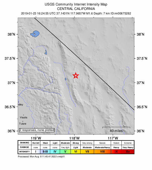
Did you feel it?
2 people reported to the USGS what they felt.
How well it is located
Reviewed by a seismologist.
- Magnitude uncertainty
- ±0.34
- Station coverage gap
- 84°
- Stations used
- 28
Nearest places
Distance and direction from each place to the epicenter, with its forecast.
Nearby
Within 100 km, magnitude 1.5 and up: 88 in the 60 days after this one and 31 in the 30 days before it.
After
- 2.215km SE of Mammoth Lakes, CA · 2811 days ago · 7 km deep · 91 km away · felt by 1
- 1.814km SE of Mammoth Lakes, CA · 2810 days ago · 6 km deep · 92 km away
- 1.915km S of Mammoth Lakes, CA · 2808 days ago · 3 km deep · 99 km away
- 1.616km WSW of Round Valley, CA · 2805 days ago · 14 km deep · 76 km away
- 1.714km W of Round Valley, CA · 2804 days ago · 14 km deep · 76 km away
- 2.915km W of Round Valley, CA · 2804 days ago · 14 km deep · 76 km away · felt by 303
- 1.714km NW of Toms Place, CA · 2803 days ago · 3 km deep · 93 km away · felt by 1
- 1.614km NW of Toms Place, CA · 2803 days ago · 2 km deep · 93 km away
- 1.614km NW of Toms Place, CA · 2803 days ago · 3 km deep · 93 km away
- 2.114km NW of Toms Place, CA · 2803 days ago · 3 km deep · 93 km away
- 1.614km NW of Toms Place, CA · 2803 days ago · 3 km deep · 93 km away
- 1.814km NW of Toms Place, CA · 2803 days ago · 3 km deep · 93 km away · felt by 1
- 1.914km NW of Toms Place, CA · 2803 days ago · 3 km deep · 93 km away
- 1.614km NW of Toms Place, CA · 2803 days ago · 2 km deep · 93 km away
- 1.820 km S of Goldfield, Nevada · 2801 days ago · 0 km deep · 75 km away
- 1.610 km NNW of Benton, California · 2801 days ago · 2 km deep · 98 km away
- 3.014km NW of Toms Place, CA · 2800 days ago · 3 km deep · 93 km away · felt by 2
- 1.517km SW of Toms Place, CA · 2800 days ago · 2 km deep · 84 km away
- 1.77km SSW of Wilkerson, CA · 2797 days ago · 3 km deep · 41 km away
- 1.815km SW of Toms Place, CA · 2796 days ago · 5 km deep · 83 km away
- 1.811km ENE of Mammoth Lakes, CA · 2796 days ago · 2 km deep · 98 km away
- 2.127 km SSE of Silver Peak, Nevada · 2795 days ago · 6 km deep · 55 km away
- 1.714km SE of Mammoth Lakes, CA · 2795 days ago · 7 km deep · 91 km away · felt by 1
- 1.514km NW of Toms Place, CA · 2790 days ago · 2 km deep · 93 km away
- 2.113km W of Toms Place, CA · 2789 days ago · 7 km deep · 88 km away · felt by 1
- 1.713km W of Toms Place, CA · 2789 days ago · 7 km deep · 88 km away
- 2.429km S of Mammoth Lakes, CA · 2789 days ago · 5 km deep · 98 km away
- 2.118km SW of Toms Place, CA · 2789 days ago · 4 km deep · 85 km away · felt by 1
- 1.816km SW of Toms Place, CA · 2788 days ago · 5 km deep · 83 km away
- 1.513km W of Toms Place, CA · 2786 days ago · 4 km deep · 89 km away
- 2.215km SW of Toms Place, CA · 2785 days ago · 5 km deep · 83 km away
- 2.339km ESE of Big Pine, CA · 2785 days ago · 1 km deep · 11 km away · felt by 1
- 1.536km NW of Stovepipe Wells, CA · 2782 days ago · -1 km deep · 59 km away
- 1.724km SW of Toms Place, CA · 2779 days ago · 1 km deep · 87 km away
- 2.313km ESE of Mammoth Lakes, CA · 2777 days ago · 6 km deep · 92 km away
- 1.855 km SSW of Goldfield, Nevada · 2777 days ago · 2 km deep · 44 km away · felt by 1
- 1.556 km S of Silver Peak, Nevada · 2777 days ago · 9 km deep · 41 km away
- 2.155 km SSW of Goldfield, Nevada · 2777 days ago · 2 km deep · 44 km away
- 1.562 km W of Beatty, Nevada · 2776 days ago · 6 km deep · 50 km away
- 1.851 km SSW of Goldfield, Nevada · 2776 days ago · 8 km deep · 46 km away
- 1.850 km SSW of Goldfield, Nevada · 2776 days ago · 4 km deep · 46 km away
- 2.851 km SSW of Goldfield, Nevada · 2776 days ago · 5 km deep · 45 km away · felt by 1
- 3.151 km SSW of Goldfield, Nevada · 2776 days ago · 5 km deep · 46 km away
- 1.652 km SSW of Goldfield, Nevada · 2776 days ago · 7 km deep · 45 km away
- 2.450 km SSW of Goldfield, Nevada · 2776 days ago · 6 km deep · 46 km away
- 1.550 km SSW of Goldfield, Nevada · 2776 days ago · 5 km deep · 46 km away
- 1.815km SE of Mammoth Lakes, CA · 2773 days ago · 8 km deep · 91 km away
- 1.715km SE of Mammoth Lakes, CA · 2773 days ago · 8 km deep · 91 km away
- 1.551 km SSW of Goldfield, Nevada · 2773 days ago · 1 km deep · 46 km away
- 1.814km SW of Toms Place, CA · 2772 days ago · 8 km deep · 81 km away
- 1.610km WSW of Wilkerson, CA · 2772 days ago · 2 km deep · 48 km away
- 1.510km WSW of Wilkerson, CA · 2772 days ago · 3 km deep · 49 km away
- 1.550 km SSW of Goldfield, Nevada · 2771 days ago · 3 km deep · 45 km away
- 1.555 km SSW of Goldfield, Nevada · 2771 days ago · 0 km deep · 44 km away
- 1.625km SW of Toms Place, CA · 2770 days ago · 4 km deep · 87 km away · felt by 2
- 1.514km W of Toms Place, CA · 2770 days ago · 5 km deep · 88 km away
- 1.619 km NE of Dyer, Nevada · 2768 days ago · 0 km deep · 72 km away
- 2.450 km SSW of Goldfield, Nevada · 2766 days ago · 0 km deep · 46 km away
- 1.651 km SSW of Goldfield, Nevada · 2765 days ago · 0 km deep · 45 km away
- 2.150 km SSW of Goldfield, Nevada · 2765 days ago · 0 km deep · 46 km away · felt by 1
The first 60 of 88.
Before
- 1.86km E of Big Pine, CA · 2812 days ago · 8 km deep · 23 km away
- 1.515km SE of Mammoth Lakes, CA · 2813 days ago · 8 km deep · 91 km away
- 3.215km E of Mammoth Lakes, CA · 2813 days ago · 2 km deep · 93 km away · felt by 3
- 2.114km NW of Toms Place, CA · 2817 days ago · 2 km deep · 93 km away · felt by 1
- 2.61km SSW of Round Valley, CA · 2817 days ago · 10 km deep · 64 km away · felt by 2
- 1.815km SW of Toms Place, CA · 2817 days ago · 7 km deep · 83 km away
- 1.615km E of Mammoth Lakes, CA · 2818 days ago · 3 km deep · 93 km away · felt by 2
- 1.515km E of Mammoth Lakes, CA · 2818 days ago · 2 km deep · 93 km away
- 1.514km E of Mammoth Lakes, CA · 2818 days ago · 2 km deep · 93 km away
- 2.01km SSW of Round Valley, CA · 2818 days ago · 10 km deep · 64 km away · felt by 4
- 2.314km E of Mammoth Lakes, CA · 2819 days ago · 3 km deep · 93 km away
- 1.612km E of Mammoth Lakes, CA · 2820 days ago · 5 km deep · 96 km away · felt by 1
- 1.634 km SSE of Goldfield, Nevada · 2820 days ago · 2 km deep · 85 km away
- 1.814km NW of Toms Place, CA · 2821 days ago · 3 km deep · 93 km away
- 3.316km SW of Toms Place, CA · 2823 days ago · 3 km deep · 84 km away · felt by 14
- 2.63km ENE of Round Valley, CA · 2825 days ago · 14 km deep · 62 km away · felt by 2
- 1.820 km SE of Silver Peak, Nevada · 2825 days ago · 5 km deep · 69 km away
- 1.716km WSW of Toms Place, CA · 2826 days ago · 7 km deep · 87 km away
- 1.916km WSW of Toms Place, CA · 2826 days ago · 6 km deep · 87 km away
- 2.04km ENE of Round Valley, CA · 2827 days ago · 12 km deep · 62 km away
Earthquakes todayCalifornia earthquakesLive radar here
Sources
From the USGS Earthquake Hazards Program and its partner networks, event nn00675282. Read Mon, Oct 5, 2026, 2:40 AM UTC.