M4.4 earthquake 88 km NW of Aleneva, Alaska
A magnitude 4.4 earthquake struck 88 km NW of Aleneva, Alaska on Thu, Jan 3, 2019, 9:51 AM AKST (18:51 UTC), 86 km (54 mi) below the surface.
A larger quake followed: M5.2 87 km ESE of King Salmon, Alaska. This one was a foreshock.
Map
Where this earthquake was located, with the others nearby. Select one for its page.
The earthquake
- Magnitude
- 4.4 (ML, local (Richter)), light
- Magnitude from
- Alaska Earthquake Center
- Local time
- UTC
- 2019-01-03 18:51:38 UTC
- Depth
- 86.4 km (53.7 mi), intermediate-depth
- Epicenter
- 58.548° N, 154.106° W
- Region
- Alaska
- Strongest shaking
- III, weak shaking
- PAGER alert
- Green
- Tsunami flag
- Yes: a large quake in an oceanic region
- Status
- Reviewed by a seismologist
Magnitude estimates
Different scales measure different things and differ by a few tenths. The USGS marks one as preferred, and it is the one this page uses.
| Mag. | Scale | Computed by | Notes |
|---|---|---|---|
| 4.4 | ML, local (Richter) | Alaska Earthquake Center | Preferred · Preliminary |
| 4.4 | ML, local (Richter) | AACSE | Preliminary |
| 4.7 | mb, body-wave | USGS National Earthquake Information Center | Reviewed · ±0.057 · 92 stations |
| 4.1 | ML, local (Richter) | NOAA National Tsunami Warning Center | Reviewed · 16 stations |
Tsunami
The USGS flags a quake this large in an oceanic region. The flag does not mean a tsunami happened; the tsunami warning centers decide that, and their messages are below when they issued any.
Current tsunami warnings: tsunami.gov. Warnings in force in the US also appear on our alerts pages.
Shaking
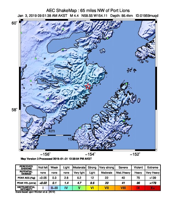
The USGS ShakeMap: shaking estimated from seismic stations and the quake’s size, on the Modified Mercalli intensity scale.
- Strongest estimated
- III, weak shaking
- Peak ground acceleration
- 230.0% of gravity
- Peak ground velocity
- 0.3 cm/s
- Map
- Automatic
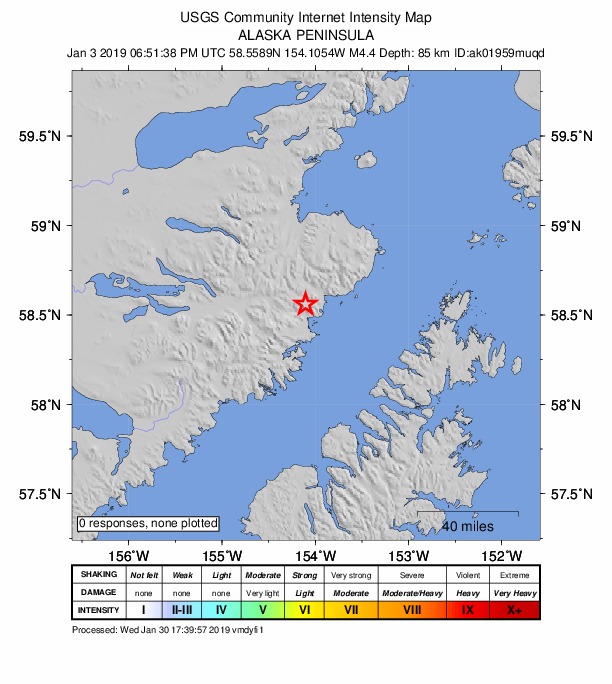
Did you feel it?
No one has reported feeling this quake to the USGS.
Estimated impact
The USGS PAGER system estimates deaths and economic losses from the shaking and the population and buildings exposed to it.
- Alert level
- Green: little or no damage or loss of life expected
| Range | Chance |
|---|---|
| Under 1 | 69% |
| 1 to 10 | 29% |
| 10 to 100 | 2% |
| 100 to 1,000 | Under 1% |
| 1,000 to 10,000 | Under 1% |
| 10,000 to 100,000 | Under 1% |
| 100,000 to 10,000,000 | Under 1% |
| Range, million USD | Chance |
|---|---|
| Under 1 | 65% |
| 1 to 10 | 30% |
| 10 to 100 | 4% |
| 100 to 1,000 | Under 1% |
| 1,000 to 10,000 | Under 1% |
| 10,000 to 100,000 | Under 1% |
| 100,000 to 10,000,000 | Under 1% |
How well it is located
Reviewed by a seismologist.
- Stations used
- 237
Nearest places
Distance and direction from each place to the epicenter, with its forecast.
Nearby
Within 100 km, magnitude 1.5 and up: 142 in the 60 days after this one and 57 in the 30 days before it.
After
- 1.595 km NNW of Aleneva, Alaska · 2829 days ago · 69 km deep · 53 km away
- 1.536 km NNW of Aleneva, Alaska · 2829 days ago · 65 km deep · 58 km away
- 1.779 km SW of Nanwalek, Alaska · 2828 days ago · 68 km deep · 83 km away
- 1.874 km S of Kokhanok, Alaska · 2828 days ago · 124 km deep · 48 km away
- 1.927 km NNE of Aleneva, Alaska · 2828 days ago · 44 km deep · 84 km away
- 1.858 km ESE of Pope-Vannoy Landing, Alaska · 2827 days ago · 106 km deep · 85 km away
- 1.959 km SW of Nanwalek, Alaska · 2827 days ago · 67 km deep · 95 km away
- 1.692 km NW of Aleneva, Alaska · 2827 days ago · 80 km deep · 25 km away
- 1.524 km N of Karluk, Alaska · 2827 days ago · 47 km deep · 87 km away
- 1.685 km N of Karluk, Alaska · 2826 days ago · 87 km deep · 26 km away
- 1.769 km SE of Kokhanok, Alaska · 2826 days ago · 99 km deep · 54 km away
- 1.945 km N of Aleneva, Alaska · 2825 days ago · 52 km deep · 64 km away
- 2.351 km SSE of Kokhanok, Alaska · 2823 days ago · 119 km deep · 56 km away
- 2.070 km S of Kokhanok, Alaska · 2823 days ago · 116 km deep · 40 km away
- 1.780 km NNW of Aleneva, Alaska · 2822 days ago · 60 km deep · 57 km away
- 1.855 km ESE of Pope-Vannoy Landing, Alaska · 2822 days ago · 115 km deep · 95 km away
- 2.186 km N of Aleneva, Alaska · 2822 days ago · 68 km deep · 67 km away
- 2.494 km NNW of Aleneva, Alaska · 2822 days ago · 73 km deep · 55 km away · felt by 1
- 2.755 km NNW of Karluk, Alaska · 2822 days ago · 78 km deep · 74 km away
- 1.560 km NW of Karluk, Alaska · 2822 days ago · 93 km deep · 97 km away
- 1.9Kodiak Island region, Alaska · 2822 days ago · 75 km deep · 21 km away
- 1.753 km SSE of Kokhanok, Alaska · 2821 days ago · 127 km deep · 53 km away
- 2.160 km SSE of Kokhanok, Alaska · 2821 days ago · 122 km deep · 46 km away
- 1.815 km NNW of Aleneva, Alaska · 2820 days ago · 37 km deep · 74 km away
- 1.963 km SW of Nanwalek, Alaska · 2820 days ago · 44 km deep · 93 km away
- 2.178 km NNW of Karluk, Alaska · 2820 days ago · 99 km deep · 54 km away
- 2.157 km WNW of Aleneva, Alaska · 2820 days ago · 61 km deep · 42 km away
- 2.044 km NW of Karluk, Alaska · 2819 days ago · 82 km deep · 97 km away
- 1.964 km SE of Pedro Bay, Alaska · 2819 days ago · 110 km deep · 99 km away
- 2.164 km S of Kokhanok, Alaska · 2819 days ago · 113 km deep · 45 km away
- 3.687 km NW of Aleneva, Alaska · 2818 days ago · 77 km deep · 15 km away
- 1.673 km WSW of Nanwalek, Alaska · 2817 days ago · 85 km deep · 92 km away
- 1.778 km SW of Nanwalek, AK · 2817 days ago · 59 km deep · 78 km away
- 2.062 km SSW of Kokhanok, Alaska · 2817 days ago · 148 km deep · 73 km away
- 1.967 km WSW of Nanwalek, Alaska · 2816 days ago · 68 km deep · 87 km away
- 1.541 km NNW of Aleneva, Alaska · 2815 days ago · 56 km deep · 57 km away
- 2.058 km NW of Aleneva, Alaska · 2814 days ago · 66 km deep · 31 km away
- 1.526 km SSE of Kokhanok, Alaska · 2814 days ago · 3 km deep · 80 km away
- 1.880 km NW of Aleneva, Alaska · 2813 days ago · 84 km deep · 19 km away
- 1.523 km NNE of Karluk, Alaska · 2813 days ago · 45 km deep · 88 km away
- 1.965 km ESE of Pope-Vannoy Landing, Alaska · 2812 days ago · 108 km deep · 88 km away
- 1.984 km SSE of Igiugig, Alaska · 2812 days ago · 134 km deep · 63 km away
- 5.287 km ESE of King Salmon, Alaska · 2811 days ago · 122 km deep · 75 km away · felt by 50 · tsunami flag
- 2.156 km SSE of Kokhanok, Alaska · 2810 days ago · 126 km deep · 50 km away
- 1.833 km N of Aleneva, Alaska · 2809 days ago · 41 km deep · 77 km away
- 2.525 km N of Aleneva, Alaska · 2809 days ago · 40 km deep · 77 km away
- 2.176 km SSE of Kokhanok, Alaska · 2809 days ago · 106 km deep · 31 km away
- 2.769 km N of Aleneva, Alaska · 2809 days ago · 59 km deep · 73 km away · felt by 3
- 2.257 km SSE of Kokhanok, Alaska · 2809 days ago · 119 km deep · 49 km away
- 2.544 km ESE of Pope-Vannoy Landing, Alaska · 2809 days ago · 117 km deep · 97 km away
- 2.865 km SSE of Kokhanok, Alaska · 2807 days ago · 116 km deep · 42 km away
- 1.965 km SSE of Kokhanok, Alaska · 2807 days ago · 130 km deep · 42 km away
- 1.969 km SE of Kokhanok, Alaska · 2806 days ago · 111 km deep · 49 km away
- 2.018 km N of Karluk, Alaska · 2806 days ago · 63 km deep · 93 km away
- 1.759 km NW of Aleneva, Alaska · 2805 days ago · 60 km deep · 36 km away
- 2.069 km SW of Nanwalek, Alaska · 2805 days ago · 63 km deep · 85 km away
- 1.887 km N of Aleneva, Alaska · 2805 days ago · 54 km deep · 62 km away
- 2.692 km ESE of King Salmon, Alaska · 2804 days ago · 116 km deep · 65 km away
- 1.782 km NNW of Aleneva, Alaska · 2804 days ago · 75 km deep · 33 km away
- 1.942 km WNW of Aleneva, Alaska · 2804 days ago · 68 km deep · 51 km away
The first 60 of 142.
Before
- 1.631 km N of Karluk, Alaska · 2830 days ago · 61 km deep · 80 km away
- 1.935 km NNW of Aleneva, Alaska · 2830 days ago · 62 km deep · 59 km away
- 1.840 km NNW of Aleneva, Alaska · 2831 days ago · 59 km deep · 55 km away
- 1.635 km NNW of Aleneva, Alaska · 2831 days ago · 57 km deep · 58 km away
- 1.737 km NNW of Aleneva, Alaska · 2831 days ago · 63 km deep · 60 km away
- 4.933 km NNW of Aleneva, Alaska · 2831 days ago · 62 km deep · 61 km away · felt by 90 · tsunami flag
- 2.086 km N of Aleneva, Alaska · 2833 days ago · 63 km deep · 65 km away
- 1.653 km N of Larsen Bay, Alaska · 2834 days ago · 67 km deep · 60 km away
- 1.987 km N of Karluk, Alaska · 2834 days ago · 4 km deep · 39 km away
- 2.387 km N of Karluk, Alaska · 2834 days ago · 4 km deep · 41 km away
- 1.786 km N of Karluk, Alaska · 2834 days ago · 3 km deep · 42 km away
- 2.266 km NNW of Aleneva, Alaska · 2835 days ago · 59 km deep · 46 km away
- 2.665 km SSE of Kokhanok, Alaska · 2835 days ago · 116 km deep · 41 km away
- 1.591 km NW of Aleneva, Alaska · 2836 days ago · 78 km deep · 12 km away
- 1.549 km NNW of Aleneva, Alaska · 2836 days ago · 55 km deep · 53 km away
- 1.861 km SSE of Kokhanok, Alaska · 2837 days ago · 114 km deep · 45 km away
- 1.854 km NNE of Aleneva, Alaska · 2837 days ago · 47 km deep · 81 km away
- 1.685 km NW of Karluk, Alaska · 2837 days ago · 0 km deep · 84 km away
- 1.841 km NW of Aleneva, Alaska · 2838 days ago · 56 km deep · 47 km away
- 1.884 km SW of Nanwalek, Alaska · 2838 days ago · 63 km deep · 70 km away
Earthquakes todayAlaska earthquakesLive radar here
Sources
From the USGS Earthquake Hazards Program and its partner networks, event ak01959muqd (also filed as us2000j02w, at00pkrr22, aacse01959muts). Read Sat, Oct 3, 2026, 6:30 AM UTC.