M2.2 earthquake 11 km SW of Henefer, Utah
A magnitude 2.2 earthquake struck 11 km SW of Henefer, Utah on Sat, Dec 22, 2018, 11:06 PM MST (06:06 UTC), 8 km (5 mi) below the surface.
A larger quake followed: M3.7 3 km SSW of Bluffdale, Utah. This one was a foreshock.
Map
Where this earthquake was located, with the others nearby. Select one for its page.
The earthquake
- Magnitude
- 2.2 (ML, local (Richter)), micro
- Magnitude from
- University of Utah Seismograph Stations
- Local time
- UTC
- 2018-12-23 06:06:33 UTC
- Depth
- 7.6 km (4.7 mi), shallow
- Epicenter
- 40.934° N, 111.579° W
- Region
- Utah
- Felt reports
- 1
- Tsunami flag
- No
- Status
- Reviewed by a seismologist
Magnitude estimates
Different scales measure different things and differ by a few tenths. The USGS marks one as preferred, and it is the one this page uses.
| Mag. | Scale | Computed by | Notes |
|---|---|---|---|
| 2.19 | ML, local (Richter) | University of Utah Seismograph Stations | Preferred · Final · ±0.066 · 6 stations |
| 2.2 | ML, local (Richter) | USGS National Earthquake Information Center | Reviewed · ±0.066 · 6 stations |
Did you feel it?
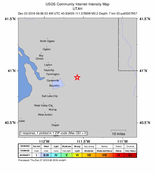
1 person reported to the USGS what they felt; the strongest reported shaking was II, weak shaking.
How well it is located
Reviewed by a seismologist.
- Location uncertainty
- About 0.3 km horizontally, 0.4 km in depth
- Magnitude uncertainty
- ±0.07
- Depth from
- From location
- Station coverage gap
- 32°
- Stations used
- 45
Nearest places
Distance and direction from each place to the epicenter, with its forecast.
Nearby
Within 100 km, magnitude 1.5 and up: 25 in the 60 days after this one and 2 in the 30 days before it.
After
- 1.610 km W of Woodruff, Utah · 2834 days ago · 18 km deep · 69 km away
- 2.34 km N of Saratoga Springs, Utah · 2807 days ago · 4 km deep · 67 km away · felt by 772
- 1.57 km SW of Bluffdale, Utah · 2805 days ago · 11 km deep · 65 km away · felt by 1
- 1.92 km S of Bluffdale, Utah · 2790 days ago · 7 km deep · 60 km away · felt by 4
- 1.81 km S of Bluffdale, Utah · 2789 days ago · 7 km deep · 60 km away · felt by 1
- 3.22 km S of Bluffdale, Utah · 2788 days ago · 9 km deep · 61 km away · felt by 534
- 3.73 km SSW of Bluffdale, Utah · 2788 days ago · 9 km deep · 61 km away · felt by 8,867
- 2.22 km S of Bluffdale, Utah · 2788 days ago · 8 km deep · 60 km away · felt by 2
- 1.7Utah · 2788 days ago · 7 km deep · 60 km away · felt by 10
- 2.22 km S of Bluffdale, Utah · 2787 days ago · 7 km deep · 60 km away · felt by 82
- 1.61 km S of Bluffdale, Utah · 2787 days ago · 7 km deep · 60 km away
- 1.52 km SSE of Bluffdale, Utah · 2787 days ago · 7 km deep · 60 km away
- 1.62 km SSE of Bluffdale, Utah · 2787 days ago · 5 km deep · 60 km away · felt by 12
- 1.62 km SSE of Bluffdale, Utah · 2786 days ago · 6 km deep · 59 km away
- 2.42 km S of Bluffdale, Utah · 2786 days ago · 6 km deep · 60 km away · felt by 136
- 1.81 km SSE of Bluffdale, Utah · 2786 days ago · 6 km deep · 59 km away
- 1.62 km S of Bluffdale, Utah · 2785 days ago · 6 km deep · 60 km away
- 1.91 km S of Bluffdale, Utah · 2784 days ago · 6 km deep · 60 km away · felt by 3
- 1.61 km S of Bluffdale, Utah · 2783 days ago · 7 km deep · 59 km away
- 1.62 km S of Bluffdale, Utah · 2783 days ago · 6 km deep · 60 km away · felt by 1
- 1.82 km S of Bluffdale, Utah · 2782 days ago · 9 km deep · 60 km away · felt by 2
- 1.91 km SSW of Bluffdale, Utah · 2782 days ago · 7 km deep · 59 km away
- 1.70 km S of Bluffdale, Utah · 2782 days ago · 5 km deep · 59 km away
- 2.21 km S of Bluffdale, Utah · 2782 days ago · 7 km deep · 60 km away · felt by 43
- 2.52 km S of Bluffdale, Utah · 2782 days ago · 8 km deep · 60 km away · felt by 1,065
Before
Earthquakes todayUtah earthquakesLive radar here
Sources
From the USGS Earthquake Hazards Program and its partner networks, event uu60307957 (also filed as us2000ixqh). Read Sun, Oct 4, 2026, 12:22 AM UTC.