M1.8 earthquake 18 km NE of Healy, Alaska
A magnitude 1.8 earthquake struck 18 km NE of Healy, Alaska on Fri, Jan 5, 2018, 3:50 PM AKST (00:50 UTC), 5 km (3 mi) below the surface.
A larger quake followed: M4.6 7 km SE of Ferry, Alaska. This one was a foreshock.
Map
Where this earthquake was located, with the others nearby. Select one for its page.
The earthquake
- Magnitude
- 1.8 (ML, local (Richter)), micro
- Magnitude from
- Alaska Earthquake Center
- Local time
- UTC
- 2018-01-06 00:50:57 UTC
- Depth
- 5.0 km (3.1 mi), shallow
- Epicenter
- 63.987° N, 148.735° W
- Region
- Alaska
- Felt reports
- 1
- Tsunami flag
- No
- Status
- Reviewed by a seismologist
Did you feel it?
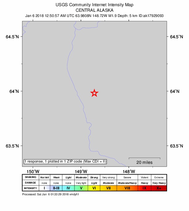
1 person reported to the USGS what they felt; the strongest reported shaking was II, weak shaking.
How well it is located
Reviewed by a seismologist.
- Stations used
- 47
Nearest places
Distance and direction from each place to the epicenter, with its forecast.
Nearby
Within 100 km, magnitude 1.5 and up: 67 in the 60 days after this one and 44 in the 30 days before it.
After
- 2.382 km E of Cantwell, Alaska · 3193 days ago · 2 km deep · 89 km away
- 3.75 km ESE of Healy, Alaska · 3191 days ago · 119 km deep · 18 km away · felt by 1
- 2.557 km WNW of Cantwell, Alaska · 3190 days ago · 135 km deep · 85 km away
- 1.618 km NW of Four Mile Road, Alaska · 3190 days ago · 25 km deep · 88 km away
- 1.66 km ESE of Healy, Alaska · 3187 days ago · 13 km deep · 17 km away
- 1.839 km WSW of McKinley Park, Alaska · 3186 days ago · 121 km deep · 61 km away
- 1.910 km W of Healy, Alaska · 3185 days ago · 116 km deep · 27 km away
- 1.960 km E of Cantwell, Alaska · 3185 days ago · 4 km deep · 77 km away
- 2.241 km ENE of Ferry, Alaska · 3183 days ago · 18 km deep · 26 km away
- 1.522 km N of Four Mile Road, Alaska · 3183 days ago · 22 km deep · 94 km away
- 2.026 km SSW of Cantwell, Alaska · 3183 days ago · 84 km deep · 93 km away
- 1.559 km W of Cantwell, Alaska · 3182 days ago · 111 km deep · 93 km away
- 1.510 km WSW of Nenana, Alaska · 3182 days ago · 13 km deep · 68 km away
- 1.89 km WSW of Nenana, Alaska · 3182 days ago · 20 km deep · 64 km away
- 1.558 km E of Cantwell, Alaska · 3181 days ago · 11 km deep · 79 km away
- 1.515 km W of McKinley Park, Alaska · 3181 days ago · 120 km deep · 36 km away
- 2.213 km ENE of Ferry, Alaska · 3180 days ago · 128 km deep · 10 km away
- 1.843 km WSW of Cantwell, Alaska · 3179 days ago · 83 km deep · 100 km away
- 1.636 km SW of Cantwell, Alaska · 3179 days ago · 91 km deep · 96 km away
- 4.67 km SE of Ferry, Alaska · 3179 days ago · 129 km deep · 12 km away · felt by 46
- 1.755 km ENE of Cantwell, Alaska · 3178 days ago · 2 km deep · 68 km away
- 2.226 km N of Four Mile Road, Alaska · 3178 days ago · 21 km deep · 96 km away
- 1.555 km SSE of Manley Hot Springs, Alaska · 3176 days ago · 8 km deep · 96 km away
- 2.060 km W of Cantwell, Alaska · 3174 days ago · 112 km deep · 94 km away
- 2.343 km ENE of Ferry, Alaska · 3174 days ago · 16 km deep · 28 km away
- 1.814 km NW of Cantwell, Alaska · 3174 days ago · 5 km deep · 60 km away
- 1.613 km ENE of Healy, Alaska · 3173 days ago · 114 km deep · 12 km away
- 1.645 km WSW of Clear, Alaska, Alaska · 3171 days ago · 11 km deep · 70 km away
- 1.511 km E of Healy, Alaska · 3170 days ago · 111 km deep · 13 km away
- 2.19 km WSW of Nenana, Alaska · 3169 days ago · 12 km deep · 67 km away
- 1.830 km S of Cantwell, Alaska · 3168 days ago · 75 km deep · 96 km away
- 1.919 km NE of Four Mile Road, Alaska · 3167 days ago · 22 km deep · 84 km away
- 1.732 km W of Cantwell, Alaska · 3167 days ago · 99 km deep · 81 km away
- 2.433 km SSW of Harding-Birch Lakes, Alaska · 3165 days ago · 4 km deep · 87 km away · felt by 1
- 1.857 km ENE of Cantwell, Alaska · 3164 days ago · 1 km deep · 67 km away
- 1.612 km NNW of Four Mile Road, Alaska · 3163 days ago · 22 km deep · 83 km away
- 1.726 km S of South Van Horn, Alaska · 3163 days ago · 20 km deep · 78 km away
- 1.578 km ESE of Denali Park, Alaska · 3162 days ago · 66 km deep · 82 km away
- 1.66 km ENE of Healy, Alaska · 3161 days ago · 106 km deep · 12 km away
- 1.725 km WSW of Ferry, Alaska · 3161 days ago · 136 km deep · 42 km away
- 1.646 km SE of Manley Hot Springs, Alaska · 3160 days ago · 23 km deep · 99 km away
- 1.6Central Alaska · 3158 days ago · 124 km deep · 30 km away
- 1.885 km ESE of McKinley Park, Alaska · 3154 days ago · 0 km deep · 89 km away
- 1.538 km SW of Cantwell, Alaska · 3153 days ago · 13 km deep · 99 km away
- 1.959 km WNW of Cantwell, Alaska · 3152 days ago · 119 km deep · 85 km away
- 1.827 km WNW of Four Mile Road, Alaska · 3151 days ago · 20 km deep · 91 km away
- 1.513 km NNW of Ferry, Alaska · 3150 days ago · 140 km deep · 30 km away
- 1.970 km E of Cantwell, Alaska · 3150 days ago · 6 km deep · 83 km away
- 2.652 km WSW of McKinley Park, Alaska · 3149 days ago · 143 km deep · 73 km away
- 1.553 km E of McKinley Park, Alaska · 3149 days ago · 80 km deep · 51 km away
- 1.956 km WNW of Cantwell, Alaska · 3149 days ago · 133 km deep · 79 km away
- 2.368 km W of Ferry, Alaska · 3149 days ago · 18 km deep · 86 km away
- 1.963 km ESE of McKinley Park, Alaska · 3148 days ago · 8 km deep · 70 km away
- 3.234 km WSW of McKinley Park, Alaska · 3147 days ago · 124 km deep · 56 km away
- 2.770 km E of Cantwell, Alaska · 3146 days ago · 15 km deep · 81 km away
- 1.918 km WSW of Nenana, Alaska · 3144 days ago · 19 km deep · 68 km away
- 1.6Central Alaska · 3144 days ago · 6 km deep · 81 km away
- 1.918 km W of Cantwell, Alaska · 3143 days ago · 92 km deep · 73 km away
- 1.7Central Alaska · 3142 days ago · 119 km deep · 43 km away
- 2.461 km ESE of McKinley Park, Alaska · 3141 days ago · 9 km deep · 69 km away
The first 60 of 67.
Before
- 1.637 km SSW of North Pole, Alaska · 3193 days ago · 11 km deep · 72 km away
- 1.715 km W of Cantwell, Alaska · 3195 days ago · 97 km deep · 70 km away
- 1.822 km W of McKinley Park, Alaska · 3198 days ago · 119 km deep · 43 km away
- 1.522 km WSW of Healy, Alaska · 3198 days ago · 115 km deep · 40 km away
- 1.97 km SSW of Healy, Alaska · 3199 days ago · 5 km deep · 25 km away
- 1.84 km ESE of Healy, Alaska · 3199 days ago · 114 km deep · 18 km away
- 4.06 km SSW of Healy, Alaska · 3199 days ago · 7 km deep · 25 km away · felt by 48
- 1.69 km WSW of Healy, Alaska · 3200 days ago · 120 km deep · 27 km away
- 1.754 km WNW of Cantwell, Alaska · 3201 days ago · 134 km deep · 76 km away
- 1.789 km ESE of McKinley Park, Alaska · 3201 days ago · 9 km deep · 92 km away
- 1.767 km ESE of Denali Park, Alaska · 3201 days ago · 4 km deep · 74 km away
- 1.549 km ESE of McKinley Park, Alaska · 3202 days ago · 4 km deep · 60 km away
- 1.967 km E of Cantwell, Alaska · 3202 days ago · 2 km deep · 76 km away
- 1.635 km W of Cantwell, Alaska · 3202 days ago · 2 km deep · 82 km away
- 2.232 km SE of Cantwell, Alaska · 3203 days ago · 74 km deep · 88 km away
- 2.037 km WSW of Cantwell, Alaska · 3205 days ago · 91 km deep · 93 km away
- 1.524 km E of McKinley Park, Alaska · 3206 days ago · 92 km deep · 31 km away
- 2.146 km WSW of Ferry, Alaska · 3206 days ago · 10 km deep · 64 km away
- 1.722 km W of McKinley Park, Alaska · 3206 days ago · 119 km deep · 43 km away
- 1.569 km E of Cantwell, Alaska · 3207 days ago · 73 km deep · 81 km away
Earthquakes todayAlaska earthquakesLive radar here
Sources
From the USGS Earthquake Hazards Program and its partner networks, event ak0189xix6m (also filed as ak17929093). Read Sat, Oct 3, 2026, 6:40 PM UTC.