M4.4 earthquake 288 km SE of Chiniak, Alaska
A magnitude 4.4 earthquake struck 288 km SE of Chiniak, Alaska on Thu, Mar 8, 2018, 12:47 PM AKST (21:47 UTC), 10 km (6 mi) below the surface.
A larger quake followed: M5.2 228 km SE of Chiniak, Alaska. This one was a foreshock.
Map
Where this earthquake was located, with the others nearby. Select one for its page.
The earthquake
- Magnitude
- 4.4 (mwr), light
- Local time
- UTC
- 2018-03-08 21:47:57 UTC
- Depth
- 10.0 km (6.2 mi), shallow
- Epicenter
- 55.635° N, 149.229° W
- Region
- Alaska
- Felt reports
- 1
- Tsunami flag
- No
- Status
- Reviewed by a seismologist
Did you feel it?
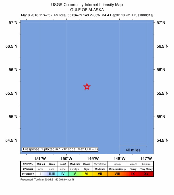
1 person reported to the USGS what they felt; the strongest reported shaking was II, weak shaking.
Fault motion and ground failure
How the rock slipped, from the moment tensor, and the USGS estimate of landslides and liquefaction.
- Faulting
- Oblique reverse
- Moment magnitude
- 4.4 Mwr
- Nodal plane 1
- Strike 107°, dip 65°, rake 48°
- Nodal plane 2
- Strike 351°, dip 48°, rake 145°
How well it is located
Reviewed by a seismologist.
- Location uncertainty
- About 6.8 km horizontally, 1.9 km in depth
- Magnitude uncertainty
- ±0.05
- Depth from
- Operator assigned
- Station coverage gap
- 175°
- Stations used
- 210
Nearby
Within 100 km, magnitude 1.5 and up: at least 201 in the 60 days after this one and at least 200 in the 30 days before it.
After
- 4.4294 km SE of Chiniak, Alaska · 3125 days ago · 12 km deep · 6 km away
- 3.7Gulf of Alaska · 3125 days ago · 7 km deep · 15 km away
- 3.2294 km SE of Chiniak, Alaska · 3125 days ago · 8 km deep · 5 km away
- 3.6293 km SE of Chiniak, Alaska · 3125 days ago · 12 km deep · 4 km away
- 3.1293 km SE of Chiniak, Alaska · 3125 days ago · 7 km deep · 5 km away
- 5.0289 km SE of Chiniak, Alaska · 3124 days ago · 17 km deep · 1 km away · tsunami flag
- 3.2285 km SE of Chiniak, Alaska · 3124 days ago · 8 km deep · 3 km away
- 4.0293 km SE of Chiniak, Alaska · 3124 days ago · 7 km deep · 7 km away
- 4.6287 km SE of Chiniak, Alaska · 3124 days ago · 6 km deep · 2 km away
- 3.5278 km SE of Chiniak, Alaska · 3124 days ago · 10 km deep · 11 km away
- 3.4279 km SE of Chiniak, Alaska · 3124 days ago · 20 km deep · 65 km away
- 3.4230 km SE of Chiniak, Alaska · 3124 days ago · 20 km deep · 59 km away
- 3.3243 km SE of Chiniak, Alaska · 3124 days ago · 24 km deep · 67 km away
- 3.6229 km SE of Chiniak, Alaska · 3124 days ago · 23 km deep · 59 km away
- 3.3221 km SE of Chiniak, Alaska · 3124 days ago · 22 km deep · 68 km away
- 3.1207 km SE of Chiniak, Alaska · 3124 days ago · 22 km deep · 88 km away
- 4.2Gulf of Alaska · 3124 days ago · 8 km deep · 20 km away · felt by 1
- 3.8277 km ESE of Chiniak, Alaska · 3124 days ago · 21 km deep · 95 km away
- 3.0218 km SE of Chiniak, Alaska · 3124 days ago · 20 km deep · 72 km away · felt by 1
- 3.3224 km SE of Chiniak, Alaska · 3124 days ago · 12 km deep · 65 km away
- 3.0259 km ESE of Chiniak, Alaska · 3124 days ago · 21 km deep · 98 km away
- 3.2284 km SE of Chiniak, Alaska · 3124 days ago · 8 km deep · 5 km away
- 3.3239 km SE of Chiniak, Alaska · 3124 days ago · 10 km deep · 54 km away
- 3.1220 km SE of Chiniak, Alaska · 3124 days ago · 21 km deep · 96 km away
- 2.8238 km SE of Chiniak, Alaska · 3123 days ago · 8 km deep · 50 km away
- 2.9253 km SE of Chiniak, Alaska · 3123 days ago · 21 km deep · 46 km away
- 3.4257 km SE of Chiniak, Alaska · 3123 days ago · 21 km deep · 76 km away
- 2.7221 km SE of Chiniak, Alaska · 3123 days ago · 21 km deep · 89 km away
- 3.0221 km SE of Chiniak, Alaska · 3123 days ago · 21 km deep · 100 km away
- 2.9254 km SE of Chiniak, Alaska · 3123 days ago · 21 km deep · 47 km away
- 3.1229 km SE of Chiniak, Alaska · 3123 days ago · 20 km deep · 59 km away
- 3.0234 km SE of Chiniak, Alaska · 3123 days ago · 7 km deep · 57 km away
- 3.1260 km SE of Chiniak, Alaska · 3123 days ago · 7 km deep · 28 km away
- 3.0236 km SE of Chiniak, Alaska · 3123 days ago · 7 km deep · 56 km away
- 3.4274 km SE of Chiniak, Alaska · 3123 days ago · 9 km deep · 16 km away
- 2.8290 km SE of Chiniak, Alaska · 3123 days ago · 7 km deep · 2 km away
- 3.3268 km SE of Chiniak, Alaska · 3123 days ago · 9 km deep · 23 km away
- 3.4253 km ESE of Chiniak, Alaska · 3123 days ago · 22 km deep · 98 km away
- 2.9221 km SE of Chiniak, Alaska · 3123 days ago · 21 km deep · 68 km away
- 3.1242 km ESE of Chiniak, Alaska · 3123 days ago · 10 km deep · 95 km away
- 2.7230 km SE of Chiniak, Alaska · 3123 days ago · 4 km deep · 62 km away
- 2.9246 km SE of Chiniak, Alaska · 3123 days ago · 10 km deep · 52 km away
- 3.0265 km SE of Chiniak, Alaska · 3123 days ago · 23 km deep · 70 km away
- 2.7Gulf of Alaska · 3123 days ago · 21 km deep · 49 km away
- 3.0224 km SE of Chiniak, Alaska · 3123 days ago · 20 km deep · 73 km away
- 2.9220 km SE of Chiniak, Alaska · 3123 days ago · 21 km deep · 93 km away
- 3.3243 km SE of Chiniak, Alaska · 3123 days ago · 9 km deep · 49 km away
- 2.8233 km SE of Chiniak, Alaska · 3122 days ago · 20 km deep · 66 km away
- 3.1226 km SE of Chiniak, Alaska · 3122 days ago · 20 km deep · 66 km away
- 2.8240 km SE of Chiniak, Alaska · 3122 days ago · 21 km deep · 61 km away
- 3.2242 km ESE of Chiniak, Alaska · 3122 days ago · 23 km deep · 94 km away
- 2.9249 km SE of Chiniak, Alaska · 3122 days ago · 20 km deep · 50 km away
- 2.8223 km SE of Chiniak, Alaska · 3122 days ago · 21 km deep · 91 km away
- 2.9235 km SE of Chiniak, Alaska · 3122 days ago · 20 km deep · 53 km away
- 2.7219 km SE of Chiniak, Alaska · 3122 days ago · 20 km deep · 71 km away
- 4.3247 km SE of Chiniak, Alaska · 3122 days ago · 21 km deep · 53 km away
- 3.4231 km SE of Chiniak, Alaska · 3122 days ago · 19 km deep · 84 km away
- 3.4212 km SE of Chiniak, Alaska · 3122 days ago · 10 km deep · 77 km away
- 3.2234 km SE of Chiniak, Alaska · 3122 days ago · 10 km deep · 60 km away
- 2.7211 km SE of Chiniak, Alaska · 3122 days ago · 10 km deep · 77 km away
The first 60 of at least 201.
Before
- 3.1249 km SE of Chiniak, Alaska · 3125 days ago · 22 km deep · 85 km away
- 2.9214 km SE of Chiniak, Alaska · 3125 days ago · 10 km deep · 74 km away
- 2.9256 km SE of Chiniak, Alaska · 3125 days ago · 10 km deep · 41 km away
- 2.7216 km SE of Chiniak, Alaska · 3125 days ago · 10 km deep · 73 km away
- 2.7230 km SE of Chiniak, Alaska · 3125 days ago · 21 km deep · 84 km away
- 2.9254 km SE of Chiniak, Alaska · 3125 days ago · 21 km deep · 42 km away
- 3.2233 km SE of Chiniak, Alaska · 3125 days ago · 21 km deep · 55 km away
- 3.0276 km ESE of Chiniak, Alaska · 3125 days ago · 20 km deep · 96 km away
- 3.1233 km SE of Chiniak, Alaska · 3125 days ago · 20 km deep · 67 km away
- 3.1253 km ESE of Chiniak, Alaska · 3125 days ago · 20 km deep · 97 km away
- 3.1273 km ESE of Chiniak, Alaska · 3125 days ago · 24 km deep · 96 km away
- 3.7256 km SE of Chiniak, Alaska · 3125 days ago · 22 km deep · 45 km away
- 4.4278 km SE of Chiniak, Alaska · 3125 days ago · 8 km deep · 15 km away
- 3.2228 km SE of Chiniak, Alaska · 3125 days ago · 22 km deep · 89 km away
- 3.2233 km SE of Chiniak, Alaska · 3125 days ago · 20 km deep · 72 km away
- 3.0214 km SE of Chiniak, Alaska · 3125 days ago · 25 km deep · 75 km away
- 2.9250 km SE of Chiniak, Alaska · 3126 days ago · 21 km deep · 85 km away
- 3.4206 km SE of Chiniak, Alaska · 3126 days ago · 33 km deep · 83 km away
- 4.0253 km SE of Chiniak, Alaska · 3126 days ago · 10 km deep · 82 km away
- 3.4227 km SE of Chiniak, Alaska · 3126 days ago · 10 km deep · 72 km away
Earthquakes todayAlaska earthquakesLive radar here
Sources
From the USGS Earthquake Hazards Program and its partner networks, event us1000d1sj (also filed as ak18632879). Read Sun, Sep 27, 2026, 11:42 AM UTC.