M2.7 earthquake 77 km WNW of Paxson, Alaska
A magnitude 2.7 earthquake struck 77 km WNW of Paxson, Alaska on Mon, Sep 25, 2017, 6:03 AM AKDT (14:03 UTC), 77 km (48 mi) below the surface.
A larger quake followed: M2.8 69 km E of McKinley Park, Alaska. This one was a foreshock.
Map
Where this earthquake was located, with the others nearby. Select one for its page.
The earthquake
- Magnitude
- 2.7 (ML, local (Richter)), micro
- Magnitude from
- Alaska Earthquake Center
- Local time
- UTC
- 2017-09-25 14:03:51 UTC
- Depth
- 76.8 km (47.7 mi), intermediate-depth
- Epicenter
- 63.349° N, 147.045° W
- Region
- Alaska
- Felt reports
- 1
- Tsunami flag
- No
- Status
- Reviewed by a seismologist
Magnitude estimates
Different scales measure different things and differ by a few tenths. The USGS marks one as preferred, and it is the one this page uses.
| Mag. | Scale | Computed by | Notes |
|---|---|---|---|
| 2.7 | ML, local (Richter) | Alaska Earthquake Center | Preferred · Preliminary |
| 2.7 | ML, local (Richter) | USGS National Earthquake Information Center | Reviewed |
Did you feel it?
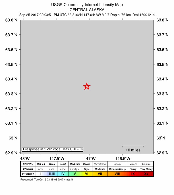
1 person reported to the USGS what they felt; the strongest reported shaking was II, weak shaking.
How well it is located
Reviewed by a seismologist.
- Stations used
- 134
Nearest places
Distance and direction from each place to the epicenter, with its forecast.
Nearby
Within 100 km, magnitude 1.5 and up: 43 in the 60 days after this one and 8 in the 30 days before it.
After
- 2.530 km NE of Paxson, Alaska · 3294 days ago · 5 km deep · 90 km away
- 2.487 km E of Cantwell, Alaska · 3294 days ago · 63 km deep · 15 km away
- 2.072 km ESE of McKinley Park, Alaska · 3294 days ago · 73 km deep · 31 km away
- 2.264 km SE of Cantwell, Alaska · 3294 days ago · 64 km deep · 71 km away
- 1.761 km SE of Cantwell, Alaska · 3294 days ago · 65 km deep · 75 km away
- 1.662 km NW of Paxson, Alaska · 3291 days ago · 4 km deep · 34 km away
- 1.881 km ESE of McKinley Park, Alaska · 3290 days ago · 14 km deep · 24 km away
- 1.632 km NE of Paxson, Alaska · 3289 days ago · 7 km deep · 91 km away
- 2.431 km NNE of Paxson, Alaska · 3285 days ago · 5 km deep · 88 km away
- 2.546 km SW of Fort Greely, Alaska · 3284 days ago · 10 km deep · 52 km away
- 1.625 km S of Cantwell, Alaska · 3283 days ago · 81 km deep · 95 km away
- 2.333 km SSE of Cantwell, Alaska · 3283 days ago · 9 km deep · 92 km away
- 1.569 km ESE of McKinley Park, Alaska · 3282 days ago · 7 km deep · 34 km away
- 1.566 km E of Cantwell, Alaska · 3282 days ago · 1 km deep · 31 km away
- 1.663 km SE of Cantwell, Alaska · 3281 days ago · 6 km deep · 55 km away
- 2.346 km SW of Harding-Birch Lakes, Alaska · 3281 days ago · 14 km deep · 80 km away
- 1.851 km SSE of Cantwell, Alaska · 3280 days ago · 66 km deep · 93 km away
- 1.751 km SSE of Cantwell, Alaska · 3280 days ago · 7 km deep · 89 km away
- 1.553 km SSE of Cantwell, Alaska · 3280 days ago · 13 km deep · 94 km away
- 2.076 km W of Paxson, Alaska · 3276 days ago · 3 km deep · 17 km away
- 1.638 km SE of Cantwell, Alaska · 3274 days ago · 73 km deep · 75 km away
- 2.224 km S of Cantwell, Alaska · 3274 days ago · 3 km deep · 99 km away
- 1.567 km E of McKinley Park, Alaska · 3274 days ago · 2 km deep · 43 km away
- 2.172 km SSE of Cantwell, Alaska · 3270 days ago · 62 km deep · 84 km away
- 1.544 km SE of Cantwell, Alaska · 3263 days ago · 73 km deep · 70 km away
- 1.640 km SSE of Cantwell, Alaska · 3263 days ago · 70 km deep · 87 km away
- 1.971 km E of Cantwell, Alaska · 3263 days ago · 2 km deep · 26 km away
- 2.452 km NNW of Paxson, Alaska · 3263 days ago · 2 km deep · 48 km away
- 1.663 km SE of Cantwell, Alaska · 3263 days ago · 1 km deep · 52 km away
- 2.246 km SSE of Cantwell, Alaska · 3256 days ago · 66 km deep · 95 km away
- 2.869 km E of McKinley Park, Alaska · 3255 days ago · 75 km deep · 40 km away
- 1.865 km E of Cantwell, Alaska · 3254 days ago · 2 km deep · 33 km away
- 1.767 km NW of Paxson, Alaska · 3254 days ago · 4 km deep · 26 km away
- 1.912 km E of Healy, Alaska · 3253 days ago · 9 km deep · 99 km away
- 1.714 km E of Healy, Alaska · 3253 days ago · 113 km deep · 99 km away
- 1.954 km SSE of Cantwell, Alaska · 3250 days ago · 66 km deep · 97 km away
- 1.616 km E of McKinley Park, Alaska · 3248 days ago · 90 km deep · 87 km away
- 1.629 km N of Paxson, Alaska · 3247 days ago · 5 km deep · 76 km away
- 2.070 km NNW of Lake Louise, Alaska · 3246 days ago · 37 km deep · 59 km away
- 2.08 km NNW of Cantwell, Alaska · 3245 days ago · 4 km deep · 97 km away
- 1.832 km E of Cantwell, Alaska · 3242 days ago · 7 km deep · 63 km away
- 1.873 km SE of Cantwell, Alaska · 3238 days ago · 57 km deep · 71 km away
- 1.579 km E of Cantwell, Alaska · 3236 days ago · 10 km deep · 24 km away
Before
- 2.071 km ESE of Cantwell, Alaska · 3300 days ago · 11 km deep · 42 km away
- 1.971 km ESE of Cantwell, Alaska · 3301 days ago · 11 km deep · 43 km away
- 1.571 km ESE of Cantwell, Alaska · 3301 days ago · 11 km deep · 43 km away
- 2.356 km SSE of Cantwell, Alaska · 3303 days ago · 67 km deep · 96 km away
- 1.574 km SSE of Cantwell, Alaska · 3305 days ago · 62 km deep · 93 km away
- 1.521 km S of Cantwell, Alaska · 3315 days ago · 82 km deep · 96 km away
- 1.938 km NE of Paxson, Alaska · 3317 days ago · 5 km deep · 98 km away
- 2.759 km E of Cantwell, Alaska · 3319 days ago · 3 km deep · 40 km away
Earthquakes todayAlaska earthquakesLive radar here
Sources
From the USGS Earthquake Hazards Program and its partner networks, event ak017cbgdty3 (also filed as ak16901214, us2000aubd). Read Sat, Oct 3, 2026, 4:58 PM UTC.