M2.0 earthquake 7 km W of Fox River, Alaska
A magnitude 2.0 earthquake struck 7 km W of Fox River, Alaska on Wed, Jun 28, 2017, 11:43 PM AKDT (07:43 UTC), 53 km (33 mi) below the surface.
A larger quake followed: M4.9 43 km WNW of Happy Valley, Alaska. This one was a foreshock.
Map
Where this earthquake was located, with the others nearby. Select one for its page.
The earthquake
- Magnitude
- 2.0 (ML, local (Richter)), micro
- Magnitude from
- Alaska Earthquake Center
- Local time
- UTC
- 2017-06-29 07:43:49 UTC
- Depth
- 53.3 km (33.1 mi), shallow
- Epicenter
- 59.858° N, 151.090° W
- Region
- Alaska
- Felt reports
- 1
- Tsunami flag
- No
- Status
- Reviewed by a seismologist
Did you feel it?
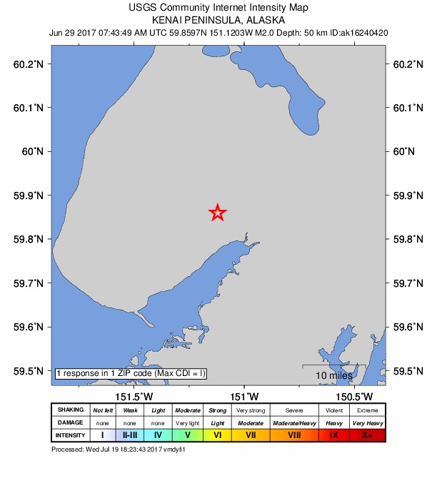
1 person reported to the USGS what they felt; the strongest reported shaking was I, not felt shaking.
How well it is located
Reviewed by a seismologist.
- Stations used
- 56
Nearest places
Distance and direction from each place to the epicenter, with its forecast.
Nearby
Within 100 km, magnitude 1.5 and up: at least 200 in the 60 days after this one and 117 in the 30 days before it.
After
- 1.649 km SE of Halibut Cove, Alaska · 3384 days ago · 30 km deep · 73 km away
- 1.65 km E of Salamatof, Alaska · 3384 days ago · 65 km deep · 84 km away
- 2.029 km WNW of Nanwalek, Alaska · 3384 days ago · 60 km deep · 87 km away
- 1.838 km W of Ninilchik, Alaska · 3384 days ago · 98 km deep · 76 km away
- 1.727 km N of Fox River, Alaska · 3383 days ago · 54 km deep · 29 km away
- 1.714 km ENE of Nikiski, Alaska · 3383 days ago · 4 km deep · 97 km away
- 1.69 km N of Ridgeway, Alaska · 3383 days ago · 59 km deep · 85 km away
- 1.556 km W of Anchor Point, Alaska · 3383 days ago · 88 km deep · 99 km away
- 1.624 km W of Anchor Point, Alaska · 3383 days ago · 88 km deep · 65 km away
- 1.923 km ESE of Fox River, Alaska · 3382 days ago · 50 km deep · 30 km away
- 1.556 km WNW of Ninilchik, Alaska · 3382 days ago · 107 km deep · 94 km away
- 1.750 km WNW of Nanwalek, Alaska · 3380 days ago · 75 km deep · 95 km away
- 2.125 km WNW of Bear Creek, Alaska · 3380 days ago · 33 km deep · 81 km away · felt by 1
- 2.14 km NE of Kalifornsky, Alaska · 3380 days ago · 60 km deep · 66 km away · felt by 1
- 1.712 km SSW of Clam Gulch, Alaska · 3380 days ago · 52 km deep · 37 km away
- 1.630 km SE of Kasilof, Alaska · 3380 days ago · 62 km deep · 36 km away
- 1.557 km W of Anchor Point, Alaska · 3380 days ago · 84 km deep · 98 km away
- 1.558 km W of Happy Valley, Alaska · 3379 days ago · 105 km deep · 96 km away
- 1.558 km W of Anchor Point, Alaska · 3379 days ago · 88 km deep · 99 km away
- 1.818 km W of Ninilchik, Alaska · 3378 days ago · 76 km deep · 56 km away
- 2.210 km S of Soldotna, Alaska · 3378 days ago · 55 km deep · 60 km away
- 1.528 km W of Nanwalek, Alaska · 3378 days ago · 72 km deep · 90 km away
- 1.741 km WSW of Salamatof, Alaska · 3377 days ago · 80 km deep · 93 km away
- 1.822 km WNW of Anchor Point, Alaska · 3377 days ago · 72 km deep · 62 km away
- 1.821 km W of Anchor Point, Alaska · 3377 days ago · 77 km deep · 63 km away
- 2.134 km ESE of Port Graham, Alaska · 3377 days ago · 48 km deep · 76 km away
- 2.55 km ENE of Sterling, Alaska · 3377 days ago · 10 km deep · 81 km away · felt by 2
- 2.142 km WNW of Anchor Point, Alaska · 3377 days ago · 82 km deep · 83 km away
- 1.846 km WNW of Happy Valley, Alaska · 3376 days ago · 90 km deep · 83 km away
- 4.326 km WNW of Kalifornsky, Alaska · 3376 days ago · 71 km deep · 78 km away · felt by 41 · tsunami flag
- 1.630 km WSW of Salamatof, Alaska · 3376 days ago · 84 km deep · 82 km away
- 2.458 km WNW of Anchor Point, Alaska · 3375 days ago · 97 km deep · 98 km away
- 3.846 km WNW of Nanwalek, Alaska · 3375 days ago · 75 km deep · 92 km away · felt by 1
- 1.58 km NW of Kalifornsky, Alaska · 3374 days ago · 59 km deep · 70 km away
- 1.928 km W of Kalifornsky, Alaska · 3374 days ago · 76 km deep · 78 km away
- 2.06 km SE of Anchor Point, Alaska · 3374 days ago · 50 km deep · 39 km away
- 1.849 km WNW of Nanwalek, Alaska · 3373 days ago · 77 km deep · 97 km away
- 1.65 km W of Happy Valley, Alaska · 3373 days ago · 62 km deep · 43 km away
- 1.633 km SSE of Funny River, Alaska · 3372 days ago · 48 km deep · 46 km away
- 1.77 km ESE of Soldotna, Alaska · 3372 days ago · 53 km deep · 66 km away
- 1.540 km WNW of Nanwalek, Alaska · 3372 days ago · 78 km deep · 97 km away
- 1.723 km WNW of Anchor Point, Alaska · 3371 days ago · 92 km deep · 64 km away
- 1.96 km SE of Ninilchik, Alaska · 3371 days ago · 61 km deep · 32 km away
- 2.035 km WNW of Ninilchik, Alaska · 3370 days ago · 77 km deep · 74 km away · felt by 1
- 1.748 km WNW of Nanwalek, Alaska · 3370 days ago · 76 km deep · 94 km away
- 1.6Southern Alaska · 3370 days ago · 76 km deep · 67 km away
- 1.749 km WSW of Anchor Point, Alaska · 3370 days ago · 77 km deep · 92 km away
- 1.527 km WNW of Anchor Point, Alaska · 3369 days ago · 83 km deep · 67 km away
- 1.658 km W of Anchor Point, Alaska · 3369 days ago · 103 km deep · 99 km away
- 1.68 km ENE of Nikolaevsk, Alaska · 3369 days ago · 74 km deep · 21 km away
- 1.926 km W of Happy Valley, Alaska · 3368 days ago · 68 km deep · 63 km away
- 1.837 km W of Nanwalek, Alaska · 3367 days ago · 75 km deep · 96 km away
- 1.57 km WNW of Nikolaevsk, Alaska · 3367 days ago · 63 km deep · 36 km away
- 1.524 km WNW of Kalifornsky, Alaska · 3366 days ago · 73 km deep · 77 km away
- 1.814 km WSW of Salamatof, Alaska · 3366 days ago · 76 km deep · 84 km away
- 1.7Southern Alaska · 3366 days ago · 80 km deep · 97 km away
- 1.563 km WNW of Happy Valley, Alaska · 3366 days ago · 101 km deep · 100 km away
- 2.554 km WNW of Happy Valley, Alaska · 3365 days ago · 104 km deep · 92 km away · felt by 1
- 1.512 km E of Sterling, Alaska · 3365 days ago · 41 km deep · 81 km away
- 2.18 km SE of Nikolaevsk, Alaska · 3365 days ago · 48 km deep · 25 km away
The first 60 of at least 200.
Before
- 1.66 km NW of Diamond Ridge, Alaska · 3384 days ago · 52 km deep · 34 km away
- 1.810 km N of Ridgeway, Alaska · 3384 days ago · 58 km deep · 85 km away
- 1.656 km WNW of Happy Valley, Alaska · 3384 days ago · 108 km deep · 93 km away
- 1.61 km SW of Diamond Ridge, Alaska · 3384 days ago · 56 km deep · 35 km away
- 2.440 km WNW of Ninilchik, Alaska · 3385 days ago · 79 km deep · 78 km away · felt by 1
- 2.715 km SSW of Anchor Point, Alaska · 3385 days ago · 51 km deep · 54 km away
- 1.715 km ENE of Nikiski, Alaska · 3385 days ago · 62 km deep · 99 km away
- 1.5Southern Alaska · 3386 days ago · 78 km deep · 94 km away
- 1.549 km WNW of Ninilchik, Alaska · 3386 days ago · 94 km deep · 88 km away
- 1.958 km WNW of Ninilchik, Alaska · 3386 days ago · 105 km deep · 96 km away
- 1.756 km WNW of Anchor Point, Alaska · 3386 days ago · 96 km deep · 96 km away
- 1.541 km NW of Ninilchik, Alaska · 3386 days ago · 96 km deep · 79 km away
- 1.958 km WNW of Anchor Point, Alaska · 3386 days ago · 105 km deep · 95 km away
- 1.659 km W of Happy Valley, Alaska · 3387 days ago · 88 km deep · 97 km away
- 1.719 km WSW of Nanwalek, Alaska · 3387 days ago · 61 km deep · 90 km away
- 1.648 km WNW of Ninilchik, Alaska · 3387 days ago · 93 km deep · 86 km away
- 2.6Southern Alaska · 3387 days ago · 76 km deep · 68 km away · felt by 1
- 1.949 km WNW of Happy Valley, Alaska · 3387 days ago · 95 km deep · 86 km away
- 1.65 km E of Fox River, Alaska · 3387 days ago · 41 km deep · 13 km away
- 1.646 km WSW of Anchor Point, Alaska · 3388 days ago · 79 km deep · 89 km away
Earthquakes todayAlaska earthquakesLive radar here
Sources
From the USGS Earthquake Hazards Program and its partner networks, event ak01789t5tri (also filed as ak16240420). Read Sun, Oct 4, 2026, 4:53 AM UTC.