M1.8 earthquake 24 km NNW of Dyer, Nevada
A magnitude 1.8 earthquake struck 24 km NNW of Dyer, Nevada on Fri, Nov 10, 2017, 12:41 AM PST (08:41 UTC), 4 km (2 mi) below the surface.
A larger quake followed: M3.8 12km W of Toms Place, CA. This one was a foreshock.
Map
Where this earthquake was located, with the others nearby. Select one for its page.
The earthquake
- Magnitude
- 1.8 (ML, local (Richter)), micro
- Magnitude from
- Nevada Seismological Laboratory
- Local time
- UTC
- 2017-11-10 08:41:47 UTC
- Depth
- 3.7 km (2.3 mi), shallow
- Epicenter
- 37.858° N, 118.196° W
- Region
- Nevada
- Felt reports
- 1
- Tsunami flag
- No
- Status
- Reviewed by a seismologist
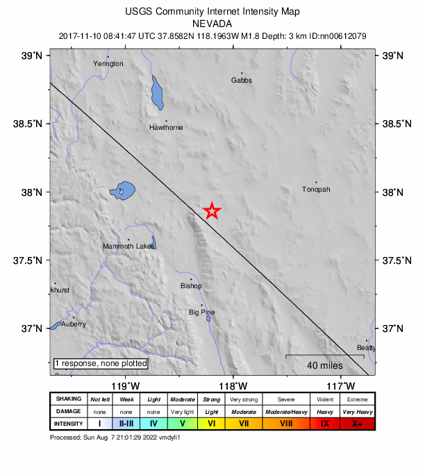
Did you feel it?
1 person reported to the USGS what they felt.
How well it is located
Reviewed by a seismologist.
- Magnitude uncertainty
- ±0.22
- Station coverage gap
- 89°
- Stations used
- 23
Nearest places
Distance and direction from each place to the epicenter, with its forecast.
Nearby
Within 100 km, magnitude 1.5 and up: 134 in the 60 days after this one and 171 in the 30 days before it.
After
- 1.612 km SW of Aspen Springs, California · 3251 days ago · 1 km deep · 69 km away
- 1.610 km WNW of Aspen Springs, California · 3250 days ago · 5 km deep · 62 km away
- 1.614 km SE of Mammoth Lakes, California · 3250 days ago · 8 km deep · 69 km away
- 1.613 km SW of Aspen Springs, California · 3249 days ago · 2 km deep · 69 km away
- 2.011 km WNW of Aspen Springs, California · 3249 days ago · 4 km deep · 62 km away
- 1.59 km SSE of Mammoth Lakes, California · 3249 days ago · 1 km deep · 73 km away
- 1.76 km SSE of Mammoth Lakes, California · 3249 days ago · 1 km deep · 72 km away
- 1.911 km WNW of Aspen Springs, California · 3248 days ago · 4 km deep · 62 km away
- 1.810 km WNW of Aspen Springs, California · 3248 days ago · 3 km deep · 62 km away
- 1.537 km SSE of Silver Peak, Nevada · 3248 days ago · 7 km deep · 75 km away
- 1.73 km NW of Swall Meadows, California · 3248 days ago · 7 km deep · 56 km away
- 1.610 km WNW of Aspen Springs, California · 3247 days ago · 4 km deep · 62 km away
- 1.710 km WNW of Aspen Springs, California · 3247 days ago · 4 km deep · 62 km away
- 1.910 km WNW of Aspen Springs, California · 3247 days ago · 4 km deep · 62 km away
- 1.511 km WNW of Aspen Springs, California · 3247 days ago · 4 km deep · 62 km away
- 1.56 km SSE of Mammoth Lakes, California · 3246 days ago · 1 km deep · 73 km away
- 1.710 km WNW of Aspen Springs, California · 3246 days ago · 4 km deep · 62 km away
- 1.619 km S of Mammoth Lakes, California · 3246 days ago · 2 km deep · 82 km away
- 1.6California-Nevada border region · 3246 days ago · 0 km deep · 72 km away
- 1.627 km WSW of Hawthorne, Nevada · 3246 days ago · 12 km deep · 88 km away
- 1.711 km WNW of Aspen Springs, California · 3245 days ago · 4 km deep · 62 km away
- 1.64 km SSE of Mammoth Lakes, California · 3245 days ago · 0 km deep · 73 km away
- 2.210 km WNW of Aspen Springs, California · 3244 days ago · 4 km deep · 62 km away
- 1.710 km WNW of Aspen Springs, California · 3244 days ago · 4 km deep · 62 km away
- 2.04 km N of Round Valley, California · 3244 days ago · 8 km deep · 56 km away
- 2.65 km SSE of Mesa, California · 3244 days ago · 13 km deep · 61 km away · felt by 1
- 1.510 km W of Aspen Springs, California · 3244 days ago · 2 km deep · 65 km away
- 1.811 km WNW of Aspen Springs, California · 3243 days ago · 3 km deep · 62 km away
- 1.913 km SW of Aspen Springs, California · 3243 days ago · 5 km deep · 70 km away
- 2.031 km SSW of Hawthorne, Nevada · 3243 days ago · 11 km deep · 63 km away
- 1.713 km SW of Aspen Springs, California · 3243 days ago · 2 km deep · 70 km away
- 1.613 km SW of Aspen Springs, California · 3243 days ago · 2 km deep · 70 km away
- 2.112 km SW of Aspen Springs, California · 3243 days ago · 2 km deep · 70 km away
- 1.618 km S of Mammoth Lakes, California · 3243 days ago · 4 km deep · 82 km away
- 2.711 km WSW of Aspen Springs, California · 3242 days ago · 2 km deep · 68 km away · felt by 3
- 2.210 km WNW of Aspen Springs, California · 3242 days ago · 5 km deep · 62 km away
- 1.810 km WNW of Aspen Springs, California · 3242 days ago · 5 km deep · 62 km away · felt by 1
- 1.712 km WSW of Aspen Springs, California · 3242 days ago · 1 km deep · 70 km away
- 1.810 km WNW of Aspen Springs, California · 3241 days ago · 5 km deep · 62 km away
- 1.611 km WNW of Aspen Springs, California · 3240 days ago · 4 km deep · 62 km away
- 1.713 km SW of Aspen Springs, California · 3240 days ago · 2 km deep · 70 km away
- 1.614km SW of Toms Place, CA · 3240 days ago · 0 km deep · 67 km away
- 1.911 km S of Mammoth Lakes, California · 3240 days ago · 2 km deep · 78 km away
- 1.517km SE of Bodie, CA · 3239 days ago · 6 km deep · 65 km away
- 1.617km SE of Bodie, CA · 3239 days ago · 12 km deep · 65 km away
- 1.525 km ENE of Mono City, California · 3239 days ago · 6 km deep · 65 km away
- 2.026 km ENE of Mono City, California · 3239 days ago · 6 km deep · 65 km away
- 1.527 km SSW of Hawthorne, Nevada · 3239 days ago · 8 km deep · 73 km away
- 1.810 km WNW of Aspen Springs, California · 3238 days ago · 4 km deep · 61 km away
- 1.517km SW of Toms Place, CA · 3236 days ago · 4 km deep · 70 km away
- 1.629 km SW of Hawthorne, Nevada · 3236 days ago · 9 km deep · 84 km away
- 2.113km SE of Mammoth Lakes, CA · 3236 days ago · 4 km deep · 67 km away · felt by 1
- 1.811km W of Toms Place, CA · 3234 days ago · 4 km deep · 64 km away
- 1.78km ESE of Deep Springs, CA · 3234 days ago · 6 km deep · 64 km away
- 1.513km WNW of Toms Place, CA · 3233 days ago · 4 km deep · 62 km away · felt by 1
- 1.617km SW of Toms Place, CA · 3232 days ago · 1 km deep · 71 km away
- 1.616km WSW of Toms Place, CA · 3230 days ago · 1 km deep · 70 km away
- 1.533 km N of Dyer, Nevada · 3230 days ago · 1 km deep · 13 km away
- 1.840km NNE of Toms Place, CA · 3229 days ago · 3 km deep · 32 km away
- 2.021 km ESE of Hawthorne, Nevada · 3229 days ago · 10 km deep · 71 km away
The first 60 of 134.
Before
- 2.511 km WNW of Aspen Springs, California · 3251 days ago · 4 km deep · 62 km away · felt by 1
- 2.123 km NNW of Dyer, Nevada · 3251 days ago · 9 km deep · 1 km away
- 1.828 km WSW of Hawthorne, Nevada · 3252 days ago · 11 km deep · 85 km away
- 2.010 km W of Aspen Springs, California · 3252 days ago · 4 km deep · 66 km away
- 1.910 km W of Aspen Springs, California · 3252 days ago · 5 km deep · 66 km away
- 1.611 km WNW of Aspen Springs, California · 3253 days ago · 4 km deep · 62 km away
- 2.111 km WNW of Aspen Springs, California · 3253 days ago · 4 km deep · 62 km away · felt by 1
- 2.510 km WNW of Aspen Springs, California · 3253 days ago · 4 km deep · 62 km away
- 3.010 km WNW of Aspen Springs, California · 3253 days ago · 3 km deep · 62 km away
- 1.910 km E of Mammoth Lakes, California · 3253 days ago · 5 km deep · 62 km away
- 1.510 km NNW of Mina, Nevada · 3254 days ago · 10 km deep · 69 km away
- 2.134 km N of Dyer, Nevada · 3254 days ago · 9 km deep · 14 km away
- 2.333 km N of Dyer, Nevada · 3254 days ago · 11 km deep · 13 km away
- 1.623 km NW of Benton, California · 3254 days ago · 3 km deep · 42 km away · felt by 2
- 1.920 km S of Mammoth Lakes, California · 3254 days ago · 2 km deep · 83 km away
- 1.633 km N of Dyer, Nevada · 3255 days ago · 5 km deep · 13 km away
- 1.633 km N of Dyer, Nevada · 3256 days ago · 4 km deep · 13 km away
- 1.912 km SW of Aspen Springs, California · 3256 days ago · 1 km deep · 68 km away
- 2.98 km NE of Mesa, California · 3257 days ago · 6 km deep · 49 km away
- 1.814 km SW of Aspen Springs, California · 3257 days ago · 2 km deep · 71 km away
Earthquakes todayNevada earthquakesLive radar here
Sources
From the USGS Earthquake Hazards Program and its partner networks, event nn00612079. Read Sun, Oct 4, 2026, 10:32 PM UTC.