M2.5 earthquake Alaska Peninsula
A magnitude 2.5 earthquake struck in the Alaska Peninsula on Fri, Aug 4, 2017, 5:52 AM AKDT (13:52 UTC), 129 km (80 mi) below the surface.
A larger quake followed: M5.6 61 km NW of Aleneva, Alaska. This one was a foreshock.
Map
Where this earthquake was located, with the others nearby. Select one for its page.
The earthquake
- Magnitude
- 2.5 (ML, local (Richter)), micro
- Magnitude from
- Alaska Earthquake Center
- Local time
- UTC
- 2017-08-04 13:52:19 UTC
- Depth
- 128.9 km (80.1 mi), intermediate-depth
- Epicenter
- 58.883° N, 154.533° W
- Region
- Alaska
- Felt reports
- 1
- Tsunami flag
- No
- Status
- Reviewed by a seismologist
Magnitude estimates
Different scales measure different things and differ by a few tenths. The USGS marks one as preferred, and it is the one this page uses.
| Mag. | Scale | Computed by | Notes |
|---|---|---|---|
| 2.5 | ML, local (Richter) | Alaska Earthquake Center | Preferred · Preliminary |
| 2.5 | ML, local (Richter) | USGS National Earthquake Information Center | Reviewed |
Did you feel it?
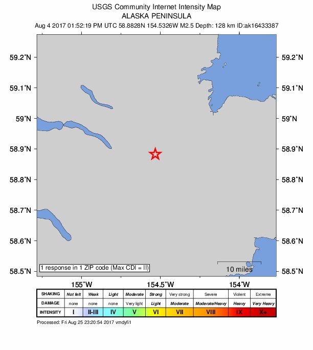
1 person reported to the USGS what they felt; the strongest reported shaking was II, weak shaking.
How well it is located
Reviewed by a seismologist.
- Stations used
- 64
Nearest places
Distance and direction from each place to the epicenter, with its forecast.
Nearby
Within 100 km, magnitude 1.5 and up: 130 in the 60 days after this one and 52 in the 30 days before it.
After
- 2.687 km N of Karluk, Alaska · 3347 days ago · 7 km deep · 60 km away
- 2.989 km SE of Kokhanok, Alaska · 3347 days ago · 87 km deep · 39 km away
- 1.661 km SE of Pedro Bay, Alaska · 3345 days ago · 1 km deep · 82 km away
- 1.951 km NNW of Aleneva, Alaska · 3343 days ago · 62 km deep · 83 km away
- 1.961 km NNW of Karluk, Alaska · 3342 days ago · 87 km deep · 93 km away
- 1.591 km NNW of Aleneva, Alaska · 3342 days ago · 9 km deep · 50 km away
- 1.594 km NNW of Aleneva, Alaska · 3342 days ago · 14 km deep · 51 km away
- 1.688 km SW of Nanwalek, Alaska · 3342 days ago · 57 km deep · 76 km away
- 1.693 km WNW of Aleneva, Alaska · 3342 days ago · 88 km deep · 45 km away
- 1.645 km SE of Pedro Bay, Alaska · 3341 days ago · 119 km deep · 98 km away
- 1.586 km NNW of Aleneva, Alaska · 3340 days ago · 6 km deep · 53 km away
- 1.684 km N of Karluk, Alaska · 3338 days ago · 80 km deep · 62 km away
- 1.865 km SSE of Kokhanok, Alaska · 3338 days ago · 116 km deep · 6 km away
- 1.682 km SE of Kokhanok, Alaska · 3337 days ago · 105 km deep · 40 km away
- 1.685 km WNW of Aleneva, Alaska · 3337 days ago · 90 km deep · 56 km away
- 1.659 km ESE of Pope-Vannoy Landing, Alaska · 3336 days ago · 107 km deep · 68 km away
- 1.783 km NNW of Karluk, Alaska · 3335 days ago · 1 km deep · 72 km away
- 1.836 km ESE of Pedro Bay, Alaska · 3334 days ago · 119 km deep · 97 km away
- 1.5Kodiak Island region, Alaska · 3333 days ago · 72 km deep · 66 km away
- 1.934 km SSE of Pedro Bay, Alaska · 3333 days ago · 137 km deep · 78 km away
- 1.578 km WSW of Nanwalek, Alaska · 3333 days ago · 63 km deep · 84 km away
- 3.075 km ESE of King Salmon, Alaska · 3333 days ago · 147 km deep · 68 km away
- 1.580 km SE of Pope-Vannoy Landing, Alaska · 3333 days ago · 83 km deep · 62 km away
- 1.858 km SE of Pedro Bay, Alaska · 3332 days ago · 107 km deep · 83 km away
- 3.359 km WSW of Nanwalek, Alaska · 3332 days ago · 69 km deep · 99 km away
- 1.990 km NNW of Aleneva, Alaska · 3331 days ago · 6 km deep · 55 km away
- 1.753 km SE of Pedro Bay, Alaska · 3331 days ago · 120 km deep · 95 km away
- 1.859 km SSE of Kokhanok, Alaska · 3331 days ago · 120 km deep · 6 km away
- 1.688 km SE of Pope-Vannoy Landing, Alaska · 3331 days ago · 79 km deep · 62 km away
- 1.994 km N of Karluk, Alaska · 3330 days ago · 92 km deep · 52 km away
- 1.676 km NNW of Karluk, Alaska · 3330 days ago · 90 km deep · 75 km away
- 2.460 km SSE of Kokhanok, Alaska · 3330 days ago · 119 km deep · 19 km away
- 1.876 km N of Aleneva, Alaska · 3329 days ago · 58 km deep · 86 km away
- 2.370 km NNW of Aleneva, Alaska · 3329 days ago · 62 km deep · 71 km away
- 2.864 km SSE of Kokhanok, Alaska · 3328 days ago · 121 km deep · 1 km away
- 2.573 km SE of Pope-Vannoy Landing, Alaska · 3327 days ago · 99 km deep · 52 km away
- 1.856 km ESE of Pope-Vannoy Landing, Alaska · 3326 days ago · 102 km deep · 70 km away
- 1.654 km SE of Pope-Vannoy Landing, Alaska · 3326 days ago · 127 km deep · 54 km away
- 1.584 km ESE of King Salmon, Alaska · 3326 days ago · 123 km deep · 73 km away
- 2.551 km N of Karluk, Alaska · 3325 days ago · 9 km deep · 95 km away
- 1.822 km SE of Pedro Bay, Alaska · 3325 days ago · 135 km deep · 98 km away
- 3.464 km ESE of Pope-Vannoy Landing, Alaska · 3325 days ago · 114 km deep · 73 km away
- 1.767 km S of Kokhanok, Alaska · 3324 days ago · 123 km deep · 7 km away
- 2.150 km SE of Pedro Bay, Alaska · 3323 days ago · 117 km deep · 86 km away
- 1.688 km N of Karluk, Alaska · 3323 days ago · 5 km deep · 58 km away
- 1.986 km NNW of Aleneva, Alaska · 3322 days ago · 67 km deep · 73 km away
- 2.055 km SSE of Kokhanok, Alaska · 3322 days ago · 120 km deep · 14 km away
- 5.661 km NW of Aleneva, Alaska · 3321 days ago · 63 km deep · 70 km away · felt by 57 · tsunami flag
- 1.660 km NW of Aleneva, Alaska · 3321 days ago · 65 km deep · 71 km away
- 2.460 km NW of Aleneva, Alaska · 3321 days ago · 63 km deep · 71 km away
- 1.768 km W of Nanwalek, Alaska · 3320 days ago · 83 km deep · 94 km away
- 1.952 km NW of Aleneva, Alaska · 3320 days ago · 74 km deep · 79 km away
- 1.685 km NW of Karluk, Alaska · 3320 days ago · 6 km deep · 91 km away
- 2.161 km NW of Aleneva, Alaska · 3320 days ago · 65 km deep · 70 km away
- 1.670 km SSE of Kokhanok, Alaska · 3320 days ago · 127 km deep · 7 km away
- 1.985 km NNW of Karluk, Alaska · 3320 days ago · 3 km deep · 80 km away
- 2.085 km NNW of Karluk, Alaska · 3320 days ago · 5 km deep · 81 km away
- 1.964 km SW of Nanwalek, Alaska · 3320 days ago · 61 km deep · 98 km away
- 1.656 km SE of Pedro Bay, Alaska · 3319 days ago · 106 km deep · 90 km away
- 2.161 km SSE of Kokhanok, Alaska · 3318 days ago · 123 km deep · 5 km away
The first 60 of 130.
Before
- 1.785 km NNW of Aleneva, Alaska · 3348 days ago · 86 km deep · 72 km away
- 2.259 km SE of Kokhanok, Alaska · 3349 days ago · 108 km deep · 32 km away
- 1.999 km NW of Aleneva, Alaska · 3350 days ago · 7 km deep · 36 km away
- 1.586 km N of Karluk, Alaska · 3350 days ago · 4 km deep · 61 km away
- 2.286 km N of Karluk, Alaska · 3350 days ago · 7 km deep · 61 km away
- 2.186 km N of Karluk, Alaska · 3350 days ago · 0 km deep · 61 km away
- 2.788 km N of Karluk, Alaska · 3350 days ago · 6 km deep · 59 km away
- 1.987 km N of Karluk, Alaska · 3350 days ago · 9 km deep · 60 km away
- 1.573 km WSW of Nanwalek, Alaska · 3350 days ago · 68 km deep · 87 km away
- 1.575 km N of Aleneva, Alaska · 3351 days ago · 57 km deep · 87 km away
- 1.672 km S of Kokhanok, Alaska · 3351 days ago · 124 km deep · 15 km away
- 2.371 km SE of Pope-Vannoy Landing, Alaska · 3353 days ago · 103 km deep · 56 km away
- 1.562 km SSE of Kokhanok, Alaska · 3354 days ago · 118 km deep · 4 km away
- 1.548 km SE of Pedro Bay, Alaska · 3355 days ago · 126 km deep · 98 km away
- 1.563 km SSE of Pope-Vannoy Landing, Alaska · 3355 days ago · 97 km deep · 40 km away
- 1.555 km N of Aleneva, Alaska · 3356 days ago · 51 km deep · 97 km away
- 1.552 km SE of Pope-Vannoy Landing, Alaska · 3356 days ago · 99 km deep · 58 km away
- 1.765 km ESE of Pope-Vannoy Landing, Alaska · 3357 days ago · 113 km deep · 77 km away
- 1.596 km S of Kokhanok, Alaska · 3358 days ago · 5 km deep · 38 km away
- 1.678 km SSE of Kokhanok, Alaska · 3360 days ago · 1 km deep · 21 km away
Earthquakes todayAlaska earthquakesLive radar here
Sources
From the USGS Earthquake Hazards Program and its partner networks, event ak0179xg4sa3 (also filed as ak16433387, us2000a4hx). Read Sun, Oct 4, 2026, 10:23 AM UTC.