M5.4 earthquake 116 km S of Unalaska, Alaska
A magnitude 5.4 earthquake struck 116 km S of Unalaska, Alaska on Tue, Jul 26, 2016, 11:46 AM AKDT (19:46 UTC), 17 km (11 mi) below the surface.
Map
Where this earthquake was located, with the others nearby. Select one for its page.
The earthquake
- Magnitude
- 5.4 (Mww, W-phase moment), moderate
- Magnitude from
- USGS National Earthquake Information Center
- Local time
- UTC
- 2016-07-26 19:46:31 UTC
- Depth
- 17.0 km (10.6 mi), shallow
- Epicenter
- 52.833° N, 166.774° W
- Region
- Alaska
- Felt reports
- 1
- Strongest shaking
- IV, light shaking
- Tsunami flag
- Yes: a large quake in an oceanic region
- Status
- Reviewed by a seismologist
Magnitude estimates
Different scales measure different things and differ by a few tenths. The USGS marks one as preferred, and it is the one this page uses.
| Mag. | Scale | Computed by | Notes |
|---|---|---|---|
| 5.4 | Mww, W-phase moment | USGS National Earthquake Information Center | Preferred · Reviewed |
| 5.46 | Mw, moment | ISC-GEM global catalog | Final · ±0.1 |
| 5.5 | Mw, moment | Alaska Earthquake Center | Preliminary |
| 5.0 | mb, body-wave | NOAA National Tsunami Warning Center | Reviewed · 24 stations |
| 5.3 | Mwb, body-wave moment | USGS National Earthquake Information Center | Moment tensor · Reviewed |
Tsunami
The USGS flags a quake this large in an oceanic region. The flag does not mean a tsunami happened; the tsunami warning centers decide that, and their messages are below when they issued any.
Current tsunami warnings: tsunami.gov. Warnings in force in the US also appear on our alerts pages.
Shaking
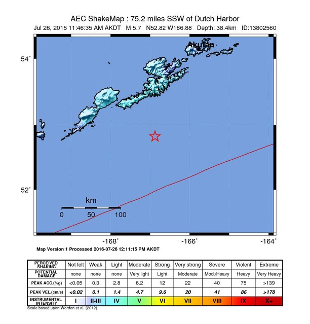
The USGS ShakeMap: shaking estimated from seismic stations and the quake’s size, on the Modified Mercalli intensity scale.
- Strongest estimated
- IV, light shaking
- Map
- Automatic
Did you feel it?
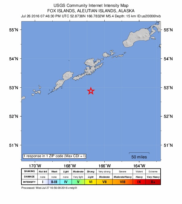
1 person reported to the USGS what they felt; the strongest reported shaking was I, not felt shaking.
Fault motion and ground failure
How the rock slipped, from the moment tensor, and the USGS estimate of landslides and liquefaction.
- Faulting
- Reverse (thrust)
- Moment magnitude
- 5.4 Mww
- Nodal plane 1
- Strike 50°, dip 67°, rake 92°
- Nodal plane 2
- Strike 223°, dip 23°, rake 84°
How well it is located
Reviewed by a seismologist.
- Location uncertainty
- About 4.2 km horizontally, 1.7 km in depth
- Depth from
- From modeling of broad-band P waveforms
- Station coverage gap
- 57°
- Stations used
- 662
Nearest places
Distance and direction from each place to the epicenter, with its forecast.
Nearby
Within 100 km, magnitude 2.4 and up: 35 in the 60 days after this one and 17 in the 30 days before it.
After
- 3.4132 km S of Unalaska, Alaska · 3722 days ago · 24 km deep · 19 km away
- 3.5120 km S of Unalaska, Alaska · 3722 days ago · 6 km deep · 4 km away
- 4.3130 km S of Unalaska, Alaska · 3722 days ago · 17 km deep · 18 km away
- 3.5121 km S of Unalaska, Alaska · 3722 days ago · 25 km deep · 5 km away
- 2.7128 km S of Unalaska, Alaska · 3722 days ago · 11 km deep · 13 km away
- 4.7119 km S of Unalaska, Alaska · 3722 days ago · 10 km deep · 5 km away
- 2.4119 km S of Unalaska, Alaska · 3722 days ago · 3 km deep · 8 km away
- 2.4Fox Islands, Aleutian Islands, Alaska · 3722 days ago · 6 km deep · 14 km away
- 3.3126 km S of Unalaska, Alaska · 3721 days ago · 3 km deep · 12 km away
- 3.0122 km S of Unalaska, Alaska · 3720 days ago · 7 km deep · 6 km away
- 2.5123 km S of Unalaska, Alaska · 3720 days ago · 14 km deep · 8 km away
- 3.5108 km SSW of Unalaska, Alaska · 3720 days ago · 39 km deep · 17 km away
- 2.9115 km S of Unalaska, Alaska · 3720 days ago · 22 km deep · 5 km away
- 4.0120 km S of Unalaska, Alaska · 3719 days ago · 34 km deep · 13 km away
- 2.971 km SSE of Unalaska, Alaska · 3718 days ago · 31 km deep · 78 km away
- 2.7139 km S of Unalaska, Alaska · 3718 days ago · 37 km deep · 28 km away
- 3.4126 km S of Unalaska, Alaska · 3718 days ago · 33 km deep · 11 km away
- 3.084 km SW of Unalaska, Alaska · 3718 days ago · 131 km deep · 66 km away
- 2.9119 km S of Unalaska, Alaska · 3717 days ago · 40 km deep · 4 km away
- 2.4118 km SSW of Unalaska, Alaska · 3716 days ago · 8 km deep · 8 km away
- 3.2Fox Islands, Aleutian Islands, Alaska · 3716 days ago · 26 km deep · 44 km away
- 2.5128 km S of Unalaska, Alaska · 3714 days ago · 14 km deep · 16 km away
- 2.4130 km S of Unalaska, Alaska · 3712 days ago · 15 km deep · 13 km away
- 2.591 km SE of Nikolski, Alaska · 3711 days ago · 26 km deep · 92 km away
- 2.5200 km S of Unalaska, Alaska · 3707 days ago · 10 km deep · 95 km away
- 2.4127 km S of Unalaska, Alaska · 3706 days ago · 16 km deep · 12 km away
- 2.5Fox Islands, Aleutian Islands, Alaska · 3698 days ago · 41 km deep · 40 km away
- 2.5147 km S of Unalaska, Alaska · 3695 days ago · 27 km deep · 40 km away
- 4.582 km S of Unalaska, Alaska · 3690 days ago · 26 km deep · 35 km away
- 3.286 km E of Nikolski, Alaska · 3687 days ago · 46 km deep · 58 km away
- 3.179 km SE of Unalaska, Alaska · 3682 days ago · 49 km deep · 99 km away
- 2.939 km SSW of Unalaska, Alaska · 3673 days ago · 68 km deep · 78 km away
- 3.350 km SE of Unalaska, Alaska · 3672 days ago · 57 km deep · 94 km away
- 2.480 km SSW of Unalaska, Alaska · 3669 days ago · 30 km deep · 37 km away
- 2.562 km SSW of Unalaska, Alaska · 3667 days ago · 69 km deep · 63 km away
Before
- 2.688 km SE of Unalaska, Alaska · 3727 days ago · 39 km deep · 93 km away
- 3.550 km SSE of Unalaska, Alaska · 3730 days ago · 35 km deep · 82 km away
- 2.5187 km S of Unalaska, Alaska · 3733 days ago · 41 km deep · 82 km away
- 3.2123 km S of Unalaska, Alaska · 3735 days ago · 2 km deep · 8 km away
- 3.3127 km S of Unalaska, Alaska · 3738 days ago · 4 km deep · 11 km away
- 3.5123 km S of Unalaska, Alaska · 3738 days ago · 8 km deep · 9 km away
- 3.1128 km S of Unalaska, Alaska · 3738 days ago · 14 km deep · 12 km away
- 4.4103 km SSW of Unalaska, Alaska · 3738 days ago · 42 km deep · 20 km away
- 4.6116 km S of Unalaska, Alaska · 3738 days ago · 32 km deep · 1 km away
- 2.478 km SE of Nikolski, Alaska · 3741 days ago · 15 km deep · 93 km away
- 2.4132 km S of Unalaska, Alaska · 3741 days ago · 25 km deep · 27 km away
- 3.6111 km SE of Unalaska, Alaska · 3743 days ago · 48 km deep · 97 km away
- 3.6117 km S of Unalaska, Alaska · 3743 days ago · 16 km deep · 5 km away
- 2.5123 km S of Unalaska, Alaska · 3743 days ago · 20 km deep · 13 km away
- 2.997 km E of Nikolski, Alaska · 3745 days ago · 45 km deep · 45 km away
- 2.829 km S of Unalaska, Alaska · 3749 days ago · 86 km deep · 88 km away
- 3.362 km SE of Unalaska, Alaska · 3752 days ago · 43 km deep · 96 km away
Earthquakes todayAlaska earthquakesLive radar here
Sources
From the USGS Earthquake Hazards Program and its partner networks, event us20006hxb (also filed as ak13802555, ak0169kbdcip, at00oaxtlm, gcmt20160726194632, iscgem611830222, ak13802560). Read Sun, Oct 4, 2026, 3:45 PM UTC.