M2.2 earthquake 128 km S of Unalaska, Alaska
A magnitude 2.2 earthquake struck 128 km S of Unalaska, Alaska on Fri, Aug 26, 2016, 11:18 AM AKDT (19:18 UTC), 6 km (4 mi) below the surface.
A larger quake followed: M4.6 120 km E of Nikolski, Alaska. This one was a foreshock.
Map
Where this earthquake was located, with the others nearby. Select one for its page.
The earthquake
- Magnitude
- 2.2 (ML, local (Richter)), micro
- Magnitude from
- Alaska Earthquake Center
- Local time
- UTC
- 2016-08-26 19:18:12 UTC
- Depth
- 5.9 km (3.7 mi), shallow
- Epicenter
- 52.720° N, 166.693° W
- Region
- Alaska
- Felt reports
- 1
- Tsunami flag
- No
- Status
- Reviewed by a seismologist
Did you feel it?
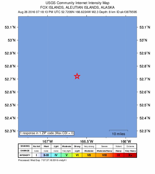
1 person reported to the USGS what they felt; the strongest reported shaking was II, weak shaking.
How well it is located
Reviewed by a seismologist.
- Stations used
- 17
Nearest places
Distance and direction from each place to the epicenter, with its forecast.
Nearby
Within 100 km, magnitude 1.5 and up: 78 in the 60 days after this one and 82 in the 30 days before it.
After
- 4.582 km S of Unalaska, Alaska · 3690 days ago · 26 km deep · 47 km away
- 1.571 km S of Unalaska, Alaska · 3689 days ago · 47 km deep · 58 km away
- 1.790 km SW of Unalaska, Alaska · 3689 days ago · 26 km deep · 82 km away
- 2.371 km SE of Unalaska, Alaska · 3688 days ago · 39 km deep · 98 km away
- 2.078 km E of Nikolski, Alaska · 3686 days ago · 26 km deep · 70 km away
- 3.286 km E of Nikolski, Alaska · 3686 days ago · 46 km deep · 68 km away
- 2.2136 km S of Unalaska, Alaska · 3686 days ago · 37 km deep · 7 km away
- 1.885 km SSW of Unalaska, Alaska · 3686 days ago · 26 km deep · 48 km away
- 2.3141 km S of Unalaska, Alaska · 3686 days ago · 26 km deep · 13 km away
- 1.871 km SW of Unalaska, Alaska · 3682 days ago · 18 km deep · 93 km away
- 2.4192 km SSE of Unalaska, Alaska · 3682 days ago · 14 km deep · 97 km away
- 1.9103 km E of Nikolski, Alaska · 3680 days ago · 21 km deep · 48 km away
- 1.973 km ENE of Nikolski, Alaska · 3678 days ago · 52 km deep · 85 km away
- 1.976 km SW of Unalaska, Alaska · 3674 days ago · 13 km deep · 88 km away
- 2.088 km SSW of Unalaska, Alaska · 3674 days ago · 29 km deep · 45 km away
- 2.161 km S of Unalaska, Alaska · 3674 days ago · 47 km deep · 68 km away
- 2.939 km SSW of Unalaska, Alaska · 3672 days ago · 68 km deep · 90 km away
- 1.953 km SSE of Unalaska, Alaska · 3671 days ago · 47 km deep · 89 km away
- 2.480 km SSW of Unalaska, Alaska · 3668 days ago · 30 km deep · 50 km away
- 2.562 km SSW of Unalaska, Alaska · 3666 days ago · 69 km deep · 76 km away
- 2.064 km SSE of Unalaska, Alaska · 3665 days ago · 38 km deep · 86 km away
- 1.995 km E of Nikolski, Alaska · 3665 days ago · 25 km deep · 56 km away
- 2.3130 km S of Unalaska, Alaska · 3664 days ago · 20 km deep · 3 km away
- 2.3138 km S of Unalaska, Alaska · 3664 days ago · 20 km deep · 9 km away
- 1.798 km E of Nikolski, Alaska · 3664 days ago · 40 km deep · 64 km away
- 2.339 km SSE of Unalaska, Alaska · 3663 days ago · 64 km deep · 94 km away
- 1.669 km SSE of Unalaska, Alaska · 3661 days ago · 26 km deep · 86 km away
- 3.4127 km ESE of Nikolski, Alaska · 3660 days ago · 28 km deep · 21 km away
- 2.6138 km ESE of Nikolski, Alaska · 3660 days ago · 39 km deep · 27 km away
- 4.6120 km E of Nikolski, Alaska · 3660 days ago · 46 km deep · 28 km away
- 3.1135 km ESE of Nikolski, Alaska · 3660 days ago · 10 km deep · 23 km away
- 2.2143 km ESE of Nikolski, Alaska · 3660 days ago · 22 km deep · 30 km away
- 2.4135 km ESE of Nikolski, Alaska · 3660 days ago · 8 km deep · 25 km away
- 2.1139 km S of Unalaska, Alaska · 3659 days ago · 19 km deep · 15 km away
- 1.8112 km S of Unalaska, Alaska · 3658 days ago · 5 km deep · 18 km away
- 2.071 km SE of Nikolski, Alaska · 3658 days ago · 35 km deep · 98 km away
- 2.247 km E of Nikolski, Alaska · 3657 days ago · 57 km deep · 100 km away
- 1.792 km SSW of Unalaska, Alaska · 3657 days ago · 72 km deep · 60 km away
- 2.6219 km S of Unalaska, Alaska · 3653 days ago · 47 km deep · 99 km away
- 1.550 km SW of Unalaska, Alaska · 3652 days ago · 13 km deep · 97 km away
- 2.1121 km S of Unalaska, Alaska · 3652 days ago · 1 km deep · 8 km away
- 2.8124 km ESE of Nikolski, Alaska · 3652 days ago · 21 km deep · 26 km away
- 2.5127 km S of Unalaska, Alaska · 3652 days ago · 5 km deep · 6 km away
- 1.691 km E of Nikolski, Alaska · 3652 days ago · 34 km deep · 62 km away
- 2.087 km SSW of Unalaska, Alaska · 3651 days ago · 35 km deep · 63 km away
- 2.0102 km SSW of Unalaska, Alaska · 3650 days ago · 13 km deep · 55 km away
- 3.355 km SW of Unalaska, Alaska · 3648 days ago · 18 km deep · 91 km away
- 3.383 km SE of Unalaska, Alaska · 3648 days ago · 39 km deep · 100 km away
- 3.890 km SSW of Unalaska, Alaska · 3646 days ago · 20 km deep · 58 km away
- 3.9140 km S of Unalaska, Alaska · 3646 days ago · 24 km deep · 17 km away
- 3.3144 km ESE of Nikolski, Alaska · 3646 days ago · 10 km deep · 36 km away
- 3.7103 km E of Nikolski, Alaska · 3646 days ago · 22 km deep · 47 km away
- 2.261 km SSE of Unalaska, Alaska · 3646 days ago · 25 km deep · 88 km away
- 2.2133 km ESE of Nikolski, Alaska · 3646 days ago · 25 km deep · 28 km away
- 2.5141 km ESE of Nikolski, Alaska · 3646 days ago · 12 km deep · 35 km away
- 2.2139 km ESE of Nikolski, Alaska · 3646 days ago · 8 km deep · 31 km away
- 2.3150 km ESE of Nikolski, Alaska · 3646 days ago · 13 km deep · 39 km away
- 1.829 km SSW of Unalaska, Alaska · 3644 days ago · 84 km deep · 100 km away
- 1.961 km SW of Unalaska, Alaska · 3642 days ago · 16 km deep · 95 km away
- 1.840 km SSE of Unalaska, Alaska · 3641 days ago · 63 km deep · 96 km away
The first 60 of 78.
Before
- 1.8132 km S of Unalaska, Alaska · 3690 days ago · 12 km deep · 3 km away
- 2.2134 km S of Unalaska, Alaska · 3690 days ago · 15 km deep · 7 km away
- 1.7113 km ESE of Nikolski, Alaska · 3691 days ago · 10 km deep · 55 km away
- 1.985 km SSW of Unalaska, Alaska · 3692 days ago · 26 km deep · 48 km away
- 2.5147 km S of Unalaska, Alaska · 3694 days ago · 27 km deep · 27 km away
- 1.577 km SW of Unalaska, Alaska · 3694 days ago · 14 km deep · 100 km away
- 2.294 km SE of Unalaska, Alaska · 3695 days ago · 24 km deep · 95 km away
- 2.5Fox Islands, Aleutian Islands, Alaska · 3698 days ago · 41 km deep · 54 km away
- 2.3105 km SE of Nikolski, Alaska · 3698 days ago · 26 km deep · 70 km away
- 1.667 km SE of Unalaska, Alaska · 3701 days ago · 23 km deep · 91 km away
- 1.9113 km E of Nikolski, Alaska · 3701 days ago · 21 km deep · 36 km away
- 1.894 km ENE of Nikolski, Alaska · 3704 days ago · 58 km deep · 79 km away
- 2.274 km SSW of Unalaska, Alaska · 3704 days ago · 58 km deep · 58 km away
- 1.894 km SE of Unalaska, Alaska · 3705 days ago · 12 km deep · 96 km away
- 2.4127 km S of Unalaska, Alaska · 3705 days ago · 16 km deep · 2 km away
- 2.196 km SSW of Unalaska, Alaska · 3705 days ago · 42 km deep · 36 km away
- 2.5200 km S of Unalaska, Alaska · 3706 days ago · 10 km deep · 82 km away
- 1.6128 km S of Unalaska, Alaska · 3706 days ago · 26 km deep · 7 km away
- 2.055 km SW of Unalaska, Alaska · 3707 days ago · 78 km deep · 87 km away
- 1.9120 km S of Unalaska, Alaska · 3708 days ago · 5 km deep · 9 km away
Earthquakes todayAlaska earthquakesLive radar here
Sources
From the USGS Earthquake Hazards Program and its partner networks, event ak016azkv2ej (also filed as ak13879595). Read Sat, Oct 3, 2026, 8:46 PM UTC.