M2.5 earthquake 119 km ESE of Nikolski, Alaska
A magnitude 2.5 earthquake struck 119 km ESE of Nikolski, Alaska on Sun, Jan 24, 2016, 7:41 AM AKST (16:41 UTC), 26 km (16 mi) below the surface.
A larger quake followed: M4.1 Fox Islands, Aleutian Islands, Alaska. This one was a foreshock.
Map
Where this earthquake was located, with the others nearby. Select one for its page.
The earthquake
- Magnitude
- 2.5 (ML, local (Richter)), micro
- Magnitude from
- USGS National Earthquake Information Center
- Local time
- UTC
- 2016-01-24 16:41:43 UTC
- Depth
- 25.5 km (15.8 mi), shallow
- Epicenter
- 52.474° N, 167.274° W
- Region
- Alaska
- Tsunami flag
- No
- Status
- Reviewed by a seismologist
Magnitude estimates
Different scales measure different things and differ by a few tenths. The USGS marks one as preferred, and it is the one this page uses.
| Mag. | Scale | Computed by | Notes |
|---|---|---|---|
| 2.5 | ML, local (Richter) | USGS National Earthquake Information Center | Preferred · Reviewed |
| 2.5 | ML, local (Richter) | Alaska Earthquake Center | Preliminary |
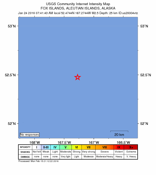
Did you feel it?
No one has reported feeling this quake to the USGS.
How well it is located
Reviewed by a seismologist.
- Location uncertainty
- About 9.0 km horizontally, 9.8 km in depth
- Station coverage gap
- 269°, poorly surrounded by stations
- Stations used
- 14
Nearest places
Distance and direction from each place to the epicenter, with its forecast.
Nearby
Within 100 km, magnitude 1.5 and up: 44 in the 60 days after this one and 26 in the 30 days before it.
After
- 2.972 km SSE of Nikolski, Alaska · 3901 days ago · 32 km deep · 70 km away
- 1.942 km ESE of Nikolski, Alaska · 3900 days ago · 41 km deep · 77 km away
- 2.363 km SSE of Nikolski, Alaska · 3899 days ago · 13 km deep · 80 km away
- 2.059 km E of Nikolski, Alaska · 3895 days ago · 43 km deep · 72 km away
- 2.884 km E of Nikolski, Alaska · 3894 days ago · 76 km deep · 71 km away
- 2.2135 km S of Unalaska, Alaska · 3886 days ago · 25 km deep · 67 km away
- 2.0121 km S of Unalaska, Alaska · 3885 days ago · 8 km deep · 48 km away
- 3.672 km SSW of Unalaska, Alaska · 3884 days ago · 46 km deep · 91 km away
- 2.777 km SSW of Unalaska, Alaska · 3884 days ago · 26 km deep · 86 km away · felt by 1
- 1.887 km ESE of Nikolski, Alaska · 3884 days ago · 49 km deep · 40 km away
- 2.4110 km S of Unalaska, Alaska · 3879 days ago · 11 km deep · 58 km away
- 1.891 km SSW of Unalaska, Alaska · 3878 days ago · 33 km deep · 73 km away
- 2.871 km S of Unalaska, Alaska · 3876 days ago · 35 km deep · 100 km away
- 3.7196 km ESE of Nikolski, Alaska · 3874 days ago · 10 km deep · 79 km away
- 2.079 km SSW of Unalaska, Alaska · 3873 days ago · 34 km deep · 85 km away
- 1.877 km S of Unalaska, Alaska · 3872 days ago · 36 km deep · 87 km away
- 1.972 km E of Nikolski, Alaska · 3872 days ago · 48 km deep · 63 km away
- 1.772 km ESE of Nikolski, Alaska · 3872 days ago · 26 km deep · 51 km away
- 2.144 km ESE of Nikolski, Alaska · 3872 days ago · 42 km deep · 75 km away
- 4.1Fox Islands, Aleutian Islands, Alaska · 3871 days ago · 25 km deep · 60 km away
- 2.093 km E of Nikolski, Alaska · 3871 days ago · 49 km deep · 60 km away
- 2.579 km S of Unalaska, Alaska · 3871 days ago · 33 km deep · 85 km away
- 2.4140 km ESE of Nikolski, Alaska · 3870 days ago · 13 km deep · 29 km away
- 2.890 km E of Nikolski, Alaska · 3870 days ago · 49 km deep · 52 km away
- 1.9106 km E of Nikolski, Alaska · 3868 days ago · 25 km deep · 44 km away
- 1.998 km E of Nikolski, Alaska · 3868 days ago · 42 km deep · 38 km away
- 2.8Fox Islands, Aleutian Islands, Alaska · 3866 days ago · 11 km deep · 94 km away
- 2.5146 km ESE of Nikolski, Alaska · 3865 days ago · 24 km deep · 32 km away
- 2.643 km ESE of Nikolski, Alaska · 3863 days ago · 42 km deep · 76 km away
- 1.887 km E of Nikolski, Alaska · 3862 days ago · 38 km deep · 55 km away
- 2.096 km E of Nikolski, Alaska · 3861 days ago · 39 km deep · 62 km away
- 2.5106 km E of Nikolski, Alaska · 3859 days ago · 26 km deep · 40 km away
- 2.364 km ESE of Nikolski, Alaska · 3859 days ago · 32 km deep · 55 km away
- 1.667 km SSW of Unalaska, Alaska · 3854 days ago · 26 km deep · 98 km away
- 2.5100 km ESE of Nikolski, Alaska · 3853 days ago · 41 km deep · 20 km away
- 3.952 km ESE of Nikolski, Alaska · 3852 days ago · 26 km deep · 67 km away
- 1.887 km SSW of Unalaska, Alaska · 3851 days ago · 18 km deep · 76 km away
- 2.643 km ESE of Nikolski, Alaska · 3851 days ago · 39 km deep · 76 km away
- 2.630 km ESE of Nikolski, Alaska · 3851 days ago · 45 km deep · 90 km away
- 2.868 km E of Nikolski, Alaska · 3850 days ago · 46 km deep · 69 km away
- 2.589 km SSE of Nikolski, Alaska · 3850 days ago · 6 km deep · 84 km away
- 1.989 km E of Nikolski, Alaska · 3849 days ago · 32 km deep · 56 km away
- 1.974 km SSW of Unalaska, Alaska · 3848 days ago · 28 km deep · 91 km away
- 2.444 km SE of Nikolski, Alaska · 3848 days ago · 45 km deep · 77 km away
Before
- 1.925 km SE of Nikolski, Alaska · 3908 days ago · 61 km deep · 95 km away
- 3.668 km SSE of Nikolski, Alaska · 3909 days ago · 37 km deep · 79 km away
- 4.185 km SSE of Nikolski, Alaska · 3909 days ago · 10 km deep · 74 km away
- 1.9107 km E of Nikolski, Alaska · 3911 days ago · 25 km deep · 41 km away
- 2.137 km E of Nikolski, Alaska · 3913 days ago · 49 km deep · 85 km away
- 2.5143 km ESE of Nikolski, Alaska · 3915 days ago · 25 km deep · 31 km away
- 2.226 km E of Nikolski, Alaska · 3915 days ago · 60 km deep · 94 km away
- 4.179 km S of Unalaska, Alaska · 3916 days ago · 26 km deep · 85 km away
- 4.3101 km ESE of Nikolski, Alaska · 3916 days ago · 18 km deep · 19 km away
- 2.085 km S of Unalaska, Alaska · 3917 days ago · 18 km deep · 81 km away
- 2.4141 km S of Unalaska, Alaska · 3917 days ago · 24 km deep · 52 km away
- 2.2130 km S of Unalaska, Alaska · 3918 days ago · 14 km deep · 52 km away
- 3.5213 km SE of Nikolski, Alaska · 3919 days ago · 24 km deep · 97 km away
- 3.078 km S of Unalaska, Alaska · 3920 days ago · 16 km deep · 88 km away
- 4.3138 km ESE of Nikolski, Alaska · 3925 days ago · 33 km deep · 22 km away
- 2.595 km SSW of Unalaska, Alaska · 3927 days ago · 60 km deep · 72 km away
- 1.990 km SSW of Unalaska, Alaska · 3928 days ago · 47 km deep · 74 km away
- 4.0Fox Islands, Aleutian Islands, Alaska · 3928 days ago · 26 km deep · 74 km away
- 1.851 km ESE of Nikolski, Alaska · 3930 days ago · 16 km deep · 68 km away
- 2.387 km SSE of Nikolski, Alaska · 3931 days ago · 38 km deep · 92 km away
Earthquakes todayAlaska earthquakesLive radar here
Sources
From the USGS Earthquake Hazards Program and its partner networks, event us20004vtz (also filed as ak12560354, ak01613yo596). Read Sun, Oct 4, 2026, 10:34 PM UTC.