M4.1 earthquake 65 km SSW of Nikolski, Alaska
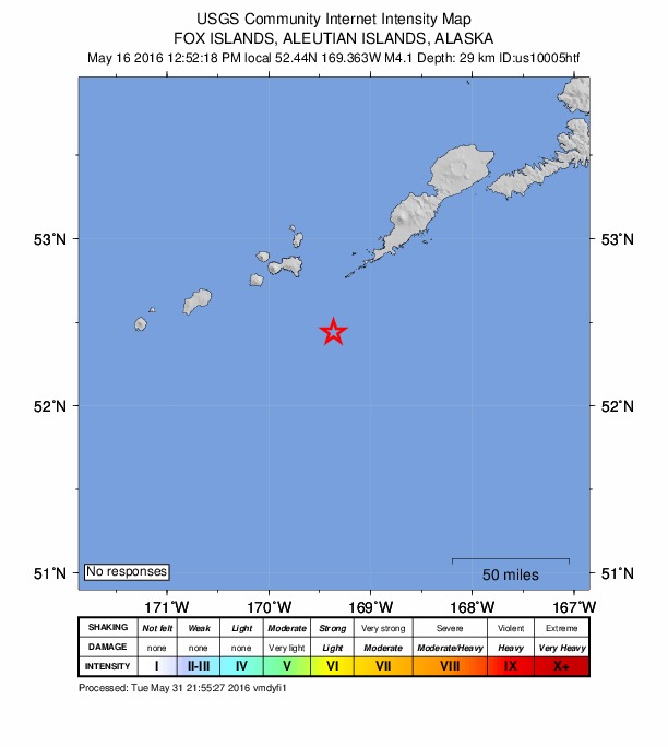
A magnitude 4.1 earthquake struck 65 km SSW of Nikolski, Alaska on Mon, May 16, 2016, 1:52 PM AKDT (21:52 UTC), 29 km (18 mi) below the surface.
A larger quake followed: M4.7 73 km SSE of Nikolski, Alaska. This one was a foreshock.
Map
Where this earthquake was located, with the others nearby. Select one for its page.
The earthquake
- Magnitude
- 4.1 (mb, body-wave), light
- Magnitude from
- USGS National Earthquake Information Center
- Local time
- UTC
- 2016-05-16 21:52:18 UTC
- Depth
- 29.4 km (18.3 mi), shallow
- Epicenter
- 52.440° N, 169.363° W
- Region
- Alaska
- Tsunami flag
- No
- Status
- Reviewed by a seismologist
Magnitude estimates
Different scales measure different things and differ by a few tenths. The USGS marks one as preferred, and it is the one this page uses.
| Mag. | Scale | Computed by | Notes |
|---|---|---|---|
| 4.1 | mb, body-wave | USGS National Earthquake Information Center | Preferred · Reviewed · ±0.056 · 89 stations |
| 4.1 | mb, body-wave | Alaska Earthquake Center | Preliminary |
Did you feel it?
No one has reported feeling this quake to the USGS.
How well it is located
Reviewed by a seismologist.
- Location uncertainty
- About 5.6 km horizontally, 3.3 km in depth
- Magnitude uncertainty
- ±0.06
- Stations used
- 25
Nearest places
Distance and direction from each place to the epicenter, with its forecast.
Nearby
Within 100 km, magnitude 1.5 and up: 106 in the 60 days after this one and 52 in the 30 days before it.
After
- 3.577 km SE of Nikolski, Alaska · 3793 days ago · 19 km deep · 99 km away
- 4.773 km SSE of Nikolski, Alaska · 3792 days ago · 17 km deep · 58 km away
- 3.989 km SSE of Nikolski, Alaska · 3792 days ago · 31 km deep · 69 km away
- 3.966 km SSE of Nikolski, Alaska · 3792 days ago · 65 km deep · 51 km away
- 2.5125 km SW of Nikolski, Alaska · 3792 days ago · 55 km deep · 72 km away
- 1.912 km E of Nikolski, Alaska · 3792 days ago · 39 km deep · 74 km away
- 2.2101 km SSE of Nikolski, Alaska · 3791 days ago · 26 km deep · 79 km away
- 2.192 km SSE of Nikolski, Alaska · 3791 days ago · 26 km deep · 72 km away
- 4.296 km SSE of Nikolski, Alaska · 3791 days ago · 13 km deep · 75 km away
- 2.4138 km WSW of Nikolski, Alaska · 3791 days ago · 61 km deep · 88 km away
- 2.194 km SSE of Nikolski, Alaska · 3791 days ago · 26 km deep · 71 km away
- 1.841 km WSW of Nikolski, Alaska · 3790 days ago · 10 km deep · 46 km away
- 2.096 km SSE of Nikolski, Alaska · 3790 days ago · 41 km deep · 72 km away
- 1.646 km NW of Nikolski, Alaska · 3790 days ago · 1 km deep · 88 km away
- 1.733 km SSW of Nikolski, Alaska · 3790 days ago · 46 km deep · 35 km away
- 3.8115 km SSW of Nikolski, Alaska · 3790 days ago · 10 km deep · 51 km away
- 1.822 km S of Nikolski, Alaska · 3790 days ago · 44 km deep · 50 km away
- 2.3134 km WSW of Nikolski, Alaska · 3790 days ago · 15 km deep · 84 km away
- 3.059 km SW of Nikolski, Alaska · 3786 days ago · 22 km deep · 9 km away
- 2.231 km SE of Nikolski, Alaska · 3786 days ago · 46 km deep · 60 km away
- 2.6133 km WSW of Nikolski, Alaska · 3783 days ago · 26 km deep · 91 km away
- 2.5107 km SSW of Nikolski, Alaska · 3783 days ago · 19 km deep · 44 km away
- 2.4127 km SSW of Nikolski, Alaska · 3781 days ago · 23 km deep · 65 km away
- 1.842 km WSW of Nikolski, Alaska · 3780 days ago · 4 km deep · 37 km away
- 3.996 km SSW of Nikolski, Alaska · 3779 days ago · 40 km deep · 35 km away
- 2.225 km E of Nikolski, Alaska · 3778 days ago · 42 km deep · 82 km away
- 2.151 km WSW of Nikolski, Alaska · 3777 days ago · 7 km deep · 44 km away
- 2.181 km SW of Nikolski, Alaska · 3776 days ago · 37 km deep · 33 km away
- 3.3145 km WSW of Nikolski, Alaska · 3775 days ago · 57 km deep · 92 km away
- 2.437 km N of Nikolski, Alaska · 3775 days ago · 102 km deep · 97 km away
- 2.029 km SSW of Nikolski, Alaska · 3773 days ago · 67 km deep · 36 km away
- 2.683 km SE of Nikolski, Alaska · 3773 days ago · 36 km deep · 91 km away
- 3.990 km SSW of Nikolski, Alaska · 3772 days ago · 35 km deep · 26 km away
- 1.660 km WSW of Nikolski, Alaska · 3772 days ago · 20 km deep · 28 km away
- 1.927 km SSE of Nikolski, Alaska · 3771 days ago · 44 km deep · 50 km away
- 2.4110 km SW of Nikolski, Alaska · 3770 days ago · 24 km deep · 56 km away
- 2.049 km ESE of Nikolski, Alaska · 3770 days ago · 43 km deep · 87 km away
- 2.163 km SW of Nikolski, Alaska · 3769 days ago · 34 km deep · 23 km away
- 2.067 km SW of Nikolski, Alaska · 3769 days ago · 47 km deep · 11 km away
- 2.023 km SE of Nikolski, Alaska · 3768 days ago · 51 km deep · 60 km away
- 1.746 km WSW of Nikolski, Alaska · 3767 days ago · 26 km deep · 31 km away
- 2.599 km SSW of Nikolski, Alaska · 3767 days ago · 23 km deep · 41 km away
- 3.147 km WSW of Nikolski, Alaska · 3767 days ago · 14 km deep · 39 km away
- 4.1125 km WSW of Nikolski, Alaska · 3767 days ago · 55 km deep · 81 km away
- 2.5104 km SSW of Nikolski, Alaska · 3766 days ago · 29 km deep · 46 km away
- 2.058 km SW of Nikolski, Alaska · 3766 days ago · 29 km deep · 26 km away
- 2.4126 km SSW of Nikolski, Alaska · 3765 days ago · 28 km deep · 64 km away
- 1.866 km S of Nikolski, Alaska · 3765 days ago · 9 km deep · 44 km away
- 1.943 km WSW of Nikolski, Alaska · 3762 days ago · 10 km deep · 35 km away
- 1.925 km SE of Nikolski, Alaska · 3762 days ago · 40 km deep · 59 km away
- 2.3141 km SW of Nikolski, Alaska · 3761 days ago · 16 km deep · 77 km away
- 1.982 km SSW of Nikolski, Alaska · 3761 days ago · 38 km deep · 17 km away
- 2.449 km ESE of Nikolski, Alaska · 3760 days ago · 49 km deep · 89 km away
- 4.474 km SSW of Nikolski, Alaska · 3759 days ago · 35 km deep · 12 km away
- 3.948 km SW of Nikolski, Alaska · 3759 days ago · 52 km deep · 20 km away
- 2.118 km SE of Nikolski, Alaska · 3759 days ago · 48 km deep · 61 km away
- 2.798 km SSW of Nikolski, Alaska · 3759 days ago · 26 km deep · 40 km away
- 3.494 km SSW of Nikolski, Alaska · 3759 days ago · 17 km deep · 35 km away
- 3.887 km SSW of Nikolski, Alaska · 3759 days ago · 34 km deep · 26 km away
- 4.278 km SSW of Nikolski, Alaska · 3759 days ago · 35 km deep · 15 km away
The first 60 of 106.
Before
- 2.386 km SE of Nikolski, Alaska · 3793 days ago · 72 km deep · 93 km away
- 3.390 km SE of Nikolski, Alaska · 3794 days ago · 16 km deep · 100 km away
- 2.543 km WSW of Nikolski, Alaska · 3794 days ago · 81 km deep · 39 km away
- 3.4136 km SW of Nikolski, Alaska · 3794 days ago · 34 km deep · 78 km away
- 2.184 km SE of Nikolski, Alaska · 3794 days ago · 25 km deep · 94 km away
- 3.392 km SE of Nikolski, Alaska · 3794 days ago · 10 km deep · 97 km away
- 4.088 km SE of Nikolski, Alaska · 3794 days ago · 6 km deep · 100 km away
- 2.668 km SSW of Nikolski, Alaska · 3794 days ago · 44 km deep · 3 km away
- 5.478 km SE of Nikolski, Alaska · 3794 days ago · 10 km deep · 97 km away
- 2.283 km SSW of Nikolski, Alaska · 3794 days ago · 40 km deep · 18 km away
- 2.377 km SSW of Nikolski, Alaska · 3794 days ago · 27 km deep · 13 km away
- 2.161 km SW of Nikolski, Alaska · 3794 days ago · 21 km deep · 12 km away
- 2.486 km SSW of Nikolski, Alaska · 3794 days ago · 24 km deep · 21 km away
- 2.5125 km WSW of Nikolski, Alaska · 3796 days ago · 35 km deep · 79 km away
- 2.264 km SSE of Nikolski, Alaska · 3796 days ago · 19 km deep · 68 km away
- 2.252 km SW of Nikolski, Alaska · 3796 days ago · 23 km deep · 24 km away
- 2.585 km WSW of Nikolski, Alaska · 3797 days ago · 26 km deep · 39 km away
- 2.7149 km SW of Nikolski, Alaska · 3799 days ago · 24 km deep · 90 km away
- 2.747 km WSW of Nikolski, Alaska · 3799 days ago · 5 km deep · 40 km away
- 2.6113 km SW of Nikolski, Alaska · 3800 days ago · 39 km deep · 52 km away
Earthquakes todayAlaska earthquakesLive radar here
Sources
From the USGS Earthquake Hazards Program and its partner networks, event us10005htf (also filed as ak0166axfu17, ak13589998). Read Sun, Oct 4, 2026, 7:07 PM UTC.