M4.5 earthquake 107 km ESE of Neiafu, Tonga
A magnitude 4.5 earthquake struck 107 km ESE of Neiafu, Tonga on Thu, Jan 28, 2016, 8:15 AM GMT+13 (19:15 UTC), 9 km (5 mi) below the surface.
A larger quake followed: M5.3 166 km ESE of Neiafu, Tonga. This one was a foreshock.
Map
Where this earthquake was located, with the others nearby. Select one for its page.
The earthquake
- Magnitude
- 4.5 (mb, body-wave), light
- Magnitude from
- USGS National Earthquake Information Center
- Local time
- UTC
- 2016-01-27 19:15:48 UTC
- Depth
- 8.8 km (5.5 mi), shallow
- Epicenter
- 18.873° S, 172.989° W
- Region
- Tonga
- Tsunami flag
- No
- Status
- Reviewed by a seismologist
Did you feel it?
No one has reported feeling this quake to the USGS.
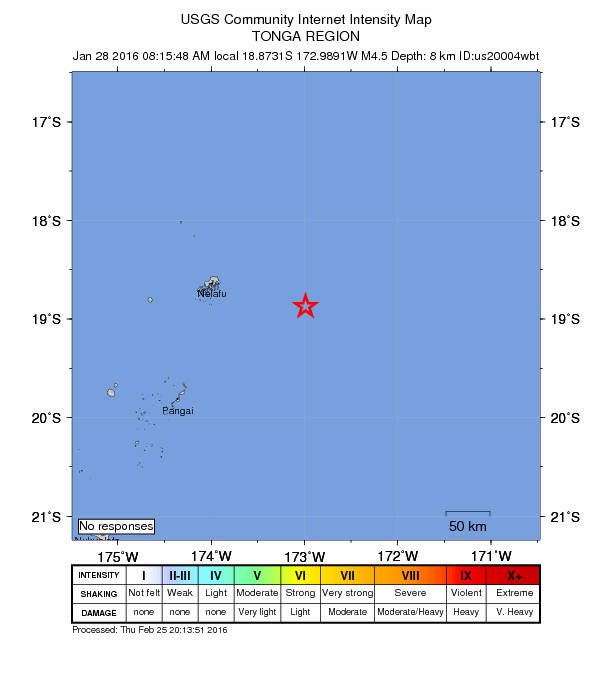
How well it is located
Reviewed by a seismologist.
- Location uncertainty
- About 9.3 km horizontally, 6.0 km in depth
- Magnitude uncertainty
- ±0.15
- Depth from
- From location
- Station coverage gap
- 104°
- Stations used
- 15
Nearest places
Distance and direction from each place to the epicenter, with its forecast.
Nearby
Within 100 km, magnitude 1.5 and up: 7 in the 60 days after this one and 1 in the 30 days before it.
After
- 4.6124 km ESE of Neiafu, Tonga · 3902 days ago · 13 km deep · 39 km away
- 4.8130 km SE of Neiafu, Tonga · 3892 days ago · 24 km deep · 64 km away
- 5.3166 km ESE of Neiafu, Tonga · 3891 days ago · 36 km deep · 59 km away
- 4.6165 km ESE of Neiafu, Tonga · 3890 days ago · 10 km deep · 58 km away
- 5.0152 km E of Pangai, Tonga · 3890 days ago · 28 km deep · 83 km away
- 4.528 km NE of Neiafu, Tonga · 3874 days ago · 35 km deep · 94 km away
- 4.4129 km ESE of Neiafu, Tonga · 3871 days ago · 10 km deep · 37 km away
Before
Earthquakes todayTonga earthquakesLive radar here
Sources
From the USGS Earthquake Hazards Program and its partner networks, event us20004wbt. Read Sun, Oct 4, 2026, 11:44 PM UTC.