M2.3 earthquake 58 km SSE of Kokhanok, Alaska
A magnitude 2.3 earthquake struck 58 km SSE of Kokhanok, Alaska on Sun, May 15, 2016, 4:55 PM AKDT (00:55 UTC), 119 km (74 mi) below the surface.
A larger quake followed: M4.1 67 km SE of Pope-Vannoy Landing, Alaska. This one was a foreshock.
Map
Where this earthquake was located, with the others nearby. Select one for its page.
The earthquake
- Magnitude
- 2.3 (ML, local (Richter)), micro
- Magnitude from
- Alaska Earthquake Center
- Local time
- UTC
- 2016-05-16 00:55:36 UTC
- Depth
- 118.7 km (73.8 mi), intermediate-depth
- Epicenter
- 58.960° N, 154.361° W
- Region
- Alaska
- Felt reports
- 1
- Tsunami flag
- No
- Status
- Reviewed by a seismologist
Did you feel it?
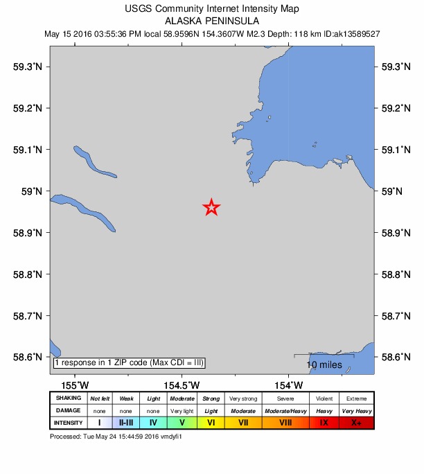
1 person reported to the USGS what they felt; the strongest reported shaking was III, weak shaking.
How well it is located
Reviewed by a seismologist.
- Stations used
- 49
Nearest places
Distance and direction from each place to the epicenter, with its forecast.
Nearby
Within 100 km, magnitude 1.5 and up: 129 in the 60 days after this one and 61 in the 30 days before it.
After
- 1.711 km NNE of Pope-Vannoy Landing, Alaska · 3794 days ago · 185 km deep · 77 km away
- 1.673 km SE of Pope-Vannoy Landing, Alaska · 3793 days ago · 83 km deep · 54 km away
- 1.652 km W of Nanwalek, Alaska · 3793 days ago · 76 km deep · 98 km away
- 1.859 km NW of Aleneva, Alaska · 3792 days ago · 80 km deep · 73 km away
- 1.571 km SW of Nanwalek, Alaska · 3791 days ago · 70 km deep · 82 km away
- 1.646 km WSW of Nanwalek, Alaska · 3790 days ago · 68 km deep · 99 km away
- 2.728 km SE of Kokhanok, Alaska · 3789 days ago · 150 km deep · 35 km away
- 1.740 km SE of Pedro Bay, Alaska · 3787 days ago · 105 km deep · 80 km away
- 2.960 km ESE of Pedro Bay, Alaska · 3787 days ago · 94 km deep · 99 km away
- 1.663 km N of Karluk, Alaska · 3786 days ago · 7 km deep · 92 km away
- 1.557 km W of Nanwalek, Alaska · 3786 days ago · 99 km deep · 99 km away
- 1.964 km SW of Nanwalek, Alaska · 3786 days ago · 67 km deep · 92 km away
- 1.647 km SE of Pedro Bay, Alaska · 3786 days ago · 106 km deep · 80 km away
- 1.859 km SE of Pope-Vannoy Landing, Alaska · 3786 days ago · 109 km deep · 51 km away
- 2.063 km NW of Aleneva, Alaska · 3785 days ago · 59 km deep · 68 km away
- 1.917 km SE of Kokhanok, Alaska · 3785 days ago · 154 km deep · 42 km away
- 1.628 km ESE of Pedro Bay, Alaska · 3784 days ago · 136 km deep · 92 km away
- 1.667 km SW of Nanwalek, Alaska · 3784 days ago · 60 km deep · 100 km away
- 1.624 km ESE of Pedro Bay, Alaska · 3784 days ago · 141 km deep · 92 km away
- 1.840 km ESE of Pedro Bay, Alaska · 3783 days ago · 117 km deep · 86 km away
- 1.557 km ESE of Pedro Bay, Alaska · 3783 days ago · 96 km deep · 98 km away
- 1.941 km ESE of Pedro Bay, Alaska · 3782 days ago · 115 km deep · 87 km away
- 2.492 km NW of Aleneva, Alaska · 3782 days ago · 16 km deep · 40 km away
- 2.022 km E of Pedro Bay, Alaska · 3782 days ago · 136 km deep · 97 km away
- 2.443 km ESE of Pedro Bay, Alaska · 3781 days ago · 112 km deep · 92 km away
- 2.286 km NNW of Karluk, Alaska · 3781 days ago · 5 km deep · 91 km away
- 2.652 km SE of Pope-Vannoy Landing, Alaska · 3781 days ago · 126 km deep · 47 km away
- 1.890 km NNW of Karluk, Alaska · 3781 days ago · 3 km deep · 88 km away
- 1.875 km SSE of Kokhanok, Alaska · 3781 days ago · 107 km deep · 20 km away
- 2.043 km ESE of Pedro Bay, Alaska · 3781 days ago · 113 km deep · 94 km away
- 4.167 km SE of Pope-Vannoy Landing, Alaska · 3780 days ago · 103 km deep · 37 km away
- 2.144 km ESE of Pedro Bay, Alaska · 3779 days ago · 109 km deep · 99 km away
- 2.265 km NNW of Karluk, Alaska · 3779 days ago · 3 km deep · 97 km away
- 1.555 km WSW of Nanwalek, Alaska · 3779 days ago · 76 km deep · 91 km away
- 1.737 km E of Pedro Bay, Alaska · 3778 days ago · 127 km deep · 100 km away
- 2.640 km ESE of Pedro Bay, Alaska · 3776 days ago · 121 km deep · 87 km away
- 1.580 km WSW of Nanwalek, Alaska · 3776 days ago · 76 km deep · 66 km away
- 1.781 km SE of Kokhanok, Alaska · 3776 days ago · 10 km deep · 32 km away
- 2.385 km NNW of Karluk, Alaska · 3774 days ago · 8 km deep · 83 km away
- 1.968 km SW of Nanwalek, Alaska · 3773 days ago · 63 km deep · 84 km away
- 1.645 km ESE of Pedro Bay, Alaska · 3772 days ago · 110 km deep · 100 km away
- 1.565 km SW of Nanwalek, Alaska · 3772 days ago · 61 km deep · 86 km away
- 1.840 km SE of Pedro Bay, Alaska · 3772 days ago · 119 km deep · 78 km away
- 1.627 km SSE of Pedro Bay, Alaska · 3772 days ago · 139 km deep · 72 km away
- 2.585 km SSE of Kokhanok, Alaska · 3771 days ago · 97 km deep · 27 km away
- 1.768 km WNW of Aleneva, Alaska · 3771 days ago · 73 km deep · 78 km away
- 2.359 km ESE of Pope-Vannoy Landing, Alaska · 3771 days ago · 116 km deep · 56 km away
- 1.946 km ESE of Pedro Bay, Alaska · 3770 days ago · 113 km deep · 96 km away
- 1.769 km WNW of Aleneva, Alaska · 3770 days ago · 4 km deep · 87 km away
- 1.665 km SE of Pedro Bay, Alaska · 3769 days ago · 94 km deep · 80 km away
- 1.684 km WSW of Nanwalek, Alaska · 3769 days ago · 74 km deep · 69 km away
- 1.559 km SE of Pedro Bay, Alaska · 3769 days ago · 107 km deep · 66 km away
- 1.538 km SE of Pedro Bay, Alaska · 3768 days ago · 113 km deep · 79 km away
- 1.697 km NNW of Aleneva, Alaska · 3768 days ago · 2 km deep · 57 km away
- 1.656 km SE of Kokhanok, Alaska · 3767 days ago · 119 km deep · 18 km away
- 1.562 km ESE of Pedro Bay, Alaska · 3764 days ago · 103 km deep · 99 km away
- 1.8104 km S of Kokhanok, Alaska · 3764 days ago · 5 km deep · 50 km away
- 1.743 km ESE of Pope-Vannoy Landing, Alaska · 3764 days ago · 99 km deep · 56 km away
- 1.990 km WNW of Aleneva, Alaska · 3764 days ago · 3 km deep · 58 km away
- 1.696 km NNW of Karluk, Alaska · 3763 days ago · 9 km deep · 66 km away
The first 60 of 129.
Before
- 2.581 km S of Kokhanok, Alaska · 3795 days ago · 114 km deep · 36 km away
- 1.585 km ESE of King Salmon, Alaska · 3795 days ago · 123 km deep · 67 km away
- 1.681 km SSE of Igiugig, Alaska · 3795 days ago · 135 km deep · 55 km away
- 2.742 km ESE of Pedro Bay, Alaska · 3796 days ago · 111 km deep · 95 km away
- 1.624 km E of Pedro Bay, Alaska · 3796 days ago · 131 km deep · 98 km away
- 1.5Kodiak Island region, Alaska · 3797 days ago · 84 km deep · 51 km away
- 1.944 km ESE of Pedro Bay, Alaska · 3797 days ago · 114 km deep · 94 km away
- 1.541 km SSE of Pedro Bay, Alaska · 3797 days ago · 128 km deep · 68 km away
- 2.265 km ESE of Pedro Bay, Alaska · 3798 days ago · 104 km deep · 100 km away
- 1.733 km SE of Pedro Bay, Alaska · 3798 days ago · 129 km deep · 74 km away
- 1.755 km WSW of Nanwalek, Alaska · 3798 days ago · 72 km deep · 92 km away
- 1.770 km ESE of Pope-Vannoy Landing, Alaska · 3799 days ago · 93 km deep · 65 km away
- 1.669 km NW of Aleneva, Alaska · 3800 days ago · 62 km deep · 61 km away
- 1.976 km N of Aleneva, Alaska · 3801 days ago · 71 km deep · 74 km away
- 1.555 km W of Nanwalek, Alaska · 3802 days ago · 91 km deep · 98 km away
- 1.886 km NNW of Karluk, Alaska · 3802 days ago · 13 km deep · 81 km away
- 1.853 km NNW of Aleneva, Alaska · 3802 days ago · 64 km deep · 84 km away
- 1.884 km N of Aleneva, Alaska · 3802 days ago · 68 km deep · 75 km away
- 3.186 km WNW of Aleneva, Alaska · 3803 days ago · 90 km deep · 53 km away
- 1.564 km SE of Pope-Vannoy Landing, Alaska · 3803 days ago · 95 km deep · 51 km away
Earthquakes todayAlaska earthquakesLive radar here
Sources
From the USGS Earthquake Hazards Program and its partner networks, event ak0166akyev0 (also filed as ak13589527). Read Mon, Oct 5, 2026, 12:06 PM UTC.