M2.5 earthquake 65 km W of False Pass, Alaska
A magnitude 2.5 earthquake struck 65 km W of False Pass, Alaska on Sat, Feb 20, 2016, 6:03 AM AKST (15:03 UTC), 138 km (86 mi) below the surface.
A larger quake followed: M4.1 84 km NW of Cold Bay, Alaska. This one was a foreshock.
Map
Where this earthquake was located, with the others nearby. Select one for its page.
The earthquake
- Magnitude
- 2.5 (ML, local (Richter)), micro
- Magnitude from
- USGS National Earthquake Information Center
- Local time
- UTC
- 2016-02-20 15:03:37 UTC
- Depth
- 138.0 km (85.7 mi), intermediate-depth
- Epicenter
- 54.880° N, 164.424° W
- Region
- Alaska
- Tsunami flag
- No
- Status
- Reviewed by a seismologist
Magnitude estimates
Different scales measure different things and differ by a few tenths. The USGS marks one as preferred, and it is the one this page uses.
| Mag. | Scale | Computed by | Notes |
|---|---|---|---|
| 2.5 | ML, local (Richter) | USGS National Earthquake Information Center | Preferred · Reviewed · 11 stations |
| 2.5 | ML, local (Richter) | Alaska Earthquake Center | Preliminary |
Did you feel it?
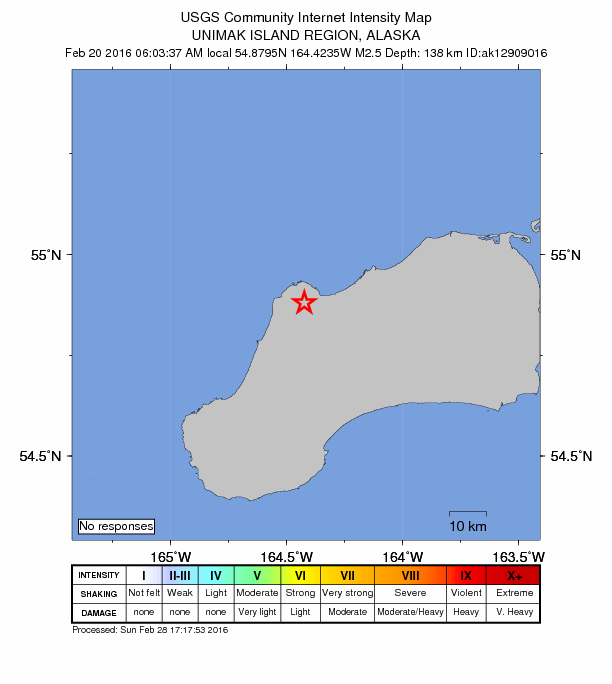
No one has reported feeling this quake to the USGS.
How well it is located
Reviewed by a seismologist.
- Location uncertainty
- About 15.2 km horizontally, 5.8 km in depth
- Stations used
- 11
Nearest places
Distance and direction from each place to the epicenter, with its forecast.
Nearby
Within 100 km, magnitude 1.5 and up: 30 in the 60 days after this one and 8 in the 30 days before it.
After
- 2.128 km S of False Pass, Alaska · 3878 days ago · 7 km deep · 69 km away
- 2.390 km E of Akutan, Alaska · 3878 days ago · 60 km deep · 99 km away
- 3.234 km NE of Akutan, Alaska · 3876 days ago · 87 km deep · 86 km away
- 2.377 km E of Akutan, Alaska · 3875 days ago · 50 km deep · 97 km away
- 2.1100 km SSW of False Pass, Alaska · 3871 days ago · 48 km deep · 96 km away
- 2.979 km E of Akutan, Alaska · 3870 days ago · 72 km deep · 71 km away
- 2.371 km SSW of False Pass, Alaska · 3868 days ago · 54 km deep · 79 km away
- 2.381 km SSW of False Pass, Alaska · 3867 days ago · 56 km deep · 88 km away
- 2.094 km E of Akutan, Alaska · 3866 days ago · 58 km deep · 89 km away
- 2.853 km SSE of False Pass, Alaska · 3864 days ago · 74 km deep · 98 km away
- 3.491 km SSW of False Pass, Alaska · 3858 days ago · 32 km deep · 84 km away
- 1.941 km SSW of False Pass, Alaska · 3853 days ago · 82 km deep · 61 km away
- 2.815 km N of False Pass, Alaska · 3849 days ago · 161 km deep · 68 km away
- 2.325 km ENE of Akutan, Alaska · 3849 days ago · 89 km deep · 97 km away
- 2.268 km S of False Pass, Alaska · 3848 days ago · 39 km deep · 93 km away
- 4.184 km NW of Cold Bay, Alaska · 3848 days ago · 183 km deep · 94 km away
- 2.462 km S of False Pass, Alaska · 3847 days ago · 61 km deep · 87 km away
- 2.099 km SSW of False Pass, Alaska · 3845 days ago · 64 km deep · 90 km away
- 1.8Unimak Island region, Alaska · 3845 days ago · 62 km deep · 83 km away
- 2.116 km SW of False Pass, Alaska · 3844 days ago · 18 km deep · 54 km away
- 2.344 km SSE of False Pass, Alaska · 3844 days ago · 70 km deep · 96 km away
- 2.278 km ENE of Akutan, Alaska · 3833 days ago · 79 km deep · 61 km away
- 2.186 km E of Akutan, Alaska · 3833 days ago · 64 km deep · 84 km away
- 2.250 km SSW of False Pass, Alaska · 3832 days ago · 18 km deep · 59 km away
- 2.799 km SSW of False Pass, Alaska · 3830 days ago · 29 km deep · 90 km away
- 2.785 km E of Akutan, Alaska · 3830 days ago · 64 km deep · 86 km away
- 2.537 km S of False Pass, Alaska · 3829 days ago · 9 km deep · 74 km away
- 2.477 km E of Akutan, Alaska · 3828 days ago · 71 km deep · 79 km away
- 2.192 km SSW of False Pass, Alaska · 3826 days ago · 21 km deep · 88 km away
- 2.293 km SSW of False Pass, Alaska · 3826 days ago · 26 km deep · 87 km away
Before
- 2.182 km E of Akutan, Alaska · 3879 days ago · 13 km deep · 70 km away
- 2.154 km SSW of False Pass, Alaska · 3883 days ago · 96 km deep · 64 km away
- 2.485 km ENE of Akutan, Alaska · 3885 days ago · 2 km deep · 41 km away
- 1.994 km SSW of False Pass, Alaska · 3886 days ago · 27 km deep · 89 km away
- 2.498 km E of Akutan, Alaska · 3890 days ago · 29 km deep · 98 km away
- 2.730 km W of False Pass, Alaska · 3894 days ago · 141 km deep · 35 km away
- 2.515 km SE of False Pass, Alaska · 3898 days ago · 103 km deep · 77 km away
- 2.053 km SSW of False Pass, Alaska · 3905 days ago · 58 km deep · 69 km away
Earthquakes todayAlaska earthquakesLive radar here
Sources
From the USGS Earthquake Hazards Program and its partner networks, event us10004tee (also filed as ak12909016, ak0162clcxa7). Read Sun, Oct 4, 2026, 5:44 AM UTC.