M3.0 earthquake 79 km ESE of Egegik, Alaska
A magnitude 3.0 earthquake struck 79 km ESE of Egegik, Alaska on Mon, May 16, 2016, 12:06 PM AKDT (20:06 UTC), 133 km (83 mi) below the surface.
A larger quake followed: M4.1 20 km S of King Salmon, Alaska. This one was a foreshock.
Map
Where this earthquake was located, with the others nearby. Select one for its page.
The earthquake
- Magnitude
- 3.0 (ML, local (Richter)), minor
- Magnitude from
- Alaska Earthquake Center
- Local time
- UTC
- 2016-05-16 20:06:17 UTC
- Depth
- 133.4 km (82.9 mi), intermediate-depth
- Epicenter
- 57.871° N, 156.193° W
- Region
- Alaska
- Tsunami flag
- No
- Status
- Reviewed by a seismologist
Magnitude estimates
Different scales measure different things and differ by a few tenths. The USGS marks one as preferred, and it is the one this page uses.
| Mag. | Scale | Computed by | Notes |
|---|---|---|---|
| 3.0 | ML, local (Richter) | Alaska Earthquake Center | Preferred · Preliminary |
| 3.0 | ML, local (Richter) | USGS National Earthquake Information Center | Reviewed |
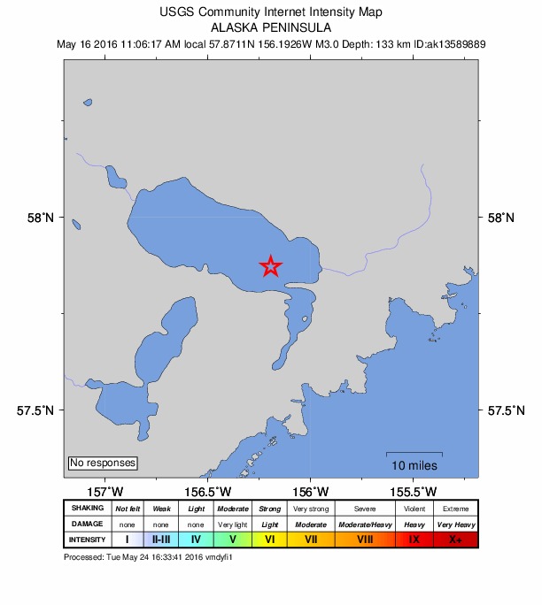
Did you feel it?
No one has reported feeling this quake to the USGS.
How well it is located
Reviewed by a seismologist.
- Stations used
- 49
Nearest places
Distance and direction from each place to the epicenter, with its forecast.
Nearby
Within 100 km, magnitude 1.5 and up: 52 in the 60 days after this one and 23 in the 30 days before it.
After
- 2.859 km SE of King Salmon, Alaska · 3790 days ago · 149 km deep · 51 km away
- 2.266 km ENE of Ugashik, Alaska · 3790 days ago · 148 km deep · 25 km away
- 2.918 km SW of Karluk, Alaska · 3788 days ago · 40 km deep · 99 km away
- 1.884 km E of Ugashik, Alaska · 3784 days ago · 82 km deep · 43 km away
- 1.945 km WNW of Karluk, Alaska · 3783 days ago · 63 km deep · 63 km away
- 1.867 km WNW of Karluk, Alaska · 3783 days ago · 11 km deep · 44 km away
- 1.984 km W of Akhiok, Alaska · 3781 days ago · 78 km deep · 98 km away
- 2.286 km NNW of Karluk, Alaska · 3780 days ago · 5 km deep · 75 km away
- 1.890 km NNW of Karluk, Alaska · 3780 days ago · 3 km deep · 76 km away
- 2.244 km WNW of Karluk, Alaska · 3779 days ago · 96 km deep · 65 km away
- 4.120 km S of King Salmon, Alaska · 3778 days ago · 201 km deep · 76 km away
- 2.265 km NNW of Karluk, Alaska · 3778 days ago · 3 km deep · 85 km away
- 2.044 km SE of Ugashik, Alaska · 3775 days ago · 72 km deep · 85 km away
- 2.453 km SE of King Salmon, Alaska · 3774 days ago · 144 km deep · 63 km away
- 2.385 km NNW of Karluk, Alaska · 3773 days ago · 8 km deep · 85 km away
- 2.185 km E of Ugashik, Alaska · 3773 days ago · 91 km deep · 32 km away
- 2.155 km WSW of Karluk, Alaska · 3773 days ago · 78 km deep · 80 km away
- 3.469 km ENE of Ugashik, Alaska · 3769 days ago · 131 km deep · 14 km away
- 2.463 km SE of King Salmon, Alaska · 3767 days ago · 145 km deep · 44 km away
- 1.831 km SW of Karluk, Alaska · 3762 days ago · 41 km deep · 94 km away
- 2.380 km ESE of Egegik, Alaska · 3759 days ago · 129 km deep · 18 km away
- 2.287 km ESE of King Salmon, Alaska · 3757 days ago · 118 km deep · 92 km away
- 2.016 km NW of Karluk, Alaska · 3756 days ago · 63 km deep · 93 km away
- 2.264 km ENE of Ugashik, Alaska · 3754 days ago · 108 km deep · 22 km away
- 1.676 km NNW of Karluk, Alaska · 3752 days ago · 11 km deep · 78 km away
- 1.767 km NW of Karluk, Alaska · 3751 days ago · 81 km deep · 55 km away
- 1.628 km NW of Karluk, Alaska · 3751 days ago · 63 km deep · 85 km away
- 1.685 km NNW of Karluk, Alaska · 3750 days ago · 90 km deep · 97 km away
- 2.178 km ENE of Ugashik, Alaska · 3749 days ago · 115 km deep · 12 km away
- 1.820 km WNW of Karluk, Alaska · 3749 days ago · 69 km deep · 88 km away
- 1.767 km W of Karluk, Alaska · 3748 days ago · 70 km deep · 58 km away
- 1.831 km WNW of Karluk, Alaska · 3745 days ago · 61 km deep · 78 km away
- 2.066 km ENE of Ugashik, Alaska · 3745 days ago · 119 km deep · 19 km away
- 1.965 km W of Karluk, Alaska · 3744 days ago · 86 km deep · 49 km away
- 1.946 km NW of Karluk, Alaska · 3744 days ago · 79 km deep · 66 km away
- 1.714 km W of Karluk, Alaska · 3744 days ago · 47 km deep · 95 km away
- 3.980 km ENE of Ugashik, Alaska · 3742 days ago · 128 km deep · 4 km away
- 1.624 km WNW of Karluk, Alaska · 3741 days ago · 76 km deep · 85 km away
- 1.886 km SE of King Salmon, Alaska · 3741 days ago · 8 km deep · 44 km away
- 1.6Alaska Peninsula · 3740 days ago · 2 km deep · 85 km away
- 1.681 km WNW of Karluk, Alaska · 3740 days ago · 96 km deep · 35 km away
- 1.766 km ESE of Egegik, Alaska · 3740 days ago · 154 km deep · 16 km away
- 1.758 km NNW of Karluk, Alaska · 3739 days ago · 87 km deep · 92 km away
- 1.782 km NW of Karluk, Alaska · 3739 days ago · 9 km deep · 62 km away
- 1.786 km NW of Karluk, Alaska · 3738 days ago · 9 km deep · 60 km away
- 1.828 km WNW of Karluk, Alaska · 3738 days ago · 74 km deep · 81 km away
- 2.863 km WSW of Karluk, Alaska · 3738 days ago · 15 km deep · 80 km away
- 3.465 km WSW of Karluk, Alaska · 3738 days ago · 16 km deep · 82 km away
- 1.956 km NW of Karluk, Alaska · 3737 days ago · 79 km deep · 70 km away
- 1.579 km NW of Karluk, Alaska · 3736 days ago · 10 km deep · 45 km away
- 3.439 km ESE of Ugashik, Alaska · 3734 days ago · 9 km deep · 65 km away
- 1.960 km ESE of King Salmon, Alaska · 3733 days ago · 137 km deep · 65 km away
Before
- 1.585 km ESE of King Salmon, Alaska · 3794 days ago · 123 km deep · 94 km away
- 2.670 km E of Ugashik, Alaska · 3794 days ago · 101 km deep · 27 km away
- 2.184 km NW of Karluk, Alaska · 3794 days ago · 3 km deep · 58 km away
- 1.654 km SE of King Salmon, Alaska · 3795 days ago · 146 km deep · 60 km away
- 2.086 km NW of Karluk, Alaska · 3797 days ago · 4 km deep · 61 km away
- 1.890 km SE of King Salmon, Alaska · 3800 days ago · 107 km deep · 43 km away
- 1.886 km NNW of Karluk, Alaska · 3801 days ago · 13 km deep · 87 km away
- 2.168 km ESE of Egegik, Alaska · 3802 days ago · 139 km deep · 14 km away
- 1.882 km NW of Karluk, Alaska · 3804 days ago · 6 km deep · 40 km away
- 2.873 km ESE of King Salmon, Alaska · 3806 days ago · 174 km deep · 65 km away
- 4.064 km ESE of King Salmon, Alaska · 3807 days ago · 155 km deep · 69 km away
- 2.774 km ESE of Egegik, Alaska · 3808 days ago · 124 km deep · 7 km away
- 2.373 km ESE of Egegik, Alaska · 3810 days ago · 139 km deep · 6 km away
- 1.978 km W of Karluk, Alaska · 3810 days ago · 84 km deep · 50 km away
- 2.428 km SE of Ugashik, Alaska · 3812 days ago · 103 km deep · 74 km away
- 1.787 km W of Karluk, Alaska · 3814 days ago · 11 km deep · 24 km away
- 1.860 km NNW of Karluk, Alaska · 3814 days ago · 82 km deep · 77 km away
- 1.834 km WSW of Karluk, Alaska · 3814 days ago · 72 km deep · 88 km away
- 2.065 km WSW of Karluk, Alaska · 3814 days ago · 65 km deep · 84 km away
- 2.043 km NW of Karluk, Alaska · 3817 days ago · 73 km deep · 68 km away
Earthquakes todayAlaska earthquakesLive radar here
Sources
From the USGS Earthquake Hazards Program and its partner networks, event ak0166awkjes (also filed as ak13589889, us10005hsv). Read Sun, Oct 4, 2026, 9:45 AM UTC.