M2.5 earthquake 78 km SSE of Chignik, Alaska
A magnitude 2.5 earthquake struck 78 km SSE of Chignik, Alaska on Fri, Jun 24, 2016, 1:44 AM AKDT (09:44 UTC), 32 km (20 mi) below the surface.
A larger quake followed: M3.4 77 km SE of Perryville, Alaska. This one was a foreshock.
Map
Where this earthquake was located, with the others nearby. Select one for its page.
The earthquake
- Magnitude
- 2.5 (ML, local (Richter)), micro
- Magnitude from
- Alaska Earthquake Center
- Local time
- UTC
- 2016-06-24 09:44:53 UTC
- Depth
- 32.1 km (19.9 mi), shallow
- Epicenter
- 55.692° N, 157.751° W
- Region
- Alaska
- Tsunami flag
- No
- Status
- Reviewed by a seismologist
Magnitude estimates
Different scales measure different things and differ by a few tenths. The USGS marks one as preferred, and it is the one this page uses.
| Mag. | Scale | Computed by | Notes |
|---|---|---|---|
| 2.5 | ML, local (Richter) | Alaska Earthquake Center | Preferred · Preliminary |
| 2.6 | ML, local (Richter) | USGS National Earthquake Information Center | Reviewed · ±0.077 · 22 stations |
Did you feel it?
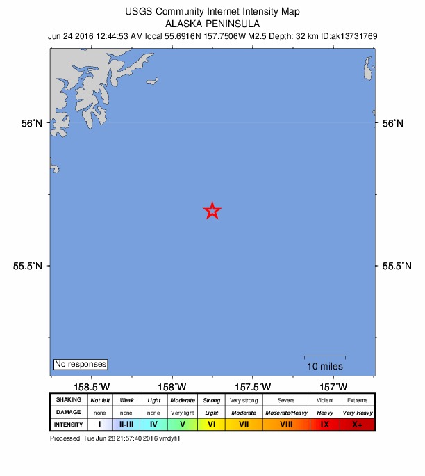
No one has reported feeling this quake to the USGS.
How well it is located
Reviewed by a seismologist.
- Stations used
- 16
Nearest places
Distance and direction from each place to the epicenter, with its forecast.
Nearby
Within 100 km, magnitude 1.5 and up: 46 in the 60 days after this one and 52 in the 30 days before it.
After
- 2.473 km SE of Perryville, Alaska · 3753 days ago · 27 km deep · 49 km away
- 2.165 km SSE of Perryville, Alaska · 3750 days ago · 27 km deep · 61 km away
- 2.028 km SE of Chignik, Alaska · 3750 days ago · 79 km deep · 51 km away
- 1.979 km SE of Perryville, Alaska · 3750 days ago · 27 km deep · 48 km away
- 1.957 km ESE of Chignik, Alaska · 3749 days ago · 52 km deep · 52 km away
- 2.246 km NE of Chignik, Alaska · 3747 days ago · 101 km deep · 98 km away
- 2.975 km SE of Perryville, Alaska · 3746 days ago · 25 km deep · 55 km away
- 2.360 km SSE of Perryville, Alaska · 3746 days ago · 2 km deep · 71 km away
- 2.376 km SE of Perryville, Alaska · 3745 days ago · 15 km deep · 53 km away
- 1.978 km SE of Perryville, Alaska · 3744 days ago · 22 km deep · 51 km away
- 3.195 km SSE of Perryville, Alaska · 3740 days ago · 11 km deep · 74 km away
- 2.686 km SSE of Perryville, Alaska · 3740 days ago · 21 km deep · 74 km away
- 2.572 km SE of Perryville, Alaska · 3739 days ago · 27 km deep · 56 km away
- 2.489 km SE of Chignik, Alaska · 3739 days ago · 48 km deep · 15 km away
- 2.373 km SE of Perryville, Alaska · 3735 days ago · 26 km deep · 50 km away
- 2.172 km E of Chignik, Alaska · 3735 days ago · 54 km deep · 69 km away
- 2.476 km SE of Perryville, Alaska · 3735 days ago · 26 km deep · 54 km away
- 1.863 km SE of Perryville, Alaska · 3732 days ago · 21 km deep · 47 km away
- 2.426 km SE of Chignik, Alaska · 3727 days ago · 62 km deep · 53 km away
- 2.477 km SE of Perryville, Alaska · 3727 days ago · 17 km deep · 53 km away
- 2.459 km SSE of Perryville, Alaska · 3725 days ago · 15 km deep · 63 km away
- 2.7Alaska Peninsula · 3723 days ago · 23 km deep · 49 km away
- 2.054 km SSE of Perryville, Alaska · 3721 days ago · 39 km deep · 72 km away
- 2.49 km WSW of Chignik Lake, Alaska · 3721 days ago · 5 km deep · 93 km away
- 2.369 km SE of Perryville, Alaska · 3720 days ago · 32 km deep · 56 km away
- 1.521 km NNE of Chignik, Alaska · 3719 days ago · 3 km deep · 93 km away
- 1.774 km SSE of Perryville, Alaska · 3718 days ago · 25 km deep · 62 km away
- 1.976 km ESE of Chignik, Alaska · 3717 days ago · 11 km deep · 58 km away
- 2.849 km ESE of Perryville, Alaska · 3716 days ago · 46 km deep · 45 km away
- 2.338 km SSE of Chignik, Alaska · 3715 days ago · 57 km deep · 41 km away
- 2.285 km ESE of Chignik, Alaska · 3714 days ago · 45 km deep · 61 km away
- 2.58 km WSW of Chignik Lake, Alaska · 3714 days ago · 6 km deep · 92 km away
- 3.477 km SE of Perryville, Alaska · 3714 days ago · 10 km deep · 55 km away
- 1.714 km N of Chignik Lake, Alaska · 3713 days ago · 99 km deep · 99 km away
- 2.377 km SE of Perryville, Alaska · 3712 days ago · 25 km deep · 54 km away
- 1.971 km SE of Perryville, Alaska · 3710 days ago · 15 km deep · 57 km away
- 1.8108 km E of Chignik, Alaska · 3707 days ago · 66 km deep · 90 km away
- 2.575 km SE of Perryville, Alaska · 3706 days ago · 15 km deep · 53 km away
- 1.8122 km ESE of Chignik, Alaska · 3704 days ago · 44 km deep · 88 km away
- 2.874 km SE of Perryville, Alaska · 3704 days ago · 17 km deep · 55 km away
- 2.861 km SE of Perryville, Alaska · 3703 days ago · 13 km deep · 52 km away
- 3.074 km SE of Perryville, Alaska · 3703 days ago · 15 km deep · 48 km away
- 2.4111 km SSE of Perryville, Alaska · 3702 days ago · 22 km deep · 96 km away
- 1.947 km E of Chignik, Alaska · 3701 days ago · 54 km deep · 61 km away
- 2.060 km ENE of Chignik, Alaska · 3696 days ago · 66 km deep · 87 km away
- 1.755 km SE of Perryville, Alaska · 3693 days ago · 46 km deep · 58 km away
Before
- 2.243 km SSE of Perryville, Alaska · 3755 days ago · 53 km deep · 77 km away
- 2.939 km NE of Chignik, Alaska · 3756 days ago · 77 km deep · 94 km away
- 2.774 km SE of Perryville, Alaska · 3758 days ago · 26 km deep · 51 km away
- 3.475 km SE of Perryville, Alaska · 3758 days ago · 14 km deep · 49 km away
- 3.071 km SE of Perryville, Alaska · 3758 days ago · 42 km deep · 52 km away
- 2.14 km E of Chignik, Alaska · 3760 days ago · 84 km deep · 77 km away
- 3.071 km SE of Perryville, Alaska · 3760 days ago · 26 km deep · 57 km away
- 2.366 km SE of Perryville, Alaska · 3760 days ago · 29 km deep · 51 km away
- 1.953 km SE of Chignik, Alaska · 3762 days ago · 0 km deep · 27 km away
- 2.873 km SE of Perryville, Alaska · 3764 days ago · 26 km deep · 54 km away
- 3.474 km SE of Perryville, Alaska · 3764 days ago · 20 km deep · 49 km away
- 2.167 km SE of Perryville, Alaska · 3766 days ago · 15 km deep · 58 km away
- 2.365 km SSE of Perryville, Alaska · 3768 days ago · 15 km deep · 59 km away
- 2.578 km SE of Perryville, Alaska · 3769 days ago · 56 km deep · 57 km away
- 3.294 km SSE of Chignik, Alaska · 3769 days ago · 23 km deep · 16 km away
- 2.174 km SE of Perryville, Alaska · 3769 days ago · 45 km deep · 55 km away
- 2.366 km SE of Perryville, Alaska · 3770 days ago · 26 km deep · 58 km away
- 2.372 km SE of Perryville, Alaska · 3770 days ago · 16 km deep · 57 km away
- 4.376 km SE of Perryville, Alaska · 3770 days ago · 25 km deep · 57 km away
- 2.6131 km SSE of Perryville, Alaska · 3771 days ago · 30 km deep · 94 km away
Earthquakes todayAlaska earthquakesLive radar here
Sources
From the USGS Earthquake Hazards Program and its partner networks, event ak0168387j0d (also filed as ak13731769, us200067pw). Read Sat, Oct 3, 2026, 8:27 PM UTC.