M2.7 earthquake 120 km ESE of Akutan, Alaska
A magnitude 2.7 earthquake struck 120 km ESE of Akutan, Alaska on Mon, Apr 11, 2016, 11:20 AM AKDT (19:20 UTC), 26 km (16 mi) below the surface.
A larger quake followed: M3.9 152 km S of False Pass, Alaska. This one was a foreshock.
Map
Where this earthquake was located, with the others nearby. Select one for its page.
The earthquake
- Magnitude
- 2.7 (ML, local (Richter)), micro
- Magnitude from
- USGS National Earthquake Information Center
- Local time
- UTC
- 2016-04-11 19:20:18 UTC
- Depth
- 25.8 km (16.0 mi), shallow
- Epicenter
- 53.752° N, 164.065° W
- Region
- Alaska
- Tsunami flag
- No
- Status
- Reviewed by a seismologist
Magnitude estimates
Different scales measure different things and differ by a few tenths. The USGS marks one as preferred, and it is the one this page uses.
| Mag. | Scale | Computed by | Notes |
|---|---|---|---|
| 2.7 | ML, local (Richter) | USGS National Earthquake Information Center | Preferred · Reviewed |
| 2.7 | ML, local (Richter) | Alaska Earthquake Center | Preliminary |
Did you feel it?
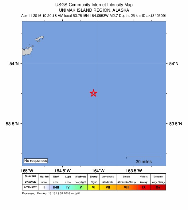
No one has reported feeling this quake to the USGS.
How well it is located
Reviewed by a seismologist.
- Location uncertainty
- About 7.9 km horizontally, 9.3 km in depth
- Stations used
- 23
Nearest places
Distance and direction from each place to the epicenter, with its forecast.
Nearby
Within 100 km, magnitude 1.5 and up: 84 in the 60 days after this one and 37 in the 30 days before it.
After
- 2.383 km SSE of Akutan, Alaska · 3827 days ago · 26 km deep · 86 km away
- 2.192 km SSW of False Pass, Alaska · 3827 days ago · 21 km deep · 41 km away
- 2.293 km SSW of False Pass, Alaska · 3827 days ago · 26 km deep · 41 km away
- 2.832 km ESE of Akutan, Alaska · 3826 days ago · 73 km deep · 88 km away
- 2.440 km ESE of Akutan, Alaska · 3826 days ago · 65 km deep · 81 km away
- 2.194 km SE of Akutan, Alaska · 3826 days ago · 25 km deep · 52 km away
- 3.093 km SE of Akutan, Alaska · 3826 days ago · 42 km deep · 47 km away
- 2.478 km SE of Akutan, Alaska · 3824 days ago · 50 km deep · 53 km away
- 2.691 km SE of Akutan, Alaska · 3824 days ago · 42 km deep · 52 km away
- 2.289 km SE of Akutan, Alaska · 3824 days ago · 20 km deep · 63 km away
- 2.383 km SE of Akutan, Alaska · 3823 days ago · 59 km deep · 48 km away
- 2.275 km ESE of Akutan, Alaska · 3819 days ago · 57 km deep · 48 km away
- 2.096 km SSE of Akutan, Alaska · 3818 days ago · 4 km deep · 84 km away
- 2.379 km SSE of Akutan, Alaska · 3816 days ago · 57 km deep · 99 km away
- 3.498 km SSW of False Pass, Alaska · 3815 days ago · 40 km deep · 32 km away
- 2.6109 km SSW of False Pass, Alaska · 3814 days ago · 44 km deep · 21 km away
- 1.674 km SSE of Akutan, Alaska · 3810 days ago · 6 km deep · 98 km away
- 1.963 km SSE of Akutan, Alaska · 3810 days ago · 65 km deep · 89 km away
- 1.950 km SE of Akutan, Alaska · 3809 days ago · 61 km deep · 79 km away
- 1.9103 km ESE of Akutan, Alaska · 3807 days ago · 56 km deep · 17 km away
- 2.074 km SE of Akutan, Alaska · 3806 days ago · 60 km deep · 71 km away
- 1.685 km SE of Akutan, Alaska · 3805 days ago · 14 km deep · 50 km away
- 2.069 km SSW of False Pass, Alaska · 3805 days ago · 67 km deep · 63 km away
- 2.759 km SW of False Pass, Alaska · 3805 days ago · 73 km deep · 74 km away
- 1.976 km SSE of Akutan, Alaska · 3802 days ago · 16 km deep · 97 km away
- 2.8108 km S of False Pass, Alaska · 3799 days ago · 25 km deep · 52 km away
- 2.190 km SE of Akutan, Alaska · 3799 days ago · 17 km deep · 66 km away
- 2.3128 km ESE of Akutan, Alaska · 3798 days ago · 14 km deep · 15 km away
- 2.838 km S of False Pass, Alaska · 3797 days ago · 78 km deep · 97 km away
- 3.569 km SSE of False Pass, Alaska · 3797 days ago · 50 km deep · 85 km away
- 2.3110 km SSW of False Pass, Alaska · 3797 days ago · 26 km deep · 20 km away
- 2.1108 km SSW of False Pass, Alaska · 3797 days ago · 55 km deep · 22 km away
- 2.446 km SE of Akutan, Alaska · 3796 days ago · 65 km deep · 85 km away
- 1.686 km SSE of Akutan, Alaska · 3796 days ago · 40 km deep · 79 km away
- 3.687 km SSE of Akutan, Alaska · 3796 days ago · 21 km deep · 74 km away
- 2.374 km SE of Akutan, Alaska · 3796 days ago · 50 km deep · 73 km away
- 2.386 km SSE of Akutan, Alaska · 3796 days ago · 20 km deep · 79 km away
- 2.988 km SSE of Akutan, Alaska · 3796 days ago · 34 km deep · 78 km away
- 1.872 km SSE of Akutan, Alaska · 3796 days ago · 24 km deep · 84 km away
- 2.7155 km S of False Pass, Alaska · 3795 days ago · 35 km deep · 40 km away
- 2.897 km SSE of False Pass, Alaska · 3794 days ago · 35 km deep · 84 km away
- 2.290 km S of False Pass, Alaska · 3793 days ago · 22 km deep · 42 km away
- 1.9Unimak Island region, Alaska · 3793 days ago · 55 km deep · 47 km away
- 2.673 km SSE of False Pass, Alaska · 3793 days ago · 39 km deep · 88 km away
- 1.927 km SE of Akutan, Alaska · 3791 days ago · 68 km deep · 94 km away
- 2.697 km SSE of False Pass, Alaska · 3791 days ago · 28 km deep · 78 km away
- 1.961 km E of Akutan, Alaska · 3790 days ago · 93 km deep · 72 km away
- 2.359 km E of Akutan, Alaska · 3789 days ago · 80 km deep · 76 km away
- 2.3129 km SE of Akutan, Alaska · 3789 days ago · 25 km deep · 55 km away
- 2.7115 km SSW of False Pass, Alaska · 3788 days ago · 34 km deep · 15 km away
- 3.057 km E of Akutan, Alaska · 3787 days ago · 79 km deep · 71 km away
- 2.2155 km S of False Pass, Alaska · 3785 days ago · 26 km deep · 48 km away
- 2.0113 km ESE of Akutan, Alaska · 3785 days ago · 25 km deep · 19 km away
- 2.286 km SE of Akutan, Alaska · 3784 days ago · 51 km deep · 58 km away
- 3.183 km SSE of Akutan, Alaska · 3783 days ago · 21 km deep · 77 km away
- 2.178 km SSE of Akutan, Alaska · 3783 days ago · 51 km deep · 80 km away
- 2.364 km SSE of Akutan, Alaska · 3783 days ago · 65 km deep · 85 km away
- 1.985 km SSE of Akutan, Alaska · 3783 days ago · 20 km deep · 85 km away
- 2.382 km SE of Akutan, Alaska · 3783 days ago · 35 km deep · 44 km away
- 2.1103 km S of False Pass, Alaska · 3783 days ago · 26 km deep · 35 km away
The first 60 of 84.
Before
- 2.180 km ESE of Akutan, Alaska · 3828 days ago · 59 km deep · 40 km away
- 2.477 km E of Akutan, Alaska · 3829 days ago · 71 km deep · 59 km away
- 2.537 km S of False Pass, Alaska · 3830 days ago · 9 km deep · 94 km away
- 2.785 km E of Akutan, Alaska · 3831 days ago · 64 km deep · 48 km away
- 2.799 km SSW of False Pass, Alaska · 3831 days ago · 29 km deep · 37 km away
- 2.5109 km ESE of Akutan, Alaska · 3832 days ago · 36 km deep · 15 km away
- 3.5105 km ESE of Akutan, Alaska · 3832 days ago · 23 km deep · 18 km away
- 2.083 km SSE of Akutan, Alaska · 3832 days ago · 26 km deep · 87 km away
- 2.250 km SSW of False Pass, Alaska · 3832 days ago · 18 km deep · 82 km away
- 2.186 km E of Akutan, Alaska · 3833 days ago · 64 km deep · 49 km away
- 2.278 km ENE of Akutan, Alaska · 3834 days ago · 79 km deep · 75 km away
- 2.4110 km ESE of Akutan, Alaska · 3835 days ago · 54 km deep · 14 km away
- 2.6121 km S of False Pass, Alaska · 3835 days ago · 52 km deep · 35 km away
- 2.646 km SE of Akutan, Alaska · 3837 days ago · 64 km deep · 82 km away
- 2.169 km SE of Akutan, Alaska · 3838 days ago · 54 km deep · 58 km away
- 1.885 km SSE of Akutan, Alaska · 3842 days ago · 15 km deep · 86 km away
- 2.4127 km SE of Akutan, Alaska · 3842 days ago · 71 km deep · 70 km away
- 1.8109 km SE of Akutan, Alaska · 3846 days ago · 22 km deep · 53 km away
- 1.8Unimak Island region, Alaska · 3846 days ago · 62 km deep · 57 km away
- 1.7104 km SE of Akutan, Alaska · 3846 days ago · 14 km deep · 61 km away
Earthquakes todayAlaska earthquakesLive radar here
Sources
From the USGS Earthquake Hazards Program and its partner networks, event us20005jnj (also filed as ak13425091, ak0164p08yl9). Read Sun, Oct 4, 2026, 11:05 PM UTC.