M5.3 earthquake 130 km WSW of Adak, Alaska
A magnitude 5.3 earthquake struck 130 km WSW of Adak, Alaska on Sun, Jul 3, 2016, 7:13 AM HADT (16:13 UTC), 37 km (23 mi) below the surface.
Map
Where this earthquake was located, with the others nearby. Select one for its page.
The earthquake
- Magnitude
- 5.3 (mb, body-wave), moderate
- Magnitude from
- USGS National Earthquake Information Center
- Local time
- UTC
- 2016-07-03 16:13:34 UTC
- Depth
- 37.5 km (23.3 mi), shallow
- Epicenter
- 51.614° N, 178.479° W
- Region
- Alaska
- Strongest shaking
- IV, light shaking
- Tsunami flag
- Yes: a large quake in an oceanic region
- Status
- Reviewed by a seismologist
Magnitude estimates
Different scales measure different things and differ by a few tenths. The USGS marks one as preferred, and it is the one this page uses.
| Mag. | Scale | Computed by | Notes |
|---|---|---|---|
| 5.3 | mb, body-wave | USGS National Earthquake Information Center | Preferred · Reviewed · ±0.022 · 684 stations |
| 5.07 | Mw, moment | ISC-GEM global catalog | Final · ±0.1 |
| 5.3 | mb, body-wave | Alaska Earthquake Center | Preliminary |
| 5.1 | mb, body-wave | NOAA National Tsunami Warning Center | Reviewed · 23 stations |
Tsunami
The USGS flags a quake this large in an oceanic region. The flag does not mean a tsunami happened; the tsunami warning centers decide that, and their messages are below when they issued any.
Current tsunami warnings: tsunami.gov. Warnings in force in the US also appear on our alerts pages.
Shaking
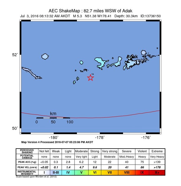
The USGS ShakeMap: shaking estimated from seismic stations and the quake’s size, on the Modified Mercalli intensity scale.
- Strongest estimated
- IV, light shaking
- Map
- Automatic
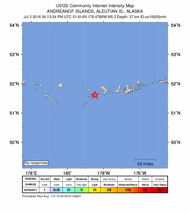
Did you feel it?
No one has reported feeling this quake to the USGS.
How well it is located
Reviewed by a seismologist.
- Location uncertainty
- About 4.9 km horizontally, 3.9 km in depth
- Magnitude uncertainty
- ±0.02
- Depth from
- From location
- Station coverage gap
- 35°
- Stations used
- 796
Nearby
Within 100 km, magnitude 2.3 and up: 40 in the 60 days after this one and 14 in the 30 days before it.
After
- 2.9136 km WSW of Adak, Alaska · 3745 days ago · 20 km deep · 28 km away
- 2.6135 km WSW of Adak, Alaska · 3744 days ago · 26 km deep · 25 km away
- 2.3200 km W of Adak, Alaska · 3744 days ago · 164 km deep · 87 km away
- 2.478 km W of Adak, AK · 3742 days ago · 81 km deep · 63 km away
- 2.575 km W of Adak, Alaska · 3742 days ago · 85 km deep · 57 km away
- 3.0134 km WSW of Adak, Alaska · 3740 days ago · 34 km deep · 21 km away
- 2.4135 km WSW of Adak, Alaska · 3739 days ago · 21 km deep · 24 km away
- 2.4110 km WSW of Adak, Alaska · 3737 days ago · 13 km deep · 22 km away
- 4.4107 km WSW of Adak, Alaska · 3737 days ago · 49 km deep · 39 km away
- 2.3128 km SW of Adak, Alaska · 3736 days ago · 14 km deep · 58 km away
- 3.2115 km SW of Adak, Alaska · 3734 days ago · 26 km deep · 56 km away
- 3.9190 km WSW of Adak, Alaska · 3734 days ago · 38 km deep · 65 km away
- 2.4165 km WSW of Adak, Alaska · 3733 days ago · 26 km deep · 59 km away
- 2.4140 km WNW of Adak, Alaska · 3731 days ago · 163 km deep · 83 km away
- 2.6198 km W of Adak, Alaska · 3729 days ago · 118 km deep · 74 km away
- 2.4215 km W of Adak, Alaska · 3729 days ago · 85 km deep · 89 km away
- 2.7216 km WSW of Adak, Alaska · 3729 days ago · 8 km deep · 96 km away
- 2.4222 km WSW of Adak, Alaska · 3727 days ago · 62 km deep · 91 km away
- 2.9222 km W of Adak, Alaska · 3726 days ago · 81 km deep · 94 km away
- 2.787 km WSW of Adak, Alaska · 3724 days ago · 58 km deep · 47 km away
- 2.7197 km W of Adak, Alaska · 3722 days ago · 13 km deep · 72 km away
- 2.3136 km W of Adak, Alaska · 3718 days ago · 164 km deep · 53 km away
- 4.4186 km WSW of Adak, Alaska · 3717 days ago · 11 km deep · 58 km away
- 3.150 km SW of Adak, Alaska · 3716 days ago · 53 km deep · 96 km away
- 3.2133 km SW of Adak, Alaska · 3715 days ago · 26 km deep · 59 km away
- 3.5106 km SW of Adak, Alaska · 3713 days ago · 26 km deep · 69 km away
- 2.891 km SW of Adak, Alaska · 3712 days ago · 37 km deep · 57 km away
- 2.5200 km WSW of Adak, Alaska · 3710 days ago · 25 km deep · 77 km away
- 2.4203 km WSW of Adak, Alaska · 3709 days ago · 64 km deep · 73 km away
- 2.576 km SW of Adak, Alaska · 3708 days ago · 38 km deep · 67 km away
- 2.957 km SW of Adak, Alaska · 3707 days ago · 31 km deep · 94 km away
- 3.087 km WSW of Adak, Alaska · 3703 days ago · 22 km deep · 55 km away
- 2.3135 km WSW of Adak, Alaska · 3700 days ago · 65 km deep · 19 km away
- 2.4187 km W of Adak, Alaska · 3700 days ago · 171 km deep · 71 km away
- 2.7179 km WSW of Adak, Alaska · 3697 days ago · 26 km deep · 61 km away
- 2.7194 km WSW of Adak, Alaska · 3695 days ago · 70 km deep · 63 km away
- 2.5192 km WSW of Adak, Alaska · 3695 days ago · 26 km deep · 71 km away
- 2.7213 km W of Adak, Alaska · 3695 days ago · 188 km deep · 96 km away
- 2.3154 km WSW of Adak, Alaska · 3691 days ago · 17 km deep · 23 km away
- 3.8118 km SW of Adak, Alaska · 3686 days ago · 27 km deep · 79 km away
Before
- 2.575 km WSW of Adak, Alaska · 3749 days ago · 53 km deep · 63 km away
- 2.5120 km WSW of Adak, Alaska · 3751 days ago · 26 km deep · 20 km away
- 3.799 km W of Adak, Alaska · 3751 days ago · 98 km deep · 32 km away
- 4.0198 km WSW of Adak, Alaska · 3752 days ago · 76 km deep · 68 km away
- 2.543 km WSW of Adak, Alaska · 3757 days ago · 16 km deep · 87 km away
- 2.5138 km W of Adak, Alaska · 3759 days ago · 82 km deep · 15 km away
- 2.6142 km WSW of Adak, Alaska · 3760 days ago · 43 km deep · 41 km away
- 2.774 km SW of Adak, Alaska · 3763 days ago · 26 km deep · 69 km away
- 5.139 km SW of Adak, Alaska · 3764 days ago · 54 km deep · 98 km away · tsunami flag
- 3.1128 km W of Adak, Alaska · 3764 days ago · 103 km deep · 20 km away
- 2.6128 km W of Adak, Alaska · 3770 days ago · 13 km deep · 27 km away
- 2.7209 km WSW of Adak, Alaska · 3773 days ago · 68 km deep · 79 km away
- 2.497 km SW of Adak, Alaska · 3774 days ago · 37 km deep · 69 km away
- 2.6197 km WSW of Adak, Alaska · 3775 days ago · 25 km deep · 77 km away
Earthquakes todayAlaska earthquakesLive radar here
Sources
From the USGS Earthquake Hazards Program and its partner networks, event us10005zmh (also filed as ak13736150, at00o9qyel, ak0168i80zvc, iscgem609069898). Read Sun, Oct 4, 2026, 4:09 PM UTC.