M2.5 earthquake 45 km SW of Unalaska, Alaska
A magnitude 2.5 earthquake struck 45 km SW of Unalaska, Alaska on Thu, Nov 19, 2015, 9:23 AM AKST (18:23 UTC), 93 km (58 mi) below the surface.
A larger quake followed: M4.1 79 km S of Unalaska, Alaska. This one was a foreshock.
Map
Where this earthquake was located, with the others nearby. Select one for its page.
The earthquake
- Magnitude
- 2.5 (ML, local (Richter)), micro
- Magnitude from
- Alaska Earthquake Center
- Local time
- UTC
- 2015-11-19 18:23:37 UTC
- Depth
- 93.2 km (57.9 mi), intermediate-depth
- Epicenter
- 53.571° N, 167.003° W
- Region
- Alaska
- Tsunami flag
- No
- Status
- Reviewed by a seismologist
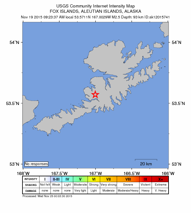
Did you feel it?
No one has reported feeling this quake to the USGS.
How well it is located
Reviewed by a seismologist.
- Stations used
- 19
Nearest places
Distance and direction from each place to the epicenter, with its forecast.
Nearby
Within 100 km, magnitude 1.5 and up: 79 in the 60 days after this one and 41 in the 30 days before it.
After
- 2.077 km S of Unalaska, Alaska · 3971 days ago · 29 km deep · 47 km away
- 2.065 km SE of Unalaska, Alaska · 3971 days ago · 12 km deep · 81 km away
- 1.967 km SE of Unalaska, Alaska · 3971 days ago · 35 km deep · 83 km away
- 2.155 km SSW of Unalaska, Alaska · 3971 days ago · 63 km deep · 25 km away
- 1.654 km SW of Unalaska, Alaska · 3970 days ago · 15 km deep · 15 km away
- 1.771 km SE of Unalaska, Alaska · 3970 days ago · 43 km deep · 88 km away
- 3.9129 km S of Unalaska, Alaska · 3970 days ago · 26 km deep · 100 km away
- 2.132 km S of Akutan, Alaska · 3970 days ago · 79 km deep · 84 km away
- 1.666 km SW of Unalaska, Alaska · 3969 days ago · 9 km deep · 21 km away
- 2.023 km W of Dutch Harbor, Alaska · 3969 days ago · 8 km deep · 33 km away
- 2.5123 km S of Unalaska, Alaska · 3968 days ago · 5 km deep · 93 km away
- 2.5121 km S of Unalaska, Alaska · 3968 days ago · 23 km deep · 87 km away
- 2.230 km WSW of Unalaska, Alaska · 3967 days ago · 118 km deep · 23 km away
- 1.773 km SW of Unalaska, Alaska · 3967 days ago · 20 km deep · 29 km away
- 1.552 km SW of Unalaska, Alaska · 3967 days ago · 14 km deep · 7 km away
- 1.620 km E of Unalaska, Alaska · 3966 days ago · 74 km deep · 62 km away
- 2.046 km SSW of Unalaska, Alaska · 3965 days ago · 63 km deep · 22 km away
- 2.083 km SE of Unalaska, Alaska · 3965 days ago · 19 km deep · 89 km away
- 2.057 km SE of Unalaska, Alaska · 3965 days ago · 43 km deep · 70 km away
- 1.850 km SE of Unalaska, Alaska · 3965 days ago · 48 km deep · 70 km away
- 1.980 km S of Unalaska, Alaska · 3964 days ago · 26 km deep · 50 km away
- 2.2110 km SSW of Unalaska, Alaska · 3962 days ago · 49 km deep · 72 km away
- 1.885 km SE of Unalaska, Alaska · 3962 days ago · 23 km deep · 94 km away
- 1.765 km S of Akutan, Alaska · 3961 days ago · 49 km deep · 87 km away
- 2.364 km SE of Unalaska, Alaska · 3960 days ago · 26 km deep · 80 km away
- 2.7104 km E of Nikolski, Alaska · 3960 days ago · 29 km deep · 63 km away
- 1.885 km SSW of Unalaska, Alaska · 3958 days ago · 26 km deep · 51 km away
- 3.576 km S of Akutan, Alaska · 3957 days ago · 59 km deep · 94 km away
- 1.981 km SE of Unalaska, Alaska · 3957 days ago · 20 km deep · 94 km away
- 1.657 km SSW of Unalaska, Alaska · 3954 days ago · 70 km deep · 14 km away
- 1.888 km S of Unalaska, Alaska · 3954 days ago · 18 km deep · 67 km away
- 2.0129 km ESE of Nikolski, Alaska · 3953 days ago · 5 km deep · 95 km away
- 2.276 km SW of Unalaska, Alaska · 3952 days ago · 64 km deep · 31 km away
- 1.875 km SE of Unalaska, Alaska · 3951 days ago · 40 km deep · 81 km away
- 1.769 km SE of Unalaska, Alaska · 3950 days ago · 36 km deep · 82 km away
- 2.090 km SE of Unalaska, Alaska · 3949 days ago · 20 km deep · 93 km away
- 2.076 km SW of Unalaska, Alaska · 3949 days ago · 13 km deep · 31 km away
- 2.635 km SE of Unalaska, Alaska · 3948 days ago · 42 km deep · 51 km away
- 2.179 km SSW of Unalaska, Alaska · 3948 days ago · 26 km deep · 46 km away
- 2.422 km ESE of Unalaska, Alaska · 3947 days ago · 85 km deep · 59 km away
- 2.185 km ENE of Nikolski, Alaska · 3945 days ago · 49 km deep · 65 km away
- 2.177 km E of Nikolski, Alaska · 3945 days ago · 33 km deep · 96 km away
- 2.376 km ENE of Nikolski, Alaska · 3944 days ago · 77 km deep · 66 km away
- 1.829 km ESE of Unalaska, Alaska · 3941 days ago · 72 km deep · 60 km away
- 1.969 km SE of Unalaska, Alaska · 3940 days ago · 23 km deep · 87 km away
- 3.887 km ENE of Nikolski, Alaska · 3939 days ago · 97 km deep · 55 km away
- 1.733 km SSW of Unalaska, Alaska · 3939 days ago · 70 km deep · 16 km away
- 1.866 km WSW of Unalaska, Alaska · 3939 days ago · 13 km deep · 30 km away
- 2.078 km S of Unalaska, Alaska · 3938 days ago · 34 km deep · 52 km away
- 2.580 km S of Unalaska, Alaska · 3937 days ago · 26 km deep · 49 km away
- 2.075 km SE of Unalaska, Alaska · 3937 days ago · 49 km deep · 89 km away
- 2.2Fox Islands, Aleutian Islands, Alaska · 3936 days ago · 57 km deep · 41 km away
- 2.061 km S of Unalaska, Alaska · 3935 days ago · 38 km deep · 50 km away
- 2.644 km SSW of Unalaska, Alaska · 3935 days ago · 95 km deep · 15 km away
- 2.243 km S of Akutan, Alaska · 3935 days ago · 32 km deep · 90 km away
- 2.777 km SSW of Unalaska, Alaska · 3934 days ago · 44 km deep · 42 km away
- 1.982 km S of Unalaska, Alaska · 3932 days ago · 20 km deep · 52 km away
- 1.995 km S of Unalaska, Alaska · 3931 days ago · 24 km deep · 63 km away
- 1.551 km ESE of Unalaska, Alaska · 3930 days ago · 27 km deep · 75 km away
- 2.247 km NE of Nikolski, Alaska · 3929 days ago · 12 km deep · 97 km away
The first 60 of 79.
Before
- 2.065 km SE of Unalaska, Alaska · 3972 days ago · 24 km deep · 80 km away
- 2.856 km SW of Unalaska, Alaska · 3973 days ago · 20 km deep · 12 km away
- 1.980 km SW of Unalaska, Alaska · 3973 days ago · 75 km deep · 36 km away
- 2.076 km SW of Unalaska, Alaska · 3974 days ago · 13 km deep · 32 km away
- 2.592 km WNW of Dutch Harbor, Alaska · 3974 days ago · 155 km deep · 83 km away
- 2.556 km S of Akutan, Alaska · 3974 days ago · 26 km deep · 81 km away
- 2.1128 km S of Unalaska, Alaska · 3974 days ago · 10 km deep · 100 km away
- 1.751 km SW of Unalaska, Alaska · 3975 days ago · 15 km deep · 6 km away
- 1.7Fox Islands, Aleutian Islands, Alaska · 3975 days ago · 27 km deep · 75 km away
- 2.373 km SSW of Unalaska, Alaska · 3976 days ago · 50 km deep · 40 km away
- 2.148 km NE of Nikolski, Alaska · 3976 days ago · 81 km deep · 99 km away
- 2.130 km WSW of Unalaska, Alaska · 3978 days ago · 109 km deep · 21 km away
- 2.522 km S of Unalaska, Alaska · 3979 days ago · 75 km deep · 34 km away
- 1.715 km WSW of Dutch Harbor, Alaska · 3979 days ago · 7 km deep · 35 km away
- 1.918 km E of Unalaska, Alaska · 3979 days ago · 78 km deep · 58 km away
- 2.471 km S of Unalaska, Alaska · 3980 days ago · 22 km deep · 49 km away
- 1.773 km SW of Unalaska, Alaska · 3980 days ago · 30 km deep · 29 km away
- 3.970 km WSW of Dutch Harbor, Alaska · 3980 days ago · 149 km deep · 42 km away
- 2.255 km SE of Unalaska, Alaska · 3983 days ago · 46 km deep · 72 km away
- 2.6109 km S of Unalaska, Alaska · 3983 days ago · 17 km deep · 77 km away
Earthquakes todayAlaska earthquakesLive radar here
Sources
From the USGS Earthquake Hazards Program and its partner networks, event ak015euhfws2 (also filed as ak12015741). Read Sun, Oct 4, 2026, 11:00 PM UTC.