M3.0 earthquake 11 km N of Summit Park, Utah
A magnitude 3.0 earthquake struck 11 km N of Summit Park, Utah on Sat, May 9, 2015, 11:41 AM MDT (17:41 UTC), 12 km (7 mi) below the surface.
Map
Where this earthquake was located, with the others nearby. Select one for its page.
The earthquake
- Magnitude
- 3.0 (ML, local (Richter)), micro
- Magnitude from
- University of Utah Seismograph Stations
- Local time
- UTC
- 2015-05-09 17:41:45 UTC
- Depth
- 12.0 km (7.4 mi), shallow
- Epicenter
- 40.846° N, 111.593° W
- Region
- Utah
- Felt reports
- 16
- Strongest shaking
- III, weak shaking
- Tsunami flag
- No
- Status
- Reviewed by a seismologist
Magnitude estimates
Different scales measure different things and differ by a few tenths. The USGS marks one as preferred, and it is the one this page uses.
| Mag. | Scale | Computed by | Notes |
|---|---|---|---|
| 2.95 | ML, local (Richter) | University of Utah Seismograph Stations | Preferred · Final · ±0.189 · 21 stations |
| 3.0 | ML, local (Richter) | USGS National Earthquake Information Center | Reviewed · ±0.189 · 21 stations |
What happened
The USGS’s account of the effects of this earthquake.
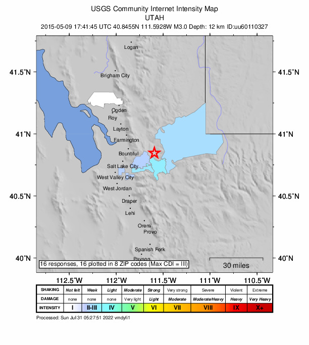
Felt (III) at Park City and Salt Lake City. Also felt at American Fork, Bountiful, Coalville, Kamas and South Jordan.
From the USGS event page for uu60110327. U.S. Geological Survey text and figures are in the public domain.
Shaking
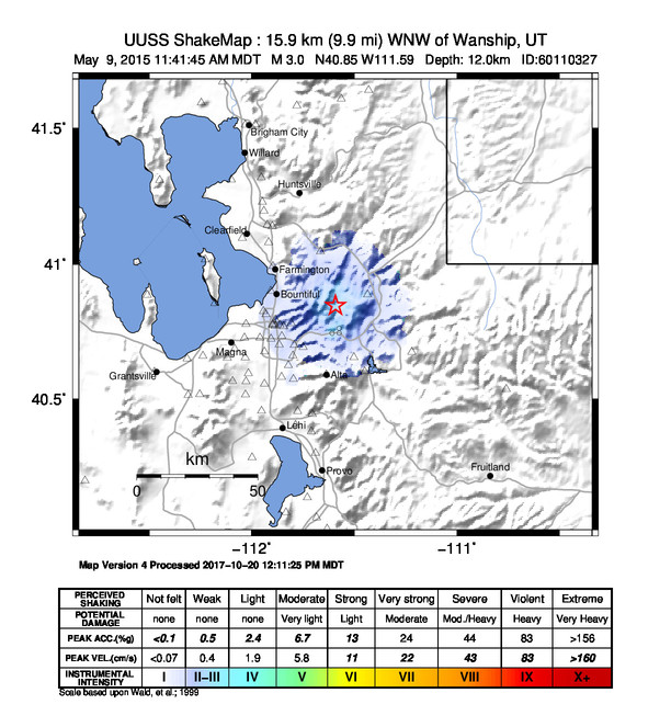
The USGS ShakeMap: shaking estimated from seismic stations and the quake’s size, on the Modified Mercalli intensity scale.
- Strongest estimated
- III, weak shaking
- Peak ground acceleration
- 56.0% of gravity
- Peak ground velocity
- 0.1 cm/s
- Map
- Automatic
Did you feel it?
16 people reported to the USGS what they felt; the strongest reported shaking was III, weak shaking.
How well it is located
Reviewed by a seismologist.
- Location uncertainty
- About 0.3 km horizontally, 0.4 km in depth
- Magnitude uncertainty
- ±0.19
- Depth from
- From location
- Station coverage gap
- 57°
- Stations used
- 70
Nearest places
Distance and direction from each place to the epicenter, with its forecast.
Nearby
Within 100 km, magnitude 1.5 and up: 6 in the 60 days after this one and 6 in the 30 days before it.
After
- 1.810 km N of Summit Park, Utah · 4166 days ago · 11 km deep · 1 km away
- 1.624 km SE of Evanston, Wyoming · 4156 days ago · 14 km deep · 73 km away
- 1.615 km ENE of Huntsville, Utah · 4153 days ago · 5 km deep · 54 km away
- 1.619 km E of Huntsville, Utah · 4133 days ago · 6 km deep · 47 km away
- 1.721 km W of Tabiona, Utah · 4133 days ago · 2 km deep · 77 km away
- 2.116 km SSW of Robertson, Wyoming · 4130 days ago · 3 km deep · 97 km away
Before
- 1.516 km ESE of Independence, Utah · 4174 days ago · 13 km deep · 79 km away
- 1.920 km NNW of Tabiona, Utah · 4175 days ago · 12 km deep · 75 km away
- 1.7Utah · 4182 days ago · 1 km deep · 74 km away
- 2.017 km E of Independence, Utah · 4182 days ago · 0 km deep · 73 km away
- 1.60 km WNW of Huntsville, Utah · 4193 days ago · 5 km deep · 49 km away
- 2.17 km NE of Provo, Utah · 4196 days ago · -3 km deep · 64 km away
Earthquakes todayUtah earthquakesLive radar here
Sources
From the USGS Earthquake Hazards Program and its partner networks, event uu60110327 (also filed as us20002e3g). Read Sun, Oct 4, 2026, 7:06 PM UTC.