M4.7 earthquake 63 km ESE of Arica, Chile
A magnitude 4.7 earthquake struck 63 km ESE of Arica, Chile on Mon, Nov 16, 2015, 1:55 AM GMT-3 (04:55 UTC), 78 km (49 mi) below the surface.
A larger quake followed: M4.9 42 km SE of Arica, Chile. This one was a foreshock.
Map
Where this earthquake was located, with the others nearby. Select one for its page.
The earthquake
- Magnitude
- 4.7 (mb, body-wave), light
- Magnitude from
- USGS National Earthquake Information Center
- Local time
- UTC
- 2015-11-16 04:55:35 UTC
- Depth
- 78.1 km (48.6 mi), intermediate-depth
- Epicenter
- 18.752° S, 69.770° W
- Region
- Chile
- Felt reports
- 1
- Tsunami flag
- No
- Status
- Reviewed by a seismologist
What happened
The USGS’s account of the effects of this earthquake.
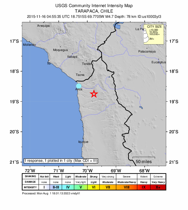
Felt (IV) at Poconchile and (III) at Arica. Felt (II) at Tacna, Peru.
From the USGS event page for us10003yl3. U.S. Geological Survey text and figures are in the public domain.
Did you feel it?
1 person reported to the USGS what they felt; the strongest reported shaking was III, weak shaking.
How well it is located
Reviewed by a seismologist.
- Location uncertainty
- About 6.0 km horizontally, 5.7 km in depth
- Magnitude uncertainty
- ±0.07
- Depth from
- From location
- Station coverage gap
- 92°
- Stations used
- 94
Nearest places
Distance and direction from each place to the epicenter, with its forecast.
Nearby
Within 100 km, magnitude 1.7 and up: 6 in the 60 days after this one and 1 in the 30 days before it.
After
- 4.7132 km NE of Iquique, Chile · 3970 days ago · 100 km deep · 81 km away
- 4.471 km ESE of Palca, Peru · 3965 days ago · 126 km deep · 90 km away
- 4.451 km SE of Palca, Peru · 3959 days ago · 144 km deep · 78 km away
- 4.942 km SE of Arica, Chile · 3950 days ago · 100 km deep · 24 km away · felt by 3
- 4.717 km ENE of Arica, Chile · 3932 days ago · 52 km deep · 55 km away
- 4.890 km S of Arica, Chile · 3914 days ago · 55 km deep · 73 km away · felt by 5
Before
Earthquakes todayChile earthquakesLive radar here
Sources
From the USGS Earthquake Hazards Program and its partner networks, event us10003yl3. Read Thu, Oct 1, 2026, 3:36 AM UTC.