M3.2 earthquake 12 km SE of Akutan, Alaska
A magnitude 3.2 earthquake struck 12 km SE of Akutan, Alaska on Wed, Dec 30, 2015, 11:01 AM AKST (20:01 UTC), 104 km (65 mi) below the surface.
A larger quake followed: M4.1 80 km SSE of Akutan, Alaska. This one was a foreshock.
Map
Where this earthquake was located, with the others nearby. Select one for its page.
The earthquake
- Magnitude
- 3.2 (ML, local (Richter)), minor
- Magnitude from
- USGS National Earthquake Information Center
- Local time
- UTC
- 2015-12-30 20:01:41 UTC
- Depth
- 104.3 km (64.8 mi), intermediate-depth
- Epicenter
- 54.048° N, 165.649° W
- Region
- Alaska
- Tsunami flag
- No
- Status
- Reviewed by a seismologist
Magnitude estimates
Different scales measure different things and differ by a few tenths. The USGS marks one as preferred, and it is the one this page uses.
| Mag. | Scale | Computed by | Notes |
|---|---|---|---|
| 3.2 | ML, local (Richter) | USGS National Earthquake Information Center | Preferred · Reviewed |
| 3.2 | ML, local (Richter) | Alaska Earthquake Center | Preliminary |
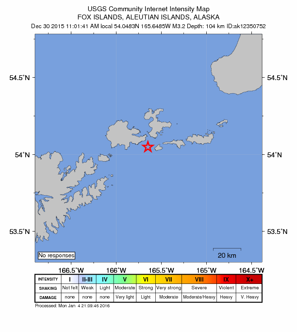
Did you feel it?
No one has reported feeling this quake to the USGS.
How well it is located
Reviewed by a seismologist.
- Location uncertainty
- About 8.4 km horizontally, 6.0 km in depth
- Stations used
- 44
Nearest places
Distance and direction from each place to the epicenter, with its forecast.
Nearby
Within 100 km, magnitude 1.5 and up: 83 in the 60 days after this one and 45 in the 30 days before it.
After
- 1.551 km ESE of Unalaska, Alaska · 3929 days ago · 27 km deep · 48 km away
- 1.838 km S of Unalaska, Alaska · 3928 days ago · 21 km deep · 85 km away
- 3.975 km SE of Unalaska, Alaska · 3928 days ago · 55 km deep · 72 km away
- 2.089 km SE of Akutan, Alaska · 3927 days ago · 42 km deep · 76 km away
- 2.851 km E of Akutan, Alaska · 3926 days ago · 66 km deep · 43 km away
- 3.484 km SE of Akutan, Alaska · 3923 days ago · 28 km deep · 72 km away
- 2.189 km SE of Akutan, Alaska · 3923 days ago · 16 km deep · 77 km away
- 2.099 km SE of Akutan, Alaska · 3922 days ago · 47 km deep · 87 km away
- 2.238 km S of Akutan, Alaska · 3922 days ago · 71 km deep · 31 km away
- 4.083 km SE of Akutan, Alaska · 3922 days ago · 42 km deep · 71 km away
- 1.869 km SE of Unalaska, Alaska · 3922 days ago · 11 km deep · 68 km away
- 3.633 km SE of Unalaska, Alaska · 3922 days ago · 70 km deep · 51 km away
- 2.379 km SE of Akutan, Alaska · 3922 days ago · 62 km deep · 67 km away
- 2.131 km SSW of Akutan, Alaska · 3921 days ago · 72 km deep · 27 km away
- 2.271 km SE of Akutan, Alaska · 3921 days ago · 61 km deep · 59 km away
- 1.764 km S of Akutan, Alaska · 3919 days ago · 24 km deep · 55 km away
- 2.123 km W of Akutan, Alaska · 3919 days ago · 111 km deep · 34 km away
- 1.622 km SSE of Unalaska, Alaska · 3918 days ago · 75 km deep · 67 km away
- 2.425 km NNE of Akutan, Alaska · 3915 days ago · 109 km deep · 33 km away
- 2.235 km NE of Akutan, Alaska · 3915 days ago · 80 km deep · 38 km away
- 3.390 km SE of Akutan, Alaska · 3913 days ago · 32 km deep · 78 km away
- 2.489 km SE of Akutan, Alaska · 3913 days ago · 50 km deep · 77 km away
- 2.271 km SSE of Akutan, Alaska · 3913 days ago · 49 km deep · 59 km away
- 3.295 km SE of Akutan, Alaska · 3913 days ago · 25 km deep · 83 km away
- 2.148 km SSE of Unalaska, Alaska · 3912 days ago · 48 km deep · 71 km away
- 2.295 km E of Akutan, Alaska · 3912 days ago · 43 km deep · 87 km away
- 1.948 km ESE of Unalaska, Alaska · 3912 days ago · 25 km deep · 46 km away
- 2.271 km E of Akutan, Alaska · 3911 days ago · 74 km deep · 65 km away
- 1.725 km SW of Akutan, Alaska · 3910 days ago · 80 km deep · 26 km away
- 1.654 km S of Akutan, Alaska · 3910 days ago · 48 km deep · 46 km away
- 1.715 km SW of Unalaska, Alaska · 3908 days ago · 100 km deep · 74 km away
- 1.839 km SE of Akutan, Alaska · 3908 days ago · 66 km deep · 28 km away
- 1.977 km SSE of Akutan, Alaska · 3908 days ago · 55 km deep · 65 km away
- 1.961 km SE of Unalaska, Alaska · 3908 days ago · 26 km deep · 67 km away
- 3.982 km SSE of Akutan, Alaska · 3907 days ago · 40 km deep · 70 km away
- 2.692 km ESE of Akutan, Alaska · 3907 days ago · 44 km deep · 80 km away
- 2.072 km SE of Unalaska, Alaska · 3903 days ago · 24 km deep · 77 km away
- 2.181 km SE of Akutan, Alaska · 3902 days ago · 57 km deep · 69 km away
- 2.07 km ENE of Unalaska, Alaska · 3901 days ago · 12 km deep · 54 km away
- 1.518 km W of Akutan, Alaska · 3900 days ago · 16 km deep · 28 km away
- 2.37 km SW of Akutan, Alaska · 3899 days ago · 109 km deep · 14 km away
- 1.57 km ENE of Unalaska, Alaska · 3899 days ago · 9 km deep · 54 km away
- 2.986 km SE of Akutan, Alaska · 3898 days ago · 51 km deep · 73 km away
- 1.739 km ESE of Unalaska, Alaska · 3898 days ago · 71 km deep · 36 km away
- 2.386 km SE of Unalaska, Alaska · 3897 days ago · 20 km deep · 89 km away
- 2.345 km SSE of Akutan, Alaska · 3895 days ago · 56 km deep · 33 km away
- 2.135 km SSW of Unalaska, Alaska · 3895 days ago · 76 km deep · 91 km away
- 1.851 km ESE of Unalaska, Alaska · 3894 days ago · 25 km deep · 45 km away
- 1.737 km WSW of Unalaska, Alaska · 3894 days ago · 15 km deep · 98 km away
- 1.68 km NNW of Dutch Harbor, Alaska · 3894 days ago · 7 km deep · 62 km away
- 2.296 km SE of Unalaska, Alaska · 3893 days ago · 26 km deep · 93 km away
- 1.970 km SE of Unalaska, Alaska · 3893 days ago · 36 km deep · 80 km away
- 1.928 km S of Akutan, Alaska · 3892 days ago · 68 km deep · 23 km away
- 2.084 km SE of Akutan, Alaska · 3891 days ago · 50 km deep · 71 km away
- 1.864 km SE of Unalaska, Alaska · 3890 days ago · 26 km deep · 57 km away
- 2.498 km E of Akutan, Alaska · 3890 days ago · 29 km deep · 88 km away
- 2.180 km SE of Unalaska, Alaska · 3890 days ago · 42 km deep · 87 km away
- 4.180 km SSE of Akutan, Alaska · 3889 days ago · 51 km deep · 68 km away
- 3.6Fox Islands, Aleutian Islands, Alaska · 3889 days ago · 24 km deep · 74 km away
- 1.850 km SSE of Unalaska, Alaska · 3888 days ago · 45 km deep · 70 km away
The first 60 of 83.
Before
- 1.967 km SE of Akutan, Alaska · 3931 days ago · 43 km deep · 55 km away
- 3.384 km SE of Akutan, Alaska · 3933 days ago · 54 km deep · 72 km away
- 3.689 km SE of Akutan, Alaska · 3933 days ago · 46 km deep · 77 km away
- 2.588 km SE of Akutan, Alaska · 3934 days ago · 45 km deep · 76 km away
- 2.491 km NNE of Akutan, Alaska · 3934 days ago · 139 km deep · 96 km away
- 2.243 km S of Akutan, Alaska · 3934 days ago · 32 km deep · 33 km away
- 2.644 km SSW of Unalaska, Alaska · 3935 days ago · 95 km deep · 96 km away
- 2.061 km S of Unalaska, Alaska · 3935 days ago · 38 km deep · 93 km away
- 2.594 km E of Akutan, Alaska · 3936 days ago · 54 km deep · 85 km away
- 2.283 km SE of Akutan, Alaska · 3936 days ago · 26 km deep · 71 km away
- 2.277 km ESE of Akutan, Alaska · 3936 days ago · 20 km deep · 66 km away
- 2.075 km SE of Unalaska, Alaska · 3937 days ago · 49 km deep · 68 km away
- 1.977 km SSE of Akutan, Alaska · 3938 days ago · 16 km deep · 66 km away
- 2.080 km SSE of Akutan, Alaska · 3939 days ago · 35 km deep · 68 km away
- 1.733 km SSW of Unalaska, Alaska · 3939 days ago · 70 km deep · 89 km away
- 2.482 km ENE of Akutan, Alaska · 3940 days ago · 60 km deep · 77 km away
- 1.969 km SE of Unalaska, Alaska · 3940 days ago · 23 km deep · 61 km away
- 1.829 km ESE of Unalaska, Alaska · 3941 days ago · 72 km deep · 47 km away
- 1.893 km SW of False Pass, Alaska · 3943 days ago · 25 km deep · 89 km away
- 2.485 km ESE of Akutan, Alaska · 3944 days ago · 50 km deep · 74 km away
Earthquakes todayAlaska earthquakesLive radar here
Sources
From the USGS Earthquake Hazards Program and its partner networks, event us10004bcl (also filed as ak12350752, ak015gqbjaqs). Read Sun, Oct 4, 2026, 2:38 PM UTC.