M4.6 earthquake 25 km SW of Akhiok, Alaska
A magnitude 4.6 earthquake struck 25 km SW of Akhiok, Alaska on Sat, Dec 12, 2015, 1:36 PM AKST (22:36 UTC), 41 km (26 mi) below the surface.
Map
Where this earthquake was located, with the others nearby. Select one for its page.
The earthquake
- Magnitude
- 4.6 (Mw, moment), light
- Magnitude from
- Alaska Earthquake Center
- Local time
- UTC
- 2015-12-12 22:36:44 UTC
- Depth
- 41.3 km (25.7 mi), shallow
- Epicenter
- 56.760° N, 154.419° W
- Region
- Alaska
- Strongest shaking
- IV, light shaking
- PAGER alert
- Green
- Tsunami flag
- Yes: a large quake in an oceanic region
- Status
- Reviewed by a seismologist
Magnitude estimates
Different scales measure different things and differ by a few tenths. The USGS marks one as preferred, and it is the one this page uses.
| Mag. | Scale | Computed by | Notes |
|---|---|---|---|
| 4.6 | Mw, moment | Alaska Earthquake Center | Preferred · Preliminary |
| 4.6 | Mwr, regional moment | USGS National Earthquake Information Center | Reviewed · ±0.04 · 60 stations |
| 4.4 | ML, local (Richter) | NOAA National Tsunami Warning Center | Reviewed · 4 stations |
Tsunami
The USGS flags a quake this large in an oceanic region. The flag does not mean a tsunami happened; the tsunami warning centers decide that, and their messages are below when they issued any.
Current tsunami warnings: tsunami.gov. Warnings in force in the US also appear on our alerts pages.
Shaking
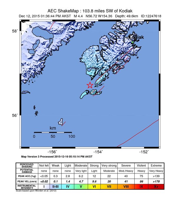
The USGS ShakeMap: shaking estimated from seismic stations and the quake’s size, on the Modified Mercalli intensity scale.
- Strongest estimated
- IV, light shaking
- Map
- Automatic
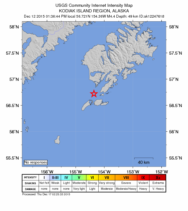
Did you feel it?
No one has reported feeling this quake to the USGS.
Estimated impact
The USGS PAGER system estimates deaths and economic losses from the shaking and the population and buildings exposed to it.
- Alert level
- Green: little or no damage or loss of life expected
Fault motion and ground failure
How the rock slipped, from the moment tensor, and the USGS estimate of landslides and liquefaction.
- Faulting
- Strike-slip
- Moment magnitude
- 4.6 Mwr
- Nodal plane 1
- Strike 159°, dip 70°, rake 153°
- Nodal plane 2
- Strike 259°, dip 65°, rake 22°
How well it is located
Reviewed by a seismologist.
- Stations used
- 182
Nearest places
Distance and direction from each place to the epicenter, with its forecast.
Nearby
Within 100 km, magnitude 1.6 and up: 32 in the 60 days after this one and 14 in the 30 days before it.
After
- 2.616 km WSW of Akhiok, Alaska · 3949 days ago · 15 km deep · 13 km away
- 2.570 km SW of Karluk, Alaska · 3946 days ago · 80 km deep · 69 km away
- 2.443 km SSW of Akhiok, Alaska · 3940 days ago · 10 km deep · 18 km away
- 2.114 km WSW of Karluk, Alaska · 3937 days ago · 47 km deep · 84 km away
- 2.6121 km SSW of Akhiok, Alaska · 3936 days ago · 23 km deep · 98 km away
- 2.728 km SSW of Akhiok, Alaska · 3936 days ago · 50 km deep · 3 km away
- 2.221 km SSW of Larsen Bay, Alaska · 3934 days ago · 48 km deep · 69 km away
- 1.96 km E of Karluk, Alaska · 3933 days ago · 39 km deep · 90 km away
- 2.128 km WSW of Karluk, Alaska · 3931 days ago · 39 km deep · 80 km away
- 2.420 km NNW of Akhiok, Alaska · 3930 days ago · 58 km deep · 38 km away
- 2.666 km SW of Karluk, Alaska · 3927 days ago · 74 km deep · 66 km away
- 2.554 km WNW of Akhiok, Alaska · 3926 days ago · 55 km deep · 55 km away
- 2.632 km NNE of Akhiok, Alaska · 3922 days ago · 67 km deep · 57 km away
- 2.277 km SW of Karluk, Alaska · 3920 days ago · 91 km deep · 81 km away
- 2.037 km NW of Akhiok, Alaska · 3918 days ago · 39 km deep · 49 km away
- 2.720 km SSW of Akhiok, Alaska · 3917 days ago · 44 km deep · 8 km away
- 3.195 km W of Akhiok, Alaska · 3917 days ago · 69 km deep · 79 km away
- 2.880 km SW of Akhiok, Alaska · 3916 days ago · 74 km deep · 57 km away
- 3.136 km W of Karluk, Alaska · 3915 days ago · 55 km deep · 96 km away
- 2.227 km NW of Old Harbor, Alaska · 3915 days ago · 26 km deep · 84 km away
- 1.726 km SSW of Karluk, Alaska · 3913 days ago · 15 km deep · 69 km away
- 2.174 km WSW of Karluk, Alaska · 3910 days ago · 76 km deep · 96 km away
- 2.733 km ESE of Akhiok, Alaska · 3907 days ago · 41 km deep · 47 km away
- 2.3Kodiak Island region, Alaska · 3907 days ago · 46 km deep · 66 km away
- 3.625 km SSW of Old Harbor, Alaska · 3907 days ago · 27 km deep · 66 km away
- 2.066 km WSW of Karluk, Alaska · 3906 days ago · 64 km deep · 95 km away
- 2.160 km WSW of Karluk, Alaska · 3906 days ago · 77 km deep · 91 km away
- 2.222 km NNW of Akhiok, Alaska · 3903 days ago · 58 km deep · 40 km away
- 1.9Kodiak Island region, Alaska · 3902 days ago · 68 km deep · 98 km away
- 1.933 km SW of Karluk, Alaska · 3898 days ago · 54 km deep · 75 km away
- 1.829 km SW of Karluk, Alaska · 3895 days ago · 17 km deep · 74 km away
- 2.354 km SSW of Akhiok, Alaska · 3890 days ago · 38 km deep · 29 km away
Before
- 2.710 km NE of Akhiok, Alaska · 3950 days ago · 4 km deep · 36 km away
- 2.578 km W of Akhiok, Alaska · 3950 days ago · 68 km deep · 69 km away
- 3.265 km SSE of Akhiok, Alaska · 3951 days ago · 7 km deep · 53 km away
- 3.073 km SSE of Akhiok, Alaska · 3951 days ago · 4 km deep · 61 km away
- 2.319 km WSW of Karluk, Alaska · 3956 days ago · 53 km deep · 83 km away
- 2.313 km WSW of Akhiok, Alaska · 3956 days ago · 52 km deep · 17 km away
- 1.812 km ENE of Karluk, Alaska · 3958 days ago · 81 km deep · 97 km away
- 1.881 km WSW of Karluk, Alaska · 3959 days ago · 79 km deep · 97 km away
- 2.023 km W of Akhiok, Alaska · 3962 days ago · 54 km deep · 21 km away
- 1.920 km S of Karluk, Alaska · 3967 days ago · 46 km deep · 70 km away
- 1.866 km WSW of Karluk, Alaska · 3969 days ago · 73 km deep · 87 km away
- 3.225 km W of Akhiok, Alaska · 3973 days ago · 50 km deep · 26 km away
- 1.932 km S of Karluk, Alaska · 3975 days ago · 69 km deep · 58 km away
- 2.451 km WSW of Karluk, Alaska · 3977 days ago · 91 km deep · 84 km away
Earthquakes todayAlaska earthquakesLive radar here
Sources
From the USGS Earthquake Hazards Program and its partner networks, event ak015fwl9ff2 (also filed as ak12247618, at00nz9o59, us20004gtq). Read Mon, Oct 5, 2026, 1:42 PM UTC.