M5.9 earthquake 45 km SSW of San Antonio, Chile
A magnitude 5.9 earthquake struck 45 km SSW of San Antonio, Chile on Wed, Nov 21, 2012, 6:36 PM GMT-3 (21:36 UTC), 18 km (11 mi) below the surface.
Map
Where this earthquake was located, with the others nearby. Select one for its page.
The earthquake
- Magnitude
- 5.9 (Mww, W-phase moment), moderate
- Magnitude from
- USGS National Earthquake Information Center
- Local time
- UTC
- 2012-11-21 21:36:22 UTC
- Depth
- 18.0 km (11.2 mi), shallow
- Epicenter
- 33.939° S, 71.868° W
- Region
- Chile
- Felt reports
- 73
- Strongest shaking
- VI, strong shaking
- Tsunami flag
- No
- Status
- Reviewed by a seismologist
Magnitude estimates
Different scales measure different things and differ by a few tenths. The USGS marks one as preferred, and it is the one this page uses.
| Mag. | Scale | Computed by | Notes |
|---|---|---|---|
| 5.9 | Mww, W-phase moment | USGS National Earthquake Information Center | Preferred · Reviewed |
| 5.88 | Mw, moment | ISC-GEM global catalog | Final · ±0.1 |
| 5.66 | Me, energy | Choy, USGS energy magnitude | Reviewed |
What happened
The USGS’s account of the effects of this earthquake.
Felt (VI) at Litueche, Navidad and Pichilemu; (V) in much of Maule and Libertador General Bernardo O'Higgins. Felt as far as Chillan, Concepcion, Los Andes and Zapallar.
From the USGS event page for usp000jvxm. U.S. Geological Survey text and figures are in the public domain.
Shaking
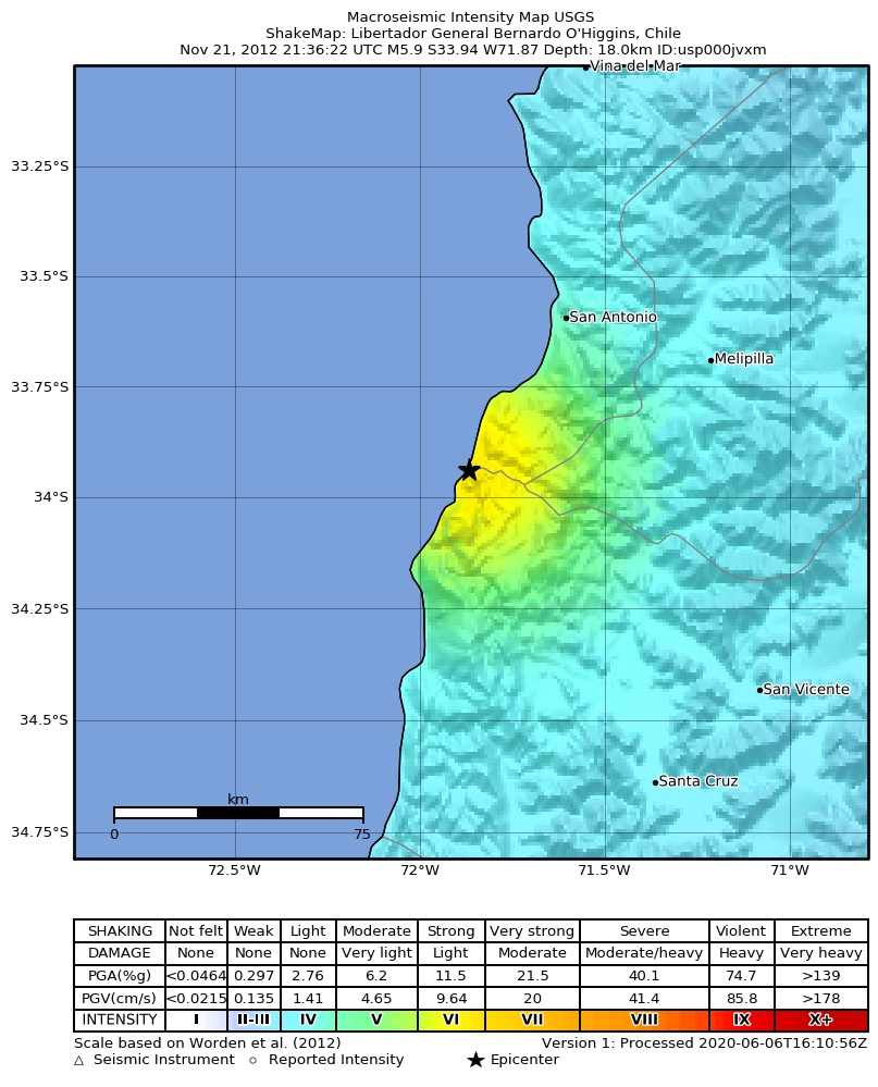
The USGS ShakeMap: shaking estimated from seismic stations and the quake’s size, on the Modified Mercalli intensity scale.
- Strongest estimated
- VI, strong shaking
- Peak ground acceleration
- 24.5% of gravity
- Peak ground velocity
- 2.4 cm/s
- Map
- Automatic
Did you feel it?
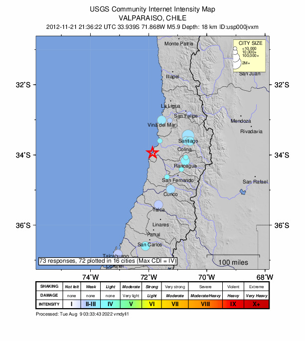
73 people reported to the USGS what they felt; the strongest reported shaking was IV, light shaking.
Fault motion and ground failure
How the rock slipped, from the moment tensor, and the USGS estimate of landslides and liquefaction.
- Faulting
- Reverse (thrust)
- Nodal plane 1
- Strike 360°, dip 17°, rake 99°
- Nodal plane 2
- Strike 170°, dip 73°, rake 87°
How well it is located
Reviewed by a seismologist.
- Depth from
- OPERATOR_ASSIGNED
- Station coverage gap
- 30°
- Stations used
- 483
Nearest places
Distance and direction from each place to the epicenter, with its forecast.
Nearby
Within 100 km, magnitude 2.9 and up: 7 in the 60 days after this one and 9 in the 30 days before it.
After
- 4.279 km SW of San Antonio, Chile · 5063 days ago · 35 km deep · 41 km away
- 5.250 km SW of San Antonio, Chile · 5063 days ago · 16 km deep · 12 km away · felt by 10
- 3.921 km SW of Melipilla, Chile · 5041 days ago · 59 km deep · 48 km away
- 4.621 km SW of Melipilla, Chile · 5038 days ago · 63 km deep · 45 km away · felt by 18
- 3.95 km NNE of Melipilla, Chile · 5037 days ago · 66 km deep · 71 km away
- 4.851 km SW of San Antonio, Chile · 5031 days ago · 12 km deep · 7 km away · felt by 10
- 4.731 km SW of Santa Cruz, Chile · 5022 days ago · 49 km deep · 98 km away · felt by 37
Before
- 5.158 km SW of San Antonio, Chile · 5063 days ago · 19 km deep · 21 km away · felt by 19
- 5.469 km WSW of San Antonio, Chile · 5064 days ago · 16 km deep · 36 km away · felt by 28
- 5.163 km SW of San Antonio, Chile · 5065 days ago · 11 km deep · 28 km away · felt by 9
- 4.2Off the coast of Valparaiso, Chile · 5066 days ago · 1 km deep · 26 km away
- 4.474 km SW of San Antonio, Chile · 5074 days ago · 38 km deep · 37 km away
- 4.868 km SW of San Antonio, Chile · 5074 days ago · 16 km deep · 29 km away · felt by 3
- 4.663 km SW of San Antonio, Chile · 5074 days ago · 13 km deep · 24 km away · felt by 5
- 4.016 km N of Cartagena, Chile · 5088 days ago · 34 km deep · 64 km away
- 4.437 km W of San Antonio, Chile · 5089 days ago · 47 km deep · 35 km away
Earthquakes todayChile earthquakesLive radar here
Sources
From the USGS Earthquake Hazards Program and its partner networks, event usp000jvxm (also filed as usc000dwip, choy20121121213622, iscgem601993538, atlas20121121213622). Read Sat, Oct 3, 2026, 2:34 AM UTC.