M5.7 earthquake 55 km WNW of Minas de Marcona, Peru
A magnitude 5.7 earthquake struck 55 km WNW of Minas de Marcona, Peru on Mon, Aug 19, 1985, 2:53 AM GMT-5 (07:53 UTC), 33 km (21 mi) below the surface.
Map
Where this earthquake was located, with the others nearby. Select one for its page.
The earthquake
- Magnitude
- 5.7 (Mw, moment), moderate
- Magnitude from
- USGS National Earthquake Information Center
- Local time
- UTC
- 1985-08-19 07:53:48 UTC
- Depth
- 33.0 km (20.5 mi), shallow
- Epicenter
- 15.043° S, 75.594° W
- Region
- Peru
- Strongest shaking
- V, moderate shaking
- Tsunami flag
- No
- Status
- Reviewed by a seismologist
Magnitude estimates
Different scales measure different things and differ by a few tenths. The USGS marks one as preferred, and it is the one this page uses.
| Mag. | Scale | Computed by | Notes |
|---|---|---|---|
| 5.7 | Mw, moment | USGS National Earthquake Information Center | Preferred · Reviewed |
| 5.69 | Mw, moment | ISC-GEM global catalog | Final · ±0.1 |
| 5.7 | Mwc, centroid moment | Global CMT project | Preliminary |
What happened
The USGS’s account of the effects of this earthquake.
CENTROID, MOMENT TENSOR (HRV) Data Used: GDSN L.P.B.: 16S, 33C Centroid Location: Origin Time 07:53:53.4 0.2 Lat 15.43S 0.05 Lon 75.80W 0.05 Dep 28.0 2.4 Half-duration 2.4 Moment Tensor; Scale 10**24 D-CM Mrr=2.47 0.11 Mtt=0.14 0.10 Mff=-2.61 0.18 Mrt=0.37 0.18 Mrf=-2.62 0.31 Mtf=2.11 0.11 Principal Axes: (T) Val=3.66 Plg=63 Azm=111 (N) Val=0.97 Plg=18 Azm=341 (P) Val=-4.63 Plg=20 Azm=245 Best Double Couple:Mo=4.1*10**24 NP1:Strike=307 Dip=30 Slip=52 NP2:Strike=169 Dip=67 Slip=110
From the USGS event page for usp0002hwz. U.S. Geological Survey text and figures are in the public domain.
Shaking
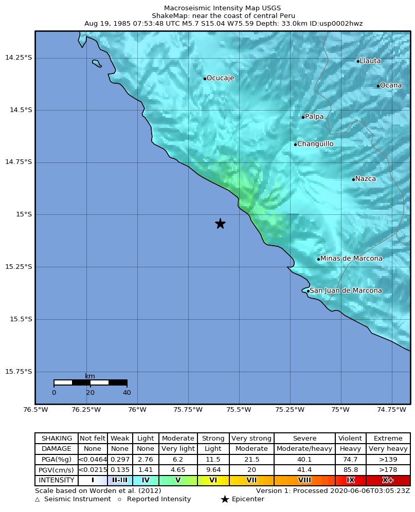
The USGS ShakeMap: shaking estimated from seismic stations and the quake’s size, on the Modified Mercalli intensity scale.
- Strongest estimated
- V, moderate shaking
- Peak ground acceleration
- 8.0% of gravity
- Peak ground velocity
- 1.2 cm/s
- Map
- Automatic
Did you feel it?
No one has reported feeling this quake to the USGS.
How well it is located
Reviewed by a seismologist.
- Depth from
- OPERATOR_ASSIGNED
Nearest places
Distance and direction from each place to the epicenter, with its forecast.
Nearby
Within 100 km, magnitude 2.7 and up: 1 in the 60 days after this one and 4 in the 30 days before it.
After
Before
- 4.460 km WSW of Changuillo, Peru · 15025 days ago · 33 km deep · 14 km away
- 4.745 km WNW of Minas de Marcona, Peru · 15025 days ago · 33 km deep · 10 km away
- 5.549 km WNW of Minas de Marcona, Peru · 15026 days ago · 33 km deep · 9 km away
- 5.442 km WNW of Minas de Marcona, Peru · 15027 days ago · 26 km deep · 14 km away
Earthquakes todayPeru earthquakesLive radar here
Sources
From the USGS Earthquake Hazards Program and its partner networks, event usp0002hwz (also filed as gcmtb081985a, gcmt19850819075348, iscgem518425). Read Sat, Oct 3, 2026, 5:29 PM UTC.