M6.2 earthquake 4 km SW of Tu?epi, Croatia
A magnitude 6.2 earthquake struck 4 km SW of Tu?epi, Croatia on Sun, Jan 7, 1962, 11:03 AM GMT+1 (10:03 UTC), 15 km (9 mi) below the surface.
A larger quake followed: M6.2 4 km ENE of Baška Voda, Croatia. This one was a foreshock.
Map
Where this earthquake was located, with the others nearby. Select one for its page.
The earthquake
- Magnitude
- 6.2 (Mw, moment), strong
- Magnitude from
- ISC-GEM global catalog
- Local time
- UTC
- 1962-01-07 10:03:13 UTC
- Depth
- 15.0 km (9.3 mi), shallow
- Epicenter
- 43.247° N, 17.019° E
- Region
- Croatia
- Strongest shaking
- VII, very strong shaking
- Tsunami flag
- No
- Status
- Reviewed by a seismologist
Deaths and damage
From NOAA NCEI’s Significant Earthquake Database (record 4255), matched to this event by time and place.
- Deaths
- 4
- Damage
- Moderate (about $1 to $5 million)
Where the literature gives no number, NCEI records a description on a scale of 1 to 4, printed here in its words. Damage is in millions of US dollars of the year of the event, not adjusted for inflation.
From Wikipedia
The 1962 Makarska earthquakes occurred on January 7 to January 11 near the towns of Podgora and Makarska in Dalmatia, Croatia (at the time part of SFR Yugoslavia). The event is what is known as a doublet earthquake, where there are two or more main shocks occurring in a short span of time. The two earthquake measured 6.2 on the moment magnitude scale. The first tremor was assigned VIII (Severe), and the second event IX (Violent) on the Modified Mercalli intensity scale.
The earthquakes killed a total of 6 people, and caused damage to vulnerable structures. A tsunami may have been triggered by the quakes according to nearby tide gauges.
Text from Wikipedia, “1962 Makarska earthquakes”, licensed CC BY-SA 4.0. Quoted as written; the full article has the rest.
The article is about the earthquake NOAA’s record describes, matched to this one by date, place and magnitude.
What happened
The USGS’s account of the effects of this earthquake.
Two people killed, 19 injured, and moderate damage occurred at Makarska, Croatia1.
Abridged from Principal Earthquakes of the World from January through December, 1962, in United States Earthquakes, 1962, by James F. Lander and William K. Cloud, U.S. Dept. of Commerce, Coast and Geodetic Survey, Washington: 1964.
1Historical note: At the time of this earthquake, Croatia was part of Yugoslavia.
A second Mw 6.2 earthquake occurred in this area 4 days later, on January 11 at 05:05:03 UTC.
From the USGS event page for iscgem873992. U.S. Geological Survey text and figures are in the public domain.
Shaking
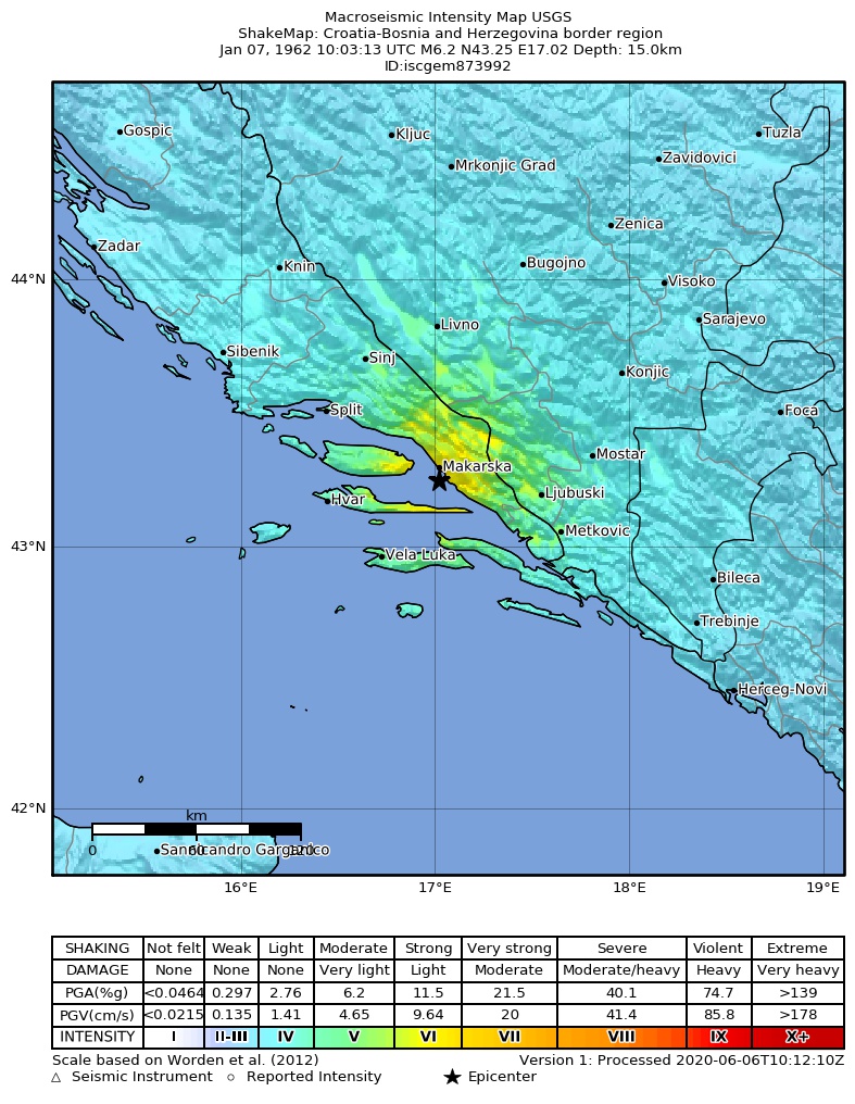
The USGS ShakeMap: shaking estimated from seismic stations and the quake’s size, on the Modified Mercalli intensity scale.
- Strongest estimated
- VII, very strong shaking
- Peak ground acceleration
- 29.6% of gravity
- Peak ground velocity
- 2.9 cm/s
- Map
- Automatic
Did you feel it?
No one has reported feeling this quake to the USGS.
How well it is located
Reviewed by a seismologist.
- Magnitude uncertainty
- ±0.37
- Depth from
- From location
Nearest places
Distance and direction from each place to the epicenter, with its forecast.
Nearby
Within 100 km, magnitude 3.2 and up: 1 in the 60 days after this one and 0 in the 30 days before it.
After
Earthquakes todayCroatia earthquakesLive radar here
Sources
From the USGS Earthquake Hazards Program and its partner networks, event iscgem873992. Read Mon, Oct 5, 2026, 11:46 AM UTC.