March 28, 1964 Earthquake: Alaska, United States
A magnitude 9.2 earthquake struck Alaska, United States on March 28, 1964 at 03:36:16 UTC, 25 km below the surface. It killed 139 people, counting the tsunami it caused.
Map
Where it struck, with the other significant earthquakes within 200 km. Circles are sized and colored by magnitude; select one for its page.
The earthquake
- Date
- March 28, 1964
- Time
- 03:36:16 UTC
- Place
- Alaska, United States
- Magnitude
- 9.2 (Mw)
- Focal depth
- 25 km (16 mi)
- Intensity
- 10 on the Modified Mercalli scale
- Tsunami
- Yes: the tsunami it caused
- Epicenter
- 60.908° N, 147.339° W
- Country
- United States
The toll
- Deaths
- 15; 139 with its tsunami and other effects
- Damage
- $284 million; $400 million with its tsunami and other effects
- Houses destroyed
- Many (101 to 1,000)
Where the literature gives no number, NCEI records a description on a scale of 1 to 4, printed here in its words. Damage is in millions of US dollars of the year of the event, not adjusted for inflation.
What the record says
NCEI’s account, from the sources it cites.
1964, March 28. This magnitude 9.2 Mw earthquake and ensuing tsunami caused 139 deaths and $400 million in property loss. The earthquake caused 15 deaths and the tsunami caused 124 deaths (106 in Alaska, 13 in California and 5 in Oregon).
Ref #542:
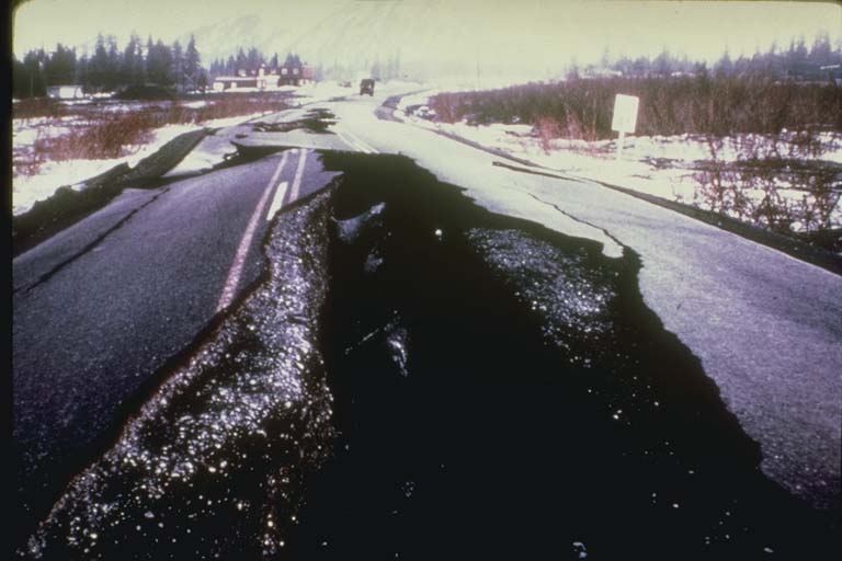
1964, March 28, 1964, 03:36:14 UTC. 61.04 N, 147.73 W, depth 33 km, magnitude 8.4 MS, intensity X. Prince William Sound, Alaska. This great earthquake and ensuing tsunami took 125 lives (tsunami 110, earthquake 15), and caused about $311 million in property loss. Earthquake effects were heavy in many towns, including Anchorage, Chitina, Glennallen, Homer, Hope, Kasilof, Kenai, Kodiak, Moose Pass, Portage, Seldovia, Seward, Sterling, Valdez, Wasilla, and Whittier.
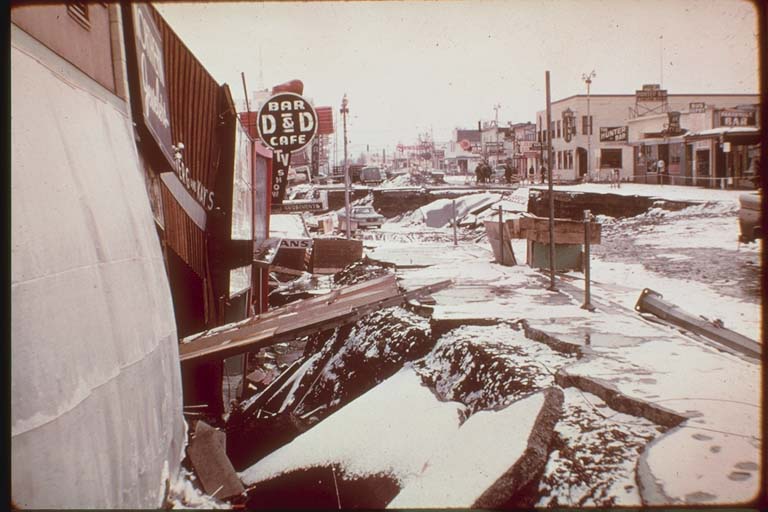
Anchorage, about 120 km northwest of the epicenter, sustained the most severe damage to property. About 30 blocks of dwellings and commercial buildings were damaged or destroyed in the downtown area. The J.C. Penney Company building was damaged beyond repair; the Four Seasons apartment building, a new six-story structure, collapsed; and many other multistory buildings were damaged heavily. The schools in Anchorage were almost devastated. The Government Hill Grade School, sitting astride a huge landslide, was almost a total loss. Anchorage High School and Denali Grade School were damaged severely. Duration of the shock was estimated at 3 minutes.
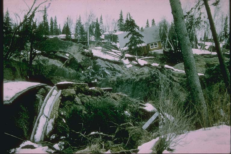
Landslides in Anchorage caused heavy damage. Huge slides occurred in the downtown business section, at Government Hill, and at Turnagain Heights. The largest and most devastating landslide occurred at Turnagain Heights. An area of about 130 acres was devastated by displacements that broke the ground into many deranged blocks that were collapsed and tilted at all angles. This slide destroyed about 75 private houses. Water mains and gas, sewer, telephone, and electrical systems were disrupted throughout the area.
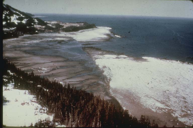
The earthquake was accompanied by vertical displacement over an area of about 520,000 km2. The major area of uplift trended northeast from southern Kodiak Island to Prince William Sound and trended east-west to the east of the sound. Vertical displacements ranged from about 11.5 m of uplift to 2.3 m of subsidence relative to sea level. Off the southwest end of Montague Island, there was absolute vertical displacement of about 13-15 m. Uplift also occurred along the extreme southeast coast of Kodiak Island, Sitkalidak Island, and over part or all of Sitkinak Island. This zone of subsidence covered about 285,000 km2, including the north and west parts of Prince William Sound, the west part of the Chugach Mountains and a part of the lowlands north of the mountains, most of Kenai Peninsula, and almost all the Kodiak Island group.
This great earthquake was felt over a large area of Alaska and in parts of western Yukon Territory and British Columbia, Canada.
Ref #10476, v.10:
1964 March 28 03:36:16 UTC, 60.908 N 147.339 W, 25 km depth, 9.3 Mw
Ref #13456 (access date 2023):
1964 March 28 03:36:16 UTC, 60.908 N 147.339 W, 25 km depth, 9.2 Mw
Ref #1314:
1964, March 28. 8.4 MS, 9.2 Mw.
Ref #88:
1964, March 28, 03:36:13 UTC. 61.1 N, 147.6 W, depth 20 km, magnitude 8.5 MS.
Reference #1250:
1964, March 28. 131 killed, $1020 million damage.
Ref #45:
1964, March 27 17:36:14.2. Maximum intensity IX-X. Civil defense estimates included 122 deaths from the tsunami and 9 from the earthquake. Total damage from the earthquake and tsunami was between $400-$500 million.
Ref #3381:
Public and private property damage exceeded 300 million dollars, but there were only 114 casualties.
Ref #2102:
The tsunami generated by the Prince William Sound Earthquake of March 28, 1964, was the largest since the 1960 Chilean tsunami.. 122 fatalities and over $104 million in damage resulted...
Photos
From the NCEI/WDS Natural Hazards Image Database (doi:10.7289/V5154F01). Only photos by the USGS and NOAA, which are public domain, are shown.





Other significant earthquakes nearby
Within 200 km, the deadliest first.
More
Significant earthquakes of 1964The 1900sEvery quake the USGS located in 1964Recent earthquakes near hereThis day in weather history
Sources
Significant earthquakes from NOAA’s National Centers for Environmental Information, Global Historical Hazard Database, cited as NCEI/WDS, doi:10.7289/V5PN93H7. Public domain. Read 2026-09-24. NCEI earthquake 4311.