M1.9 earthquake 11 km N of Midland, Texas
A magnitude 1.9 earthquake struck 11 km N of Midland, Texas on Mon, Aug 2, 2021, 4:34 PM CDT (21:34 UTC), 10 km (6 mi) below the surface.
A larger quake followed: M3.7 16 km NNW of Midland, Texas. This one was a foreshock.
Map
Where this earthquake was located, with the others nearby. Select one for its page.
The earthquake
- Magnitude
- 1.9 (ml), micro
- Local time
- UTC
- 2021-08-02 21:34:12 UTC
- Depth
- 10.3 km (6.4 mi), shallow
- Epicenter
- 32.104° N, 102.088° W
- Region
- Texas
- Felt reports
- 2
- Tsunami flag
- No
- Status
- Reviewed by a seismologist
Did you feel it?
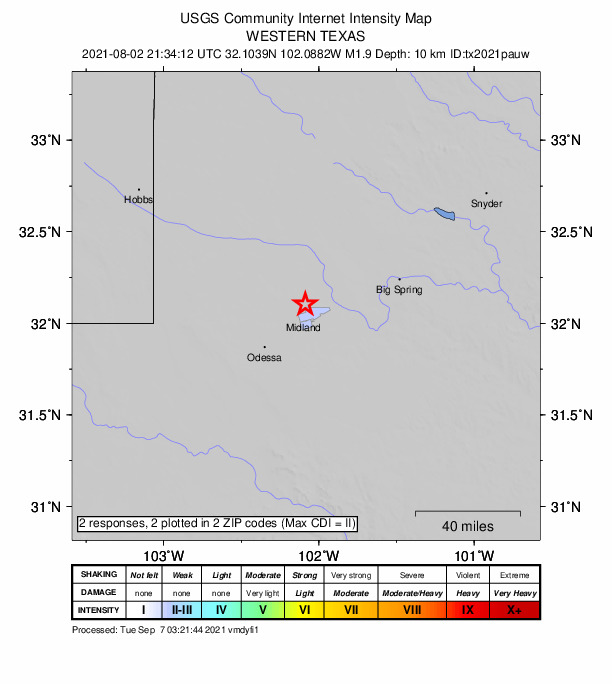
2 people reported to the USGS what they felt; the strongest reported shaking was II, weak shaking.
How well it is located
Reviewed by a seismologist.
- Location uncertainty
- About 0.7 km horizontally, 1.3 km in depth
- Magnitude uncertainty
- ±0.20
- Station coverage gap
- 62°
- Stations used
- 17
Nearest places
Distance and direction from each place to the epicenter, with its forecast.
Nearby
Within 100 km, magnitude 1.5 and up: 62 in the 60 days after this one and 23 in the 30 days before it.
After
- 1.512 km N of Midland, Texas · 1878 days ago · 9 km deep · 1 km away
- 2.712 km N of Midland, Texas · 1877 days ago · 10 km deep · 1 km away · felt by 47
- 1.613 km SSE of Ackerly, Texas · 1877 days ago · 8 km deep · 53 km away
- 1.812 km N of Midland, Texas · 1877 days ago · 9 km deep · 1 km away
- 2.012 km N of Midland, Texas · 1877 days ago · 9 km deep · 1 km away
- 2.712 km N of Midland, Texas · 1876 days ago · 9 km deep · 1 km away · felt by 34
- 1.89 km SE of Midland, Texas · 1876 days ago · 11 km deep · 20 km away
- 2.218 km NNE of Goldsmith, Texas · 1875 days ago · 4 km deep · 45 km away
- 2.015 km NNW of Midland, Texas · 1873 days ago · 7 km deep · 7 km away · felt by 1
- 1.69 km SSE of Gardendale, Texas · 1868 days ago · 7 km deep · 30 km away
- 2.714 km NNW of Midland, Texas · 1867 days ago · 7 km deep · 6 km away · felt by 4
- 2.815 km NNW of Midland, Texas · 1865 days ago · 8 km deep · 8 km away · felt by 15
- 1.68 km SE of Midland, Texas · 1863 days ago · 12 km deep · 20 km away
- 2.317 km N of Stanton, Texas · 1862 days ago · 4 km deep · 32 km away
- 1.512 km N of Midland, Texas · 1858 days ago · 9 km deep · 0 km away
- 2.338 km ENE of McKinney Acres, Texas · 1858 days ago · 10 km deep · 33 km away
- 1.814 km NNW of Midland, Texas · 1856 days ago · 7 km deep · 6 km away
- 1.78 km SE of Midland, Texas · 1856 days ago · 12 km deep · 19 km away
- 1.96 km SE of Ackerly, Texas · 1856 days ago · 12 km deep · 58 km away
- 1.96 km SE of Ackerly, Texas · 1856 days ago · 11 km deep · 58 km away
- 2.214 km NNW of Midland, Texas · 1853 days ago · 10 km deep · 7 km away
- 2.231 km E of McKinney Acres, Texas · 1851 days ago · 8 km deep · 22 km away
- 2.931 km E of McKinney Acres, Texas · 1851 days ago · 11 km deep · 21 km away · felt by 1
- 2.113 km NE of Jal, New Mexico · 1850 days ago · 7 km deep · 97 km away
- 2.514 km NE of Jal, New Mexico · 1849 days ago · 5 km deep · 96 km away · felt by 2
- 2.126 km W of Garden City, Texas · 1849 days ago · 9 km deep · 40 km away
- 1.813 km NE of Jal, New Mexico · 1849 days ago · 5 km deep · 96 km away
- 2.414 km NE of Jal, New Mexico · 1849 days ago · 3 km deep · 95 km away
- 1.915 km NNW of Midland, Texas · 1848 days ago · 7 km deep · 8 km away
- 2.412 km NNW of Midland, Texas · 1847 days ago · 8 km deep · 2 km away · felt by 1
- 2.013 km NE of Jal, New Mexico · 1847 days ago · 5 km deep · 96 km away
- 1.812 km NNW of Midland, Texas · 1846 days ago · 9 km deep · 3 km away
- 1.829 km ESE of Midland, Texas · 1846 days ago · 11 km deep · 38 km away
- 2.011 km NE of Jal, New Mexico · 1845 days ago · 6 km deep · 96 km away
- 2.116 km WNW of Big Spring, Texas · 1845 days ago · 8 km deep · 50 km away
- 1.615 km NNW of Midland, Texas · 1844 days ago · 9 km deep · 7 km away
- 3.716 km NNW of Midland, Texas · 1844 days ago · 7 km deep · 8 km away · felt by 593
- 1.915 km NNW of Midland, Texas · 1844 days ago · 7 km deep · 8 km away
- 2.312 km N of Midland, Texas · 1843 days ago · 9 km deep · 1 km away · felt by 2
- 2.213 km NE of Jal, New Mexico · 1843 days ago · 2 km deep · 95 km away
- 1.815 km NNW of Midland, Texas · 1843 days ago · 7 km deep · 8 km away
- 2.615 km NNW of Midland, Texas · 1842 days ago · 7 km deep · 8 km away · felt by 8
- 2.512 km NE of Jal, New Mexico · 1841 days ago · 6 km deep · 95 km away
- 1.910 km NE of Jal, New Mexico · 1841 days ago · 6 km deep · 97 km away
- 1.910 km NE of Jal, New Mexico · 1840 days ago · 8 km deep · 97 km away
- 2.229 km E of McKinney Acres, Texas · 1839 days ago · 9 km deep · 23 km away
- 1.813 km NE of Jal, New Mexico · 1836 days ago · 6 km deep · 95 km away
- 2.929 km E of McKinney Acres, Texas · 1834 days ago · 6 km deep · 22 km away
- 3.430 km E of McKinney Acres, Texas · 1833 days ago · 6 km deep · 22 km away · felt by 4
- 2.1western Texas · 1833 days ago · 10 km deep · 54 km away
- 2.211 km N of Midland, Texas · 1831 days ago · 9 km deep · 1 km away
- 1.66 km S of Gardendale, Texas · 1831 days ago · 7 km deep · 31 km away
- 1.88 km WSW of Westbrook, Texas · 1830 days ago · 7 km deep · 96 km away
- 2.713 km NE of Jal, New Mexico · 1830 days ago · 3 km deep · 95 km away
- 2.512 km N of Midland, Texas · 1830 days ago · 9 km deep · 1 km away · felt by 7
- 1.914 km NE of Jal, New Mexico · 1830 days ago · 4 km deep · 96 km away
- 3.312 km S of Ackerly, Texas · 1826 days ago · 11 km deep · 50 km away · felt by 5
- 2.337 km SSW of Los Ybanez, Texas · 1826 days ago · 9 km deep · 35 km away
- 2.915 km NNW of Midland, Texas · 1825 days ago · 8 km deep · 7 km away · felt by 31
- 2.38 km SE of Gardendale, Texas · 1824 days ago · 8 km deep · 26 km away
The first 60 of 62.
Before
- 2.3western Texas · 1883 days ago · 7 km deep · 31 km away
- 2.034 km WSW of Ackerly, Texas · 1887 days ago · 11 km deep · 35 km away
- 1.738 km ENE of McKinney Acres, Texas · 1889 days ago · 7 km deep · 33 km away
- 2.811 km N of Midland, Texas · 1890 days ago · 9 km deep · 1 km away · felt by 12
- 1.614 km NNW of Midland, Texas · 1890 days ago · 7 km deep · 4 km away
- 1.816 km NNW of Midland, Texas · 1892 days ago · 8 km deep · 8 km away
- 2.116 km NNW of Midland, Texas · 1892 days ago · 8 km deep · 8 km away
- 1.618 km SSE of Ackerly, Texas · 1893 days ago · 13 km deep · 51 km away
- 1.718 km SSE of Ackerly, Texas · 1893 days ago · 6 km deep · 52 km away
- 1.536 km WSW of Ackerly, Texas · 1894 days ago · 15 km deep · 31 km away
- 2.838 km ENE of McKinney Acres, Texas · 1896 days ago · 5 km deep · 33 km away · felt by 1
- 2.012 km N of Midland, Texas · 1899 days ago · 8 km deep · 1 km away
- 2.713 km NNW of Midland, Texas · 1900 days ago · 8 km deep · 4 km away · felt by 7
- 1.613 km NNW of Midland, Texas · 1901 days ago · 8 km deep · 4 km away
- 1.618 km N of Stanton, Texas · 1901 days ago · 7 km deep · 35 km away
- 1.917 km NW of Midland, Texas · 1902 days ago · 6 km deep · 9 km away
- 1.57 km SE of Midland, Texas · 1903 days ago · 12 km deep · 18 km away
- 2.118 km SSW of McKinney Acres, Texas · 1906 days ago · 4 km deep · 52 km away
- 1.610 km NNE of Odessa, Texas · 1906 days ago · 7 km deep · 30 km away
- 1.911 km N of Midland, Texas · 1907 days ago · 8 km deep · 0 km away · felt by 1
Earthquakes todayTexas earthquakesLive radar here
Sources
From the USGS Earthquake Hazards Program and its partner networks, event tx2021pauw (also filed as us6000f1mi). Read Thu, Sep 24, 2026, 3:40 PM UTC.