M4.2 earthquake 46 km SW of Adak, Alaska
A magnitude 4.2 earthquake struck 46 km SW of Adak, Alaska on Sun, May 30, 2021, 1:56 AM HADT (10:56 UTC), 48 km (30 mi) below the surface.
A larger quake followed: M5.0 49 km ESE of Adak, Alaska. This one was a foreshock.
Map
Where this earthquake was located, with the others nearby. Select one for its page.
The earthquake
- Magnitude
- 4.2 (mb), light
- Local time
- UTC
- 2021-05-30 10:56:45 UTC
- Depth
- 47.7 km (29.6 mi), shallow
- Epicenter
- 51.587° N, 177.115° W
- Region
- Alaska
- Tsunami flag
- No
- Status
- Reviewed by a seismologist
Did you feel it?
No one has reported feeling this quake to the USGS.
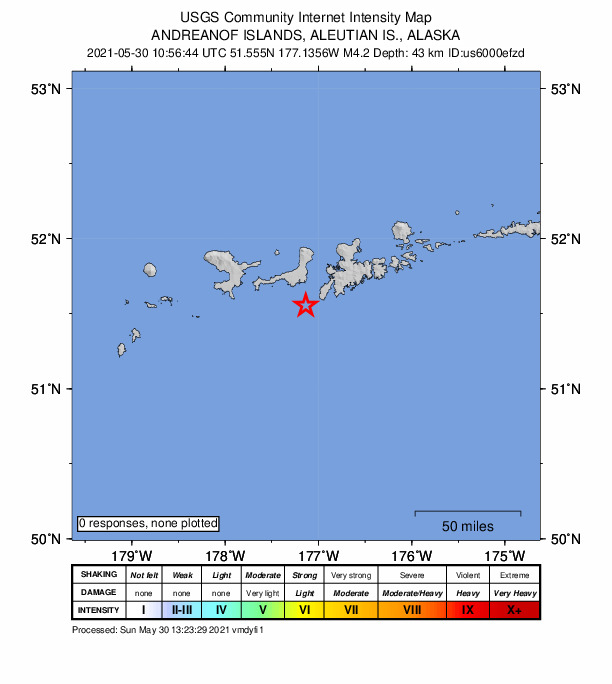
How well it is located
Reviewed by a seismologist.
- Location uncertainty
- About 4.1 km horizontally, 8.2 km in depth
- Magnitude uncertainty
- ±0.10
- Depth from
- From location
- Station coverage gap
- 178°
- Stations used
- 81
Nearby
Within 100 km, magnitude 1.5 and up: 164 in the 60 days after this one and 31 in the 30 days before it.
After
- 1.7120 km WSW of Adak, Alaska · 1942 days ago · 26 km deep · 80 km away
- 1.750 km W of Adak, Alaska · 1942 days ago · 71 km deep · 28 km away
- 2.039 km ESE of Adak, Alaska · 1942 days ago · 62 km deep · 75 km away
- 3.482 km SW of Adak, Alaska · 1941 days ago · 45 km deep · 37 km away
- 1.6127 km WSW of Adak, Alaska · 1936 days ago · 7 km deep · 89 km away
- 2.754 km WSW of Adak, Alaska · 1931 days ago · 96 km deep · 27 km away
- 2.158 km W of Adak, Alaska · 1931 days ago · 88 km deep · 43 km away
- 1.7133 km WSW of Adak, Alaska · 1931 days ago · 9 km deep · 98 km away
- 1.640 km ENE of Adak, Alaska · 1930 days ago · 154 km deep · 86 km away
- 1.5111 km WSW of Adak, Alaska · 1924 days ago · 12 km deep · 72 km away
- 1.754 km SSE of Adak, Alaska · 1924 days ago · 27 km deep · 51 km away
- 1.8130 km WSW of Adak, Alaska · 1924 days ago · 45 km deep · 86 km away
- 2.776 km W of Adak, Alaska · 1923 days ago · 110 km deep · 46 km away
- 1.642 km ENE of Adak, Alaska · 1919 days ago · 3 km deep · 88 km away
- 1.898 km SW of Adak, Alaska · 1919 days ago · 38 km deep · 52 km away
- 1.5133 km WSW of Adak, Alaska · 1919 days ago · 14 km deep · 96 km away
- 1.888 km W of Adak, Alaska · 1914 days ago · 8 km deep · 63 km away
- 1.652 km SSW of Adak, Alaska · 1914 days ago · 35 km deep · 12 km away
- 1.769 km WSW of Adak, Alaska · 1914 days ago · 52 km deep · 29 km away
- 1.644 km ESE of Adak, Alaska · 1914 days ago · 68 km deep · 79 km away
- 2.075 km SE of Adak, Alaska · 1914 days ago · 26 km deep · 90 km away
- 1.8133 km WSW of Adak, Alaska · 1914 days ago · 22 km deep · 93 km away
- 2.9107 km WSW of Adak, Alaska · 1914 days ago · 49 km deep · 64 km away
- 1.6123 km WSW of Adak, Alaska · 1914 days ago · 42 km deep · 80 km away
- 1.524 km E of Adak, Alaska · 1914 days ago · 72 km deep · 65 km away
- 1.7138 km WSW of Adak, Alaska · 1914 days ago · 41 km deep · 94 km away
- 1.7126 km WSW of Adak, Alaska · 1914 days ago · 25 km deep · 85 km away
- 1.8131 km WSW of Adak, Alaska · 1911 days ago · 13 km deep · 95 km away
- 1.972 km SW of Adak, Alaska · 1911 days ago · 34 km deep · 28 km away
- 2.029 km NE of Adak, Alaska · 1910 days ago · 125 km deep · 75 km away
- 1.539 km SSE of Adak, Alaska · 1910 days ago · 35 km deep · 51 km away
- 1.784 km SW of Adak, Alaska · 1910 days ago · 26 km deep · 39 km away
- 1.5134 km SW of Adak, Alaska · 1909 days ago · 26 km deep · 89 km away
- 1.648 km WSW of Adak, Alaska · 1909 days ago · 70 km deep · 20 km away
- 1.658 km W of Adak, Alaska · 1909 days ago · 115 km deep · 41 km away
- 1.862 km SE of Adak, Alaska · 1909 days ago · 23 km deep · 79 km away
- 1.867 km SSW of Adak, Alaska · 1909 days ago · 26 km deep · 33 km away
- 2.639 km ENE of Adak, Alaska · 1909 days ago · 96 km deep · 82 km away
- 3.446 km NNE of Adak, Alaska · 1909 days ago · 198 km deep · 89 km away
- 2.4104 km WNW of Adak, Alaska · 1909 days ago · 247 km deep · 94 km away
- 1.847 km SW of Adak, Alaska · 1908 days ago · 64 km deep · 3 km away
- 1.7131 km W of Adak, Alaska · 1908 days ago · 8 km deep · 98 km away
- 1.757 km SE of Adak, Alaska · 1908 days ago · 13 km deep · 69 km away
- 3.9117 km SW of Adak, Alaska · 1908 days ago · 42 km deep · 72 km away
- 3.085 km SSE of Adak, Alaska · 1908 days ago · 10 km deep · 87 km away
- 3.638 km SW of Adak, Alaska · 1907 days ago · 73 km deep · 8 km away
- 3.7135 km SW of Adak, Alaska · 1907 days ago · 27 km deep · 91 km away
- 1.836 km ESE of Adak, Alaska · 1907 days ago · 61 km deep · 66 km away
- 1.670 km SW of Adak, Alaska · 1907 days ago · 44 km deep · 25 km away
- 1.6130 km WSW of Adak, Alaska · 1907 days ago · 17 km deep · 94 km away
- 1.667 km W of Adak, Alaska · 1907 days ago · 13 km deep · 51 km away
- 1.9Andreanof Islands, Aleutian Islands, Alaska · 1907 days ago · 26 km deep · 53 km away
- 1.849 km S of Adak, Alaska · 1907 days ago · 26 km deep · 40 km away
- 1.758 km SE of Adak, Alaska · 1907 days ago · 17 km deep · 73 km away
- 1.9100 km WSW of Adak, Alaska · 1907 days ago · 62 km deep · 59 km away
- 1.864 km WSW of Adak, Alaska · 1907 days ago · 10 km deep · 34 km away
- 3.753 km SSW of Adak, Alaska · 1906 days ago · 49 km deep · 24 km away
- 2.332 km SE of Adak, Alaska · 1905 days ago · 50 km deep · 54 km away
- 3.041 km S of Adak, Alaska · 1904 days ago · 36 km deep · 32 km away
- 2.051 km S of Adak, Alaska · 1904 days ago · 21 km deep · 45 km away
The first 60 of 164.
Before
- 2.744 km E of Adak, Alaska · 1944 days ago · 69 km deep · 82 km away
- 2.0108 km WSW of Adak, Alaska · 1944 days ago · 48 km deep · 65 km away
- 1.9128 km WSW of Adak, Alaska · 1944 days ago · 42 km deep · 85 km away
- 4.065 km SW of Adak, Alaska · 1946 days ago · 43 km deep · 23 km away
- 1.5125 km WSW of Adak, Alaska · 1947 days ago · 15 km deep · 90 km away
- 1.638 km NE of Adak, Alaska · 1947 days ago · 8 km deep · 84 km away
- 1.637 km NE of Adak, Alaska · 1947 days ago · 10 km deep · 84 km away
- 1.539 km NE of Adak, Alaska · 1947 days ago · 10 km deep · 85 km away
- 4.1101 km S of Adak, Alaska · 1949 days ago · 10 km deep · 79 km away
- 1.581 km W of Adak, Alaska · 1950 days ago · 8 km deep · 57 km away
- 1.979 km W of Adak, Alaska · 1952 days ago · 9 km deep · 56 km away
- 3.975 km WSW of Adak, Alaska · 1953 days ago · 68 km deep · 33 km away
- 4.2122 km WSW of Adak, Alaska · 1953 days ago · 35 km deep · 83 km away
- 1.5131 km WSW of Adak, Alaska · 1956 days ago · 5 km deep · 96 km away
- 1.957 km SSE of Adak, Alaska · 1957 days ago · 26 km deep · 63 km away
- 3.831 km SSE of Adak, Alaska · 1959 days ago · 50 km deep · 50 km away
- 1.652 km SW of Adak, Alaska · 1959 days ago · 45 km deep · 7 km away
- 1.8131 km WSW of Adak, Alaska · 1959 days ago · 12 km deep · 95 km away
- 1.974 km SW of Adak, Alaska · 1959 days ago · 26 km deep · 29 km away
- 1.963 km W of Adak, Alaska · 1960 days ago · 103 km deep · 42 km away
Earthquakes todayAlaska earthquakesLive radar here
Sources
From the USGS Earthquake Hazards Program and its partner networks, event us6000efzd (also filed as ak0216w8whiw). Read Thu, Sep 24, 2026, 11:11 AM UTC.