M4.3 earthquake 152 km W of Langlois, Oregon
A magnitude 4.3 earthquake struck 152 km W of Langlois, Oregon on Thu, Jul 23, 2026, 12:16 PM PDT (19:16 UTC), 10 km (6 mi) below the surface.
A larger quake followed: M4.9 125 km WSW of Port Orford, Oregon. This one was a foreshock.
Map
Where this earthquake was located, with the others nearby. Select one for its page.
The earthquake
- Magnitude
- 4.3 (mwr), light
- Local time
- UTC
- 2026-07-23 19:16:27 UTC
- Depth
- 10.0 km (6.2 mi), shallow
- Epicenter
- 43.094° N, 126.305° W
- Region
- Oregon
- Felt reports
- 2
- Tsunami flag
- No
- Status
- Reviewed by a seismologist
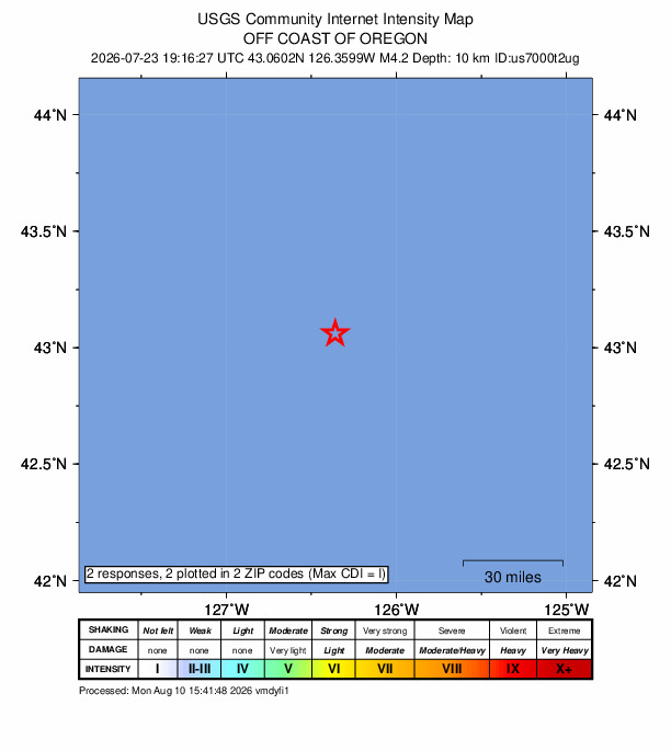
Did you feel it?
2 people reported to the USGS what they felt; the strongest reported shaking was I, not felt shaking.
Aftershock forecast
The chance of at least one aftershock this large or larger, from the USGS operational aftershock forecast, issued Thu, Sep 17, 2026, 7:16 PM UTC. The USGS updates it as the sequence unfolds.
| Within | M3+ | M4+ | M5+ | M6+ | M7+ |
|---|---|---|---|---|---|
| 1 day | Under 1% | Under 1% | Under 1% | Under 1% | Under 1% |
| 1 week | Under 1% | Under 1% | Under 1% | Under 1% | Under 1% |
| 1 month | Under 1% | Under 1% | Under 1% | Under 1% | Under 1% |
| 1 year | 4% | Under 1% | Under 1% | Under 1% | Under 1% |
In the coming week the USGS expects about 0 aftershocks of magnitude 3 or more, and most likely between 0 and 0.
Fault motion and ground failure
How the rock slipped, from the moment tensor, and the USGS estimate of landslides and liquefaction.
- Faulting
- Oblique reverse
- Moment magnitude
- 4.3 Mwr
- Nodal plane 1
- Strike 117°, dip 65°, rake 146°
- Nodal plane 2
- Strike 223°, dip 60°, rake 29°
How well it is located
Reviewed by a seismologist.
- Location uncertainty
- About 6.3 km horizontally, 1.9 km in depth
- Magnitude uncertainty
- ±0.04
- Depth from
- Operator assigned
- Station coverage gap
- 153°
- Stations used
- 104
Nearest places
Distance and direction from each place to the epicenter, with its forecast.
Nearby
Within 100 km, magnitude 1.5 and up: 7 in the 60 days after this one and 11 in the 30 days before it.
After
- 4.9125 km WSW of Port Orford, Oregon · 47 days ago · 10 km deep · 81 km away · felt by 5
- 4.1116 km W of Gold Beach, Oregon · 46 days ago · 10 km deep · 89 km away
- 2.8172 km W of Langlois, Oregon · 44 days ago · 10 km deep · 20 km away
- 2.8237 km W of Bandon, Oregon · 30 days ago · 10 km deep · 92 km away
- 3.0204 km W of Bandon, Oregon · 28 days ago · 10 km deep · 56 km away
- 2.7186 km W of Bandon, Oregon · 22 days ago · 10 km deep · 47 km away
- 3.2196 km W of Port Orford, Oregon · 20 days ago · 10 km deep · 45 km away
Before
- 3.9188 km W of Bandon, Oregon · 63 days ago · 10 km deep · 43 km away
- 3.5216 km W of Bandon, Oregon · 63 days ago · 10 km deep · 69 km away
- 4.6225 km W of Bandon, Oregon · 63 days ago · 10 km deep · 78 km away · felt by 2
- 2.7168 km WSW of Port Orford, Oregon · 66 days ago · 10 km deep · 78 km away
- 4.0228 km W of Bandon, Oregon · 72 days ago · 10 km deep · 80 km away · felt by 1
- 3.7186 km W of Bandon, Oregon · 85 days ago · 10 km deep · 46 km away
- 3.3217 km W of Langlois, Oregon · 85 days ago · 10 km deep · 66 km away
- 3.9211 km W of Bandon, Oregon · 85 days ago · 10 km deep · 63 km away · felt by 1
- 3.7217 km W of Bandon, Oregon · 85 days ago · 10 km deep · 68 km away
- 3.9224 km W of Bandon, Oregon · 85 days ago · 10 km deep · 74 km away
- 5.5226 km W of Langlois, Oregon · 85 days ago · 10 km deep · 75 km away · felt by 22
Earthquakes todayOregon earthquakesLive radar here
Sources
From the USGS Earthquake Hazards Program and its partner networks, event us7000t2ug. Read Tue, Sep 22, 2026, 5:16 PM UTC.