M2.9 earthquake 12 km N of Snyder, Texas
A magnitude 2.9 earthquake struck 12 km N of Snyder, Texas on Mon, Oct 9, 2023, 1:35 PM CDT (18:35 UTC), 6 km (4 mi) below the surface.
A larger quake followed: M3.3 18 km SE of Ackerly, Texas. This one was a foreshock.
Map
Where this earthquake was located, with the others nearby. Select one for its page.
The earthquake
- Magnitude
- 2.9 (ml(texnet)), micro
- Local time
- UTC
- 2023-10-09 18:35:11 UTC
- Depth
- 6.1 km (3.8 mi), shallow
- Epicenter
- 32.832° N, 100.940° W
- Region
- Texas
- Felt reports
- 4
- Tsunami flag
- No
- Status
- Reviewed by a seismologist
Did you feel it?
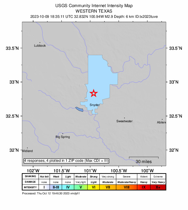
4 people reported to the USGS what they felt; the strongest reported shaking was III, weak shaking.
How well it is located
Reviewed by a seismologist.
- Location uncertainty
- About 0.8 km horizontally, 1.6 km in depth
- Magnitude uncertainty
- ±0.10
- Station coverage gap
- 63°
- Stations used
- 19
Nearest places
Distance and direction from each place to the epicenter, with its forecast.
Nearby
Within 100 km, magnitude 1.5 and up: 52 in the 60 days after this one and 46 in the 30 days before it.
After
- 1.79 km NE of Hermleigh, Texas · 1079 days ago · 6 km deep · 28 km away
- 2.87 km WSW of Westbrook, Texas · 1076 days ago · 12 km deep · 58 km away
- 1.510 km E of Coahoma, Texas · 1076 days ago · 6 km deep · 63 km away
- 2.125 km S of Westbrook, Texas · 1074 days ago · 8 km deep · 79 km away
- 1.825 km S of Westbrook, Texas · 1074 days ago · 6 km deep · 79 km away
- 1.823 km S of Westbrook, Texas · 1073 days ago · 0 km deep · 77 km away
- 1.827 km S of Westbrook, Texas · 1073 days ago · 4 km deep · 81 km away
- 2.6western Texas · 1072 days ago · 6 km deep · 28 km away
- 2.413 km NNE of Hermleigh, Texas · 1071 days ago · 8 km deep · 26 km away
- 1.816 km SW of Rotan, Texas · 1069 days ago · 4 km deep · 32 km away
- 2.216 km SW of Rotan, Texas · 1069 days ago · 6 km deep · 32 km away
- 2.016 km SW of Rotan, Texas · 1069 days ago · 7 km deep · 31 km away
- 2.011 km W of Rotan, Texas · 1066 days ago · 7 km deep · 33 km away
- 2.611 km W of Rotan, Texas · 1066 days ago · 7 km deep · 33 km away · felt by 1
- 1.911 km WSW of Rotan, Texas · 1064 days ago · 7 km deep · 33 km away
- 1.917 km NE of Hermleigh, Texas · 1062 days ago · 8 km deep · 29 km away
- 2.716 km NE of Hermleigh, Texas · 1060 days ago · 7 km deep · 29 km away
- 2.226 km S of Westbrook, Texas · 1060 days ago · 9 km deep · 80 km away
- 2.124 km NW of Westbrook, Texas · 1058 days ago · 7 km deep · 44 km away
- 1.98 km NE of Hermleigh, Texas · 1057 days ago · 6 km deep · 29 km away
- 3.318 km SE of Ackerly, Texas · 1055 days ago · 4 km deep · 77 km away · felt by 2
- 2.418 km SE of Ackerly, Texas · 1055 days ago · 4 km deep · 77 km away
- 1.525 km S of Westbrook, Texas · 1052 days ago · 6 km deep · 79 km away
- 1.69 km NNW of Forsan, Texas · 1052 days ago · 6 km deep · 84 km away
- 1.88 km NE of Hermleigh, Texas · 1049 days ago · 5 km deep · 28 km away
- 2.025 km S of Westbrook, Texas · 1046 days ago · 8 km deep · 79 km away
- 1.94 km S of Sand Springs, Texas · 1046 days ago · 8 km deep · 76 km away
- 1.625 km NW of Westbrook, Texas · 1044 days ago · 6 km deep · 43 km away
- 2.117 km NE of Hermleigh, Texas · 1043 days ago · 0 km deep · 28 km away
- 1.617 km NE of Hermleigh, Texas · 1043 days ago · 6 km deep · 29 km away
- 1.825 km S of Westbrook, Texas · 1041 days ago · 3 km deep · 79 km away
- 2.723 km E of Forsan, Texas · 1040 days ago · 5 km deep · 80 km away · felt by 4
- 3.516 km NE of Hermleigh, Texas · 1039 days ago · 9 km deep · 28 km away · felt by 5
- 1.818 km WSW of Rotan, Texas · 1039 days ago · 8 km deep · 26 km away
- 2.319 km N of Snyder, Texas · 1038 days ago · 4 km deep · 8 km away
- 2.519 km N of Snyder, Texas · 1038 days ago · 4 km deep · 8 km away
- 2.419 km N of Snyder, Texas · 1038 days ago · 5 km deep · 8 km away
- 2.019 km WSW of Rotan, Texas · 1037 days ago · 6 km deep · 26 km away
- 2.219 km WSW of Rotan, Texas · 1037 days ago · 8 km deep · 26 km away
- 1.58 km NE of Hermleigh, Texas · 1035 days ago · 7 km deep · 29 km away
- 2.215 km NE of Hermleigh, Texas · 1031 days ago · 8 km deep · 28 km away
- 2.116 km NNE of Hermleigh, Texas · 1031 days ago · 6 km deep · 27 km away
- 2.125 km S of Westbrook, Texas · 1031 days ago · 9 km deep · 79 km away
- 1.725 km S of Westbrook, Texas · 1031 days ago · 6 km deep · 79 km away
- 1.626 km S of Westbrook, Texas · 1030 days ago · 8 km deep · 80 km away
- 2.38 km NE of Hermleigh, Texas · 1030 days ago · 5 km deep · 28 km away
- 2.217 km SW of Rotan, Texas · 1028 days ago · 7 km deep · 32 km away
- 1.510 km E of Coahoma, Texas · 1028 days ago · 7 km deep · 63 km away
- 2.217 km SW of Rotan, Texas · 1026 days ago · 7 km deep · 32 km away
- 3.315 km NE of Hermleigh, Texas · 1026 days ago · 9 km deep · 28 km away · felt by 3
- 1.89 km NE of Hermleigh, Texas · 1020 days ago · 2 km deep · 26 km away
- 2.814 km NNW of Snyder, Texas · 1019 days ago · 9 km deep · 4 km away · felt by 1
Before
- 1.717 km NE of Hermleigh, Texas · 1079 days ago · 7 km deep · 29 km away
- 2.27 km NE of Hermleigh, Texas · 1079 days ago · 6 km deep · 28 km away
- 2.97 km NE of Hermleigh, Texas · 1079 days ago · 7 km deep · 28 km away
- 1.78 km NE of Hermleigh, Texas · 1079 days ago · 5 km deep · 27 km away
- 2.17 km NE of Hermleigh, Texas · 1079 days ago · 7 km deep · 28 km away
- 2.17 km NE of Hermleigh, Texas · 1080 days ago · 7 km deep · 28 km away
- 2.37 km NE of Hermleigh, Texas · 1080 days ago · 7 km deep · 27 km away
- 3.17 km NE of Hermleigh, Texas · 1080 days ago · 6 km deep · 28 km away · felt by 1
- 2.4western Texas · 1081 days ago · 8 km deep · 73 km away
- 1.59 km E of Coahoma, Texas · 1082 days ago · 9 km deep · 64 km away
- 2.116 km NE of Hermleigh, Texas · 1083 days ago · 8 km deep · 27 km away
- 2.316 km SW of Rotan, Texas · 1084 days ago · 7 km deep · 32 km away
- 2.7western Texas · 1085 days ago · 7 km deep · 29 km away
- 3.518 km SW of Rotan, Texas · 1086 days ago · 4 km deep · 32 km away · felt by 1
- 2.224 km SSW of Westbrook, Texas · 1086 days ago · 9 km deep · 78 km away
- 2.1western Texas · 1086 days ago · 0 km deep · 27 km away
- 3.616 km NE of Hermleigh, Texas · 1087 days ago · 4 km deep · 28 km away · felt by 7
- 2.97 km NE of Hermleigh, Texas · 1087 days ago · 6 km deep · 28 km away
- 2.08 km NE of Hermleigh, Texas · 1088 days ago · 7 km deep · 29 km away
- 2.2western Texas · 1088 days ago · 9 km deep · 80 km away
Earthquakes todayTexas earthquakesLive radar here
Sources
From the USGS Earthquake Hazards Program and its partner networks, event tx2023tuve (also filed as us6000lec8). Read Tue, Sep 22, 2026, 9:29 PM UTC.