M2.9 earthquake 21 km NNW of Cantwell, Alaska
A magnitude 2.9 earthquake struck 21 km NNW of Cantwell, Alaska on Mon, Nov 8, 2021, 12:09 AM AKST (09:09 UTC), 6 km (4 mi) below the surface.
A larger quake followed: M3.0 57 km NNE of Petersville, Alaska. This one was a foreshock.
Map
Where this earthquake was located, with the others nearby. Select one for its page.
The earthquake
- Magnitude
- 2.9 (ml), micro
- Local time
- UTC
- 2021-11-08 09:09:21 UTC
- Depth
- 5.8 km (3.6 mi), shallow
- Epicenter
- 63.553° N, 149.186° W
- Region
- Alaska
- Felt reports
- 2
- Tsunami flag
- No
- Status
- Reviewed by a seismologist
Did you feel it?
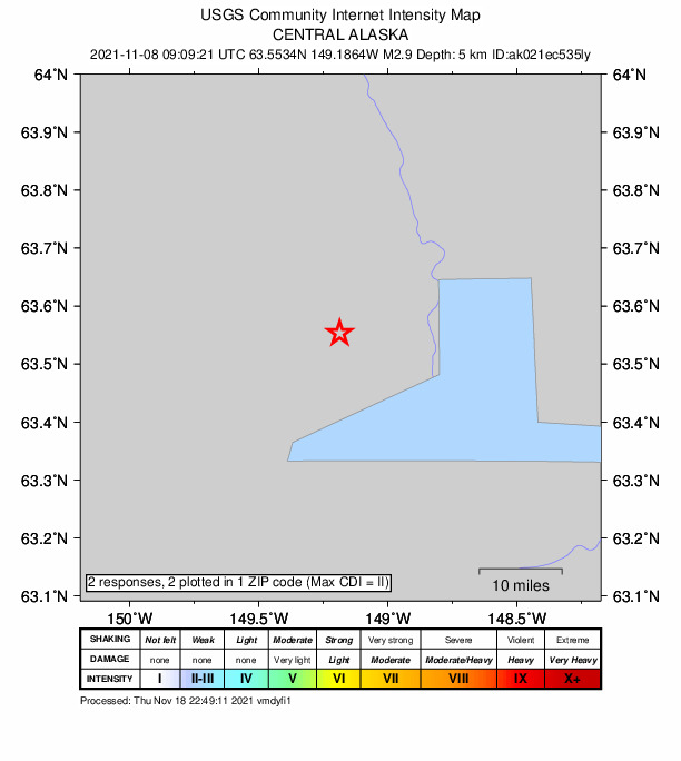
2 people reported to the USGS what they felt; the strongest reported shaking was III, weak shaking.
How well it is located
Reviewed by a seismologist.
- Stations used
- 153
Nearest places
Distance and direction from each place to the epicenter, with its forecast.
Nearby
Within 100 km, magnitude 1.5 and up: 168 in the 60 days after this one and 30 in the 30 days before it.
After
- 1.870 km ENE of Chase, Alaska · 1781 days ago · 51 km deep · 96 km away
- 1.569 km ESE of Denali National Park, Alaska · 1780 days ago · 118 km deep · 74 km away
- 2.028 km ESE of Denali National Park, Alaska · 1780 days ago · 10 km deep · 99 km away
- 1.540 km SE of Cantwell, Alaska · 1779 days ago · 75 km deep · 61 km away
- 1.569 km ENE of Chase, Alaska · 1779 days ago · 9 km deep · 91 km away
- 1.566 km N of Petersville, Alaska · 1779 days ago · 114 km deep · 95 km away
- 1.556 km N of Petersville, Alaska · 1778 days ago · 101 km deep · 98 km away
- 1.570 km ENE of Chase, Alaska · 1777 days ago · 9 km deep · 92 km away
- 2.068 km E of Cantwell, Alaska · 1777 days ago · 67 km deep · 82 km away
- 1.569 km SE of Cantwell, Alaska · 1777 days ago · 60 km deep · 91 km away
- 2.563 km ESE of Denali National Park, Alaska · 1777 days ago · 134 km deep · 76 km away
- 2.045 km WSW of Denali Park, Alaska · 1776 days ago · 123 km deep · 29 km away
- 1.870 km NNE of Petersville, Alaska · 1774 days ago · 105 km deep · 81 km away
- 1.730 km SSE of Cantwell, Alaska · 1774 days ago · 70 km deep · 52 km away
- 1.863 km N of Petersville, Alaska · 1774 days ago · 113 km deep · 94 km away
- 1.971 km SE of Denali National Park, Alaska · 1774 days ago · 120 km deep · 83 km away
- 1.649 km E of Denali National Park, Alaska · 1774 days ago · 13 km deep · 76 km away
- 1.569 km ENE of Chase, Alaska · 1774 days ago · 9 km deep · 90 km away
- 2.223 km W of Denali Park, Alaska · 1773 days ago · 110 km deep · 22 km away
- 1.561 km SE of Denali National Park, Alaska · 1773 days ago · 127 km deep · 85 km away
- 1.664 km NNE of Petersville, Alaska · 1772 days ago · 100 km deep · 85 km away
- 1.960 km SE of Denali National Park, Alaska · 1772 days ago · 130 km deep · 92 km away
- 1.560 km ESE of Denali National Park, Alaska · 1772 days ago · 122 km deep · 82 km away
- 1.674 km ESE of Denali Park, Alaska · 1772 days ago · 5 km deep · 86 km away
- 1.615 km W of Healy, Alaska · 1771 days ago · 118 km deep · 33 km away
- 1.567 km SE of Denali National Park, Alaska · 1771 days ago · 121 km deep · 94 km away
- 1.561 km NNE of Petersville, Alaska · 1771 days ago · 92 km deep · 84 km away
- 2.939 km WSW of Clear, Alaska, Alaska · 1771 days ago · 20 km deep · 78 km away · felt by 1
- 2.366 km ESE of Denali National Park, Alaska · 1771 days ago · 121 km deep · 79 km away
- 1.563 km W of Cantwell, Alaska · 1770 days ago · 121 km deep · 52 km away
- 1.9Central Alaska · 1770 days ago · 99 km deep · 82 km away
- 2.472 km ESE of Denali Park, Alaska · 1770 days ago · 3 km deep · 83 km away
- 2.136 km W of Cantwell, Alaska · 1770 days ago · 101 km deep · 33 km away
- 1.869 km ESE of Denali National Park, Alaska · 1770 days ago · 122 km deep · 74 km away
- 1.857 km NNE of Petersville, Alaska · 1770 days ago · 108 km deep · 89 km away
- 1.642 km WSW of Clear, Alaska, Alaska · 1770 days ago · 15 km deep · 78 km away
- 1.532 km SSE of Cantwell, Alaska · 1769 days ago · 5 km deep · 53 km away
- 1.764 km ESE of Denali National Park, Alaska · 1769 days ago · 134 km deep · 79 km away
- 1.951 km NNE of Petersville, Alaska · 1769 days ago · 95 km deep · 96 km away
- 1.639 km NNE of Chase, Alaska · 1768 days ago · 69 km deep · 92 km away
- 1.666 km ENE of Cantwell, Alaska · 1768 days ago · 8 km deep · 76 km away
- 1.554 km WNW of Cantwell, Alaska · 1767 days ago · 112 km deep · 38 km away
- 1.663 km NNE of Petersville, Alaska · 1767 days ago · 103 km deep · 86 km away
- 2.256 km N of Chase, Alaska · 1767 days ago · 87 km deep · 82 km away
- 1.550 km NE of Chase, Alaska · 1767 days ago · 71 km deep · 84 km away
- 2.171 km SE of Denali National Park, Alaska · 1767 days ago · 114 km deep · 85 km away
- 1.557 km NNE of Petersville, Alaska · 1767 days ago · 91 km deep · 87 km away
- 1.5Central Alaska · 1767 days ago · 117 km deep · 82 km away
- 2.347 km SSE of Cantwell, Alaska · 1766 days ago · 71 km deep · 68 km away
- 1.866 km SE of Denali National Park, Alaska · 1766 days ago · 109 km deep · 89 km away
- 2.248 km NE of Chase, Alaska · 1765 days ago · 5 km deep · 92 km away
- 1.534 km E of Clear, Alaska, Alaska · 1765 days ago · 4 km deep · 89 km away
- 2.060 km SW of Cantwell, Alaska · 1765 days ago · 97 km deep · 66 km away
- 1.664 km SW of Cantwell, Alaska · 1764 days ago · 82 km deep · 68 km away
- 1.83 km ENE of Healy, Alaska · 1764 days ago · 104 km deep · 38 km away
- 2.351 km ENE of Chase, Alaska · 1764 days ago · 59 km deep · 100 km away
- 1.943 km SE of Denali National Park, Alaska · 1763 days ago · 13 km deep · 96 km away
- 1.668 km ENE of Denali National Park, Alaska · 1763 days ago · 8 km deep · 73 km away
- 2.343 km SE of Denali National Park, Alaska · 1763 days ago · 14 km deep · 99 km away
- 1.662 km SSE of Cantwell, Alaska · 1762 days ago · 12 km deep · 84 km away
The first 60 of 168.
Before
- 1.742 km NE of Chase, Alaska · 1781 days ago · 64 km deep · 95 km away
- 1.742 km NE of Chase, Alaska · 1781 days ago · 64 km deep · 95 km away
- 1.561 km ESE of Denali Park, Alaska · 1782 days ago · 5 km deep · 72 km away
- 1.866 km ESE of Denali National Park, Alaska · 1783 days ago · 133 km deep · 73 km away
- 2.043 km WSW of Cantwell, Alaska · 1783 days ago · 105 km deep · 41 km away · felt by 1
- 2.860 km SSE of Cantwell, Alaska · 1783 days ago · 9 km deep · 82 km away · felt by 1
- 1.963 km SE of Denali National Park, Alaska · 1783 days ago · 135 km deep · 89 km away
- 1.959 km SW of Cantwell, Alaska · 1784 days ago · 76 km deep · 67 km away
- 2.465 km SE of Denali National Park, Alaska · 1785 days ago · 123 km deep · 92 km away
- 1.571 km SE of Denali National Park, Alaska · 1786 days ago · 113 km deep · 81 km away
- 1.651 km NNE of Petersville, Alaska · 1786 days ago · 94 km deep · 94 km away
- 1.738 km W of Cantwell, Alaska · 1787 days ago · 95 km deep · 35 km away
- 1.658 km NNE of Chase, Alaska · 1787 days ago · 91 km deep · 73 km away
- 1.567 km SE of Denali National Park, Alaska · 1787 days ago · 135 km deep · 89 km away
- 1.667 km ESE of Denali National Park, Alaska · 1787 days ago · 136 km deep · 73 km away
- 1.620 km WSW of Ferry, Alaska · 1787 days ago · 144 km deep · 47 km away
- 2.4Central Alaska · 1788 days ago · 17 km deep · 81 km away
- 2.553 km N of Petersville, Alaska · 1788 days ago · 2 km deep · 99 km away
- 1.515 km WSW of Healy, Alaska · 1788 days ago · 113 km deep · 29 km away
- 1.669 km SE of Cantwell, Alaska · 1788 days ago · 65 km deep · 91 km away
Earthquakes todayAlaska earthquakesLive radar here
Sources
From the USGS Earthquake Hazards Program and its partner networks, event ak021ec535ly (also filed as us7000fscx). Read Thu, Sep 24, 2026, 8:39 AM UTC.