M2.3 earthquake 26 km NW of Anchor Point, Alaska
A magnitude 2.3 earthquake struck 26 km NW of Anchor Point, Alaska on Thu, Sep 23, 2021, 11:00 AM AKDT (19:00 UTC), 85 km (53 mi) below the surface.
A larger quake followed: M3.2 67 km WNW of Happy Valley, Alaska. This one was a foreshock.
Map
Where this earthquake was located, with the others nearby. Select one for its page.
The earthquake
- Magnitude
- 2.3 (ml), micro
- Local time
- UTC
- 2021-09-23 19:00:38 UTC
- Depth
- 85.4 km (53.1 mi), intermediate-depth
- Epicenter
- 59.919° N, 152.221° W
- Region
- Alaska
- Felt reports
- 1
- Tsunami flag
- No
- Status
- Reviewed by a seismologist
Did you feel it?
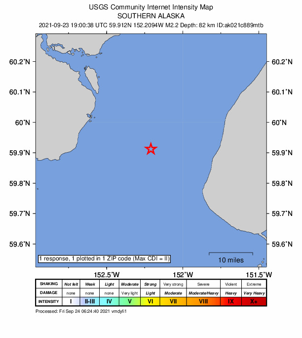
1 person reported to the USGS what they felt; the strongest reported shaking was II, weak shaking.
How well it is located
Reviewed by a seismologist.
- Stations used
- 89
Nearest places
Distance and direction from each place to the epicenter, with its forecast.
Nearby
Within 100 km, magnitude 1.5 and up: 200 in the 60 days after this one and 0 in the 30 days before it.
After
- 1.646 km WNW of Ninilchik, Alaska · 1785 days ago · 95 km deep · 30 km away
- 1.759 km E of Pedro Bay, Alaska · 1785 days ago · 104 km deep · 48 km away
- 1.626 km W of Anchor Point, Alaska · 1785 days ago · 70 km deep · 16 km away
- 1.660 km ENE of Pedro Bay, Alaska · 1785 days ago · 113 km deep · 48 km away
- 1.765 km WNW of Nanwalek, Alaska · 1785 days ago · 84 km deep · 60 km away
- 1.852 km E of Pedro Bay, Alaska · 1784 days ago · 124 km deep · 54 km away
- 1.833 km ENE of Pedro Bay, Alaska · 1784 days ago · 151 km deep · 74 km away
- 3.267 km WNW of Happy Valley, Alaska · 1784 days ago · 123 km deep · 43 km away · felt by 1
- 1.666 km W of Happy Valley, Alaska · 1784 days ago · 108 km deep · 41 km away
- 1.742 km ENE of Pedro Bay, Alaska · 1784 days ago · 136 km deep · 66 km away
- 1.556 km WNW of Anchor Point, Alaska · 1784 days ago · 98 km deep · 33 km away
- 1.612 km SSE of Clam Gulch, Alaska · 1784 days ago · 58 km deep · 57 km away
- 1.58 km W of Happy Valley, Alaska · 1784 days ago · 68 km deep · 19 km away
- 1.566 km WNW of Happy Valley, Alaska · 1783 days ago · 109 km deep · 42 km away
- 1.520 km SW of Nanwalek, Alaska · 1783 days ago · 64 km deep · 80 km away
- 2.653 km NW of Ninilchik, Alaska · 1783 days ago · 84 km deep · 50 km away
- 2.654 km NW of Ninilchik, Alaska · 1783 days ago · 85 km deep · 51 km away
- 1.769 km WNW of Happy Valley, Alaska · 1783 days ago · 112 km deep · 46 km away
- 1.928 km WNW of Anchor Point, Alaska · 1783 days ago · 88 km deep · 3 km away
- 1.763 km E of Pedro Bay, Alaska · 1783 days ago · 98 km deep · 43 km away
- 1.965 km ESE of Pedro Bay, Alaska · 1782 days ago · 92 km deep · 62 km away
- 1.650 km WSW of Nanwalek, Alaska · 1782 days ago · 78 km deep · 87 km away
- 1.650 km E of Pedro Bay, Alaska · 1782 days ago · 126 km deep · 56 km away
- 1.660 km ENE of Pedro Bay, Alaska · 1782 days ago · 125 km deep · 49 km away
- 1.661 km E of Pedro Bay, Alaska · 1782 days ago · 104 km deep · 46 km away
- 1.557 km WNW of Nanwalek, Alaska · 1782 days ago · 80 km deep · 50 km away
- 1.736 km ENE of Pedro Bay, Alaska · 1782 days ago · 133 km deep · 72 km away
- 1.753 km E of Pedro Bay, Alaska · 1782 days ago · 116 km deep · 53 km away
- 1.565 km WNW of Happy Valley, Alaska · 1782 days ago · 106 km deep · 41 km away
- 1.773 km WNW of Ninilchik, Alaska · 1782 days ago · 123 km deep · 57 km away
- 1.765 km ENE of Pedro Bay, Alaska · 1782 days ago · 124 km deep · 45 km away
- 1.663 km WNW of Ninilchik, Alaska · 1782 days ago · 107 km deep · 45 km away
- 1.749 km ESE of Pedro Bay, Alaska · 1782 days ago · 108 km deep · 67 km away
- 1.557 km WNW of Ninilchik, Alaska · 1782 days ago · 105 km deep · 42 km away
- 2.052 km ENE of Pedro Bay, Alaska · 1781 days ago · 127 km deep · 60 km away
- 1.821 km SE of Clam Gulch, Alaska · 1781 days ago · 59 km deep · 67 km away
- 1.821 km SE of Clam Gulch, Alaska · 1781 days ago · 59 km deep · 67 km away
- 1.841 km WNW of Ninilchik, Alaska · 1781 days ago · 92 km deep · 31 km away
- 1.654 km W of Anchor Point, Alaska · 1781 days ago · 84 km deep · 40 km away
- 1.623 km WNW of Anchor Point, Alaska · 1781 days ago · 74 km deep · 8 km away
- 1.927 km W of Anchor Point, Alaska · 1781 days ago · 68 km deep · 15 km away
- 1.927 km W of Anchor Point, Alaska · 1781 days ago · 68 km deep · 15 km away
- 2.237 km WNW of Happy Valley, Alaska · 1781 days ago · 84 km deep · 18 km away
- 2.237 km WNW of Happy Valley, Alaska · 1781 days ago · 84 km deep · 18 km away
- 1.68 km SSE of Soldotna, Alaska · 1781 days ago · 47 km deep · 89 km away
- 1.641 km WNW of Ninilchik, Alaska · 1781 days ago · 82 km deep · 36 km away
- 2.121 km ESE of Kasilof, Alaska · 1781 days ago · 62 km deep · 83 km away
- 1.67 km NW of Seldovia, Alaska · 1781 days ago · 48 km deep · 54 km away
- 1.750 km W of Anchor Point, Alaska · 1781 days ago · 87 km deep · 28 km away
- 1.778 km ENE of Port Alsworth, Alaska · 1781 days ago · 123 km deep · 65 km away
- 2.070 km WNW of Ninilchik, Alaska · 1781 days ago · 121 km deep · 55 km away
- 1.754 km WSW of Nanwalek, Alaska · 1781 days ago · 71 km deep · 94 km away
- 1.757 km W of Anchor Point, Alaska · 1781 days ago · 91 km deep · 34 km away
- 1.666 km ENE of Pedro Bay, Alaska · 1781 days ago · 108 km deep · 47 km away
- 1.656 km WNW of Anchor Point, Alaska · 1781 days ago · 100 km deep · 32 km away
- 2.134 km SE of Seldovia, Alaska · 1780 days ago · 59 km deep · 93 km away
- 1.765 km WNW of Anchor Point, Alaska · 1780 days ago · 101 km deep · 41 km away
- 1.924 km WSW of Anchor Point, Alaska · 1780 days ago · 67 km deep · 23 km away
- 1.756 km W of Anchor Point, Alaska · 1780 days ago · 96 km deep · 34 km away
- 1.614 km W of Anchor Point, Alaska · 1780 days ago · 65 km deep · 19 km away
The first 60 of 200.
Earthquakes todayAlaska earthquakesLive radar here
Sources
From the USGS Earthquake Hazards Program and its partner networks, event ak021c889mtb (also filed as us7000fdvg). Read Thu, Sep 24, 2026, 9:22 AM UTC.